Free Downloads: Medion Europe Maps
MapComp is a powerful and free Windows Software for drawing images of linkage Maps and to compare linkage Maps and indicate common markers.
MapInspect can display, print and save images, and has no limit to the number of Maps it can compare (but only neighbouring Maps are compared). Maps can be flipped within MapINspect, an the on-screen order of...
Category: Multimedia & Design / Multimedia App's
Publisher: MapInspect, License: Freeware, Price: USD $0.00, File Size: 616.7 KB
Platform: Windows
Golden SpotsMap of Europe for websites, presentations and more.
Golden SpotsMap of Europe for websites, presentations and more. The map contains detailed Maps of each state. Easy adjustment.Variants of using a map locator:- Real-Estate websites- Quick access to contact organization data, having affiliated network in USAWith this fully-clickable map you will be able to improve navigation and provide visitors with a better and faster means of...
Category: Web Authoring / Flash Utilities
Publisher: Fla-shop.com Inc., License: Demo, Price: USD $149.00, File Size: 470.0 KB
Platform: Windows, Mac
Absolute Europe Mega is a spectacular photographic Windows screen saver that captures the mountains, forests, wilderness, villages, and towns of central and northern Europe. These evocative pictures from veteran photographer Eric Fookes are saved as high-resolution images, allowing outstanding viewing at screen settings as high as 1600 by 1200 pixels. Absolute Europe Mega...
Category: Desktop Enhancements / Screensavers
Publisher: Fookes Software, License: Shareware, Price: USD $24.95, File Size: 16.1 KB
Platform: Unknown
This software development kit (SDK) provides the binaries and programming reference for the Bing Maps Silverlight Control. You can use this control to build your own web sites that use Bing Maps.
The Bing Maps Silverlight Control combines the power of Silverlight and Bing Maps to provide an enhanced mapping experience. Developers can use the Bing...
Category: Utilities / Misc. Utilities
Publisher: Microsoft, License: Freeware, Price: USD $0.00, File Size: 3.8 MB
Platform: Windows
SensAct -SENSORS CONVERSION Maps AND ACTUATORS COMMAND Maps
This software pack contents the sensors conversion Maps and the actuators command Maps like motorized throttles, gasoline injectors corrections, ...
It is mandatory to install it to select the type of sensor and actuators that are equiping the ECUs, because these Maps are no longer...
Category: Business & Finance / Applications
Publisher: Skynam, License: Freeware, Price: USD $0.00, File Size: 3.4 MB
Platform: Windows
PlanetGIS Explorer is a free viewer for PlanetGIS maps and GIS exchange files.
PlanetGIS Explorer is a free viewer for PlanetGIS Maps and GIS exchange files. PlanetGIS Explorer allows you to navigate through Maps, query map elements and view attribute information from linked database tables. Also PlanetGIS Explorer allows you to customize the appearance of Maps for purposes of creating hardcopy printouts, but does not allow you to save any changes to...
Category: Multimedia & Design / Graphics Viewers
Publisher: Planet GIS, License: Freeware, Price: USD $0.00, File Size: 5.4 MB
Platform: Windows


 Shareware
FPS Maps for WPF is a brand new component with a set of built-in country Maps. There are 15 Inbuilt Countries. FPS Maps for WPF contains samples of how to work with it and customize. Maps navigation can be performed via Navigation bar which supports Themes and mouse. You can pan with mouse or zoom in/out with mouse scroll. More options will be added in future...
Category: Software Development / Components & Libraries
Publisher: FPS Components, License: Shareware, Price: USD $199.00, File Size: 1.1 MB
Platform: Windows
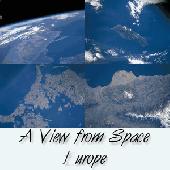
See satellite-eye views of different parts of Europe. See pictures of Spain, England, France, Denmark, Sweden, Ireland, Germany, Italy and more. This 32-bit screen-saver engine rotates photos of different locations of Europe as seen on clear days from the earth's orbit. Over a dozen visual effects can appear between images. Plus, each of the photos can be displayed as your...
Category: Utilities / Screensavers
Publisher: !13-Soft, License: Shareware, Price: USD $14.95, EUR10.25, File Size: 2.2 MB
Platform: Windows
The Rhine Falls of Schaffhausen are a magnificent spectacle of nature and the largest plain waterfalls of Europe. This screensaver displays the beauty of one of Europe's most famous nature sceneries
Category: Desktop Enhancements / Screensavers
Publisher: erotikblog24, License: Freeware, Price: USD $0.00, File Size: 1013.8 KB
Platform: Windows,
Program converts measure units that are commonly used in Europe and the U.
Program converts measure units that are commonly used in Europe and the U.S.A. There are six categories which the application calculates with: Temperature, Length, Area, Weight, Volume and Pressure. It also contains standard MS calculator since it can be
Category: Home & Education / Miscellaneous
Publisher: dutchthewiz.com, License: Freeware, Price: USD $0.00, File Size: 1.5 MB
Platform: Windows, Mac, 2K
With yalips maps you get 4 products in 1.
With yalips Maps you get 4 products in 1. You are more productive, more creative and perform better on your job when using visual software tools. With the resulting visualizations you can communicate more effectively and convincingly to your collegues, your boss, your customer or the chairman of the board. Therefore many companies spent a lot of money on such tools. Unfortunately, most...
Category: Business & Finance / Project Management
Publisher: yalips Software, License: Shareware, Price: USD $80.00, File Size: 29.6 MB
Platform: Windows
TopoGun is a stand-alone resurfacing, and maps baking application.
TopoGun is a stand-alone resurfacing, and Maps baking application. The resurfacing functions in TopoGun will help you modify and/or recreate the edgeflow of your digital 3D models.
The Maps baking functions, will help you bake various types of texture Maps from your high resolution 3D models and then allow you to apply them to your newly created optimized...
Category: Multimedia & Design / Animation
Publisher: SC PIXELMACHINE SRL, License: Shareware, Price: USD $100.00, File Size: 55.5 MB
Platform: Windows
You can create a backup of your maps with JaVaWa GMTK and restore these (e.
You can create a backup of your Maps with JaVaWa GMTK and restore these (e.g. on another computer) including unlock codes. Re-installing Maps is unnecessary.
Migration of your Garmin Maps from and old computer to a new one is straightforward with this application.
Category: Utilities / Backup
Publisher: JaVaWa GPS-tools, License: Shareware, Price: USD $0.00, File Size: 5.4 MB
Platform: Windows
Live Satellite Maps or Google maps is a web server mapping applications.
Live Satellite Maps or Google Maps is a web server mapping applications.Provides scrolling map images and satellite photos around the earth and even the route between different places.Since 6 October 2005, live satellite Maps is part of local Google.Google live satellite Map provides the ability to zoom in or zoom out to show the map.The user can control the map with your...
Category: Home & Education / Science
Publisher: www.satelliteview-of-my-house.com, License: Freeware, Price: USD $0.00, File Size: 643.0 KB
Platform: Windows
Nokia Maps 3D browser plugin is a free mapping product and service by Nokia for its mobile phones and for internet browsers. Nokia Maps includes voice guided navigation for both pedestrians and drivers for 74 countries in 46 different languages and there are Maps for over 180 countries.
See the world in high-resolution 3D. Everything from the sky to the street. Plan...
Category: Internet / Browser Accessories
Publisher: Nokia, License: Freeware, Price: USD $0.00, File Size: 9.8 MB
Platform: Windows
From the Sacre Coeur to the Arc de Triomphe, your holiday to Paris starts from the moment you open your guide, plus you get Paris Maps and transport Maps.
Discover the best cafe terraces, unmissable museums and galleries, loveliest parks and gardens, best areas to shop or browse, unforgettable shows and live music venues, most fun places for children, and best restaurants to...
Category: Internet / Communications
Publisher: Mobile Systems, License: Shareware, Price: USD $9.80, File Size: 0
Platform: Windows
When you are looking for a powerful tool to satisfy various needs regarding vectors, raster and satellite imagery, you will find ILWIS Academic an efficient application. The program comes with such useful features as points to create Maps, lines for segment Maps, closed area segments for polygon Maps, spatial operations for raster Maps and so on. Whilst using images...
Category: Home & Education / Miscellaneous
Publisher: ITC, License: Freeware, Price: USD $0.00, File Size: 19.4 MB
Platform: Unknown
GDS Images and Document Maps is a unique document search utility.
GDS Images and Document Maps is a unique document search utility. GDS Images and Document Maps is a rather unique application that will enable you to store all your documents and images alongside other important files and folders right on your desktop so that you can use it straight from there, without the need to bother around with looking with looking for every single file...
Category: Utilities / Misc. Utilities
Publisher: toggle, License: Freeware, Price: USD $0.00, File Size: 558.8 KB
Platform: Windows
Projectplace is Europe’s Leading Online Service for Project Collaboration.
Projectplace is Europe’s Leading Online Service for Project Collaboration. More and more organizations are using web-based IT solutions as online services. The advantages are many:
- no hardware, no installation
- quick and easy to set up
- always available, anywhere, anytime
Category: Audio / Utilities & Plug-Ins
Publisher: Projectplace International AB, License: Shareware, Price: USD $0.00, File Size: 0
Platform: Windows
Absolute Europe is a spectacular photographic Windows screen saver that captures the mountains, forests, wilderness, villages, and towns of central and northern Europe. These evocative pictures from veteran photographer Eric Fookes are saved as high-resolution images, allowing outstanding viewing at screen settings as high as 1600 by 1200 pixels. Absolute Europe screen...
Category: Desktop Enhancements / Screensavers
Publisher: Fookes Software, License: Shareware, Price: USD $14.95, File Size: 8.8 MB
Platform: Unknown
MapCreator combines a cartography and a graphics programme.
MapCreator combines a cartography and a graphics programme. The software is designed to create Maps and animated Maps of the highest quality as often required for presentations. For example, this could be Maps needed for a travel presentation. But also in
Category: Multimedia & Design
Publisher: primap.com, License: Freeware, Price: USD $0.00, File Size: 103.3 MB
Platform: Windows, Vista
CacheMaps retreives a variety of maps for your caches from the Internet.
CacheMaps retreives a variety of Maps for your caches from the Internet.
CacheMaps uses the Geocaching loc- or gpx-files as input. Directely from the Geocaching site or as exported from GSAK.CacheMaps v4 has been designed to be used next to GSAK. A lot of the functionality that was available in previous versions of CacheMaps, is available in GSAK now in a much better form. What...
Category: Audio / Utilities & Plug-Ins
Publisher: BigBird Productions, License: Freeware, Price: USD $0.00, File Size: 153.2 KB
Platform: Windows
Want to brush up on the names and locations of the 40 or so countries of the new Europe?
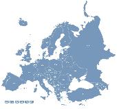
Want to brush up on the names and locations of the 40 or so countries of the new Europe? This program from the Family Games Web Center will help you. European Geography Tutor presents a scrolling map of Europe along with a list of countries. As your mouse pointer passes over the map, the country under the pointer highlights, along with its entry in the list. Simply browse the map...
Category: Home & Education / Genealogy
Publisher: AHA! Software Inc., License: Freeware, Price: USD $0.00, File Size: 508.0 KB
Platform: Windows
Europe Flash Map Locator for websites, presentations and more.
Europe Flash Map Locator for websites, presentations and more. Easy adjustment.
Variants of using a map locator:
- Real-Estate websites
- Quick access to contact organization data, having affiliated network in Europe
With this fully-clickable map you will be able to improve navigation and provide visitors with a better and faster means of accessing information, as well...
Category: Web Authoring / Web Design Utilities
Publisher: Fla-shop.com Inc., License: Demo, Price: USD $69.00, File Size: 111.0 KB
Platform: Windows, Mac
MAPC2MAPC is a program to manipulate digital Maps,it loads map images and calibrate them,loads calibrations in many different formats and Datums,view the calibrated map,crop and rescale Maps whilst preserving the calibration,reproject Maps to 'Plate Carre' (Equirectangular),rotate Maps to true North.
Category: Multimedia & Design / Digital Media Editors
Publisher: Thorn, License: Shareware, Price: USD $0.00, File Size: 1.6 MB
Platform: Windows


