Free Downloads: Microsoft Encarta Waypoints
Hunter Dictionary II is a free multifunction online dictionary for translating English word to Chinese, English or Japanese. It is also an specialized dictionary for thesaurus and computing terms.Hunter Dictionary II contains no dictionary database itself. Instead, it is a specialized Internet Browser, user can use it to browse the online Dictionary Service (e.g. Yahoo Chinese Dictionary, MSN...
Category: Home & Education / Miscellaneous
Publisher: www.graphichunter.com, License: Freeware, Price: USD $0.00, File Size: 2.6 MB
Platform: Windows
Main Features:
- 3D and 2D map based user interface
- Units are individual, section, or platoon/battery sized units
- Click on the 3D map to issue unit movement Waypoints
- Multiple players over LAN and Internet, each controlling specific forces
- Real time with 30 second time steps, time compression adjustable up to x1,000
- Detailed combat...
Category: Games / Strategy & War
Publisher: Historical Software Corporation, License: Freeware, Price: USD $0.00, File Size: 173.0 MB
Platform: Windows
DNRGarmin is a smart tool used to directly transfer data between Garmin GPS handheld receivers and various GIS software packages.
DNRGarmin was built to provide users the ability to directly transfer data between Garmin GPS handheld receivers and various GIS software packages. Using DNRGarmin a user can use point features (graphics or shapefile) and upload them to the GPS as...
Category: Utilities / Misc. Utilities
Publisher: GIS Section, Minnesota Department of Natural Resources, License: Freeware, Price: USD $0.00, File Size: 11.3 MB
Platform: Windows
The Angler's Genie was designed to be a tool to help anyone become a better angler.
The Angler's Genie was designed to be a tool to help anyone become a better angler. From one place, you'll be able to Track your time on the water, Organize your Contacts, Manage Your Money, Organize your Tasks, Track your Tournaments, and even Organize the Waypoints by importing/exporting directly from your GPS unit.
Category: Home & Education / Miscellaneous
Publisher: Business Technology Integration, LLC, License: Commercial, Price: USD $39.95, File Size: 4.4 MB
Platform: Windows
IvPBot is the next generation of PODBots for Counter Strike game.
IvPBot is the next generation of PODBots for Counter Strike game. This bot is so advanced that when you're playing with them you'll think they are real players. The bot has been coded using simple yet powerful functions for great accuracy and movement using Waypoints.
Category: Games / Tools & Editors
Publisher: KaCaT, License: Freeware, Price: USD $0.00, File Size: 898.8 KB
Platform: Windows
How could you make a game like Lemmings even better?
How could you make a game like Lemmings even better? How about replacing the lemmings with teeny tiny ninja? They run around like mad and jump all over the place. This game is totally free so just download it and have a go.
Make Waypoints for your ninjas and destroy obstacles so that you can take your ninjas to their homes.
Category: Games / Arcade
Publisher: Screaming Duck Software, License: Freeware, Price: USD $0.00, File Size: 2.3 MB
Platform: Windows

OkMap is a GPS and map software that:
-Works with vectorial maps and calibrates raster maps
-Organizes paths by creating Waypoints, routes and tracks
-Uploads/downloads data to/from your GPS
-Uses altitude DEM data
-Supports GPS real-time navigation
-Sends/receives vehicles position and display tracks on maps in real time
-Provides autorouting and geocoding...
Category: Business & Finance / Applications
Publisher: Gian Paolo Saliola, License: Freeware, Price: USD $0.00, File Size: 20.2 MB
Platform: Windows
Microsoft Dots! is a new interactive strategy game. Your objective is to connect four adjacent dots with the pen to form a complete square.This template has been supplied by a member of the Microsoft Office Online community. Microsoft does not promise that it will work for your purposes or be free from viruses and defects.
Category: Games / Misc. Games
Publisher: Microsoft, License: Freeware, Price: USD $0.00, File Size: 278.3 KB
Platform: Windows
This Digital Chart covers the following chart areas: C1, C8, C23, C24, C25, C26, C27, C28, C29, C30, C68, Y9, Y16, Y17, Y18, 2000.3, 2000.6, 2000.7, 2100.2, 2100.4, 2100.6. Imray Digital Charts for the East Coast, North Sea and Channel Coasts were first published at the end of 2005. Their clear and simple format has come to be regarded as one that has set standards for entry level electronic...
Category: Home & Education / Miscellaneous
Publisher: Imray, Laurie, Norie & Wilson Ltd, License: Shareware, Price: USD $117.00, File Size: 13.1 MB
Platform: Windows
 Shareware
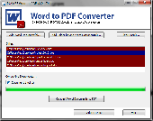
Microsoft Word to PDF Converter is an essential utility for users who are in need to convert Microsoft Word files to PDF files. Microsoft Word to PDF Converter easily converts Word files of MS Word 2010, 2007, 2003, 2002, 2000, 98, 97, 95, and 6.0. Microsoft Word to PDF Converter to convert MS Word to PDF, convert Microsoft Word to PDF. Moreover,...
Category: Utilities / File Compression
Publisher: Microsoft Word to PDF Converter, License: Shareware, Price: USD $20.00, File Size: 5.5 MB
Platform: Windows
Asynchron Communication: Communication with the Web is asynchronous, so that the work flow is not disturbed by bad or missing connection.
AAT adapted to the 2011 rules.
Multi selection of Waypoints.
DCW Map demonstration accelerated.
Glider index saved with flight track. Default comes from active pilot of the pilot list .
Category: Home & Education / Miscellaneous
Publisher: 8F Computer GmbH, License: Shareware, Price: USD $400.41, File Size: 18.5 MB
Platform: Windows
Mappoint Demo is a software tool designed to improve an entire set of features and gadgets.
Mappoint Demo is a software tool designed to improve an entire set of features and gadgets. You are allowed to set up the Mappoint defaults and access many helpful tools such as : pushpin, directions (Waypoints), demographics data to map, locate addresses by zipcode, pushpin sets maintenance and more.
Category: Business & Finance / Business Finance
Publisher: WC Software Development Inc., License: Demo, Price: USD $0.00, File Size: 4.2 MB
Platform: Windows
Flight Planner 3000 is a comprehensive flight planning tool which produces detailed, accurate flight plans plus provides the pilot with additional information relating to the flight. It does the weight & balance, calculates CP & PNR’s, first and last light, does all the fuel calculations, draws detailed maps of your route, displays the different (NAS) airspace on the maps,...
Category: Business & Finance / Business Finance
Publisher: Champagne PC Services, License: Shareware, Price: USD $255.00, File Size: 5.4 MB
Platform: Windows
TwoNav is a dual navigation system (On-Road/Off-Road) to perform most of your outdoor activities (hiking, biking, skiing, geoacaching, ...). TwoNav can also guide you when driving. A single solution for all your orientation needs. Load maps, tracks, routes and Waypoints and get ready for your trip!
Category: Home & Education / Miscellaneous
Publisher: CompeGPS TEAM, S.L., License: Shareware, Price: USD $67.28, File Size: 21.2 MB
Platform: Windows
MyGPS is a Freeware software for the creation and the management of longitude and latitude calibrated maps.
The software can define points of interest obtaining their coordinates (Waypoints), can create routes (routepoints), can visualize track paths (trackpoints).
Using a serial link, points routes and tracks can be shared with "eTrex" and "Geko" GARMIN...
Category: Home & Education / Miscellaneous
Publisher: GPSInfo, License: Freeware, Price: USD $0.00, File Size: 2.3 MB
Platform: Windows
Freeware
org, uses file and position names that suit to the display of the TomTom Rider, uses file, route and position names that suit to the display of the Map&Guide Motorrad Tourenplaner, remembers language, paths, window size and position. . .
Category: Business & Finance / Conversion Applications
Publisher: Christian Pesch, License: Freeware, Price: USD $0.00, File Size: 6.6 MB
Platform: Windows, Mac, Linux, Solaris, FreeBSD, OpenBSD, Java
QuakeMap is a powerful GPS/mapping program for your Windows computer.
QuakeMap is a powerful GPS/mapping program for your Windows computer. It can be downloaded here for free. The trial mode allows you to use most features indefinitely. When you need to unlock certain powerful features, a License Key can be ordered here. QuakeMap is designed for ease of use. It eatures intuitive user interface, supports most popular Garmin and Magellan receivers, reads and writes...
Category: Utilities / Misc. Utilities
Publisher: quakemap.com, License: Freeware, Price: USD $0.00, File Size: 821.2 KB
Platform: Windows
GPSCommunicator is a FREE utility to visually represent NMEA GPS position data in realtime.
GPSCommunicator is a FREE utility to visually represent NMEA GPS position data in realtime. It works with NMEA 0183 GPS receivers connected via a serial port. GPSCommunicator has the following features:
- Vessel position display over moving map.
- User selectable maps.
- Create and save Waypoints.
- Graphical GPS data display
- .NET components for use in...
Category: Internet / Misc. Plugins
Publisher: Panazzolo.Com, License: Freeware, Price: USD $0.00, File Size: 772.5 KB
Platform: Windows
The Workook Manager for Microsoft Excel can become your irreplaceable assistant in managing Microsoft Excel worksheets. This handy add-in for Microsoft Excel visually organizes all open spreadsheets in a tree-view catalogue so that you can easily navigate between your Microsoft Excel workbooks, drag sheets across workbooks, rename, delete, re-arrange them and insert...
Category: Software Development / Misc. Programming
Publisher: Add-in Express Ltd., License: Demo, Price: USD $0.00, File Size: 8.1 MB
Platform: Windows
Shareware
Users of XLSX to XLS Converter can easily convert Microsoft XLSX file to XLS file with Convert Microsoft XLSX to XLS tool, it will give easy or simple way to copy Microsoft XLS to XLS file. Convert Microsoft XLSX to XLS file tool has easy process which will help you to Migrate Microsoft XLSX to XLS file with same content like; records, rows, table, column...
Category: Utilities / File & Disk Management
Publisher: Birdie Software, License: Shareware, Price: USD $29.00, EUR21, File Size: 5.4 MB
Platform: Windows
RouteBuddy is the only modern, advanced digital map application for Windows and Mac OS X.
RouteBuddy is the only modern, advanced digital map application for Windows and Mac OS X. It doesn't matter on which platform you wish to use the application as it sports a universal toolbar and comparable features throughout.
- High resolution Road, Topo and Satellite maps can be viewed in the same application using our state-of-the-art animated layer technology.
- Easy...
Category: Home & Education / Miscellaneous
Publisher: RouteBuddy Ltd, License: Shareware, Price: USD $59.99, File Size: 121.5 MB
Platform: Windows
The Earthmate GPS PN-20 updates the PN-20 with new features including geocaching support.
The Earthmate GPS PN-20 updates the PN-20 with new features including geocaching support.
Features:
-Added a Geocaching page, which separates Geocaches from Waypoints. This page allows you to sort Geocaches by Name/Distance/Logged/Not Logged.
-Geocache/Waypoint Comment character limit increased from 800 to 2,000 characters.
-Added graphics to the...
Category: Software Development / Misc. Programming
Publisher: DeLorme, License: Freeware, Price: USD $0.00, File Size: 51.6 MB
Platform: Windows
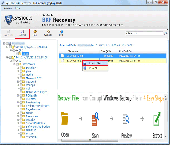
Microsoft Backup Recovery software easily retrieve NTBakcup and Veritas BKF files data in a second. Grab superb Microsoft backup recovery software which has advanced technology and latest algorithm that enable to repair Microsoft backup files from corrupted BKF database. Now download demo version of Microsoft backup recovery software which is free of cost that check...
Category: Utilities / Backup
Publisher: Microsoft Backup Recovery, License: Shareware, Price: USD $89.00, EUR73, File Size: 2.9 MB
Platform: Windows, Other
SeaClear is a PC-based chart plotter for Windows 2000/XP/NT/95/98/ME.
SeaClear is a PC-based chart plotter for Windows 2000/XP/NT/95/98/ME. With a GPS connected, it displays the current position, speed, heading and other data on the screen. The chart is repositioned and new charts are loaded automatically as needed. Tracks may be saved to files for later reviewing, and log book entries can be manually and automatically entered. Unlimited number of routes and...
Category: Home & Education / Miscellaneous
Publisher: Sping, License: Shareware, Price: USD $0.00, File Size: 0
Platform: Windows
This program converts from GPX format to CSV format or vice versa.
This program converts from GPX format to CSV format or vice versa. You can create Waypoints in MapSource and then convert them to POI (CSV) files for download or sharing with others.
You can also convert POI (CSV) files that others have created, and then edit them in MapSource. Now that the Garmin POI loader supports GPX files, GPXtoPOI's most important role is CSV to...
Category: Business & Finance / Calculators
Publisher: MasterClass, License: Freeware, Price: USD $0.00, File Size: 1.4 MB
Platform: Windows