Free Downloads: Mobile Farsi Maps
 Shareware
FPS Maps for WPF is a brand new component with a set of built-in country Maps. There are 15 Inbuilt Countries. FPS Maps for WPF contains samples of how to work with it and customize. Maps navigation can be performed via Navigation bar which supports Themes and mouse. You can pan with mouse or zoom in/out with mouse scroll. More options will be added in future...
Category: Software Development / Components & Libraries
Publisher: FPS Components, License: Shareware, Price: USD $199.00, File Size: 1.1 MB
Platform: Windows
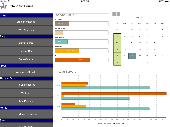
With yalips maps you get 4 products in 1.
With yalips Maps you get 4 products in 1. You are more productive, more creative and perform better on your job when using visual software tools. With the resulting visualizations you can communicate more effectively and convincingly to your collegues, your boss, your customer or the chairman of the board. Therefore many companies spent a lot of money on such tools. Unfortunately, most...
Category: Business & Finance / Project Management
Publisher: yalips Software, License: Shareware, Price: USD $80.00, File Size: 29.6 MB
Platform: Windows
In order to make EfficientPIM be enjoyed by the people from all over the world, Efficient Software added the Multiple Languages feature into EfficientPIM including English, Bulgarian, Croatian, Czech, Danish, Dutch, Farsi, Finnish, French, French (Canadian), German, Greek, Hungarian, Indonesian, Italian, Korean, Norwegian, Polish, Portuguese (Brazilian), Russian, Simplified Chinese,...
Category: Home & Education / Language
Publisher: Efficient Software, License: Freeware, Price: USD $0.00, File Size: 9.7 MB
Platform: Windows
TopoGun is a stand-alone resurfacing, and maps baking application.
TopoGun is a stand-alone resurfacing, and Maps baking application. The resurfacing functions in TopoGun will help you modify and/or recreate the edgeflow of your digital 3D models.
The Maps baking functions, will help you bake various types of texture Maps from your high resolution 3D models and then allow you to apply them to your newly created optimized...
Category: Multimedia & Design / Animation
Publisher: SC PIXELMACHINE SRL, License: Shareware, Price: USD $100.00, File Size: 55.5 MB
Platform: Windows
You can create a backup of your maps with JaVaWa GMTK and restore these (e.
You can create a backup of your Maps with JaVaWa GMTK and restore these (e.g. on another computer) including unlock codes. Re-installing Maps is unnecessary.
Migration of your Garmin Maps from and old computer to a new one is straightforward with this application.
Category: Utilities / Backup
Publisher: JaVaWa GPS-tools, License: Shareware, Price: USD $0.00, File Size: 5.4 MB
Platform: Windows
Live Satellite Maps or Google maps is a web server mapping applications.
Live Satellite Maps or Google Maps is a web server mapping applications.Provides scrolling map images and satellite photos around the earth and even the route between different places.Since 6 October 2005, live satellite Maps is part of local Google.Google live satellite Map provides the ability to zoom in or zoom out to show the map.The user can control the map with your...
Category: Home & Education / Science
Publisher: www.satelliteview-of-my-house.com, License: Freeware, Price: USD $0.00, File Size: 643.0 KB
Platform: Windows
TeeChart Charting Library for Xamarin.Android offers full set of 60+ Chart styles in 2D and 3D, Maps and gauges, 50+ financial and statistical indicators and a full set of Chart tools components for additional functionality. The TeeChart for Xamarin.Android license provides support for Android Mobile platform and includes a renewable one-year subscription service that entitles...
Category: Software Development / Components & Libraries
Publisher: Steema Software, License: Shareware, Price: USD $339.00, File Size: 15.4 MB
Platform: Mac
TeeChart Charting component for Xamarin.iOS offers 50+ Chart types in 2D and 3D, 50+ financial and statistical indicators, gauges and Maps with customizable tools for data visualization in the Mobile applications. It supports Mac iOS platform: iPhone and iPad devices. The TeeChart for Xamarin.iOS license includes a renewable one-year subscription service that entitles...
Category: Software Development / Components & Libraries
Publisher: Steema Software, License: Shareware, Price: USD $339.00, File Size: 6.7 MB
Platform: Mac
From the Sacre Coeur to the Arc de Triomphe, your holiday to Paris starts from the moment you open your guide, plus you get Paris Maps and transport Maps.
Discover the best cafe terraces, unmissable museums and galleries, loveliest parks and gardens, best areas to shop or browse, unforgettable shows and live music venues, most fun places for children, and best restaurants to...
Category: Internet / Communications
Publisher: Mobile Systems, License: Shareware, Price: USD $9.80, File Size: 0
Platform: Windows
When you are looking for a powerful tool to satisfy various needs regarding vectors, raster and satellite imagery, you will find ILWIS Academic an efficient application. The program comes with such useful features as points to create Maps, lines for segment Maps, closed area segments for polygon Maps, spatial operations for raster Maps and so on. Whilst using images...
Category: Home & Education / Miscellaneous
Publisher: ITC, License: Freeware, Price: USD $0.00, File Size: 19.4 MB
Platform: Unknown
GDS Images and Document Maps is a unique document search utility.
GDS Images and Document Maps is a unique document search utility. GDS Images and Document Maps is a rather unique application that will enable you to store all your documents and images alongside other important files and folders right on your desktop so that you can use it straight from there, without the need to bother around with looking with looking for every single file...
Category: Utilities / Misc. Utilities
Publisher: toggle, License: Freeware, Price: USD $0.00, File Size: 558.8 KB
Platform: Windows
MapCreator combines a cartography and a graphics programme.
MapCreator combines a cartography and a graphics programme. The software is designed to create Maps and animated Maps of the highest quality as often required for presentations. For example, this could be Maps needed for a travel presentation. But also in
Category: Multimedia & Design
Publisher: primap.com, License: Freeware, Price: USD $0.00, File Size: 103.3 MB
Platform: Windows, Vista
Mobile Witness Analyzer is a powerful tool for examining the effectiveness and efficiency of a business or organization's vehicles. Formerly known as the "Playback Analysis Software," Mobile Witness Analyzer improves upon its predecessor through an integration with Google Maps. Users can view the paths of vehicles on a Google map while simultaneously viewing...
Category: Business & Finance / Business Finance
Publisher: Tundra Software, LLC, License: Freeware, Price: USD $0.00, File Size: 120.0 MB
Platform: Windows
CacheMaps retreives a variety of maps for your caches from the Internet.
CacheMaps retreives a variety of Maps for your caches from the Internet.
CacheMaps uses the Geocaching loc- or gpx-files as input. Directely from the Geocaching site or as exported from GSAK.CacheMaps v4 has been designed to be used next to GSAK. A lot of the functionality that was available in previous versions of CacheMaps, is available in GSAK now in a much better form. What...
Category: Audio / Utilities & Plug-Ins
Publisher: BigBird Productions, License: Freeware, Price: USD $0.00, File Size: 153.2 KB
Platform: Windows
AdaptAir is PC/Windows software for mobile publishing.
AdaptAir is PC/Windows software for Mobile publishing. With AdaptAir you can compose and create Java ME content (MIDlets) from wide range of file formats (text and images) and/or from the internet links, WITHOUT any programming.
Creating Mobile Java midlets with AdaptAir is as simple as creating PowerPoint presentations, just inserting and editing the text and/or image...
Category: Internet / Communications
Publisher: Colovare srl, License: Shareware, Price: USD $49.95, File Size: 25.3 MB
Platform: Windows
From the Palaciao Real to the green Retiro park - the 10 best of everything to see, buy, do, taste and avoid in Madrid, plus Maps and Metro map.
Discover where to enjoy fashion, football or the art of Goya, bullfighting festivals, fun places for kids, top nightspots, finest tapas bars and local delicacies, best hotels for every budget and much more.
With included Maps...
Category: Internet / Communications
Publisher: Mobile Systems, License: Shareware, Price: USD $9.80, File Size: 0
Platform: Windows

AdaptAir LITE is PC/Windows software for mobile publishing.
AdaptAir LITE is PC/Windows software for Mobile publishing. With AdaptAir LITE you can compose and create Java ME content (MIDlets) from text and image files and/or from the internet links, WITHOUT any programming.
Creating Mobile Java midlets with AdaptAir LITE is as simple as creating PowerPoint presentations, just inserting and editing the text and/or image content and...
Category: Internet / Communications
Publisher: Colovare srl, License: Shareware, Price: USD $29.95, File Size: 18.2 MB
Platform: Windows
MAPC2MAPC is a program to manipulate digital Maps,it loads map images and calibrate them,loads calibrations in many different formats and Datums,view the calibrated map,crop and rescale Maps whilst preserving the calibration,reproject Maps to 'Plate Carre' (Equirectangular),rotate Maps to true North.
Category: Multimedia & Design / Digital Media Editors
Publisher: Thorn, License: Shareware, Price: USD $0.00, File Size: 1.6 MB
Platform: Windows
Create GPS enabled geo Maps directly on the background of aereal photos and road Maps from the internet. Import geodata from Google-Earth, OpenStreetMap, GPS tracks and GPS logger. Map editor , manually digitizing. Specifical graphical objects (borderlines, borderareas) to guarantee exact same borders of neighbour areas..Screen calibration for true to display on the screnn.
Category: Multimedia & Design / Digital Media Editors
Publisher: GPSur Dr. Erhard Regener, License: Shareware, Price: USD $65.00, File Size: 6.4 MB
Platform: Windows
Learn Travel Guide (LTG) Paris - city guide of Paris, it contains city guide (Guide-Paris) with Maps and illustrations; phrase-book (Phrasebook-French) with useful phrases to communicate in French; notes (Notes-Paris) is for writing impressions. Program works on Mobile devices with Windows Mobile 6, Windows Mobile 5, Windows Mobile 2003, Pocket PC. Guide -...
Category: Home & Education / Genealogy
Publisher: LearnWords Software, License: Shareware, Price: USD $19.95, File Size: 1.7 MB
Platform:
Terrain Tools - Create maps quickly and easily!
Terrain Tools - Create Maps quickly and easily!
Terrain Tools is the ideal tool for outdoor recreationists, real-estate professionals, farmers, ecologists, archaeologists and others who need to create basic Maps, calculate areas, lengths, bearings and distances.
Overlay GPS tracks on scanned images such as USGS or Canadian NTS topos. Import and export...
Category: Business & Finance / Applications
Publisher: Softree, License: Shareware, Price: USD $124.00, File Size: 15.0 MB
Platform: Windows
Learn more while you play! The most effective and enjoyable way to build your vocabulary ever invented now includes more than 8000 words! LingvoSoft FlashCards 2011 English Persian (Farsi) for Windows Mobile is part of LingvoSoft Suite - the complete language solution available only from LingvoSoft. Now it is simpler than ever before to improve your vocabulary and learn thousands...
Category: Home & Education / E-books & Literature
Publisher: ECTACO, Inc., License: Shareware, Price: USD $49.95, File Size: 2.4 MB
Platform: Windows
GPSMapEdit is an application designed for visual authoring of GPS-Maps in various cartographic formats: Polish format, Garmin MapSource, Lowrance MapCreate, Navitel Navigator (navigation software for Windows Mobile, Android, Symbian, iPhone), ALAN Map 500/600, Holux MapSho, and custom POIs and speedcams.
The program may also load and convert GPS-tracks, waypoints and...
Category: Utilities / Misc. Utilities
Publisher: Konstantin Galichsky, License: Shareware, Price: USD $65.00, File Size: 2.4 MB
Platform: Windows
Shareware
Offline Map Maker is a tool that help you to get offline tile images from Google Maps, Openstreetmap, Yandex Maps, Yahoo Maps, Mapquest, Gaode map, Tencent Maps, Baidu Maps, Tianditu, Arcgis Online, OneMap, Whereis, mapy.cz, Mappy, Waze, Sentinel-2 map, Strava Gloabal Heatmap, Wikimapia, GoMap.Az, Longdo Map, Bhuvan, National Map Australia, New Zealand...
Category: Internet / Download Managers
Publisher: allmapsoft.com, License: Shareware, Price: USD $79.00, File Size: 31.1 MB
Platform: Windows
With MapAuthor you can create, print and save desktop Maps, using data that you obtain from commercial sources or perhaps your in-hous GIS department as shapefiles (shapefiles are a very common GIS exchange format.) You can also produce internet-based Maps based on Google Maps, for use on your web site.
MapAuthor allows you to link your own data to Maps, for...
Category: Internet / Misc. Plugins
Publisher: MapAuthor.com, License: Freeware, Price: USD $0.00, File Size: 6.3 MB
Platform: Windows