Free Downloads: National Geographic Explorer
An easy method for recording and displaying hurricane information.
An easy method for recording and displaying hurricane information. Storm tracks are displayed on a world view high resolution globe that can be easily zoomed to any location. Bearing, distance and ETA to any Geographic location can be instantly displayed. The globe display can also be used as general Geographic aid for countries, cities, states, rivers, and lakes. Database of all...
Category: Home & Education / Miscellaneous
Publisher: Joel Graffman, License: Shareware, Price: USD $20.00, File Size: 1.2 MB
Platform: Windows
An incredibly easy app to watch and listen to your favorite video and music from around the world without annoying Geographic restrictions. Its interface is designed in an easy manner and also when you register you get 500 MB traffic as a free plan. It is easy to install and use.
Category: Audio / Utilities & Plug-Ins
Publisher: TunnelBear, License: Freeware, Price: USD $0.00, File Size: 13.1 MB
Platform: Windows
MapInfo Professional® is a powerful Microsoft® Windows®-based mapping and Geographic analysis application from the experts in location intelligence. Designed to easily visualize the relationships between data and geography, MapInfo Professional helps business analysts, planners, GIS professionals – even non-GIS users – gain new insights into their markets, share...
Category: Home & Education / Miscellaneous
Publisher: Pitney Bowes Software Inc., License: Shareware, Price: USD $0.00, File Size: 58.8 KB
Platform: Windows
Are you worried about teaching the OCR Nationals in ICT, or are you starting to feel a little overwhelmed by the workload?Advantage National is our revolutionary e-learning package that is designed to make your life easier.
Advantage National contains over 200 accurate simulations that teach and assess all of the ICT skills required, leaving you free to concentrate on the...
Category: Home & Education / Teaching Tools
Publisher: Varndean e-Learning Ltd, License: Demo, Price: USD $0.00, File Size: 32.8 MB
Platform: Windows
CoordTrans converts geographic coordinates between different coordinate systems.
CoordTrans converts Geographic coordinates between different coordinate systems.
CoordTrans is very easy to use, and full of Wizards to help you with more complex tasks.
Convert between UTM, WGS84 and NAD27 / NAD83, and more... almost all projections and datums on Earth are supported. See complete list..
You can convert single coordinates, or...
Category: Business & Finance / Business Finance
Publisher: Franson, License: Shareware, Price: USD $49.00, File Size: 6.5 MB
Platform: Windows
Track your websites growth and forecast internet trends with integrated features like Geographic reporting, and enhanced data mining. SmarterStats 3.x is the perfect solution for individuals, small businesses, and hosting companies who are looking for an enterprise-level web analytics application without the inflated price.
Category: Web Authoring / Web Design Utilities
Publisher: SmarterTools Inc., License: Freeware, Price: USD $0.00, File Size: 8.8 MB
Platform: Windows
Demonstrates visual representation of scalar values over a grid of geographic positions.
Demonstrates visual representation of scalar values over a grid of Geographic positions. AnalyticSurface supports dynamic scalar data by providing a simple, high throughput rendering pipeline for the application. This demonstrates two unique surface types:
- A dynamic surface representing random altitudes over the Coast of Florida, USA.
- A static surface representing annual...
Category: Home & Education / Teaching Tools
Publisher: NASA, License: Shareware, Price: USD $0.00, File Size: 0
Platform: Windows
The CANVAS 9 GIS Mapping Edition adds native support for Geographic Information System (GIS) data to Canvas. You can take measurements in Geographic coordinates, import industry standard SHAPE and GeoTIFF files into unlimited numbers of automatically aligned overlapping layers and choose among the following options: 2,104 Coordinate Reference Systems 67 Operation Methods (like...
Category: Multimedia & Design / Multimedia App's
Publisher: ACD Systems, License: Shareware, Price: USD $549.99, File Size: 51.9 MB
Platform: Mac, PPC
AGIS for Windows is a mapping and simple GIS shareware package.
AGIS for Windows is a mapping and simple GIS shareware package. Plot your own Geographic data on the map of the world provided without the high cost and steep learning curve usually associated with this kind of software. Create high resolution publication quality images that can be pasted into popular packages such as MS Word. Animation, web serving, distance measuring, searching, GPS...
Category: Multimedia & Design / Multimedia App's
Publisher: AGIS Software Pty Ltd, License: Shareware, Price: USD $49.00, File Size: 3.6 MB
Platform: Windows

This screensaver will show you off the beautiful images of 2 famous National parks of USA - Yellowstone and Yosemite. Yellowsone park was the first of its kind, and is known for its wildlife and its many geothermal features, especially Old Faithful Geyser, one of the most popular features in the park. Yosemite park is internationally recognized for its spectacular granite cliffs,...
Category: Desktop Enhancements / Screensavers
Publisher: Mega-Screens.com, License: Freeware, Price: USD $0.00, File Size: 5.7 MB
Platform: Windows
My World GIS™ is a Geographic Information System (GIS) designed specifically for use in middle school through college classrooms. It has been developed by the GEODE Initiative at Northwestern University as part of a research program on the adaptation of scientific visualization and data analysis tools to support inquiry-based learning.
My World gives learners access to...
Category: Home & Education / Miscellaneous
Publisher: Northwestern University, License: Shareware, Price: USD $59.00, File Size: 100.2 MB
Platform: Windows
MapInfo Professional® is a powerful Microsoft® Windows®–based mapping and Geographic analysis application. Designed to easily visualise the relationships between data and geography, MapInfo Professional 11 makes it faster and easier than ever to create, share and use maps.
Category: Software Development / Misc. Programming
Publisher: Pitney Bowes Software, Inc, License: Shareware, Price: USD $1950.00, File Size: 15.1 MB
Platform: Windows
The Geospatial Toolkit (GsT) is an NREL-developed map-based software application that integrates resource data and other Geographic information systems . The available resources for different countries allows you to see, calculate and manage the informations you got.
Category: Multimedia & Design / Graphics Viewers
Publisher: NREL, License: Shareware, Price: USD $0.00, File Size: 0
Platform: Windows
The Blue Marble Desktop is the all in one geospatial data management platform for Blue Marble’s popular data transformation tools.The Geographic Calculator and Geographic Transformer reside in the same desktop window along with a Spatial Connect module for working directly with spatial databases. Access all of these available features in a single interface through a combined...
Category: Multimedia & Design / Image Editing
Publisher: Blue Marble Geographics, License: Shareware, Price: USD $7.50, File Size: 191.9 MB
Platform: Windows
This is a very easy to use desktop application that will alert you whenever new articles are added to Yosemite National Park.net. Simply install the software and any time new content is added to the website, you will receive an alert on your desktop letting you know, and showing you part of the article. If you are interested and want to read the rest of the article, simply click on the...
Category: Utilities / Launchers
Publisher: Yosemite National Park, License: Freeware, Price: USD $0.00, File Size: 656.0 KB
Platform: Windows
Explorestart is a very simple utility that simply restart Explorer and Internet Explorer.
Explorestart is a very simple utility that simply restart Explorer and Internet Explorer. When you run this tool, all instances of Explorer (Explorer.exe) and Internet Explorer (iexplore.exe) are terminated instantly, and a new instance of Explorer is created after a few seconds.
You can use this utility when something goes wrong with...
Category: Utilities / Misc. Utilities
Publisher: NirSoft, License: Freeware, Price: USD $0.00, File Size: 3.7 KB
Platform: Windows
CensusInfo is an innovative and flexible database technology for the dissemination of population and housing census results.
Main features:
- Census indicators organised by sector
- Country-specific adaptation for indicator lists
- Census data disaggregated by socio-economic characteristics
- Sub-National data linked to...
Category: Business & Finance / Database Management
Publisher: United Nations Statistics Division, License: Freeware, Price: USD $0.00, File Size: 167.0 MB
Platform: Windows

The Grand Canyon Aerial Screensaver Standard contains 200 panoramas of the Grand Canyon National Park and surrounding areas including Bryce Canyon, Monument Valley, Zion National Park and Las Vegas. The Grand Canyon Aerial Screensaver was created over 2,000 flight hours and 2 years by a professional Grand Canyon air tour pilot and photographer. The screensaver photo collection was...
Category: Desktop Enhancements / Screensavers
Publisher: Grand Canyon Aerial, License: Shareware, Price: USD $7.99, File Size: 15.3 MB
Platform: Windows

The Grand Canyon Aerial Screensaver Deluxe contains 400 panoramas of the Grand Canyon National Park and surrounding areas including Bryce Canyon, Monument Valley, Zion National Park and Las Vegas. The Grand Canyon Aerial Screensaver was created over 2,000 flight hours and 2 years by a professional Grand Canyon air tour pilot and photographer. The screensaver photo collection was...
Category: Desktop Enhancements / Screensavers
Publisher: Grand Canyon Aerial, License: Shareware, Price: USD $10.99, File Size: 34.1 MB
Platform: Windows
The free screensaver, A Weed of National Significance, was created by RateMyScreensaver.
The free screensaver, A Weed of National Significance, was created by RateMyScreensaver.com and contains 15 high resolution images of the Lantana flowering plant. Lantana is a genus of about 150 species of perennial flowering plants, native to tropical regions of the Americas and Africa. The genus includes both herbaceous plants and shrubs growing to 0.5-2 m tall. Lantana's aromatic...
Category: Desktop Enhancements / Screensavers
Publisher: RateMyScreensaver, License: Freeware, Price: USD $0.00, File Size: 3.2 MB
Platform: Windows
Your announcement can be published in the national and local community paper.
Your announcement can be published in the National and local community paper. The more people you contacting, the more guests you have. You may also announce in swap papers that are published by real estate associations or the housing authority.Use as many resources as you can. You have no notion how much more successful you could be in selling when there is a larger visitors difficult.
Category: Home & Education / Miscellaneous
Publisher: hotsoul.info, License: Freeware, Price: USD $0.00, File Size: 532.5 KB
Platform: Windows
Explorer LaunchPad is an extension for the Windows Explorer.
Explorer LaunchPad is an extension for the Windows Explorer. Instead of opening the Explorer and moving through the directories until you have the directory you would like to see, use this program to make it much more easier.
Simply add an item to Explorer LaunchPad and click "View" - your directory is opened immediately. You can also selected...
Category: Utilities / Launchers
Publisher: Xteq Systems, License: Freeware, Price: USD $0.00, File Size: 387.9 KB
Platform: Windows
The National Reading Panel did an intensive review of effective reading strategiesfor teaching reading comprehension. The most outstanding scholars in the field,with no financial ties to anything involved in the study, conducted a remarkablythorough analysis to see which techniques and strategies yielded significant andreliable improvement in students' reading comprehension. An...
Category: Home & Education / Miscellaneous
Publisher: VLE Solutions Inc, License: Demo, Price: USD $0.00, File Size: 849.9 KB
Platform: Windows
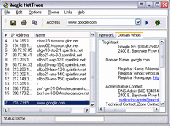
Magic NetTrace is an easy-to-use versatile program that combines ping, WHOIS and traceroute functions into one friendly GUI utility. Using this tool you can identify the source of Internet connectivity problems, track down the source of junk mail, find out a Geographic location of a web server or your ICQ buddy, troubleshoot e-mail problems and more. Multithreaded architecture makes the...
Category: Internet
Publisher: TialSoft software, License: Shareware, Price: USD $23.95, File Size: 1.5 MB
Platform: Windows
OpenJUMP is an open source Geographic Information System (GIS), it can read and write shapefiles and simple GML files. It has limited support for the display of images and good support for showing data retrieved from WFS and WMS web-services. So you can use it as GIS Data Viewer.OpenJUMP has limits in reading very large data files and has limited support for cartographic projections.
Category: Home & Education / Miscellaneous
Publisher: Jump Pilot Project, License: Shareware, Price: USD $0.00, File Size: 0
Platform: Windows