Free Downloads: Navigate Interactive Image Map
The C-Map Chart Catalog allows you to view, Navigate, select and order C-Map electronic charts, or various weather options, in an Interactive way. After selection of required items is completed, simply press the 'E-mail order' button, and enter the address of your local C-Map distributor.
Category: Home & Education / Hobbies
Publisher: Jeppesen Marine, License: Freeware, Price: USD $0.00, File Size: 6.1 MB
Platform: Windows
iMapBuilder Interactive Flash Map Builder creates Interactive flash Map and Image maps, with clickable regions, editable points and icons. You can easily embed online maps to your website for showing facts and figures interactively. It is easy to use and requires no coding or flash knowledge.
Map templates gallery are included for easy...
Category: Multimedia & Design / Animation
Publisher: WebUnion Media Ltd., License: Shareware, Price: USD $0.00, File Size: 0
Platform: Windows
The VB Image Map OCX is an ActiveX Control designed to provide your applications with the ability to display Interactive images. Hotspots, or specially designated areas on your Image, can be defined that will react to various mouse events. It is easily integrated into your existing applications - just drop the control on a form, assign a background picture, and...
Category: Software Development / Tools & Editors
Publisher: Silverband Software, License: Demo, Price: USD $49.95, File Size: 512.0 KB
Platform: Windows
 Freeware
An Interactive Flash USA Map with all the features you need for your web site or project. This is the ideal solution for dealer maps, real-estate listings, or visualizing state statistics. Nearly every aspect of the Map is customizable. However, unlike competing products, our Map is very simple to install and edit. Just upload XML and SWF files and embed.
Category: Internet / Flash Tools
Publisher: http://www.flashusamap.com/trial/flashus, License: Freeware, Price: USD $0.00, File Size: 93.8 KB
Platform: Unknown
Cool Flash Map Maker is a powerful Flash Map software for developing Interactive flash mapping solutions and products for Real Estate, Spacial Statistics, Business Locator Applications, Vector USA Map,World Map, Germany Map,ASIA Map, Canada Map, Europe Map, Australia Map, Austria Map, Africa Map, UK Map,...
Category: Multimedia & Design / Multimedia App's
Publisher: Go2Share, License: Shareware, Price: USD $29.95, File Size: 17.9 MB
Platform: Windows
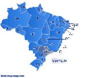
Dongsoft Interactive Brazil Flash Maps for websites, Interactive Map applications, presentations, and more.
The innovation of this fully-clickable Map will revolutionize your website navigation and provide visitors with a simple and seamless method of accessing information. Using the Map as a central navigation tool, information can be accessed with greater...
Category: Software Development / Help File Utilities
Publisher: maps flash, License: Freeware, Price: USD $0.00, File Size: 156.0 KB
Platform: Windows
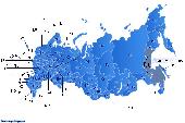
Dongsoft Interactive Russia Flash Maps for websites, Interactive Map applications, presentations, and more.
The innovation of this fully-clickable Map will revolutionize your website navigation and provide visitors with a simple and seamless method of accessing information. Using the Map as a central navigation tool, information can be accessed with greater...
Category: Software Development / Help File Utilities
Publisher: clickable map, License: Freeware, Price: USD $0.00, File Size: 156.0 KB
Platform: Windows

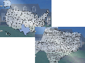
Commercial realtors require accurate and reliable tools to publish available properties online and show them on the website (specifying region, county, state, and city). We have created a unique Interactive Real Estate Map with all USA states and counties on it for real estate business. USA Real Estate Map is a unique and amazing vector-based tool that is very simple...
Category: Internet
Publisher: USFlashMap.com, License: Shareware, Price: USD $399.00, File Size: 3.9 MB
Platform: Windows, Mac, Linux, Unix, MS-DOS, AS/400, OS/2
U.S. Interactive Map for embedding into websites. State and county selection. Useful for real estate websites. FLA source files included. Among other implementation, it can be employed as: Interactive Real Estate Listing Map, Appraisal Search Software, Traveling/Timeshares Directory, Country Selector enable fast selection of the state and county, or any other purpose
Category: Software Development
Publisher: FutureVision Web Solutions, License: Commercial, Price: USD $199.00, File Size: 167.3 KB
Platform: Unknown
Anychart is a flexible Macromedia Flash based-solution, which allows you to easily display any sort of data dealing with geographical locations. It contains United States Maps with Counties, World Map, etc. XML data file and a set of customizable options make AnyChart Maps a universal solution for web developers. AnyChart allows you to create superb, compact, Interactive maps....
Category: Software Development
Publisher: AnyChart.Com, License: Shareware, Price: USD $199.00, File Size: 2.8 MB
Platform: Windows, Mac, Linux, Palm,
The flexible and powerful Data Mining and Interactive Visualization tool.
The flexible and powerful Data Mining and Interactive Visualization tool.
Import your data and Navigate at the speed of light. The tool disappears, your preferences and insight come into the spotlight.
Analyze both entities and relationships (graph and network analytics).
Build and debug predictive models, cluster similar cases together,...
Category: Multimedia & Design / Graphics Viewers
Publisher: Reactive Search Srl, License: Shareware, Price: USD $0.00, File Size: 0
Platform: Windows
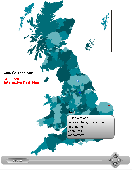
United Kingdom Interactive Flash Map.
United Kingdom Interactive Flash Map.
Suitable for Real-Estate, Dealer Maps, Branch Offices Locators.
With this fully-clickable Map you will be able to improve navigation and provide visitors with better and quicker access to information as well as improve the way you present the information. The Map can be used "as is" however it is also easily...
Category: Web Authoring / Web Design Utilities
Publisher: Fla-shop.com, License: Demo, Price: USD $44.90, File Size: 319.0 KB
Platform: Windows
Spinning Gobe Sample demonstrates how to manipulate the navigation, Map style, Map font size, and view of the Map programmatically through the MapPoint ActiveX Control. Using this simple Visual Basic project, you will learn the objects, methods, and properties that are used to Navigate a MapPoint Map or change how it looks.
Category: Home & Education / Miscellaneous
Publisher: Microsoft, License: Freeware, Price: USD $0.00, File Size: 3.4 MB
Platform: Windows
OziExplorer3D is an impeccable application for viewing Map images in 3D, along with the options of rotating it in every possible direction, zoom in/out and lots more. The application actually creates grid of heights using the height data that has been obtained and writes it to a file, along with the other required information, loads the file and the Map Image or the...
Category: Multimedia & Design / Multimedia App's
Publisher: Des Newman, License: Shareware, Price: USD $30.00, File Size: 1.9 MB
Platform: Windows
Create Image maps for your website with this easy-to-use tool from Multimedia Australia. Simply select the Image you want to use, choose a shape, then visually draw the Image Map regions. The Image Map coordinates can be copied to the clipboard for insertion into your favourite text editor.
Category: Web Authoring / Web Design Utilities
Publisher: Multimedia Australia, License: Shareware, Price: USD $24.95, File Size: 931.8 KB
Platform: Unknown
Exploring Yoga in 3D' is a fully interactive introduction to yoga.
Exploring Yoga in 3D' is a fully Interactive introduction to yoga. The journey takes you to several temples on an enchanted island to learn. Navigate via Map of the island to visit each temple at any time to review poses. History and benefits of yoga, proper breathing techniques, related concepts and basic poses/movements are covered. Differences between versions:All...
Category: Home & Education / Health & Nutrition
Publisher: Flawless Complexion, License: Shareware, Price: USD $7.95, File Size: 19.9 MB
Platform: Windows
Spikey is an onscreen Interactive Map showing each of the keys that correspond to the characters in the SPIonic font.
This is not simply an inert Map. It is a Windows application which you will need to download from this site. Once the program is installed, the shift keys and the CapsLock key "work." You can click them to show how that changes the...
Category: Desktop Enhancements / Shell & Desktop Managers
Publisher: David Howorth, License: Shareware, Price: USD $0.00, File Size: 0
Platform: Windows
You will be able to enjoy many of CompeGPS Lands features such as waypoint and route creation and edition, full communication between PDA and GPS, use of maps and the moving Map (real-time navigation). CompeGPS Pocket Land allows full communication between GPS and PDA (tracks, waypoints and routes). You will be able to create waypoints and routes, use maps and real-time...
Category: Home & Education
Publisher: CompeGPS TEAM S.L., License: Shareware, Price: USD $76.00, File Size: 3.9 MB
Platform:
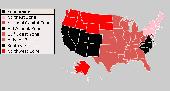
Interactive Flash maps US States.
Interactive Flash maps US States.
Suitable for Real-Estate, Dealer Maps, Branch Offices Locators.
With this fully-clickable Map you will be able to improve navigation and provide visitors with better and quicker access to information as well as improve the way you present the information. The Map can be used "as is" however it is also easily customizable....
Category: Web Authoring / Web Design Utilities
Publisher: Fla-shop.com, License: Demo, Price: USD $24.90, File Size: 229.0 KB
Platform: Windows
CyberView Image is built as an advanced, Interactive JPEG Image compressor CyberView Image is built as an advanced, Interactive JPEG Image compressor. It is based on Powerful Selective Compression Engine.
Excellent compression results and very flexible user interface are the key features of this program. CyberView Image makes it...
Category: Multimedia & Design / Media Catalogers
Publisher: CyberView Corporation, License: Freeware, Price: USD $0.00, File Size: 1.0 MB
Platform: Windows
The Microsoft Office 2007 Interactive Developer Map is a Windows Presentation Foundation (WPF) application that helps developers visualize the different programs, servers, services, and tools that will help them build solutions. It allows them to drill down to each product and technology and learn about new features, objects, Web services, namespaces, and schemas required to...
Category: Utilities / System Utilities
Publisher: Microsoft, License: Freeware, Price: USD $0.00, File Size: 18.7 KB
Platform: Windows
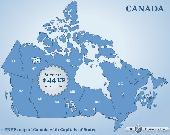
Canada Flash map (with FLA source) for web sites, interactive applications, presentations, and more.
Canada Flash Map (with FLA source) for web sites, Interactive applications, presentations, and more.
With this fully-clickable Map you will be able to improve navigation and provide visitors with better and quicker access to information as well as improve the way you present the information. The Map can be easily customizable. In just a few minutes you can make...
Category: Web Authoring / Web Design Utilities
Publisher: Fla-shop.com, License: Demo, Price: USD $44.90, File Size: 83.0 KB
Platform: Windows
Commercial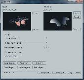
Bas-relief is intended for 2D to 3D conversion using the depth Map. The application opens two images: one is a coloured flat Image, the other is its depth Map, which shows us what areas are closer to us, and what are more distant. The white area is located at the foreground, the black one is at the background. Thereby, the general task is the acceptable depth Map...
Category: Multimedia & Design / Image Editing
Publisher: 3Dmix, License: Commercial, Price: USD $103.00, File Size: 1000 B
Platform: Windows
Shareware
CoffeeCup Image Mapper has mouseover HTML capability, includes a fully functional Image Map wizard, and enables users to attach parts of an Image to different links. Image Mapper can Map any noninterlaced GIF, interlaced GIF, standard JPEG, and progressive JPEG, as well as the first frame of an animated GIF. Users can choose from three different shape...
Category: Multimedia & Design / Button Creators
Publisher: CoffeeCup Software, License: Shareware, Price: USD $24.00, File Size: 3.8 MB
Platform: Windows
Shareware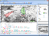
Visual Imagemapper is an Image Map editor; easy to use for the amateur, but still powerful enough for the professional developer. An Image Map is an Image that contains one or more clickable areas, also known as hotspots. Adding hotspots is both quick and easy when using Visual Imagemapper. You no longer have to cut and paste incomprehensible html code between...
Category: Internet / RSS & Web Blog Tools
Publisher: Vicentas, License: Shareware, Price: USD $30.00, File Size: 4.6 MB
Platform: Windows