Free Downloads: Nmea To Gpx Converter
 Shareware
The GPS Generator PRO application is designed for providing assitance in developing, testing and debugging programs and equipment working with the Nmea-0183 protocol. This application can also be used for learning and testing navigation applications and equipment before purchasing. This virtual GPS receiver can work without visible GPS satellites, thus it's much more efficient when...
Category: Software Development / Help File Utilities
Publisher: Avangardo, License: Shareware, Price: USD $39.99, File Size: 800.5 KB
Platform: Windows
N2KAnalyzer® is a software tool, which gives you a detailed view of all of the devices on a Nmea 2000® network, and lets you perform an enormous variety of configuration and troubleshooting tasks. All you need is a PC running Windows and a Maretron USB100 Nmea 2000 gateway.
Category: Internet / Misc. Plugins
Publisher: Maretron LLC, License: Shareware, Price: USD $0.00, File Size: 0
Platform: Windows
GeoVisu is a program that displays georeferenced data (images, graphics) and downloads data recorded by some GPS devices.
GeoVisu has a "Moving map" navigation function, which can be used with any Nmea 0183 compatible or Garmin USB GPS device.
Main features:
- Displays georeferenced image formats : GeoTiff, ECW and ECWP, MrSID, OziExplorer...
Category: Multimedia & Design / Graphics Viewers
Publisher: GeoVisu, License: Freeware, Price: USD $0.00, File Size: 1.7 MB
Platform: Windows

HS GPS is a software library (with full C source code) which provides access to a Nmea-183 compliant GPS receiver via a serial communications port, decoding Nmea sentences: $GPGGA, $GPGSA, $GPGSV, $GPGLL, $GPRMC and $GPVTG. Decoded parameters include: time, date, position, altitude, speed, course and heading, according to standard - Nmea-183 (National Marine Electronics...
Category: Software Development
Publisher: Hillstone Software, License: Freeware, Price: USD $0.00, File Size: 309.3 KB
Platform: Windows
The program accepts NMEA GPS sentences from most GPS receivers that connect to a USB port.
The program accepts Nmea GPS sentences from most GPS receivers that connect to a USB port.
The program can display satellite images of waypoint locations on the track plotter.
Is a free software for recording , monitoring and plotting GPS data, very useful and very easy.
Category: Home & Education / Miscellaneous
Publisher: Club Cruceros de La Paz A.C., License: Freeware, Price: USD $0.00, File Size: 10.6 MB
Platform: Windows
Geocache Manager is an intuitive geocache management and planning tool.
Geocache Manager is an intuitive geocache management and planning tool. Manage all your Geocaches from one place. Send only the caches you want to your GPS receiver. When you’re done Geocaching, download them to Geocache Manager to automatically update your finds.
Import Geocaches from pocket queries, .loc or .Gpx files. View all your caches on a map with the integrated Map...
Category: Multimedia & Design / Multimedia App's
Publisher: Mien Software, License: Shareware, Price: USD $19.95, File Size: 2.9 MB
Platform: Windows
GPSsim application is software based GPS device simulator.
GPSsim application is software based GPS device simulator.
GPSsim plays back Nmea data that was saved previously. It is also possible to generate custom Nmea data.
GPSsim allows you to test various PC-based navigation programs as well as use it as data logger application to track vehicle location
Category: Home & Education / Miscellaneous
Publisher: HL-soft, License: Freeware, Price: USD $0.00, File Size: 2.8 MB
Platform: Windows
Shareware
MarshallSoft GPS Component C/C++ and .NET toolkit reads and decodes industry standard GPS Nmea 183 navigation sentences from the RS232 serial port as well as computes great circle distances and bearings. Features include: - Supports both 32-bit and 64-bit Windows. - Uses the Windows API for serial port input. No special Windows driver is required. - Runs as a background thread...
Category: Software Development / Components & Libraries
Publisher: MarshallSoft Computing, License: Shareware, Price: USD $115.00, File Size: 561.6 KB
Platform: Windows
VisualGPS incorporates many advanced features found in professional programs.
VisualGPS incorporates many advanced features found in professional programs. Its sole purpose is to display graphically specific Nmea 0183 sentences and show the effects of selective availability (SA).
Main Features:
- Azimuth and Elevation Graph - View all satellites that are in view. Each satellite identifies its pseudo random number (PRN) and its azimuth and...
Category: Home & Education / Miscellaneous
Publisher: VisualGPSLLC, License: Freeware, Price: USD $0.00, File Size: 1.7 MB
Platform: Windows

GPS Clock Software is a freeware utility that runs on any Windows NT/2000/XP/2003 workstation or server. The software polls time from a standard Nmea GPS time receiver connected to the host PC's serial port and optionally allows time to be synchronised on the host PC. The GPS clock utility polls GPRMC messages from a standard Nmea GPS time receiver. Information received from the...
Category: Utilities
Publisher: ntp time server, License: Freeware, Price: USD $0.00, File Size: 1.9 MB
Platform: Windows
With Magellan Communicator for PC you can create a direct connection between your web browser and your Magellan GPS receiver connected to PC via USB cable. Enables data transfer from Geocaching.com in Gpx format.
Main features:
- Compatible with Geocaching.com
- Enable “Send to GPS" function
- Transfer Gpx files
Category: Utilities / Misc. Utilities
Publisher: MiTAC International Corporation, License: Freeware, Price: USD $0.00, File Size: 8.5 MB
Platform: Windows
Creating a map based on Gpx files for your GPS and for MapSource/BaseCamp on your computer is possible with several existing programs, but it's certainly not easy to accomplish. With IMGfromGPX it's a matter of a few mouse clicks! This program can generate a map with the following features:
tracks in 8 different colors, as lines or areas;
POIs divided into...
Category: Home & Education / Miscellaneous
Publisher: JaVaWa GPS-tools, License: Shareware, Price: USD $0.00, File Size: 4.9 MB
Platform: Windows
With this program you can convert NMEA log in format GVN, generated by GeoVisu.
With this program you can convert Nmea log in format GVN, generated by GeoVisu. GVConverter converts all files at format GVN presents in source directory and its sub-directories. It replicates source directory tree-structure into destination directory. Date and time of source file are applied to converted file. It runs on Windows 95/98/NT/2000/XP/2003.
Category: Utilities / Misc. Utilities
Publisher: GeoVisu, License: Freeware, Price: USD $0.00, File Size: 562.5 KB
Platform: Windows
Shareware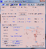
HsGpsDll is a Windows Dynamic Link Library which provides access to any Nmea-183 compliant GPS receiver via a serial communications port. HsGpsDll is designed for use from Visual C, C Sharp .NET, Visual Basic or other programming languages. HsGpsDll allows a user application to easily read from a GPS device the current GPS position fix and current velocity over ground (speed in...
Category: Software Development / Components & Libraries
Publisher: Hillstone Software, License: Shareware, Price: USD $160.00, EUR210, File Size: 1.4 MB
Platform: Windows
This free utility counts the number of finds and tabulates the finders by name for the caches in a Gpx file.
Use it to keep track of how many cachers have found your caches, or to compare the activity of your caches with your geocaching neighbors and which of your neighbors have found the most of your caches. The program provides results in simple text files and in CSV files...
Category: Utilities / Misc. Utilities
Publisher: Jim Evans, License: Freeware, Price: USD $0.00, File Size: 377.9 KB
Platform: Windows
Shareware
MarshallSoft GPS Component Visual Basic and .NET toolkit to read and decode industry standard GPS Nmea 183 navigation sentences from the RS232 serial port as well as computes great circle distances and bearings. Features include: - Supports both 32-bit and 64-bit Windows. - Uses the Windows API for serial port input. No special Windows driver is required. - Runs as a...
Category: Software Development / Components & Libraries
Publisher: MarshallSoft Computing, License: Shareware, Price: USD $115.00, File Size: 476.8 KB
Platform: Windows
MarshallSoft GPS Component VB (and VB.NET) library toolkit (MGC4VB) reads and decodes industry standard GPS Nmea 183 sentences from the RS232 serial port as well as computing great circle distances and bearings. Features of MGC4VB include: The most current GPS data is always available on demand * Runs as a background thread unattended * Works with Bluetooth virtual serial ports * Works...
Category: Software Development
Publisher: MarshallSoft Computing, License: Shareware, Price: USD $105.00, File Size: 233.4 KB
Platform: Windows
Win/CE GPS client library component reads and decodes standard GPS Nmea 183 sentences from the RS232 serial port as well as compute great circle distances and bearings. Several eVC example programs with full source code are included. Requires Windows Embedded Tools eVC compiler. Some of the many features of the MarshallSoft GPS Component (MGC) are: (1) Uses the Win/CE Win32 API for...
Category: Software Development / Tools & Editors
Publisher: MarshallSoft Computing, License: Shareware, Price: USD $105.00, File Size: 256.0 KB
Platform: Windows,
The KML Generator is a useful and reliable utility which enables you to easily analyze GPS log files containing Nmea string data and then generate Google Earth (TM) compatible KML files. It is a free to use application and has a simple and friendly interface. It has low system requirements too, and works on all windows operating systems.
Category: Software Development / Misc. Programming
Publisher: Jacob Madsen, License: Shareware, Price: USD $0.00, File Size: 0
Platform: Windows
Shareware
ZylGPSReceiverAX is an an award-winning ActiveX control that communicates with a serial GPS receiver. It returns latitude, longitude, altitude, speed, heading and many other parameters of the position. This control works with any Nmea compatible receiver connected to one of the serial ports. You can use it also with USB devices, because these devices usually have a driver that...
Category: Software Development / ActiveX
Publisher: Zyl Soft, License: Shareware, Price: USD $99.99, File Size: 863.4 KB
Platform: Windows
NemaTalker provides both user and developer of Nmea soft and hardware with a very powerful development and testing tool by simulating the output of a large number of nautical instruments, including GPS.
The program can be successfully used for educational purposes as well.
Category: Internet / Misc. Plugins
Publisher: Sailsoft, License: Shareware, Price: USD $59.00, File Size: 1.8 MB
Platform: Windows
Shareware
Virtual GPS is a GPS simulator software. You can use it to simulate a GPS receiver unit connected to your system. It's ideal when you need GPS input, but you have no signal or for development purposes. It supports various Nmea sentences, so it can be used with any GPS mapping software. You can use it using a null-modem cable connected to two physical serial ports or you can use one of...
Category: Internet / RSS & Web Blog Tools
Publisher: Zyl Soft, License: Shareware, Price: USD $39.99, File Size: 856.0 KB
Platform: Windows
NemaStudio provides the professional developer of Nmea products with a very powerful development and testing tool by simulating the output of various nautical instruments and target objects including GPS, AIS and Radar.
All instruments, targets and ports can be matched and mixed, meaning you can have multiple instances of several objects transmitting over the same or over...
Category: Software Development / Misc. Programming
Publisher: Sailsoft, License: Shareware, Price: USD $345.31, File Size: 2.4 MB
Platform: Windows
Shareware
Toolkit to add GPS functionality to your software and scripts (GPS SDK). All NMEA0183 protocol versions are supported and can be filtered by Nmea sentence type and talker ID. Information on GPS status can also be retrieved: GPS fix quality, satellites used in fix, satellites in view, satellite azimuth, elevation and signal strengths. The toolkit also offers functionality to perform map...
Category: Software Development / ActiveX
Publisher: Eye4Software B.V., License: Shareware, Price: USD $150.81, File Size: 1.6 MB
Platform: Windows
Yet another tool to read and convert GPS logs from Royaltek RGM-3800 and RBT-2300 (using serial communication), from RBT-3000 (using files), from Nmea logs files (comming from AMOD 3080 datalogger for example). Free download and easy to install. Enjoy.
Category: Utilities / Misc. Utilities
Publisher: eXtraGPS, License: Freeware, Price: USD $0.00, File Size: 2.5 MB
Platform: Windows