Free Downloads: Nmea To Kml

HS GPS is a software library (with full C source code) which provides access to a Nmea-183 compliant GPS receiver via a serial communications port, decoding Nmea sentences: $GPGGA, $GPGSA, $GPGSV, $GPGLL, $GPRMC and $GPVTG. Decoded parameters include: time, date, position, altitude, speed, course and heading, according to standard - Nmea-183 (National Marine Electronics...
Category: Software Development
Publisher: Hillstone Software, License: Freeware, Price: USD $0.00, File Size: 309.3 KB
Platform: Windows
GeoVisu is a program that displays georeferenced data (images, graphics) and downloads data recorded by some GPS devices.
GeoVisu has a "Moving map" navigation function, which can be used with any Nmea 0183 compatible or Garmin USB GPS device.
Main features:
- Displays georeferenced image formats : GeoTiff, ECW and ECWP, MrSID, OziExplorer...
Category: Multimedia & Design / Graphics Viewers
Publisher: GeoVisu, License: Freeware, Price: USD $0.00, File Size: 1.7 MB
Platform: Windows
The program accepts NMEA GPS sentences from most GPS receivers that connect to a USB port.
The program accepts Nmea GPS sentences from most GPS receivers that connect to a USB port.
The program can display satellite images of waypoint locations on the track plotter.
Is a free software for recording , monitoring and plotting GPS data, very useful and very easy.
Category: Home & Education / Miscellaneous
Publisher: Club Cruceros de La Paz A.C., License: Freeware, Price: USD $0.00, File Size: 10.6 MB
Platform: Windows
GPSsim application is software based GPS device simulator.
GPSsim application is software based GPS device simulator.
GPSsim plays back Nmea data that was saved previously. It is also possible to generate custom Nmea data.
GPSsim allows you to test various PC-based navigation programs as well as use it as data logger application to track vehicle location
Category: Home & Education / Miscellaneous
Publisher: HL-soft, License: Freeware, Price: USD $0.00, File Size: 2.8 MB
Platform: Windows
VisualGPS incorporates many advanced features found in professional programs.
VisualGPS incorporates many advanced features found in professional programs. Its sole purpose is to display graphically specific Nmea 0183 sentences and show the effects of selective availability (SA).
Main Features:
- Azimuth and Elevation Graph - View all satellites that are in view. Each satellite identifies its pseudo random number (PRN) and its azimuth and...
Category: Home & Education / Miscellaneous
Publisher: VisualGPSLLC, License: Freeware, Price: USD $0.00, File Size: 1.7 MB
Platform: Windows

GPS Clock Software is a freeware utility that runs on any Windows NT/2000/XP/2003 workstation or server. The software polls time from a standard Nmea GPS time receiver connected to the host PC's serial port and optionally allows time to be synchronised on the host PC. The GPS clock utility polls GPRMC messages from a standard Nmea GPS time receiver. Information received from the...
Category: Utilities
Publisher: ntp time server, License: Freeware, Price: USD $0.00, File Size: 1.9 MB
Platform: Windows
With this program you can convert NMEA log in format GVN, generated by GeoVisu.
With this program you can convert Nmea log in format GVN, generated by GeoVisu. GVConverter converts all files at format GVN presents in source directory and its sub-directories. It replicates source directory tree-structure into destination directory. Date and time of source file are applied to converted file. It runs on Windows 95/98/NT/2000/XP/2003.
Category: Utilities / Misc. Utilities
Publisher: GeoVisu, License: Freeware, Price: USD $0.00, File Size: 562.5 KB
Platform: Windows
Superoverlay software is a Google Earth application for tiling raster datasets and creating view based regions in Kml or KMZ files.
Also Superoverlay can generate world files for all images in ArcView style (jgw, tfw,...). It helps you put large image overlays into Google Earth (for example alternative maps or aerial photography). GE Sky mode is supported.
Category: Home & Education / Miscellaneous
Publisher: GIS Center, License: Shareware, Price: USD $0.00, File Size: 0
Platform: Windows
 Shareware
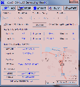
HsGpsDll is a Windows Dynamic Link Library which provides access to any Nmea-183 compliant GPS receiver via a serial communications port. HsGpsDll is designed for use from Visual C, C Sharp .NET, Visual Basic or other programming languages. HsGpsDll allows a user application to easily read from a GPS device the current GPS position fix and current velocity over ground (speed in...
Category: Software Development / Components & Libraries
Publisher: Hillstone Software, License: Shareware, Price: USD $160.00, EUR210, File Size: 1.4 MB
Platform: Windows
Demo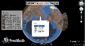
Visualize your data in 3D! Quick, easy and inexpensive. Graph Earth enables management, marketing and other business professionals to create stunning visual representations of their data, all without the time and costs associated with a full-featured GIS. Viewable by Everyone! Create one of a kind deliverables and distribute them to the world, recipients need only install Google Earth to view...
Category: Business & Finance / MS Office Addons
Publisher: Deer Creek Marketing LLC, License: Demo, Price: USD $24.95, File Size: 469.0 KB
Platform: Windows
Shareware
An add-on for AUTOCAD or BricsCAD, which makes the triangulation of a set of POINT entities, the intersection curves (isolines) between a set of 3DFACE entities and a set of equidistance plans, horizontally or vertically and the volume and center of gravity of a set of bodies or between surfaces composed of 3DFACE entities. You can also load and draw a file of points having the format: Number...
Category: Multimedia & Design / Graphics Viewers
Publisher: Rcad Software, License: Shareware, Price: USD $64.00, EUR59, File Size: 2.5 MB
Platform: Windows
Shareware
MarshallSoft GPS Component C/C++ and .NET toolkit reads and decodes industry standard GPS Nmea 183 navigation sentences from the RS232 serial port as well as computes great circle distances and bearings. Features include: - Supports both 32-bit and 64-bit Windows. - Uses the Windows API for serial port input. No special Windows driver is required. - Runs as a background thread...
Category: Software Development / Components & Libraries
Publisher: MarshallSoft Computing, License: Shareware, Price: USD $115.00, File Size: 561.6 KB
Platform: Windows
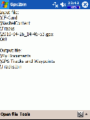
A program to convert GPS-track of *. gpx, *.
mps, *. plt or *. nmea format to Navitel Tracks.
Category: Home & Education / Sports
Publisher: DXsoft, License: Freeware, Price: USD $0.00, File Size: 31.6 KB
Platform: Windows
Win/CE GPS client library component reads and decodes standard GPS Nmea 183 sentences from the RS232 serial port as well as compute great circle distances and bearings. Several eVC example programs with full source code are included. Requires Windows Embedded Tools eVC compiler. Some of the many features of the MarshallSoft GPS Component (MGC) are: (1) Uses the Win/CE Win32 API for...
Category: Software Development / Tools & Editors
Publisher: MarshallSoft Computing, License: Shareware, Price: USD $105.00, File Size: 256.0 KB
Platform: Windows,
Shareware
ZylGPSReceiverAX is an an award-winning ActiveX control that communicates with a serial GPS receiver. It returns latitude, longitude, altitude, speed, heading and many other parameters of the position. This control works with any Nmea compatible receiver connected to one of the serial ports. You can use it also with USB devices, because these devices usually have a driver that...
Category: Software Development / ActiveX
Publisher: Zyl Soft, License: Shareware, Price: USD $99.99, File Size: 863.4 KB
Platform: Windows
NemaTalker provides both user and developer of Nmea soft and hardware with a very powerful development and testing tool by simulating the output of a large number of nautical instruments, including GPS.
The program can be successfully used for educational purposes as well.
Category: Internet / Misc. Plugins
Publisher: Sailsoft, License: Shareware, Price: USD $59.00, File Size: 1.8 MB
Platform: Windows
Shareware
Virtual GPS is a GPS simulator software. You can use it to simulate a GPS receiver unit connected to your system. It's ideal when you need GPS input, but you have no signal or for development purposes. It supports various Nmea sentences, so it can be used with any GPS mapping software. You can use it using a null-modem cable connected to two physical serial ports or you can use one of...
Category: Internet / RSS & Web Blog Tools
Publisher: Zyl Soft, License: Shareware, Price: USD $39.99, File Size: 856.0 KB
Platform: Windows

OkCustomMap is a software to produce Garmin Custom Maps.
OkCustomMap is a software to produce Garmin Custom Maps.
Supports many map formats:
- OkMap
- Ecw
- GeoTiff
- World files
- OziExplorer
- GpsTuner
You can customize:
- The quality of the output JPEG images (0=Bad, 100=Good)
- The Kml transparency (0=Transparent, 255=Opaque)
- The Kml draw order (0=Invisible, 1-49=Under the vectorial...
Category: Business & Finance / Applications
Publisher: Gian Paolo Saliola, License: Freeware, Price: USD $0.00, File Size: 3.2 MB
Platform: Windows
NemaStudio provides the professional developer of Nmea products with a very powerful development and testing tool by simulating the output of various nautical instruments and target objects including GPS, AIS and Radar.
All instruments, targets and ports can be matched and mixed, meaning you can have multiple instances of several objects transmitting over the same or over...
Category: Software Development / Misc. Programming
Publisher: Sailsoft, License: Shareware, Price: USD $345.31, File Size: 2.4 MB
Platform: Windows
KMLCSV Converter is a tool that enables you to convert the Kml file generated from Google Earth (free version) into a formatted CSV file (and vice versa). This CSV file can then be uploaded into your Garmin GPS by using Garmin POI Loader, which can be downloaded for free. This allows you to plot all the custom point of interests (POI) with Google Earth first. Then, you can transfer all...
Category: Business & Finance / Calculators
Publisher: Choon-Chern Lim, License: Freeware, Price: USD $0.00, File Size: 2.3 MB
Platform: Windows
Shareware
Toolkit to add GPS functionality to your software and scripts (GPS SDK). All NMEA0183 protocol versions are supported and can be filtered by Nmea sentence type and talker ID. Information on GPS status can also be retrieved: GPS fix quality, satellites used in fix, satellites in view, satellite azimuth, elevation and signal strengths. The toolkit also offers functionality to perform map...
Category: Software Development / ActiveX
Publisher: Eye4Software B.V., License: Shareware, Price: USD $150.81, File Size: 1.6 MB
Platform: Windows
Yet another tool to read and convert GPS logs from Royaltek RGM-3800 and RBT-2300 (using serial communication), from RBT-3000 (using files), from Nmea logs files (comming from AMOD 3080 datalogger for example). Free download and easy to install. Enjoy.
Category: Utilities / Misc. Utilities
Publisher: eXtraGPS, License: Freeware, Price: USD $0.00, File Size: 2.5 MB
Platform: Windows
Kinomap GPS File Fixer allows you to process some treatments on GPS file:
- convert almost any GPS file to standard Nmea 0183, compatible with Kinomap
- fill the gaps between points when your file is not 1Hertz: the extra point will be recreated by interpolation
- cut a long file in which there are loops of data (example: race) in several parts
Category: Home & Education / Miscellaneous
Publisher: ExcelLance, License: Freeware, Price: USD $0.00, File Size: 19.6 MB
Platform: Windows
Shareware
MarshallSoft GPS Component Visual Basic and .NET toolkit to read and decode industry standard GPS Nmea 183 navigation sentences from the RS232 serial port as well as computes great circle distances and bearings. Features include: - Supports both 32-bit and 64-bit Windows. - Uses the Windows API for serial port input. No special Windows driver is required. - Runs as a...
Category: Software Development / Components & Libraries
Publisher: MarshallSoft Computing, License: Shareware, Price: USD $115.00, File Size: 476.8 KB
Platform: Windows
MarshallSoft GPS Component VB (and VB.NET) library toolkit (MGC4VB) reads and decodes industry standard GPS Nmea 183 sentences from the RS232 serial port as well as computing great circle distances and bearings. Features of MGC4VB include: The most current GPS data is always available on demand * Runs as a background thread unattended * Works with Bluetooth virtual serial ports * Works...
Category: Software Development
Publisher: MarshallSoft Computing, License: Shareware, Price: USD $105.00, File Size: 233.4 KB
Platform: Windows