Free Downloads: Olap Connection Arcgis
Grid Translator Pro (GTP) for Arcgis® is an add-on application for Arcgis® and one stop solution for Arcgis® users to enable a wide range of raster and imaging formats within the Arcgis® suite products. Arcgis® is a family of products developed by ESRI Inc. including desktop and server products. To work properly, GTP for Arcgis®...
Category: Business & Finance / Business Finance
Publisher: Geomatics Systems, License: Shareware, Price: USD $400.00, File Size: 12.4 MB
Platform: Windows
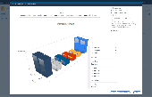
Interactive Olap Charts for SharePoint 2010 provides SharePoint web parts for charting and visual analysis of your Olap cube data. Easy to set up, and integrate in your existing SharePoint sites. Visualize Olap data with analysis functionalities which supports visual drilling, slicing, isolating and drillthroughs. With available caching options, provides tool for...
Category: Business & Finance / Applications
Publisher: Kyubit, License: Shareware, Price: USD $195.00, File Size: 173.0 KB
Platform: Windows
Arcgis Workflow Manager (formerly Job Tracking for Arcgis [JTX]) is an extension to Arcgis Desktop and Arcgis Server that lets organizations develop and enforce standard, repeatable GIS workflows across the enterprise.
Workflow Manager greatly improves the efficiency of GIS operations by organizing and automating the relationships between the activities in a...
Category: Home & Education / Miscellaneous
Publisher: ESRI, License: Shareware, Price: USD $2500.00, File Size: 1.1 MB
Platform: Windows
Arcgis Explorer is a free, downloadable GIS viewer that gives you an easy way to explore, visualize and share GIS information. Arcgis Explorer adds value to any GIS because it helps you deliver your authoritative data to a broad audience.
The Arcgis Explorer Desktop Current User setup is intended for users who do not have administrator access on their computers and...
Category: Desktop Enhancements / Shell & Desktop Managers
Publisher: Environmental Systems Research Institute, Inc., License: Freeware, Price: USD $0.00, File Size: 94.0 MB
Platform: Windows
LP360 for ArcGIS™ is a first-of-its-kind LIDAR software extension for the ESRI™ ArcGIS environment.
LP360 for Arcgis™ is a first-of-its-kind LIDAR software extension for the ESRI™ Arcgis environment. The LP360 LIDAR extension uses a specially-designed ArcMap™ data layer to access points directly from industry standard LAS files. LP360 completely integrates LIDAR point cloud datasets into Arcgis without requiring an import or conversion process. With...
Category: Multimedia & Design / Image Editing
Publisher: QCoherent Software, License: Shareware, Price: USD $0.00, File Size: 0
Platform: Windows
OLAP analysis without the cubes.
Olap analysis without the cubes. Create interactive tables, charts, and reports using ComponentOne Olap™ for WinForms. This suite of .NET controls provides analytical processing features similar to those found in Microsoft Excel Pivot Tables and Pivot Charts. Drag-and-drop views give you real-time information, insights, and results in seconds.
Category: Business & Finance / Database Management
Publisher: ComponentOne, LLC, License: Shareware, Price: USD $1795.00, File Size: 15.4 MB
Platform: Windows
Projection Engine Expansion Pack - Adds more projections and geotransformations for use with Arcgis Explorer Desktop.
Arcgis Explorer Desktop adds value to any GIS because it helps you deliver your authoritative data to a broad audience.
With Arcgis Explorer Desktop, you can access ready-to-use Arcgis Online basemaps and layers.
Category: Multimedia & Design / Multimedia App's
Publisher: Environmental Systems Research Institute, Inc., License: Freeware, Price: USD $0.00, File Size: 69.9 MB
Platform: Windows
With this release, ArcGIS transforms the way you use GIS.
With this release, Arcgis transforms the way you use GIS.Be more productive with your work and take advantage of GIS everywhere: via individual local desktops, across desktops and browsers leveraging central servers, and in the cloud.Arcgis Desktop contains two applications: ArcMap and ArcCatalog. ArcMap provides data display, query, and analysis. ArcCatalog provides data management.
Category: Business & Finance / Business Finance
Publisher: Environmental Systems Research Institute, Inc., License: Demo, Price: USD $0.00, File Size: 2.0 GB
Platform: Windows
The Arcgis Military Analyst extension incorporates a suite of display and analysis tools tailored to meet the special needs of the defense and intelligence user. With Arcgis Military Analyst, you can create, query, analyze, and display spatial data in a variety of formats.
Arcgis Military Analyst maximizes the use of the standard suite of the Department of...
Category: Multimedia & Design / Multimedia App's
Publisher: Environmental Systems Research Institute, Inc., License: Freeware, Price: USD $0.00, File Size: 31.9 MB
Platform: Windows
ET GeoWizards is a set of powerful functions that will help the Arcgis users to manipulate data with ease. It enables the Arcgis users with ArcView licenses to perform some data processing tasks standardly possible only in ArcEditor and ArcInfo. The surface functions make possible to do 3D analysis in ArcMap with no need of 3D Analyst.
Category: Multimedia & Design / Multimedia App's
Publisher: Environmental Systems Research Institute, Inc, License: Shareware, Price: USD $60.00, File Size: 5.9 MB
Platform: Windows
The Arcgis Editor for OpenStreetMap is designed to help Arcgis Desktop users to become active members in the growing community of users building an open and freely available database of geographic data.
The provided tools allow you to download data from the OSM servers and store it locally in a geodatabase. You can then use the familiar editing environment of...
Category: Business & Finance / Business Finance
Publisher: ESRI, License: Freeware, Price: USD $0.00, File Size: 3.6 MB
Platform: Windows
CrossView for Arcgis is the premier 2-dimensional cross sectioning tool for complementing the Arcgis workflow. With applications to suit professionals from environmental engineers and geologists to planners and construction engineers, CrossView makes GIS easier, saving time and money.Gain broader and more intimate visual access to geospatial terrains and subsurfaces, by...
Category: Multimedia & Design / Multimedia App's
Publisher: A-Prime Software, License: Shareware, Price: USD $0.00, File Size: 0
Platform: Windows
Arcgis Data Reviewer (formerly GIS Data ReViewer) is an extension to Arcgis for Desktop that provides a complete system to automate and simplify your data quality control (QC) process. Data Reviewer lets you centrally manage the error QC lifecycle process—finding, correcting, and verifying errors—thereby eliminating any paper trail associated with traditional QC...
Category: Utilities / Misc. Utilities
Publisher: Environmental Systems Research Institute, Inc., License: Shareware, Price: USD $0.00, File Size: 30.9 MB
Platform: Windows
Arcgis Image Server is designed to be open, enabling developers to expand its functionality and integrate it with their applications. The core structures that Arcgis Image Server uses are a combination of Extensible Markup Language (XML) and simple tables stored as shapefiles. The Service Editor component provides a graphic user interface (GUI) that enables you to create services...
Category: Utilities / Misc. Utilities
Publisher: Environmental Systems Research Institute, Inc., License: Freeware, Price: USD $0.00, File Size: 3.8 MB
Platform: Windows
GeoImaging Tools for Arcgis provides Arcgis users a suite of tools for processing and analyzing imagery in the GIS.
PCI Geomatics is introducing a suite of modules that integrate directly into Arcgis for achieving common image related tasks.
Users now have the option to save the correction parameters into the Raster Processing Definition (RPDef)...
Category: Software Development / Misc. Programming
Publisher: PCI Geomatics, License: Shareware, Price: USD $0.00, File Size: 43.5 KB
Platform: Windows
The first product from WebBridge series for operation with Internet tiles maps in the environment of Arcgis. The program allows to connect directly in project ArcMap the raster layer linked to one of Internet services, to display depending on scale appropriate level of an Internet map. The program does not demand usage Arcgis Server/ImageServer or access to Virtual Earth through...
Category: Internet / Misc. Plugins
Publisher: MitrichTools, License: Demo, Price: USD $0.00, File Size: 581.5 KB
Platform: Windows
ET GeoWizards is a set of powerful functions that will help the Arcgis users to manipulate data with ease. It enables the Arcgis users with ArcView licenses to perform some data processing tasks standardly possible only in ArcEditor and ArcInfo. The surface functions make possible to do 3D analysis in ArcMap with no need of 3D Analyst.
The main target of the software...
Category: Software Development / Misc. Programming
Publisher: ET SpatialTechniques, License: Shareware, Price: USD $245.00, File Size: 7.1 MB
Platform: Windows
Create powerful analytical dashboards using OLAP technology.
Create powerful analytical dashboards using Olap technology. Perform insightful data analysis with a wide variety of forecasting, financial and statistical formulas.
Connect to a long list of data sources, including SQL, Oracle, Excel, Access, MS Olap, SAP BW, Teradata, Visual FoxPro, Google Analytics, and many more.
Category: Desktop Enhancements / Shell & Desktop Managers
Publisher: Dundas Data Visualization, Inc., License: Freeware, Price: USD $0.00, File Size: 8.6 MB
Platform: Windows
Arcgis Explorer Desktop is a free GIS viewer that gives you an easy way to explore, visualize, and share GIS information. Arcgis Explorer adds value to any GIS because it helps you deliver your authoritative data to a broad audience.
Easy and intuitive to use it's easy for anyone to begin working with Arcgis Explorer, with its intuitive and easy to use...
Category: Home & Education / Miscellaneous
Publisher: Environmental Systems Research Institute, Inc., License: Freeware, Price: USD $0.00, File Size: 100.5 MB
Platform: Windows
BI-Lite CUBE-it Zero is an Olap Cube builder available in a number of editions, which brings building cubes within the grasp of anyone familiar with MS Access or SQL Server.
CUBE-it Zero bridges the gap between Access Queries and Olap CUBES. CUBE-it Zero extends the reach of Olap cubes to everyone by enabling the creation of cubes using a simple 4 step...
Category: Business & Finance / Database Management
Publisher: Academy Software Products Ltd, License: Shareware, Price: USD $29.00, File Size: 5.8 MB
Platform: Windows
This utility adds LAS file read capability to ArcGIS.
This utility adds LAS file read capability to Arcgis. Point x, y, z, intensity, return and classification values are read from the file and presented as a standard 3-D point data layer which can then be used as input to extensions such as 3-D Analyst.
Category: Multimedia & Design / Multimedia App's
Publisher: GeoCue, License: Freeware, Price: USD $0.00, File Size: 8.4 MB
Platform: Windows
Arcgis for AutoCAD is a free, downloadable plug-in application for AutoCAD that provides improved interoperability between AutoCAD and Arcgis. Within the AutoCAD environment, you gain easy access to enterprise GIS maps hosted by Arcgis Server.
In addition, Arcgis for AutoCAD gives you the ability to prepare CAD data for use with the Arcgis system...
Category: Multimedia & Design / Image Editing
Publisher: Environmental Systems Research Institute, Inc., License: Demo, Price: USD $0.00, File Size: 1.4 MB
Platform: Windows
HTML ImageMapper NG10 is the easiest, fastest and most comfortable solution to
convert Arcgis projects into attractive and interactive Online-GIS-applications.
With the Wizard-based Arcgis-Extension, you export maps from Arcgis to the
internet or intranet as well as to CD or DVD for use.
Category: Business & Finance / Business Finance
Publisher: alta4 Geoinformatik AG, License: Shareware, Price: USD $2231.00, File Size: 12.6 MB
Platform: Windows
The API is built on the Microsoft Silverlight platform which is integrated with Visual Studio 2010 and Expression Blend 4. The Arcgis API for Silverlight enables you to create rich internet and desktop applications that utilize the powerful mapping, geocoding, and geoprocessing capabilities provided by Arcgis Server and Bing™ services.
To use the API, simply download...
Category: Software Development / Misc. Programming
Publisher: ESRI, License: Freeware, Price: USD $0.00, File Size: 7.7 MB
Platform: Windows
TopoSurv is a management system for field data, an application to ArcGIS.
TopoSurv is a management system for field data, an application to Arcgis.
TopoSurv imports and calculates survey- and satellite data to Arcgis database and is a plug-in to Arcgis. With TopoSurv do you import survey and satellite data from Leica, Trimble and survey data from Sokkia, Topcon (LandXML) and other instruments via different file formats such as ASCII,...
Category: Multimedia & Design / Image Editing
Publisher: Adtollo AB, License: Shareware, Price: USD $899.00, File Size: 39.1 MB
Platform: Windows