Free Downloads: Open Garmin Img File
Palm Desktop for Garmin iQue 3600 is one of the first PDAs to offer built-in GPS, as opposed to the jackets often used with other models.
Mapping integrates well - you can add a location to any address book entry, for example - but you can only route to an address from your present location, not from one distant one to another.
Category: Multimedia & Design / Multimedia App's
Publisher: Garmin Ltd or its subsidiaries, License: Freeware, Price: USD $0.00, File Size: 11.7 MB
Platform: Windows
This tool massively automatically sets and updates the height and width attributes of Img tags of HTML documents based on the original height and width of the source image. It is a good practice to set the height and width of Img tags to allow the browser to display the webpage more smoothly while the webpage is being loaded. With this tool you do not need to find and set the...
Category: Internet / Misc. Plugins
Publisher: 4dots Software, License: Freeware, Price: USD $0.00, File Size: 135.0 KB
Platform: Windows
GeePeeEx Editor is specifically designed to produce and edit GPX files destined for Garmin's® Automotive Satnav (GPSr) systems. These files can be used as input to Garmin's® POI Loader to produce enhanced Custom POI's (Points of Interest).
Convert CSV files to GPX. Optionally and uniquely, GeePeeEx Editor will search for valid telephone numbers...
Category: Audio / Rippers & Encoders
Publisher: Them, License: Freeware, Price: USD $0.00, File Size: 2.6 MB
Platform: Windows
Convert IMG is an image converter.
Convert Img is an image converter. It currently can convert .gif to .bmp (bitmap) and the reverse.
Category: Utilities / File Compression
Publisher: sourceforge.net, License: Freeware, Price: USD $0.00, File Size: 2.0 KB
Platform: Windows, Mac, 2K, 2K3
Now you can plan and organize trips with MapSource, a very useful computer software.
Now you can plan and organize trips with MapSource, a very useful computer software.
MapSource is included with the purchase of a Garmin map on DVD or CD. With MapSource, you can:
- Back up important trip data separately from your Garmin device.
- Plan routes from the convenience of your computer instead of on your device.
- Create, view, and edit...
Category: Business & Finance / Database Management
Publisher: Garmin Ltd or its subsidiaries, License: Shareware, Price: USD $0.00, File Size: 54.4 MB
Platform: Windows
 Shareware
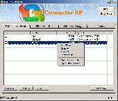
Convert PDF to Text, Img or RTF on-the-fly PDF Converter XP program can convert PDF to Text (TXT files), RTF (Rich Text Format), Img ( TIF or TIFF files) on-the-fly. If you want to read PDF File while no PDF reader installed on your computer, or if you want to use the text included in the PDF File, but it can not support copy and paste, then you may use PDF...
Category: Business & Finance / Calculators
Publisher: download-converter, License: Shareware, Price: USD $19.95, EUR18.95, File Size: 1.8 MB
Platform: Windows
MagicISO is a powerful CD/DVD image File editor, CD burner, and CD/DVD backup tool. It can directly create, edit, extract compress and burn ISO files, It also can convert almost all CD/DVD image formats to ISO/BIN/CUE. With MagicISO, you can handle DVD image up to 10GB; make cd image files from CD/DVD-ROM; also can burn ISO files and another CD/DVD image files (BIN, Img, CIF,...
Category: Utilities
Publisher: MagicISO, License: Shareware, Price: USD $29.95, File Size: 2.4 MB
Platform: Windows
Moagu: The Mother Of All GPS Utilities.
Moagu: The Mother Of All GPS Utilities.
You can convert USGS topographic maps, aerial/satellite imagery, and any other raster map imagery for use on Garmin handled GPS units.
Garmin maps have been in a "vector" format; Moagu creates maps using a "bitmap" format.
Category: Home & Education / Miscellaneous
Publisher: Moagu, License: Shareware, Price: USD $19.95, File Size: 38.2 MB
Platform: Windows
AnyToISO - Open/Extract/Convert to ISO, Extract ISO, Make ISO
- Extract/Convert to ISO: NRG, MDF, UIF, DMG, ISZ, BIN, DAA, PDI, CDI, Img, etc CD/DVD-ROM images
- Extract ISO, DMG, DEB, RPM... files
- Create ISO from CD/DVD/Blu-ray disks
- Create ISO from files/folders
- Integration with Explorer and Apple Finder
- Command line support
Category: Utilities / Misc. Utilities
Publisher: CrystalIdea Software, License: Shareware, Price: USD $22.95, File Size: 6.0 MB
Platform: Windows
Img To Html easily can convert any of your image files to complete html source.
Img To Html easily can convert any of your image files to complete html source. You can choose to either convert your imageto a sequence of chars or to a table. You can also grayscale your images, chose the fonts and even let them internally be compressed by JavaScript.
Category: Utilities / System Utilities
Publisher: Alpha Interactive, License: Freeware, Price: USD $0.00, File Size: 798.7 KB
Platform: Windows
The GPS map will help you give you with turn by turn directions to your destination using a POI, city point and/or longitude and latitude.It has the ability to preplan driving destinations before getting into your car. Compatible with ALL Garmin GPS units. Don't pay more than US$10 per day when you already own a Garmin, this is the most comprehensive GPS map available at such...
Category: Home & Education / Miscellaneous
Publisher: GPSTravelMaps.com, License: Shareware, Price: USD $0.00, File Size: 0
Platform: Windows
MetroGold is a Windows tool with which you can upgrade your Garmin MetroGuide Europe or Metroguide North America installation. After the upgrade it's possible to include routing calculation data in your upload of maps to your GPS. No extra software, apart from Mapsource, is needed, you can transfer the maps with Mapsource.
Category: Utilities / Misc. Utilities
Publisher: Geodude, License: Shareware, Price: USD $0.00, File Size: 0
Platform: Windows
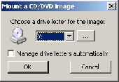
WinCDEmu is an Open-source software that allows mounting CD/DVD images by clicking at the image files in Windows Explorer. It supports both 32-bit and 64-bit Windows XP and Vista, is Open-source and completely freeware. Supports ISO, CUE, BIN/RAW/Img File formats as well as SMB network shares and includes a workaround for Windows cache bug. Each mounted image will be...
Category: Utilities / System Utilities
Publisher: Sysprogs, License: Freeware, Price: USD $0.00, File Size: 865.0 KB
Platform: Windows
PoiEditor is a software solution package for downloading and customizing road safety data.
PoiEditor is a software solution package for downloading and customizing road safety data. The software makes it easy to stay up to date with the latest road safety data also know as POI's(Points of interest), it also applies your personal preferences to the downloaded data. The PoiEditor also sends the data to your Garmin device or SSD Card by utilizing the Garmin Poi loader...
Category: Internet / Misc. Plugins
Publisher: Tinus Strauss, License: Shareware, Price: USD $12.59, File Size: 2.7 MB
Platform: Windows
DNRGarmin is a smart tool used to directly transfer data between Garmin GPS handheld receivers and various GIS software packages.
DNRGarmin was built to provide users the ability to directly transfer data between Garmin GPS handheld receivers and various GIS software packages. Using DNRGarmin a user can use point features (graphics or shapefile) and upload them to the...
Category: Utilities / Misc. Utilities
Publisher: GIS Section, Minnesota Department of Natural Resources, License: Freeware, Price: USD $0.00, File Size: 11.3 MB
Platform: Windows
The GPS TrackManager is an application for planning routes and managing routes, waypoints and trackpoints.
The application support functions such as: Open and save trackpoints files in various formats (GPX, Ozi Trackpoint File, Ozi Waypoint File, NMEA log, EasyGPS File), transmit Trackpoints, Waypoints and Routes to Garmin GPS receivers (Geko 201, GPSmap...
Category: Internet / Communications
Publisher: Frank Hamaekers, Write4u, License: Freeware, Price: USD $0.00, File Size: 4.8 MB
Platform: Windows
Whether you're exploring new coastline or cruising your favorite bay, BlueChart Atlantic contains the most detailed marine cartography around. These electronic nautical maps give you peace of mind when navigating offshore.
The BlueChart Atlantic CD-ROM includes coverage for several offshore regions — select one of these regions to view and download charts with this purchase....
Category: Home & Education / Miscellaneous
Publisher: Garmin Ltd or its subsidiaries, License: Shareware, Price: USD $0.00, File Size: 0
Platform: Windows
Freeware
Aloaha portable PDF Reader and Viewer, supports split, merge, print, re-order of PDF pages. Save as pdf, Img or html. Extract as text or Img to clipboard. Tiny footprint. Also supports the new ZUGFeRD Standard. Features: - Multi-Threaded Page rendering - supports modern multi core machines. - Works completly in memory so no PDF leftovers in %temp% for extra security. -...
Category: Business & Finance / MS Office Addons
Publisher: Wrocklage Intermedia GmbH, License: Freeware, Price: USD $0.00, File Size: 5.6 MB
Platform: Windows, Other
AdriaROUTE Lite version of map is made without Garmin NT technology so users with older device can use AdriaROUTE map. Some of devices that not support NT technology are: (eTrex Legend, eTrex Vista, eTrex LegendC, eTrex VistaC, GPSMAP 60C, GPSMAP 60CS, CPSMAP 76C, GPSMAP 76CS, iQue3600; iQue M4; iQue M5..).
Category: Utilities / Misc. Utilities
Publisher: Navigo Sistem d.o.o., License: Freeware, Price: USD $0.00, File Size: 149.6 MB
Platform: Windows
The Windows PC shareware program for Garmin and Magellan GPS receivers.
The Windows PC shareware program for Garmin and Magellan GPS receivers.
Main Features:
- transfer your waypoints, routes, and tracks from and to the GPS receiver, and save it on your computer disk
- review your waypoints
- enter and edit your waypoints
- define your routes and get the estimated traveling time
- review and edit your...
Category: Home & Education / Miscellaneous
Publisher: Heinrich Pfeifer, License: Freeware, Price: USD $0.00, File Size: 2.9 MB
Platform: Windows
MapToaster Topo New Zealand is New Zealand's only topographical mapping suite, with options for your computer and Garmin GPS, including:
- all the rich detail of the LINZ topo maps - seamless across NZ. Now includes Topo50 and Topo250 map series.
- 1:50,000 though 1:2 million scale maps on your PC and 1:50,000 on your GPS
- integrated aerial and satellite...
Category: Home & Education / Miscellaneous
Publisher: Integrated Mapping Ltd, License: Shareware, Price: USD $0.00, File Size: 38.5 MB
Platform: Windows
A virtual floppy drive that mounts image files (*.
A virtual floppy drive that mounts image files (*.Img) as new browseable computer resources.
Tested from WinXP (32bit) to Win7 (64bit).
Open source & free.
Category: Utilities / File & Disk Management
Publisher: Eng. Cosimo Oliboni, License: Freeware, Price: USD $0.00, File Size: 599.0 KB
Platform: Windows
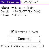
Card Reader allows to use Palm-powered handhelds as an ordinary USB card reader for quick and easy File exchange. It has the unique ability to export the card in the background mode allowing you e.g. to transfer MP3s simultaneously with web browsing. Supported devices : palm T|X; Treo 600; Treo 650; Tungsten|T5; Tungsten|T3; Tungsten|E2; Tungsten|E; GSL Xplore M68; Tungsten|C; Zire...
Category: Utilities
Publisher: Mobile Stream, License: Shareware, Price: USD $11.95, File Size: 29.0 KB
Platform: Palm
Open and Save dialogs toolkit allows you to Open 50 graphics File types and save to 27 graphics File types from your application. Just few lines of code will allow you to get your own working program. Dialogs use HBITMAP handle as input and output and even novice developer can learn how to work with it. Supported formats - reading support 50 image File types...
Category: Software Development / Misc. Programming
Publisher: fCoder Group International, License: Freeware, Price: USD $0.00, File Size: 3.4 MB
Platform: Windows
GPSMapEdit is an application designed for visual authoring of GPS-maps in various cartographic formats: Polish format, Garmin MapSource, Lowrance MapCreate, Navitel Navigator (navigation software for Windows Mobile, Android, Symbian, iPhone), ALAN Map 500/600, Holux MapSho, and custom POIs and speedcams.
The program may also load and convert GPS-tracks, waypoints and routes...
Category: Utilities / Misc. Utilities
Publisher: Konstantin Galichsky, License: Shareware, Price: USD $65.00, File Size: 2.4 MB
Platform: Windows