Free Downloads: Oziexplorer
License: All | Free
OziPhotoTool combines the technology of a GPS receiver and a digital camera to automatically keep a record of where digital photos were taken. It is designed to be used in conjunction with Oziexplorer. Most digital cameras have EXIF metadata stored as part of the photo. This includes is the date and time the photo was taken. Many GPS units have 'tracklogs'. The GPS keeps a record of...
Category: Utilities
Publisher: OziPhotoTool, License: Shareware, Price: USD $25.00, File Size: 14.3 MB
Platform: Windows
Oziexplorer is a flamboyant GPS Mapping Software that runs on the PC and works with varieties of GPS receivers such as Garmin, Lowrance, Magellan, Eagle, Brunton, Silva and MLR for the uploading or downloading the waypoints, routes and tracks and most brands of GPS receivers for real time tracking of GPS position.
Using this software, the user can use maps and charts that...
Category: Internet / Communications
Publisher: Des Newman, License: Shareware, Price: USD $95.00, File Size: 6.8 MB
Platform: Windows
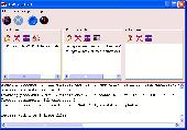
Oziexplorer File Format Converter converts various waypoint, route and track file formats to and from OziExplorers own file formats.
Formats Supported:
- Holux wrt waypoint and tlg track file formats (read and write)
- Magellan Mapsend waypoint and track formats (read only)
- Magellan GPS memory card waypoint and track formats (read only)
- NMEA...
Category: Utilities / Misc. Utilities
Publisher: Des Newman, License: Freeware, Price: USD $0.00, File Size: 262.9 KB
Platform: Windows
GPSMaster.NET can best be described as a mixture of Google Earth, World Wind, SeeYou, Oziexplorer and Garmin Mapsource. GPSMaster.NET is a Windows application (for both x86 and x64) and can communicate (via serial or USB) with any Garmin GPS that implements the Garmin communication protocol. Support for other brands of GPS or logger will be added in future releases.
Category: Internet / Communications
Publisher: Edwin Oude Vrielink, License: Shareware, Price: USD $141.85, File Size: 11.6 MB
Platform: Windows
GeoVisu is a program that displays georeferenced data (images, graphics) and downloads data recorded by some GPS devices.
GeoVisu has a "Moving map" navigation function, which can be used with any NMEA 0183 compatible or Garmin USB GPS device.
Main features:
- Displays georeferenced image formats : GeoTiff, ECW and ECWP, MrSID, Oziexplorer...
Category: Multimedia & Design / Graphics Viewers
Publisher: GeoVisu, License: Freeware, Price: USD $0.00, File Size: 1.7 MB
Platform: Windows
SmartComGPS is a GPS mapping/tracking/navigation software for Symbian smartphones. It is one of most advanced GPS mapping software on the market. SmartComGPS designed for the all Symbian phones. It is compatible with external BT GPS receivers, and internal aGPS receiver of Motorola A920/925/1000. SmartComGPS can run without GPS receiver, as "mapping" software with namesearch ability, and on...
Category: Multimedia & Design
Publisher: SmartCom Ltd GPS Mobile Solutions, License: Shareware, Price: USD $29.95, File Size: 291.1 KB
Platform: Unknown
SmartComGPS is a GPS mapping/tracking/navigation software for Symbian smartphones. It is one of most advanced GPS mapping software on the market. SmartComGPS designed for the all Symbian phones. It is compatible with external BT GPS receivers, and internal aGPS receiver of Motorola A920/925/1000. SmartComGPS can run without GPS receiver, as "mapping" software with namesearch ability, and on...
Category: Multimedia & Design
Publisher: SmartCom Ltd GPS Mobile Solutions, License: Shareware, Price: USD $29.95, File Size: 284.7 KB
Platform: Unknown
SmartComGPS is a GPS mapping/tracking/navigation software for Symbian smartphones. It is one of most advanced GPS mapping software on the market. SmartComGPS designed for the all Symbian phones. It is compatible with external BT GPS receivers, and internal aGPS receiver of Motorola A920/925/1000. SmartComGPS can run without GPS receiver, as "mapping" software with namesearch ability, and on...
Category: Multimedia & Design
Publisher: SmartCom Ltd GPS Mobile Solutions, License: Shareware, Price: USD $29.95, File Size: 291.1 KB
Platform: Unknown
SmartComGPS is a GPS mapping/tracking/navigation software for Symbian smartphones. It is one of most advanced GPS mapping software on the market. SmartComGPS designed for the all Symbian phones. It is compatible with external BT GPS receivers, and internal aGPS receiver of Motorola A920/925/1000. SmartComGPS can run without GPS receiver, as "mapping" software with namesearch ability, and on...
Category: Multimedia & Design
Publisher: SmartCom Ltd GPS Mobile Solutions, License: Shareware, Price: USD $29.95, File Size: 299.4 KB
Platform: Unknown
Freeware real time vehicle fleet monitoring software via GSM network.
Freeware real time vehicle fleet monitoring software via GSM network. Vehicles modules GuardMagic VS.
Can support up 50 units GuardMagic VS. Oziexplorer mapping software. Tool that helps you monitor your vehicles and reduces cost by devising the shortest rout.
Category: Business & Finance / Business Finance
Publisher: GuardMagic, License: Freeware, Price: USD $0.00, File Size: 1.1 MB
Platform: Windows
Rocanda Land Tracker software will allow you to convert any LSD location in Alberta, British Columbia, Saskatchewan or Manitoba into a corresponding latitude/longitude coordinate. which you can then input into mapping software such as Garmin's Mapsource products, or Oziexplorer.
Category: Business & Finance / MS Office Addons
Publisher: Rocanda, License: Shareware, Price: USD $179.00, File Size: 8.6 MB
Platform: Windows
TrackProfiler is a small free utility for exporting GPS track profiles into PNG images.
TrackProfiler is a small free utility for exporting GPS track profiles into PNG images. It works with java (version 1.3, 1.4 or 1.5)
Main Features:
- Load a track (Oziexplorer file type: .PLT) and view its profile
- The track profile can be smoothed
- You can view track extremes
- You can load track waypoints (in .WPT file format)
- You...
Category: Web Authoring / JavaScript
Publisher: Tomo Krajina, License: Shareware, Price: USD $0.00, File Size: 819 B
Platform: Windows
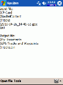
A program to convert GPS-track of *. gpx, *.
mps, *. plt or *. nmea format to Navitel Tracks.
Category: Home & Education / Sports
Publisher: DXsoft, License: Freeware, Price: USD $0.00, File Size: 31.6 KB
Platform: Windows
OkMap is a GPS and map software that:
-Works with vectorial maps and calibrates raster maps
-Organizes paths by creating waypoints, routes and tracks
-Uploads/downloads data to/from your GPS
-Uses altitude DEM data
-Supports GPS real-time navigation
-Sends/receives vehicles position and display tracks on maps in real time
-Provides autorouting and geocoding...
Category: Business & Finance / Applications
Publisher: Gian Paolo Saliola, License: Freeware, Price: USD $0.00, File Size: 20.2 MB
Platform: Windows
OkCustomMap is a software to produce Garmin Custom Maps.
OkCustomMap is a software to produce Garmin Custom Maps.
Supports many map formats:
- OkMap
- Ecw
- GeoTiff
- World files
- Oziexplorer
- GpsTuner
You can customize:
- The quality of the output JPEG images (0=Bad, 100=Good)
- The KML transparency (0=Transparent, 255=Opaque)
- The KML draw order (0=Invisible, 1-49=Under the vectorial data,...
Category: Business & Finance / Applications
Publisher: Gian Paolo Saliola, License: Freeware, Price: USD $0.00, File Size: 3.2 MB
Platform: Windows
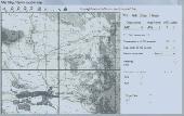
OziExplorer3D is an impeccable application for viewing map images in 3D, along with the options of rotating it in every possible direction, zoom in/out and lots more. The application actually creates grid of heights using the height data that has been obtained and writes it to a file, along with the other required information, loads the file and the map image or the image section and displays...
Category: Multimedia & Design / Multimedia App's
Publisher: Des Newman, License: Shareware, Price: USD $30.00, File Size: 1.9 MB
Platform: Windows
Features
- Easy-to-learn WINDOWS™ based user interface
- Easy-to-use thanks to single key functions
- Fully automatic (no user interface needed... suited for mobile applications)
- Very fast because of a special file format (XIM file format)
- Imperial or international units or mixture of both
- Rich, detailed configuration
- Utilizes most...
Category: Multimedia & Design / Multimedia App's
Publisher: Sapper Oy, Finland, License: Freeware, Price: USD $0.00, File Size: 1.6 MB
Platform: Windows


 Shareware
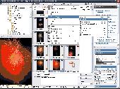
What's New in Zoner Photo Studio 10 Professional? Environment A Browser facelift, Vista style (e.g. jumbo icons, headers, and highlighting). Colored sliders Improved lighting temperature controls Previewless filter windows Graphical Tools HDR (High Dynamic Range) photo composition combining shots with a wide exposure range (sandwiching). Gradient Filter tool - a...
Category: Multimedia & Design / Digital Media Editors
Publisher: Zoner, Inc., License: Shareware, Price: USD $84.95, EUR65, File Size: 57.3 MB
Platform: Windows
License: All | Free


