Free Downloads: Periphery
License: All | Free
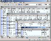
Geodata of the Federal Republic Germany with municipalities, postal codes, telefone preselections. Suitable for branch searches, Periphery searches and distance computations. Georeferences as Gauss Krueger, UTM and Geographic Coordinates and also Ground Level Elevations. ORTREF: 12.500 geocoded cities and municipalities. ORTGEM: Allocation of 12.500 cities and municipalities to the...
Category: Business & Finance
Publisher: C. Killet Software Ing.-GbR, License: Demo, Price: USD $195.00, File Size: 313.3 KB
Platform: Unknown
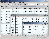
Geodata of international countries with locals, municipalities and postal codes. Georeferences as UTM- and geographic coordinates (WGS84, ETRS89). Suitable for branch searches, Periphery searches and distance computations. These countries are available: Albania, Andorra, Belgium, Bosnia, Bulgaria, Denmark, Estonia, Finland, France, Georgia, Gibraltar, Greece, Great Britain, Ireland,...
Category: Software Development
Publisher: Killet Software Ing.-GbR, License: Demo, Price: USD $195.00, File Size: 151.6 KB
Platform: Windows, Linux, Unix

Geodata of international countries with locals, municipalities and postal codes. Georeferences as UTM- and geographic coordinates (WGS84, ETRS89). Suitable for branch searches, Periphery searches and distance computations. These countries are available: Albania, Andorra, Belgium, Bosnia, Bulgaria, Denmark, Estonia, Finland, France, Georgia, Gibraltar, Greece, Great Britain, Ireland,...
Category: Business & Finance
Publisher: Killet Software Ing.-GbR, License: Demo, Price: USD $195.00, File Size: 151.6 KB
Platform: Windows, Linux, Unix, Not Applicable
Brave Pirate is a thrilling game about pirate's adventures.
Brave Pirate is a thrilling game about pirate's adventures. You are conning an enormous frigate capable of smashing everything on its way. Your mission is to find four pieces of an ancient map. All the pirates are hunting for it. The more pieces you collect the fiercer and more massive will be their attacks. Each of the four pieces is kept in well fortified towns located around the whole...
Category: Games / Arcade
Publisher: MyPlayCity.com, License: Freeware, Price: USD $0.00, File Size: 12.0 MB
Platform: Windows
 Freeware
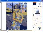
Displacement Map is an amusing image distortion, Photoshop-compatible plug-in for Windows designed by ImageSkill Software. It allows a user to get a view of the geometrically distorted image. The user is free to choose any displacement map which determines the shape of the image deformation and adjust its strength. The plugin leaves the center of an image unchanged while increasing the...
Category: Multimedia & Design / Image Plugins
Publisher: ImageSkill Software, License: Freeware, Price: USD $0.00, File Size: 3.7 MB
Platform: Windows
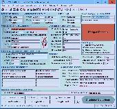
ORTWIN is a program for the state-wide inquiry of the localities, postal codes and telephone selections in Germany. It finds postal zip codes, telephone pre selections, coordinates and ground level elevations. The program determines municipal codes, local center points, car license codes, topographic maps, Unlocodes and much more. It arranges localities hierarchically into the structures...
Category: Business & Finance / Sales & Marketing Tools
Publisher: Killet GeoSoftware Ing.-GbR, License: Shareware, Price: USD $120.00, EUR110, File Size: 4.8 MB
Platform: Windows
Geodata International - World-wide database of countries with georeferenced towns, municipalities, postal codes and administrative units with WGS84 and UTM coordinates and elevations for geocoding, proximity search, navigation, distance calculation. Often is it necessarily, for an address characteristic, e.g. the place name or the postal code, to establish a local relationship - a georeference....
Category: Software Development / Databases & Networks
Publisher: Killet GeoSoftware Ing.-GbR, License: Data Only, Price: USD $165.00, EUR150, File Size: 2.3 MB
Platform: Windows, Mac, Linux,
License: All | Free