Free Downloads: Photo To Raster Gis
GeoSurveillance is software that combines spatial statistical routines with some basic Geographic Information Systems (Gis) functions to carry out retrospective and prospective statistical tests for the detection of geographic clustering. In this software, the focus is primarily on the spatial statistical analysis. Consequently, full Gis functionality is not provided. Gis...
Category: Home & Education / Miscellaneous
Publisher: NCGIA, License: Freeware, Price: USD $0.00, File Size: 2.4 MB
Platform: Windows
TerraSync is designed for fast and efficient field GIS data collection.
TerraSync is designed for fast and efficient field Gis data collection.Trimble® TerraSync™ software is designed for fast and efficient field Gis data collection and maintenance.
Integrating all the ways you collect data—with a GNSS handheld computer, laser rangefinder, or centimeter-grade equipment—it's a powerful system for the collection...
Category: Utilities / Misc. Utilities
Publisher: Trimble, License: Shareware, Price: USD $7000.00, File Size: 20.6 MB
Platform: Windows
 Shareware
Word to Raster Converter will be you good office helper when you need do file format conversion.
Word to Raster Converter enables users to convert several Word files to Raster images at one time. You can use Word to Raster Converter to set the image size and color depth for the output image files. Features of Word to Raster Converter: 1.All Windows systems are supported including both 32bit and 64bit. 2.Convert MS Office documents to PDF files in batch....
Category: Business & Finance / Business Finance
Publisher: verypdf.com Inc, License: Shareware, Price: USD $59.95, AED100, File Size: 9.2 MB
Platform: Windows
RxSpotlight for Windows is the next generation of raster and hybrid editing software.
RxSpotlight for Windows is the next generation of Raster and hybrid editing software. Today most drawing information is stored on paper or aperture cards. By using scanning technology in combination with RxSpotlight for Windows, you can edit your drawings directly without having to convert them to a CAD format. RxSpotlight for Windows is an advanced program for Raster, vector and...
Category: Multimedia & Design / Digital Media Editors
Publisher: Rasterex, License: Shareware, Price: USD $4302.35, File Size: 66.1 MB
Platform: Windows
The CANVAS 9 Advanced Gis Mapping Edition adds native support for Geographic Information System (Gis) data to Canvas. You can take measurements in geographic coordinates, import industry standard SHAPE and GeoTIFF files into unlimited numbers of automatically aligned overlapping layers and choose among the following options:2,104 Coordinate Reference Systems67 Operation Methods...
Category: Multimedia & Design / Multimedia App's
Publisher: ACD Systems, License: Shareware, Price: USD $999.95, File Size: 54.2 MB
Platform: Windows
With this release, ArcGIS transforms the way you use GIS.
With this release, ArcGIS transforms the way you use Gis.Be more productive with your work and take advantage of Gis everywhere: via individual local desktops, across desktops and browsers leveraging central servers, and in the cloud.ArcGIS Desktop contains two applications: ArcMap and ArcCatalog. ArcMap provides data display, query, and analysis. ArcCatalog provides data management.
Category: Business & Finance / Business Finance
Publisher: Environmental Systems Research Institute, Inc., License: Demo, Price: USD $0.00, File Size: 2.0 GB
Platform: Windows
Shareware
VeryDOC Raster to PS Vector Converter uses advanced algorithms to calculate the paths of Raster patterns and convert Raster patterns to vector ones.It is a key component for many professional,commercial,industrial and scientific activity. Features of Raster to PS Vector Converter: 1.Support Microsoft Windows 2000 and later systems of both 32 and 64-bit. 2.Set...
Category: Business & Finance / Business Finance
Publisher: VeryDOC.com Inc, License: Shareware, Price: USD $299.00, AED100, File Size: 2.4 MB
Platform: Windows
The CANVAS 9 Advanced Gis Mapping Edition adds native support for Geographic Information System (Gis) data to Canvas. You can take measurements in geographic coordinates, import industry standard SHAPE and GeoTIFF files into unlimited numbers of automatically aligned overlapping layers and choose among the following options:·2,104 Coordinate Reference Systems·67...
Category: Multimedia & Design / Multimedia App's
Publisher: ACD Systems, License: Shareware, Price: USD $999.95, File Size: 51.9 MB
Platform: Mac, PPC
Map Suite Wpf Desktop Edition takes Gis application development for the Windows desktop to a whole new level.Using the intuitive object model, even developers inexperienced in Geographic Information Systems (Gis) can have fully functional maps working in minutes. With blazing fast rendering performance, powerful mapping features and support for the most popular data formats, Map...
Category: Internet / Misc. Plugins
Publisher: ThinkGeo, License: Shareware, Price: USD $4995.00, File Size: 69.1 MB
Platform: Windows
Raster Effects is a plugin for Adobe Illustrator which creates high quality Raster images from Illustrator's vector geometry. Renderings are based on smooth spline vector geometry created in Illustrator, and rendered anti aliased to a high definition image suitable for print or web applications.
Category: Multimedia & Design / Multimedia App's
Publisher: Mission Software, License: Shareware, Price: USD $49.95, File Size: 2.2 MB
Platform: Windows
Shareware
PDF to Raster Converter is a Windows application with a Command Line interface that allows you to easily convert PDF document to lots of different image formats. PDF to Raster Converter is fast and easy to use, and the best tool for the job of converting PDF documents to images! PDF to Raster Converter features: 1. PDF to Raster Converter software can convert...
Category: Business & Finance / Document Management
Publisher: http://www.imagepdf.com, License: Shareware, Price: USD $59.95, File Size: 5.1 MB
Platform: Windows
ArcGIS Workflow Manager (formerly Job Tracking for ArcGIS [JTX]) is an extension to ArcGIS Desktop and ArcGIS Server that lets organizations develop and enforce standard, repeatable Gis workflows across the enterprise.
Workflow Manager greatly improves the efficiency of Gis operations by organizing and automating the relationships between the activities in a Gis...
Category: Home & Education / Miscellaneous
Publisher: ESRI, License: Shareware, Price: USD $2500.00, File Size: 1.1 MB
Platform: Windows
AEGIS– the leading GIS software in UK secondary schools.
AEGIS– the leading Gis software in UK secondary schools.
One-off software purchase and free upgrades – no subscriptions.
Brings industry-standard Gis maps to the classroom – Goad town plans, large-scale OS MasterMaps.
Try before you buy with the free AEGIS Viewer download.
Free materials: resources, help sheets,...
Category: Home & Education / Miscellaneous
Publisher: AU Enterprises Limited, License: Shareware, Price: USD $0.00, File Size: 0
Platform: Windows
My World Gis™ is a Geographic Information System (Gis) designed specifically for use in middle school through college classrooms. It has been developed by the GEODE Initiative at Northwestern University as part of a research program on the adaptation of scientific visualization and data analysis tools to support inquiry-based learning.
My World gives learners...
Category: Home & Education / Miscellaneous
Publisher: Northwestern University, License: Shareware, Price: USD $59.00, File Size: 100.2 MB
Platform: Windows
OrbisGIS is a Geographic Information System developped for and by research.
OrbisGIS is a Geographic Information System developped for and by research. This cross-platform Gis is developed by French IRSTV institute and is able to manipulate and create vectorial and Raster spatial data. OrbisGIS is distributed under GPL 3 license.
Category: Home & Education / Miscellaneous
Publisher: Free Software Foundation, Inc., License: Freeware, Price: USD $0.00, File Size: 15.4 MB
Platform: Windows
ArcGIS Explorer is a free, downloadable Gis viewer that gives you an easy way to explore, visualize and share Gis information. ArcGIS Explorer adds value to any Gis because it helps you deliver your authoritative data to a broad audience.
The ArcGIS Explorer Desktop Current User setup is intended for users who do not have administrator access on their computers and...
Category: Desktop Enhancements / Shell & Desktop Managers
Publisher: Environmental Systems Research Institute, Inc., License: Freeware, Price: USD $0.00, File Size: 94.0 MB
Platform: Windows
![MagicTracer [raster to vector converter] Screenshot](https://media.pcwin.com/images/thumbs/magictracer__raster_to_vector_converter_-350795.gif)
MagicTracer is a raster to vector conversion software for the Windows platform.
MagicTracer is a Raster to vector conversion software for the Windows platform. MagicTracer can turn Raster (bitmap) images into vector linework. With both Raster and vector tools, it is a versatile utility for image processing and vector cleanup. The vector convert tool guides you through the threshold and edge detection processes so better results can be easily obtained....
Category: Multimedia & Design / Multimedia App's
Publisher: Elgorithms, License: Demo, Price: USD $59.95, File Size: 9.7 MB
Platform: Windows
R2V is a tool for converting Raster images to vector by drawing centerlines and outlines. R2V converts architect, mechanical and various technical drawings, maps and other types from Raster to vector format. A vector format can be imported into your CAD/CAM or drawing program. R2V supports the Bmp and Jpeg Raster format. The output vector file can be saved in DXF (Autocad),...
Category: Multimedia & Design
Publisher: MR Soft, License: Shareware, Price: USD $42.00, File Size: 1.6 MB
Platform: Windows
Christine-GIS is a useful, easy-to-use tool that brings geographic information to your desktop.
Christine-Gis is a useful, easy-to-use tool that brings geographic information to your desktop. Christine gives you the power to visualize, explore, query and analyze data spatially. A key feature of Christine is that it's easy to load tabular data, such as dBASE files and data from database servers.
Category: Home & Education / Miscellaneous
Publisher: christine-gis.com, License: Shareware, Price: USD $0.00, File Size: 0
Platform: Windows
Shareware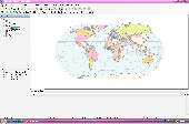
AvisMap Desktop Professional 5 is a professional desktop Gis software for map editing, managing, analysis attribute data, aid decision-making transactions and output map, print tables, 3D modeling, and other functions. As a complete analysis management tool, AvisMap Despro 5 is applicable in land management, forestry, electric power, telecom, traffic, city pipe network, resource...
Category: Multimedia & Design / Graphics Viewers
Publisher: AvisMap GIS Technologies, License: Shareware, Price: USD $499.00, File Size: 22.2 MB
Platform: Windows
Shareware
Raster to PDF Converter is a Windows application which can directly convert dozens of image formats, such as TIF, TIFF, JPG, JPEG, GIF, PNG, BMP, PSD, WMF, EMF, PCX, PIC and so on, into PDF format. Raster to PDF can automatically clear and skew-correct B/W images to insure high quality output after conversion. Raster to PDF can operate independently of Adobe Acrobat....
Category: Business & Finance / Document Management
Publisher: http://www.imagepdf.com, License: Shareware, Price: USD $59.95, File Size: 4.9 MB
Platform: Windows
Shareware
Raster to Vector Converter allows you to view the added file in the software interface. Features of Raster to Vector Converter: 1.All Windows systems are supported. 2.Input formats: BMP, GIF, JPG, PCX, PDF, PNG, PBM, PGM, PPM, TGA, etc. 3.Output formats: PDF, EPS, Postscript, PS, SVG, DXF and EMF. 4.Support various types of paper size. 5.Allow to rotate the converted...
Category: Business & Finance / Project Management
Publisher: verypdf.com Inc, License: Shareware, Price: USD $59.95, AED100, File Size: 9.2 MB
Platform: Windows
ArcGIS Explorer Desktop is a free Gis viewer that gives you an easy way to explore, visualize, and share Gis information. ArcGIS Explorer adds value to any Gis because it helps you deliver your authoritative data to a broad audience.
Easy and intuitive to use it's easy for anyone to begin working with ArcGIS Explorer, with its intuitive and easy to use...
Category: Home & Education / Miscellaneous
Publisher: Environmental Systems Research Institute, Inc., License: Freeware, Price: USD $0.00, File Size: 100.5 MB
Platform: Windows
Gis ObjectLand is a universal Geographic Information System for Windows. Key features: - creation of vector-Raster maps with arbitrary structure of layers and feature types; - creation of themes. Theme is a user presentation of a map; - control of displaying features depending on the chosen scale; - spatial data input and editing by assigning feature coordinates and also by...
Category: Business & Finance
Publisher: Radom-T, License: Shareware, Price: USD $99.00, File Size: 24.0 MB
Platform: Windows
TracTrix software provides a variety of other tools to assist CAD users with raster editing.
TracTrix software provides a variety of other tools to assist CAD users with Raster editing. Open over 100 Raster formats and edit. Convert scans of drawings, logos, boards etc. in BMP, C4, CALS, TIFF, JPEG and other Raster formats to DWG, DXF, HPGL, IGES and EPS formats. With color separation, text recognition, clean-up and editing tools.
TracTrix can be run...
Category: Multimedia & Design / Digital Media Editors
Publisher: Trix Systems AB, License: Shareware, Price: USD $865.00, File Size: 37.4 MB
Platform: Windows