Free Downloads: Plot Gps Data
With this program, you can store GPS data and real address information for every picture.
With this program, you can store Gps Data and real address information for every picture. Using photoGPS, you can capture geo-Data on site, automatically combine Gps and location Data with pictures (using included Matching software), search, sort and organise all pictures acc. to country, city, street (using included Organizer software).
Category: Multimedia & Design / Multimedia App's
Publisher: JOBO, License: Freeware, Price: USD $0.00, File Size: 46.4 MB
Platform: Windows
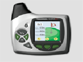
Improve your golf game with a handheld Gps that gives distance to pin, club suggestions, locations of hazards and much more. Wherever in the world you play golf, the sureshotgps will allow you to obtain distances from tee to green. Experience the difference with better club selection, speedier play and statistical information per round of golf. The sureshotgps relies on Gps...
Category: Home & Education
Publisher: Absolute Software Pty Ltd, License: Shareware, Price: USD $399.00, File Size: 3.8 MB
Platform: Windows
AGIS for Windows is a mapping and simple GIS shareware package.
AGIS for Windows is a mapping and simple GIS shareware package. Plot your own geographic Data on the map of the world provided without the high cost and steep learning curve usually associated with this kind of software. Create high resolution publication quality images that can be pasted into popular packages such as MS Word. Animation, web serving, distance measuring, searching,...
Category: Multimedia & Design / Multimedia App's
Publisher: AGIS Software Pty Ltd, License: Shareware, Price: USD $49.00, File Size: 3.6 MB
Platform: Windows
V-Clinic GPS lets you track your training routes and upload the data back to your V-Clinic account.
V-Clinic Gps lets you track your training routes and upload the Data back to your V-Clinic account. Then use V-Clinic to share your route with your training buddies. V-Clinic Gps is ideal for cyclists, joggers and outdoor enthusiasts. V-Clinic Gps runs on Gps & Java enabled phones. Use V-Clinic Gps on your own or get professional fitness analysis...
Category: Home & Education / Health & Nutrition
Publisher: V-CLINIC MOBILE CIRCLES, License: Freeware, Price: USD $0.00, File Size: 235.0 KB
Platform: Unknown
The primary purpose of XL-Plot is to create a figure rapidly.
The primary purpose of XL-Plot is to create a figure rapidly. It is ideal for for use at high school, as the path from Data in one or more spreadsheet columns to the final figure is short (just a few mouse clicks) and easy to grasp. It contains basic stat
Category: Home & Education / Mathematics
Publisher: bram.org, License: Freeware, Price: USD $0.00, File Size: 2.0 MB
Platform: Windows


 Shareware
Since our EXIF software for viewing EXIF, IPTC, and XMP Data, and editing and creating EXIF and EXIF Gps Data is integrated into the operating system, the programs give access to EXIF information in most applications.EXIF Farm Pro allows editing and creation of EXIF and IPTC Data forbatches of images directly in Windows Explorer.
Category: Multimedia & Design / Authoring Tools
Publisher: Two Pilots, License: Shareware, Price: USD $29.95, File Size: 5.1 MB
Platform: Windows
Zaitun Time Series is software designed for statistical analysis of time series data.
Zaitun Time Series is software designed for statistical analysis of time series Data. It provides easy way for time series modeling and forecasting.
Zaitun Time Series provides several statistics and neural networks models, and graphical tools that will make your work on time series analysis easier.
Statistics dan Neural Networks Analysis: Trend Analysis, Decomposition, Moving...
Category: Home & Education / Mathematics
Publisher: Zaitun Software, License: Freeware, Price: USD $0.00, File Size: 1.0 MB
Platform: Windows
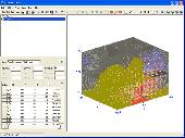
Creating graphs of regular Data and irregular Data. Creating vertex, grid and surface model, Delaunay triangles, color map, contour Plot, vector Plot, 3D contour Plot, 4D scatter, 4D slice and 4D vector.
Category: Home & Education / Science
Publisher: GraphNow, License: Shareware, Price: USD $59.95, File Size: 2.6 MB
Platform: Unknown
Kinomap Gps File Fixer allows you to process some treatments on Gps file:
- convert almost any Gps file to standard NMEA 0183, compatible with Kinomap
- fill the gaps between points when your file is not 1Hertz: the extra point will be recreated by interpolation
- cut a long file in which there are loops of Data (example: race) in several parts
Category: Home & Education / Miscellaneous
Publisher: ExcelLance, License: Freeware, Price: USD $0.00, File Size: 19.6 MB
Platform: Windows
The fast track to GPS success.
The fast track to Gps success. The Linx MDEV-Gps-SR contains everything needed to rapidly evaluate the SR Series Gps modules and implement them in record time. This all-inclusive Master Development System features a pre-assembled development board with an on-board OLED display for standalone testing. The system can also be attached to a PC via USB and operated using the...
Category: Software Development / Misc. Programming
Publisher: Linx Technologies, Inc., License: Freeware, Price: USD $0.00, File Size: 98.5 MB
Platform: Windows
GPS PLUS Collar Manager for your PC is a powerful tool to manage your collars.
Gps PLUS Collar Manager for your PC is a powerful tool to manage your collars. It is designed to communicate with your collars, the UHF/VHF handheld terminal and GSM ground station and is the basic tool to design your study. You can:
- manage collars and GSM/email communication details,
- read out Data from collar, handheld terminal and GSM ground station,
-...
Category: Home & Education / Miscellaneous
Publisher: VECTRONIC Aerospace GmbH, License: Freeware, Price: USD $0.00, File Size: 8.4 MB
Platform: Windows
Operates in English (I-P) or metric (SI) units.
Operates in English (I-P) or metric (SI) units.
Create high quality, customized psychrometric charts.
Plot your process Data with state point labels.
Print a report of state points and processes.
Add notes and annotations.
Define and Plot zones on your charts, (e.g. comfort zones)
Copy/paste charts to your presentation or word processing...
Category: Multimedia & Design / Digital Media Editors
Publisher: Linric Company, License: Shareware, Price: USD $149.95, File Size: 20.2 MB
Platform: Windows
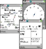
Gps/J is a console for all Bluetooth-enabled Gps receivers (now with 20000 European towns and cities!), a mobile navigation tool for cellular phone owners and the most affordable and convenient way to use location services.
It is a J2ME application for JSR82-compliant devices, which means "devices with a programmable Bluetooth interface".
Saying...
Category: Home & Education / Miscellaneous
Publisher: GPS/J Project, License: Demo, Price: USD $0.00, File Size: 281.0 KB
Platform: Windows
GPS Tuner was first launched in 2003.
Gps Tuner was first launched in 2003. Success followed introduction shortly. Over the years it became a best-selling favourite Gps software among off-roaders as a reliable, versatile feature-packed application suiting the needs of outdoor enthusiasts and professional off-road users alike. After five years of continuous development of previous Gps Tuner versions Gps...
Category: Web Authoring / Web Design Utilities
Publisher: GPS Tuner Ltd., License: Freeware, Price: USD $0.00, File Size: 4.5 MB
Platform: Windows
GPSBabel is a program that allows users to transfer GPS data files to and from numerous GPS devices.
GPSBabel is a program that allows users to transfer Gps Data files to and from numerous Gps devices. It also enables the transfer of waypoints, routes and tracks between Gps receivers and mapping programs. As already mentioned before, this application offers support for several popular Gps devices, such as Tom Tom, Garmin, Magellan, Columbus, etc.
...
Category: Multimedia & Design / Media Management
Publisher: Robert Lipe, License: Freeware, Price: USD $0.00, File Size: 973.5 KB
Platform: Windows


 Shareware
With AnyMP4 iPhone Gps Spoofer for Mac, you own one of the best Gps location spoofers for iOS devices. It lets you set the virtual Gps location within a few clicks. Whats more, you can play location-based games from anywhere in the world easily. Key Functions: 1. Fake yours iPhone location easily. AnyMP4 iPhone Gps Spoofer for Mac is an easy-to-use...
Category: Software Development
Publisher: AnyMP4 Studio, License: Shareware, Price: USD $9.96, File Size: 72.5 MB
Platform: Mac
With our locr PC software "locr Gps Photo for Windows" you can manage to automatically geotag numerous photos simultaneously. You just require a digital camera, a Gps Data logger and the application "locr Gps Photo for Windows".
There are two ways to geotag your photos: The photos can be tagged manually or automatically. For automatic...
Category: Multimedia & Design / Multimedia App's
Publisher: locr, License: Freeware, Price: USD $0.00, File Size: 490.8 KB
Platform: Windows
Gps Express provides a feature rich interface to serial NMEA-0183 protocol Data and works with most NMEA-0183 devices, including Gps Receivers. Gps Express is available in three versions (Standard, Professional, Graphical). STANDARD displays the title, value, and units for each parameter. Manual,Scan operation. Navigation buttons. Manual,automatic sentence...
Category: Internet / Dial-up & Connectivity
Publisher: Steelwater Solutions Corporation, License: Shareware, Price: USD $30.00, File Size: 2.1 MB
Platform: Windows, Vista
Gps Express provides a feature rich interface to serial NMEA-0183 protocol Data and works with most NMEA-0183 devices, including Gps Receivers. Gps Express is available in three versions (Standard, Professional, Graphical). STANDARD displays the title, value, and units for each parameter. Manual,Scan operation. Navigation buttons. Manual,automatic sentence...
Category: Internet / Communications
Publisher: Steelwater Solutions Corporation, License: Shareware, Price: USD $65.00, File Size: 2.1 MB
Platform: Windows
The Gps Detector software is used to update the Gps detector's database , updating maps , routes and camera locations . The device itself is based on pre-installed Gps coordinates, the device can indicate various road hazards like: Fixed cameras, Red light speed cameras and bus lane cameras, Usual speed measurement places and dangerous zones.
Category: Business & Finance / Business Finance
Publisher: Euro Noliker Kft., License: Freeware, Price: USD $0.00, File Size: 5.5 MB
Platform: Windows
NMEA Analyser is designed for analyse of a wide range of NMEA messages, including Gps, Gyro, Log, Echosounder, VRU, ARPA.
Data received from either:
-serial port (ONLINE Mode)
- TCP/IP (ONLINE Mode)
- file (OFFLINE Mode)
Statistics for all parameters are calculated and time serie and scatter Plot are produced.
...
Category: Multimedia & Design / Multimedia App's
Publisher: Kagstrom, License: Demo, Price: USD $0.00, File Size: 3.2 MB
Platform: Windows


 Freeware
With this tool you can add Gps coordinates to vCards - elektronic business cards - that you have previously exported from e. g. Microsoft Outlook. Therefore the tool uses the address Data contained within the vCards and adds the exact Gps position on that basis to the vCard. This way you can use these vCards for example in compatible car navigation systems. Among...
Category: Home & Education / Home Inventory
Publisher: AB-Tools.com, License: Freeware, Price: USD $0.00, File Size: 1.9 MB
Platform: Windows
Northwest Trails is a mapset of trails designed for upload to any map-enabled Garmin GPS receiver.
Northwest Trails is a mapset of trails designed for upload to any map-enabled Garmin Gps receiver. It is more than just a mapset, though; it is also a community effort initiated to record and collect Gps Data for trails in the Northwest (Washington, Idaho, Oregon, Montana, Wyoming, Alaska, British Columbia and Alberta) and provide that Data for general public use.
Category: Internet / Misc. Plugins
Publisher: Jon F. Stanley, License: Freeware, Price: USD $0.00, File Size: 31.7 MB
Platform: Windows
The Gps Controller software is a free program designed to allow you to configure a range of Gps receivers. There are versions that run on Windows desktop computers, or Windows Mobile devices.
Before downloading the software, it recommend downloading and reading the documentation to confirm which version you need.
Category: Home & Education / Miscellaneous
Publisher: Trimble Navigation, License: Freeware, Price: USD $0.00, File Size: 30.9 MB
Platform: Windows
GPS-CCD:is a novel computational program for the
Prediction of Calpain Cleavage Sites.
Gps-CCD:is a novel computational program for the
Prediction of Calpain Cleavage Sites.
The online service and local packages of Gps-CCD 1.0 were
implemented in JAVA/. For the online service, we tested the Gps-CCD1.0 on a variety of internet browsers, including Internet Explorer 6.0, Netscape Browser 8.1.3 and Firefox 2 under the Windows XPOperating System...
Category: Web Authoring / JavaScript
Publisher: The CUCKOO Workgroup, License: Freeware, Price: USD $0.00, File Size: 19.2 MB
Platform: Windows

