Free Downloads: Plot Waypoints
FREE GPS Software for your Garmin, Magellan or Lowrance GPS.
FREE GPS Software for your Garmin, Magellan or Lowrance GPS.
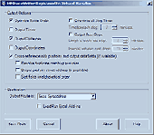
EasyGPS is the fast and easy way to upload and download Waypoints, routes, and tracks between your Windows computer and your Garmin, Magellan, or Lowrance GPS. EasyGPS lists all of your Waypoints on the left side of the screen, and shows a Plot of your GPS data on the right. Use EasyGPS to back up and...
Category: Internet / Communications
Publisher: TopoGrafix, License: Freeware, Price: USD $0.00, File Size: 3.9 MB
Platform: Windows
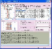
With Cartopro Evolution create,modify and save routes, tracks, and Waypoints by simple click on the screen.
Main features:
-Simple and reliable.
-Scan your maps directly from Cartopro
-3 types of powerful calibrations are available
-Large number of Datums available. You can also add them manually.
-Import and Export your track, routes and...
Category: Home & Education / Miscellaneous
Publisher: Sigrist Alain, License: Shareware, Price: USD $0.00, File Size: 0
Platform: Windows
The Windows PC shareware program for Garmin and Magellan GPS receivers.
The Windows PC shareware program for Garmin and Magellan GPS receivers.
Main Features:
- transfer your Waypoints, routes, and tracks from and to the GPS receiver, and save it on your computer disk
- review your Waypoints
- enter and edit your Waypoints
- define your routes and get the estimated traveling time
- review and...
Category: Home & Education / Miscellaneous
Publisher: Heinrich Pfeifer, License: Freeware, Price: USD $0.00, File Size: 2.9 MB
Platform: Windows
A very powerful plugin that seamlessly integrates GPS Waypoints and Garmin courses into SportTracks, features for which you would have to use Garmin Mapsource™ and Garmin TrainingCenter™ or similar 3rd party applications otherwise.
Some of the outstanding features of this plugin are:
-create courses with autorouting
-create Waypoints from...
Category: Home & Education / Miscellaneous
Publisher: Old Man Biking's SportTracks Plugins, License: Shareware, Price: USD $13.08, File Size: 1.4 MB
Platform: Windows
 Shareware
The RouteWriter add-in imports and exports Waypoints for Microsoft MapPoint routes whilst maintaining their route order. Although MapPoint can import and export Waypoints as pushpins, their order is usually re-arranged. RouteWriter exports Waypoints and their matching pushpins to Excel with their waypoint distance, time, coordinate, address data, and all available...
Category: Business & Finance / Document Management
Publisher: Winwaed Software Technology LLC, License: Shareware, Price: USD $75.00, File Size: 3.0 MB
Platform: Windows
The GPS TrackManager is an application for planning routes and managing routes, Waypoints and trackpoints.
The application support functions such as: open and save trackpoints files in various formats (GPX, Ozi Trackpoint file, Ozi Waypoint file, NMEA log, EasyGPS file), transmit Trackpoints, Waypoints and Routes to Garmin GPS receivers (Geko 201, GPSmap 60C), saves...
Category: Internet / Communications
Publisher: Frank Hamaekers, Write4u, License: Freeware, Price: USD $0.00, File Size: 4.8 MB
Platform: Windows
The MPRouteWriter add-in imports and exports Waypoints for Microsoft MapPoint routes whilst maintaining their route order. Although MapPoint can import and export Waypoints as pushpins, their order is usually re-arranged. MPRouteWriter exports Waypoints and their matching pushpins to Excel (or a text file) with their waypoint distance, time, coordinate, address data,...
Category: Business & Finance / MS Office Addons
Publisher: Winwaed Software Technology LLC, License: Shareware, Price: USD $75.00, File Size: 3.3 MB
Platform: Windows
An easy to use GPS downloading utility that lets you download your GPS Waypoints easily and export them into a variety of formats useful for editing, display and importing into many different mapping programs.
Use Lobal to save GPS Waypoints as:
- Text Files
- HTML Tables
- Shape Files
- Google Earth KML
- DBase Files.
Category: Utilities / Misc. Utilities
Publisher: Ecological Software Solutions, License: Freeware, Price: USD $0.00, File Size: 2.2 MB
Platform: Windows
GPS Software for Garmin. Download Waypoints, routes and tracks from Garmin GPS. Upload Waypoints, routes and tracks to Garmin GPS. Excel and Text files supported! This software is very easy to use!
Category: Utilities / System Utilities
Publisher: Oy Frontbase Ltd, License: Shareware, Price: USD $29.95, File Size: 1.4 MB
Platform: Windows
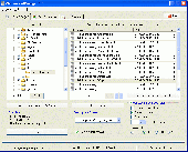
GSAK is the all in one Geocaching and waypoint management tool.
GSAK is the all in one Geocaching and waypoint management tool. Major features include: Multiple databases, sending/receiving Waypoints to GPSr, Google maps, conversion to many mapping formats, PDA output (including CacheMate support), HTML output, extensive searching, macro support, backup and restore, distance/direction from other Waypoints (including caches, locations, post...
Category: Business & Finance / Project Management
Publisher: CWE computer services, License: Shareware, Price: USD $30.00, File Size: 18.2 MB
Platform: Windows
The Plot control created to display graphs and charts on .
The Plot control created to display graphs and charts on .NET Windows Forms. Advantages of this control are very quick embedding into your application and powerful features. Written using 100% managed code. Also, this control can be used to create animated graphs. With this control You can: draw lines just from arrays, use gradients to fill lines colors, draw histograms just by passing...
Category: Software Development / Components & Libraries
Publisher: Advanced Software Solutions, License: Shareware, Price: USD $19.00, File Size: 1.1 MB
Platform: Windows
The primary purpose of XL-Plot is to create a figure rapidly.
The primary purpose of XL-Plot is to create a figure rapidly. It is ideal for for use at high school, as the path from data in one or more spreadsheet columns to the final figure is short (just a few mouse clicks) and easy to grasp. It contains basic stat
Category: Home & Education / Mathematics
Publisher: bram.org, License: Freeware, Price: USD $0.00, File Size: 2.0 MB
Platform: Windows
Easy way to convert Waypoints from KMZ or KML to GPX file format with the KML/KMZ to GPX Converter free.
Easy Steps :
- Save your Waypoints in KMZ or KML format with google earth
- Import that format in the KML/KMZ to GPX Converter free
- Then select waypoint you want to convert to GPX format
- Export the GPX format
- Upload the GPX format in...
Category: Audio / Rippers & Encoders
Publisher: HotelResortClub.com, License: Freeware, Price: USD $0.00, File Size: 656.6 KB
Platform: Windows
Are you tired of printing drawings? well! we have a solution for you. What is plot2k? plot2k is AutoCAD Batch Plot Utility which can open and print AutoCAD drawings in Batch mode. Plot2k is a 32 bit utility designed to open and print AutoCAD drawings in batch mode. with batch Plot drawings you can print either all of your drawings or selected drawings in one go. Plot2k is featured...
Category: Multimedia & Design
Publisher: PLot2k, License: Shareware, Price: USD $39.95, File Size: 968.0 KB
Platform: Windows
Zaitun Time Series is software designed for statistical analysis of time series data.
Zaitun Time Series is software designed for statistical analysis of time series data. It provides easy way for time series modeling and forecasting.
Zaitun Time Series provides several statistics and neural networks models, and graphical tools that will make your work on time series analysis easier.
Statistics dan Neural Networks Analysis: Trend Analysis, Decomposition, Moving Average,...
Category: Home & Education / Mathematics
Publisher: Zaitun Software, License: Freeware, Price: USD $0.00, File Size: 1.0 MB
Platform: Windows
User can paint individual lines by dragging the cursor over lines and identify data interactively.
User can paint individual lines by dragging the cursor over lines and identify data interactively.
In this version of Data Paint you have interactive Rotating Scatter Plot, Simple Scatter Plot, Bar Chart, Star Plot and Parallel Coordinate Plot.
This software can be customized for a specific need.
Category: Business & Finance / Business Finance
Publisher: Man Machine Interface, Inc, License: Freeware, Price: USD $0.00, File Size: 2.4 MB
Platform: Windows
You will be able to enjoy many of CompeGPS Lands features such as waypoint and route creation and edition, full communication between PDA and GPS, use of maps and the moving map (real-time navigation). CompeGPS Pocket Land allows full communication between GPS and PDA (tracks, Waypoints and routes). You will be able to create Waypoints and routes, use maps and real-time...
Category: Home & Education
Publisher: CompeGPS TEAM S.L., License: Shareware, Price: USD $76.00, File Size: 3.9 MB
Platform:
This application can be used to visualize a cobweb plot of a function.
This application can be used to visualize a cobweb Plot of a function. The software has been developed using Java language for easy deployment over the web and for easy accessing on all computers you want to use this program. The interface is a Java based style which makes it easy to use.
Category: Multimedia & Design / Multimedia App's
Publisher: Department of Mathematical Sciences - Ball State University, License: Freeware, Price: USD $0.00, File Size: 816 B
Platform: Windows
Real contour plots are created in Excel.
Real contour plots are created in Excel. You can interact with the contour Plot just like any other Excel Plot.
Contour Plot works with any contour data. It accommodates rectangular data, nearly rectangular data, and irregular data. It includes a data generator for polynomials or any equation.
Category: Business & Finance / MS Office Addons
Publisher: Office Expander, License: Shareware, Price: USD $70.00, File Size: 696.1 KB
Platform: Windows
For use with VIA Echo network analyzer instruments, all models.
For use with VIA Echo network analyzer instruments, all models.Reading data from any source (Echo live, Echo’s memory, or PC file) will Plot the data onto all the appropriate charts, not just the chart being viewed.
Category: Internet / Monitoring
You can now change chart tabs and see the data in a different formats (VIA Plot, Smith Chart, SWR Plot, etc.) without reloading the file.
Publisher: AEA Technology, Inc., License: Shareware, Price: USD $0.00, File Size: 5.8 MB
Platform: Windows
CompeGPS is an essential software to make the most of your GPS. With this PC software you will be able to download a wide variety of cartography from the internet and also analyse your routes. This software has been specially designed for free flight and motor flight pilots they use GPS and likes to create and accomplish their own routes and then later on analyse. CompeGPS allows you to...
Category: Home & Education
Publisher: CompeGPS TEAM S.L., License: Shareware, Price: USD $106.00, File Size: 14.9 MB
Platform: Windows
PSI-Plot brings flexibility to technical plotting and data analysis.
PSI-Plot brings flexibility to technical plotting and data analysis. It has a powerful scientific spreadsheet for data analysis, and an object-oriented on screen graphics editor that makes it easy to design and modify graphs. The powerful features combine with the intuitive and user friendly interface have made PSI-Plot one of the most popular data analysis and graphing program....
Category: Multimedia & Design / Multimedia App's
Publisher: Poly Software International, Inc., License: Shareware, Price: USD $0.00, File Size: 0
Platform: Windows
CompeGPS is an essential software to make the most of your GPS. With this PC software you will be able to download a wide variety of cartography from the internet and also analyse your routes. This software has been specially designed for 4x4 lovers, bike tourists, excursionists and, in general, everyone who uses GPS, likes to create and accomplish their own routes and then later on...
Category: Home & Education
Publisher: CompeGPS TEAM S.L., License: Shareware, Price: USD $106.00, File Size: 14.9 MB
Platform: Windows
PlotManager, PlotConverter and PlotViewer in one program!
PlotManager, PlotConverter and PlotViewer in one program! The PlotManager is a program for the output, conversion and viewing of Plot files in the HP-GL, HP-GL/2 and HP-RTL format. The output of Plot files is possible even on plotters and printers that don't support the HP-GL protocol! In addition, you can send Plot files directly to a plotter with this program, the files...
Category: Multimedia & Design
Publisher: Software Entwicklung Ralph Meinel, License: Shareware, Price: USD $98.00, File Size: 4.2 MB
Platform: Windows
Operates in English (I-P) or metric (SI) units.
Operates in English (I-P) or metric (SI) units.
Create high quality, customized psychrometric charts.
Plot your process data with state point labels.
Print a report of state points and processes.
Add notes and annotations.
Define and Plot zones on your charts, (e.g. comfort zones)
Copy/paste charts to your presentation or word processing...
Category: Multimedia & Design / Digital Media Editors
Publisher: Linric Company, License: Shareware, Price: USD $149.95, File Size: 20.2 MB
Platform: Windows