Free Downloads: Poi To Gpx
 Shareware
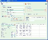
The Advanced points manager imports points to AutoCAD drawing from different data sources. OLE-DB database, SHP (ESRI shape file), Gpx (GPS eXchange format), KML (Keyhole Markup Language), GML (Geography Markup Language), TXT, CSV. Additional options: savable configurations, point coordinate transformation from/to any world coordinate system, point can be ACAD point or ACAD block with...
Category: Business & Finance / Vertical Markets
Publisher: CADdicted inc., License: Shareware, Price: USD $119.00, File Size: 609.8 KB
Platform: Windows
Shareware
iWhere iPhone Location Changer is a great location changer for iOS device. 4 modes such one-stop mode, multi-stop mode, and joystick mode help you simulate GPS location routes. You can customize the route and speed, allowing you to play geo-based games such as Pokmon Go, Monster Hunter Now anywhere. AdditionallyiWhere iPhone Location Changer can easily change the location on your iPhone with...
Category: Utilities / System Surveillance
Publisher: iWhere Technology, License: Shareware, Price: USD $49.99, File Size: 1.9 MB
Platform: Windows
Shareware
iWhere iPhone Location Changer is a great location changer for iOS device. 4 modes such one-stop mode, multi-stop mode, and joystick mode help you simulate GPS location routes. You can customize the route and speed, allowing you to play geo-based games such as Pokmon Go, Monster Hunter Now anywhere. AdditionallyiWhere iPhone Location Changer can easily change the location on your iPhone with...
Category: Utilities / System Surveillance
Publisher: iWhere Technology, License: Shareware, Price: USD $49.99, File Size: 97.9 MB
Platform: Mac
Discover the new AlerteGPS G200 !
Discover the new AlerteGPS G200 !
The AlerteGPS G200 NEO is a real copilot that combines a digital display and vocal warnings to give you a maximum of indications on the road:
- speed of your vehicle
- maximum speed
- distance between your vehicle and the speed control
- the frequency of mobile speed controls
Featuring also a speed limiter and a user memory...
Category: Web Authoring / Web Design Utilities
Publisher: AlerteGPS, License: Freeware, Price: USD $0.00, File Size: 2.8 MB
Platform: Windows

Geocode digital images with latitude, longitude, altitude, and direction information when collecting GIS field data. RoboGEO stamps this information onto the actual photo or writes it to the EXIF headers, allowing you to permanently geotag and link your photos to the GPS coordinates. All writing to the EXIF and IPTC headers is lossless and all of the existing comments (including the MakerNote...
Category: Multimedia & Design
Publisher: Pretek, Inc., License: Demo, Price: USD $34.95, File Size: 6.4 MB
Platform: Windows
GPicSync automatically inserts location in your photos metadata so they can also be used with any 'geocode aware' application like Picasa/Google Earth, Flickr, loc.alize.us.
Main fetures:
- automatically geocode your photos (in the EXIF header)
- use a GPS tracklog in the Gpx format or NMEA format (multiple selection possible)
- Support elevation...
Category: Multimedia & Design / Digital Media Editors
Publisher: Google Project, License: Freeware, Price: USD $0.00, File Size: 0
Platform: Windows

Importation/Exportation: Import/export trails to Gpx file. Unlimited number of trails, and TrackPoints. Export to Gpx, Excel, PDF, XPS and KML/KMZ. Data table: Very flexible data table that allows sorting by columns, with inheritance of data, attributes, etc. Presentation on map: View on map in accordance with the active trail, which comes from providers of maps, as in...
Category: Home & Education / Miscellaneous
Publisher: Aplicaciones Topográficas S.L., License: Freeware, Price: USD $0.00, File Size: 27.0 MB
Platform: Windows
When you have a Pocket PC based navigation system and your software supports user defined POIs (Points Of Interest), you need POIView SE. This program helps you to manage, view, edit and print these POIs directly on your desktop PC. This version has direct access to the POIHandler Poi collection.
Category: Utilities / Misc. Utilities
Publisher: Bluescreen, License: Freeware, Price: USD $0.00, File Size: 439.6 KB
Platform: Windows
WIA-Loader transfers pictures from a camera or flash card to the PC.
WIA-Loader transfers pictures from a camera or flash card to the PC. It offers many options to name image files and folders and give you the possibility to geocode pictures with Gpx-files.
Category: Multimedia & Design / Graphics Viewers
Publisher: mortara.org, License: Freeware, Price: USD $0.00, File Size: 3.8 MB
Platform: Windows, Mac, 2K, 2K3, Vista
CacheMaps retreives a variety of maps for your caches from the Internet.
CacheMaps retreives a variety of maps for your caches from the Internet.
CacheMaps uses the Geocaching loc- or Gpx-files as input. Directely from the Geocaching site or as exported from GSAK.CacheMaps v4 has been designed to be used next to GSAK. A lot of the functionality that was available in previous versions of CacheMaps, is available in GSAK now in a much better form. What...
Category: Audio / Utilities & Plug-Ins
Publisher: BigBird Productions, License: Freeware, Price: USD $0.00, File Size: 153.2 KB
Platform: Windows
QuakeMap is a powerful GPS/mapping program for your Windows computer.
QuakeMap is a powerful GPS/mapping program for your Windows computer. It can be downloaded here for free. The trial mode allows you to use most features indefinitely. When you need to unlock certain powerful features, a License Key can be ordered here. QuakeMap is designed for ease of use. It eatures intuitive user interface, supports most popular Garmin and Magellan receivers, reads and writes...
Category: Utilities / Misc. Utilities
Publisher: quakemap.com, License: Freeware, Price: USD $0.00, File Size: 821.2 KB
Platform: Windows
The GPS TrackManager is an application for planning routes and managing routes, waypoints and trackpoints.
The application support functions such as: open and save trackpoints files in various formats (Gpx, Ozi Trackpoint file, Ozi Waypoint file, NMEA log, EasyGPS file), transmit Trackpoints, Waypoints and Routes to Garmin GPS receivers (Geko 201, GPSmap 60C), saves trackpoints as...
Category: Internet / Communications
Publisher: Frank Hamaekers, Write4u, License: Freeware, Price: USD $0.00, File Size: 4.8 MB
Platform: Windows
Use your gps enabled mobile phone (WM5 / WM6) to store your position to a file and/or the internet.
Use your gps enabled mobile phone (WM5 / WM6) to store your position to a file and/or the internet.Together with the website www.mapwm.com you can use MapWM to generate Google Earth/Map output and Gpx files. You may configure the software to store in regular intervals or to perform smart save and store only important track points. Audible speed warning: prevent speeding ticket, let your...
Category: Home & Education / Genealogy
Publisher: Seiz System Engineering, License: Freeware, Price: USD $0.00, File Size: 314.0 KB
Platform: Unknown

TRANSDATpro can prove a helpful tool for professionals, providing them with the possibility to perform coordinate transformations fast and easy by use of the coordinate reference systems of their choice. TRANSDATpro performs Coordinate Transformations fast and with high accuracy. The coordinate conversion software supports worldwide thousands of Coordinate Systems, geodetic Reference Systems...
Category: Home & Education / Science
Publisher: Killet GeoSoftware Ing.-GbR, License: Shareware, Price: USD $270.00, EUR240, File Size: 5.3 MB
Platform: Windows

OkMap is a GPS and map software that:
-Works with vectorial maps and calibrates raster maps
-Organizes paths by creating waypoints, routes and tracks
-Uploads/downloads data to/from your GPS
-Uses altitude DEM data
-Supports GPS real-time navigation
-Sends/receives vehicles position and display tracks on maps in real time
-Provides autorouting and geocoding...
Category: Business & Finance / Applications
Publisher: Gian Paolo Saliola, License: Freeware, Price: USD $0.00, File Size: 20.2 MB
Platform: Windows
xGPS Manager is a must-have tool for iPhone owners.
xGPS Manager is a must-have tool for iPhone owners. It is a desktop application that talks nice to iPhone application xGPS, which is a maps and navigation tool for iPhones. This desktop application allows you to carry out certain tasks that are harder to do on iPhone.
For example, you can manage your maps in the desktop application and sync them with the iPhone app. Managing maps...
Category: Home & Education / Miscellaneous
Publisher: Xwaves, License: Freeware, Price: USD $0.00, File Size: 4.5 MB
Platform: Windows
DF Plotter can determine and display the direction of any transmission using a simple passive antenna switch. This allows voice transmissions from aircraft or other similar radio signals transmissions to be located and displayed on a chart. DF Plotter displays the direction of a radio transmission picked up by your receiver.DF Plotter can drive a passive antenna switch and display the direction...
Category: Home & Education / Science
Publisher: Centro de ObservaA§ALo AstronAlmica no Algarve, License: Shareware, Price: USD $0.00, File Size: 0
Platform: Windows
Shareware
GPS Mapping Software for Windows, Loading topographic maps, manage GPS devices and more. The software can be used with various map formats including: GeoTiff, BSB Nautical Charts, AutoCad DXF files, ESRI Shapefiles. Using calibration you can also use scanned or downloaded JPG, BMP, GIF, PNG and TIF maps. The software can be used for survey, research, track and trace, real time positioning and...
Category: Home & Education / Science
Publisher: Eye4Software B.V., License: Shareware, Price: USD $75.04, EUR49, File Size: 6.7 MB
Platform: Windows
This software is designed specifically to make the whole process of downloading data from a group of GPS devices, formatting the data into a race replay and then watching the replay as fast and pain free as possible.
Main Features:
- One-click GPS data downloading from up to 21 Velocitek devices in one batch ( USB hub required)
- Automatic Microsoft Virtual Earth...
Category: Internet / Download Managers
Publisher: Velocitek, License: Shareware, Price: USD $0.00, File Size: 5.4 MB
Platform: Windows
With Cartopro Evolution create,modify and save routes, tracks, and waypoints by simple click on the screen.
Main features:
-Simple and reliable.
-Scan your maps directly from Cartopro
-3 types of powerful calibrations are available
-Large number of Datums available. You can also add them manually.
-Import and Export your track, routes and waypoints as...
Category: Home & Education / Miscellaneous
Publisher: Sigrist Alain, License: Shareware, Price: USD $0.00, File Size: 0
Platform: Windows
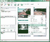
iTag is a utility that allows you to easily add title, description and keyword tags to your digital photos. The data you enter is stored into the actual photo file itself - using the open standards of IPTC and XMP. Many applications can read and write the IPTC/XMP data, but iTag is especially powerful at editing a group of photos all at once. Geocoding your photos is also straight forward...
Category: Multimedia & Design / Media Catalogers
Publisher: iTag Software, License: Freeware, Price: USD $0.00, File Size: 576.9 KB
Platform: Windows
Features
- Easy-to-learn WINDOWS™ based user interface
- Easy-to-use thanks to single key functions
- Fully automatic (no user interface needed... suited for mobile applications)
- Very fast because of a special file format (XIM file format)
- Imperial or international units or mixture of both
- Rich, detailed configuration
- Utilizes most...
Category: Multimedia & Design / Multimedia App's
Publisher: Sapper Oy, Finland, License: Freeware, Price: USD $0.00, File Size: 1.6 MB
Platform: Windows
POIbase is an application that will allow you to establish a route through Europe depending on the places you want to visit, places, like museums, shops, etc, or depending on the traffic, speed cameras, camping sites and many more.
Poi stands for “points of interest” and represents a huge database of locations from all around Europe. When you start the...
Category: Home & Education / Miscellaneous
Publisher: POICON GmbH & Co. KG, License: Freeware, Price: USD $0.00, File Size: 18.7 MB
Platform: Windows
Shareware
If you want to change your GPS location while playing AR games due to bad weather, you could achieve this with Aiseesoft AnyCoord and you do not need to walk around. Importing or exporting a Gpx file are also supported. Key functions: 1. Set virtual location for iDevices Aiseesoft AnyCoord enables you to change the actual GPS location of your iDevices to a virtual...
Category: Utilities / System Utilities
Publisher: Aiseesoft Studio, License: Shareware, Price: USD $9.95, File Size: 1.9 MB
Platform: Windows
Avisoft-SASLab Pro is a powerful Windows application (compatible to Windows 98/2000/XP/Vista/7) for investigating animal acoustic communication. It provides a broad range of processing and analysis tools that can greatly increase the efficiency in extensive sound analysis projects.
Avisoft-SASLab Pro is compatible:
- Supports all common soundcards and USB audio...
Category: Audio / Utilities & Plug-Ins
Publisher: Avisoft Bioacoustics, License: Demo, Price: USD $0.00, File Size: 5.6 MB
Platform: Windows