Free Downloads: Road And Grid Coordinates
The Grid InQuest software provides a means for transforming Coordinates between ETRS89 (WGS84) and the National coordinate systems of Great Britain, Northern Ireland and the Republic of Ireland. It provides a fully three dimensional transformation incorporating the latest geoid model and is the nationally recognised software for performing these conversions.
In...
Category: Home & Education / Miscellaneous
Publisher: Quest Geo Solutions Ltd, License: Freeware, Price: USD $0.00, File Size: 0
Platform: Windows
Cartesian Coordinates, spherical Coordinates und cylindrical Coordinates can be transformed into each other. (5 languages, 2 and 3 dimensions)
Category: Home & Education / Miscellaneous
Publisher: Greuer Andreas, License: Shareware, Price: USD $11.00, File Size: 993.3 KB
Platform: Windows
Grid Imp - imports gridded data into MS-MapPoint, to produce attractive data maps.
Grid Imp - imports gridded data into MS-MapPoint, to produce attractive data maps. Can handle imperfect data, holes, re-gridding, etc. Can be used to import such attributes as pollution data, seismic hazard, geological information, customer/population distribution, etc. Grid Imp is a software that allows you to import data and produce maps. Various text formats supported using...
Category: Home & Education / Science
Publisher: Winwaed Software Technology, License: Shareware, Price: USD $75.00, File Size: 2.0 MB
Platform: Windows
The much-awaited feature of road editing is now available.
The much-awaited feature of Road editing is now available.
- Easy to use spline based editing, all controlled with 3D gizmos or numerical input. Add, delete, move and merge complex networks of roads.
- Control Road geometry generation resolution, banking and intersections. Real-time Road/terrain interaction computation using the GPU.
Flexible...
Category: Multimedia & Design / Animation
Publisher: Quad Software, License: Shareware, Price: USD $0.00, File Size: 0
Platform: Windows
The Surface Area Calculator is a tool for easily calculating surface and planimetric areas, as well as volumes.
The extent and shape of the area in question are given in terms of the Coordinates of a number of points throughout the area.
These Coordinates can be specified as either latitude, longitude, and height, as GPS Coordinates (geocentric Cartesian...
Category: Business & Finance / Calculators
Publisher: Microsearch Corp, License: Shareware, Price: USD $134.00, File Size: 1.2 MB
Platform: Windows
Based on the memory card game.
Based on the memory card game. Road Sign Search lets you play while you learn the meaning of Road signs for the UK Driving Theory Test. Two decks of cards are dealt face down; one carries images of Road signs and the other descriptions of Road signs. You
Category: Games / Educational Games
Publisher: diktyon.co.uk, License: Freeware, Price: USD $0.00, File Size: 652.0 KB
Platform: Windows, Mac, 2K, 2K3
 Freeware
Arm Map Explorer recreates all the functionalities of Google Maps on your desktop while expanding them with new extras. Map Explorer lets you locate and view any place on the planet using dynamic interactive maps. These maps are draggable, which means there is no need for you to click and wait for graphics to reload each time you want to view adjacent parts of a map. Basically, viewing...
Category: Internet / Flash Tools
Publisher: ArmCode, License: Freeware, Price: USD $0.00, File Size: 5.5 MB
Platform: Windows
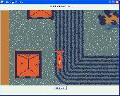
Back to the 2 Dimensions in a arcade car driving game :a Road and plenty of things to see and overtake ! Every element,car,Road,Road objects is freely customizable and expandable;it includes a Road+Road objects editor. Written in java ,the source code is available.
Category: Games / Arcade
Publisher: Francesco Piazza, License: Freeware, Price: USD $0.00, File Size: 1024 B
Platform: Windows, Linux
Imports gridded data into Microsoft MapPoint, to produce attractive data maps that resemble contour maps.
Can handle imperfect data, holes, re-gridding, etc. Can be used to import such attributes as pollution data, seismic hazard, geological information, customer/population distribution, etc.
Data can be interpolated to different Grid spacings if required. Polygon optimization...
Category: Business & Finance / Applications
Publisher: Winwaed Software Technology, License: Shareware, Price: USD $75.00, File Size: 2.2 MB
Platform: Windows
This map combines topographic mapping with road and tourist detail.
This map combines topographic mapping with Road and tourist detail. The Road information is clear and elevation is shown using contours, spot heights and altitude shading. The map shows six different types of roads, highlighting scenic routes, places of interest, archaeological sites, monasteries, monuments and viewpoints.
Category: Home & Education / Miscellaneous
Publisher: Omni Resources, License: Shareware, Price: USD $21.99, File Size: 3.0 MB
Platform: Windows
In this game there will be a city with some of the numbered buildings shown.
In this game there will be a city with some of the numbered buildings shown. Your task is to construct a Road that loops the city. The Road must not branch and there must only be one loop. The number on a building indicates the number of faces of this building facing a Road. Click at an edge to create a Road, click again to mark that edge with a cross to remind...
Category: Games / Misc. Games
Publisher: Novel Games Limited, License: Freeware, Price: USD $0.00, File Size: 253.7 KB
Platform: Windows
- Plot regular and parametric equations.
- Plot regular and parametric equations.
- Plot Coordinates tables.
Graphing Calculator 3D is an easy-to-use tool that plots 2D and 3D functions.
Graphing Calculator 3D features :
- Instant quick plotting after each key stroke.
- Cartesian/Polar Coordinates in 2D.
- Cart/Cylindrical/Spherical Coordinates in 3D.
- Inequalities in 2D...
Category: Home & Education / Mathematics
Publisher: Runiter Company, License: Shareware, Price: USD $49.95, File Size: 4.3 MB
Platform: Windows
Horrum is a free and simple, yet fun 3D racing game with infinite road.
Horrum is a free and simple, yet fun 3D racing game with infinite Road.
The goal of the game is to set the best time between two check-points. Beware the traps and the end of the Road, and use or don't power-ups on the Road.
This game requires OpenGL 3D accelerator.
Category: Games / Misc. Games
Publisher: Jordan Tuzsuzov, License: Freeware, Price: USD $0.00, File Size: 1.4 MB
Platform: Windows
CoordTrans converts geographic coordinates between different coordinate systems.
CoordTrans converts geographic Coordinates between different coordinate systems.
CoordTrans is very easy to use, and full of Wizards to help you with more complex tasks.
Convert between UTM, WGS84 and NAD27 / NAD83, and more... almost all projections and datums on Earth are supported. See complete list..
You can convert single Coordinates, or...
Category: Business & Finance / Business Finance
Publisher: Franson, License: Shareware, Price: USD $49.00, File Size: 6.5 MB
Platform: Windows
Road Doctor™ Viewer is a free software for clients.
Road Doctor™ Viewer is a free software for clients. It can be used to view projects and data views created by Road Doctor™ and Geo Doctor™ software. New views or data cannot be linked to the project. Views created with Road Doctor™ 3D GPR module and single ground penetrating radar files can be opened to the view.
Category: Multimedia & Design / Graphics Viewers
Publisher: Roadscanners Oy, License: Freeware, Price: USD $0.00, File Size: 43.6 MB
Platform: Windows
Aerial, topograhpic, and other types of maps are an important resource in the visualization of your information. HuntSmart big game hunting software gives you the ability to view your information on maps. Once you enter information with Coordinates into the system, this information can be viewed on all available maps that contain those Coordinates. One thing to remember is that...
Category: Multimedia & Design / Multimedia App's
Publisher: HuntingSouth, License: Shareware, Price: USD $0.00, File Size: 17.1 MB
Platform: Windows
Grid Matrix is a Graphical Grid simulator for Windows that is implemented over SimGrid.
Grid Matrix is a Graphical Grid simulator for Windows that is implemented over SimGrid.
Grid Matrix uses SimGrid toolkit to run the simulation. The network can be defined using a graphic interface and run within the application.
The simulation code is written in Python using bindings to SimGrid.
Category: Software Development / Misc. Programming
Publisher: Pablo Yabo, License: Freeware, Price: USD $0.00, File Size: 5.7 MB
Platform: Windows
DXF2XYZ converts a DXF file to an XYZ file, ie a comma delimited text file containing just xyz Coordinates. It can be useful for extracting the raw XYZ Coordinates from a DXF file containing say contours or other elevation entities.
This utility it limited to extracting the XYZ Coordinates from the following DXF entity types:
POINT, LINE, POLYLINE /...
Category: Business & Finance / Calculators
Publisher: H. Wind, License: Freeware, Price: USD $0.00, File Size: 657.6 KB
Platform: Windows
Detail Grid – The detail grid holds the details of data read from the meter.
Detail Grid – The detail Grid holds the details of data read from the meter. You can navigate, via he expandable Grid layout, to see individual Session, Run and Data Point information. You can even click on a Chart button on a Run Grid row to see a chart of the Run’s data points.
Category: Internet / Misc. Plugins
Publisher: Allen Face and Companies LLC, License: Freeware, Price: USD $0.00, File Size: 2.9 MB
Platform: Windows
TwoNav is a dual navigation system (On-Road/Off-Road) to perform most of your outdoor activities (hiking, biking, skiing, geoacaching, ...). TwoNav can also guide you when driving. A single solution for all your orientation needs. Load maps, tracks, routes and waypoints and get ready for your trip!
Category: Home & Education / Miscellaneous
Publisher: CompeGPS TEAM, S.L., License: Shareware, Price: USD $67.28, File Size: 21.2 MB
Platform: Windows
Omni Grid is a plug-in for SU Podium V2 or for SU Walk that allows you to create a Grid of point lights or omni lights above or below a planar surface (SketchUp face). By creating a Grid of omni lights Omni Grid creates a relatively even source of light over a wide space. It is best for interior rendering. An alternative to omni Grid is Hidden LEM.
Category: Multimedia & Design / Multimedia App's
Publisher: Cadalog Inc., License: Freeware, Price: USD $0.00, File Size: 328.5 KB
Platform: Windows
Shareware
Batch calculate route distances, travel times, and/or estimated costs for point-to-point routes listed in a database (Access, Excel, or ODBC). Uses Microsoft MapPoint for point locations and route calculations. Supports all of MapPoint's route options including fastest routes, shortest routes, preferred roads, and straight lines (Great Circles). Start and end locations are specified using...
Category: Business & Finance / MS Office Addons
Publisher: Winwaed Software Technology LLC, License: Shareware, Price: USD $75.00, File Size: 3.1 MB
Platform: Windows
The OSTN02 extension for ArcPad is a FREE tool that automatically transforms GPS data and aligns it with Ordnance Survey (OS) background map. This easy-to-use extension removes the need to manually post-process GPS data by providing’ on the fly’ transformation of WGS84 latitude and longitude into OSTN02 corrected British National Grid coordinate. Data capture using GPS and...
Category: Home & Education / Miscellaneous
Publisher: ESRI (UK) Ltd, License: Freeware, Price: USD $0.00, File Size: 8.0 MB
Platform: Windows
GoArrow displays an arrow on your screen that points towards coordinates that you specify.
GoArrow displays an arrow on your screen that points towards Coordinates that you specify. This is very handy if you have to run to Coordinates with obstacles in the way (like mountains), or if you're just directionally-challenged.
GoArrow has the ability to find a route between any two locations in Dereth, as well as look up locations' details from either the...
Category: Home & Education / Miscellaneous
Publisher: Digero of Leafcull, License: Freeware, Price: USD $0.00, File Size: 7.7 MB
Platform: Windows
Shareware
iGrid plots drawing Grid right over your desktop, so you can use it everywhere, with any drawing application without any special plugins for different graphics applications. Just install and run iGrid and you'll see Grid plotted over entire screen: Click left mouse button on the iGrid's tray icon to show/hide the Grid or right mouse button to see iGrid's menu. Choose...
Category: Multimedia & Design / Image Editing
Publisher: Greatis Software, License: Shareware, Price: USD $13.00, File Size: 428.8 KB
Platform: Windows