Free Downloads: Route Planning Software Garmin

OkCustomMap is a software to produce Garmin Custom Maps.
OkCustomMap is a Software to produce Garmin Custom Maps.
Supports many map formats:
- OkMap
- Ecw
- GeoTiff
- World files
- OziExplorer
- GpsTuner
You can customize:
- The quality of the output JPEG images (0=Bad, 100=Good)
- The KML transparency (0=Transparent, 255=Opaque)
- The KML draw order (0=Invisible, 1-49=Under the vectorial...
Category: Business & Finance / Applications
Publisher: Gian Paolo Saliola, License: Freeware, Price: USD $0.00, File Size: 3.2 MB
Platform: Windows
OZtopo provides an alternative set of maps, suitable for use on Garmin GPS units.
OZtopo provides an alternative set of maps, suitable for use on Garmin GPS units. It has been designed as a detailed set of topographical maps suitable for bushwalking, 4WDing and general touring . It is comprised of two mapsets, 10m Contours and Roads and Tracks. Both mapsets can be loaded onto a GPS at the same time. They can also be loaded concurrently with any of Garmin's...
Category: Business & Finance / Business Finance
Publisher: Oztopo, License: Shareware, Price: USD $0.00, File Size: 75.7 MB
Platform: Windows
Maritime Software - Draft Survey, Lashing and Route calculations for Merchant Navy.
Maritime Software - Draft Survey, Lashing and Route calculations for Merchant Navy. User-friendly Draft Survey, Lashing Calculations and Route Planning Software for Ships' Officers and Marine Surveyors. Mariners Office is easily operated using either Keyboard or Mouse. It complies with the latest UN ECE standards and MSC "Code of Safe Practice for Cargo...
Category: Business & Finance / Calculators
Publisher: MaritimeSoftware.com Inc., License: Shareware, Price: USD $149.95, File Size: 3.4 MB
Platform: Windows
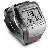
Turtle Sport is a free Software developed to communicate with Garmin fitness products (forerunner and edge).
Turtle Sport retrieves yours training sessions from your Garmin and it makes diagram. You can also order your training sessions by category and training mode. With Turtle Sport, it is also possible to map your GPS training paths in Google Earth.
...
Category: Home & Education / Miscellaneous
Publisher: TurtleSport, License: Freeware, Price: USD $0.00, File Size: 6.9 MB
Platform: Windows
Logistical planning and fleet management are critical to today's businesses and industry.
Logistical Planning and fleet management are critical to today's businesses and industry.
Everything we consume is delivered to us via trucks.
Even as Internet now offers alternatives to many of the historical parts of the supply chain, such as sales personnel and retail stores, the one part that has not been eliminated is the transportation of goods to...
Category: Business & Finance / Business Finance
Publisher: MappointAsia, License: Demo, Price: USD $0.00, File Size: 312.0 MB
Platform: Windows
Screensaver with a Garmin Forerunner theme. .
Screensaver with a Garmin Forerunner theme.
Category: Desktop Enhancements / Screensavers
Publisher: Garmin Forerunner 305, License: Freeware, Price: USD $0.00, File Size: 1.5 MB
Platform: Windows
Wedding Planning Checklist, toolbar browser for IE, Planning Wedding Guide, Wedding Planning Timeline, Planning Wedding on a budget, Wedding Planning Secrets, Tips on Planning a Wedding, For the Bride to Be, Planning Wedding of Your Dreams on a Budget, Money Saving Secrets for your Wedding, wedding invitations, wedding consultants, bride and...
Category: Internet / Browsers
Publisher: Wedding Planning Checklist, License: Freeware, Price: USD $0.00, File Size: 1.1 MB
Platform: Windows
Qualica Planning Suite for Design for Quality By Design provides researchers and process engineers with a fully integrated method and documentation toolkit for their Quality By Design project. Qualica Planning Suite for Quality By Design captures all core information about your Quality By Design project.
All Planning and risk management tools such as FMEA,...
Category: Business & Finance / Business Finance
Publisher: Qualica Software GmbH, License: Demo, Price: USD $0.00, File Size: 56.5 MB
Platform: Windows
BPC stands for Business Planning and Consolidation.
BPC stands for Business Planning and Consolidation. As the name suggest, BPC is used for both Planning and Consolidations, unlike IP, which is used for only Planning.
The concept of Planning is the same as you have in any other tool. The functional side of the Planning remains the same. However, the tool differs. The way you configure a Planning...
Category: Business & Finance / Business Finance
Publisher: SAP, License: Freeware, Price: USD $0.00, File Size: 10.5 MB
Platform: Windows
This software will not work unless you already own a MapSource product.
This Software will not work unless you already own a MapSource product.
Main Features:
- Improved memory issues when running on Windows 7.
- Improved map projection for many map products.
- Changed mouse-wheel functionality to zoom in and out.
- Added support for enhanced map security.
- Fixed unlocking...
Category: Home & Education / Miscellaneous
Publisher: Garmin Ltd or its subsidiaries, License: Freeware, Price: USD $0.00, File Size: 8.4 MB
Platform: Windows
Garmin MapConverter was developed to be a tool that will allow you to convert maps and unlock codes on your Windows PC to the Macintosh format. Transferred maps will remain fully accessible on your Windows PC. It works on Windows XP, Windows Vista, Windows 7.
Category: Utilities / Misc. Utilities
Publisher: Garmin Ltd or its subsidiaries, License: Freeware, Price: USD $0.00, File Size: 2.6 MB
Platform: Windows

JOpt.SDK is a geographic Route scheduling and optimization Java library for automatic resource and transportation Planning. It uses specialized genetic algorithms to calculate an optimized allocation of orders and stops to mobile resources. The algorithm not only provides tours at minimum costs but also considers an arbitrary set of constraints for each tour. JOpt.SDK can solve...
Category: Software Development / Components & Libraries
Publisher: DNA, License: Demo, Price: USD $0.00, File Size: 97.0 KB
Platform: Windows
You can capture the Google map window and save it as JPG format, and also show the planned Route on Google map directly.
Main Features:
- Travel Planning
- Travel database saved by calendar
- Travel detail information
- Travel files list
- Software control Function
Category: Home & Education / Miscellaneous
Publisher: GlobalSat Technology Corporation, License: Freeware, Price: USD $0.00, File Size: 68.1 MB
Platform: Windows
 Freeware
org, uses file and position names that suit to the display of the TomTom Rider, uses file, route and position names that suit to the display of the Map&Guide Motorrad Tourenplaner, remembers language, paths, window size and position. . .
Category: Business & Finance / Conversion Applications
Publisher: Christian Pesch, License: Freeware, Price: USD $0.00, File Size: 6.6 MB
Platform: Windows, Mac, Linux, Solaris, FreeBSD, OpenBSD, Java
Now you can plan and organize trips with MapSource, a very useful computer software.
Now you can plan and organize trips with MapSource, a very useful computer Software.
MapSource is included with the purchase of a Garmin map on DVD or CD. With MapSource, you can:
- Back up important trip data separately from your Garmin device.
- Plan routes from the convenience of your computer instead of on your device.
- Create, view, and edit...
Category: Business & Finance / Database Management
Publisher: Garmin Ltd or its subsidiaries, License: Shareware, Price: USD $0.00, File Size: 54.4 MB
Platform: Windows
A Windows based simulator to find the optimal route to the weather conditions and forecasts.
A Windows based simulator to find the optimal Route to the weather conditions and forecasts. According to one estimate Americans waste more than 65 billion dollars a year sitting in traffic. An efficient routing system is an indispensible tool for any delivery Route.
Manually routing your fleet even on a small scale is out of realm of human capacity and is best left...
Category: Multimedia & Design / Image Editing
Publisher: HouseOfAlgorithms, License: Freeware, Price: USD $0.00, File Size: 1.0 MB
Platform: Windows
JOpt.SDK is spatial Route optimization and Planning Java library for automatic resource scheduling and transportation Planning. It uses specialized genetic algorithms to calculate an optimized allocation of orders and stops to mobile resources. The algorithm not only provides tours at minimum costs but also considers an arbitrary set of constraints for each tour. JOpt.SDK...
Category: Software Development / Components & Libraries
Publisher: DNA, License: Freeware, Price: USD $0.00, File Size: 97.0 KB
Platform: Unknown
The GPS TrackManager is an application for Planning routes and managing routes, waypoints and trackpoints.
The application support functions such as: open and save trackpoints files in various formats (GPX, Ozi Trackpoint file, Ozi Waypoint file, NMEA log, EasyGPS file), transmit Trackpoints, Waypoints and Routes to Garmin GPS receivers (Geko 201, GPSmap 60C), saves...
Category: Internet / Communications
Publisher: Frank Hamaekers, Write4u, License: Freeware, Price: USD $0.00, File Size: 4.8 MB
Platform: Windows
The program is intended to edit the network routes table. Visual TCP/IP Router has the convenient graphic interface for a new Route adding and for the deleting of any existent. It's very simple to create new or delete existent Route using the Visaul CP/IP Router. For adding select the connection type, addressable destination, network mask, metric (1 by default), select should this...
Category: Utilities
Publisher: TM Services, License: Freeware, Price: USD $0.00, File Size: 654.1 KB
Platform: Windows
Route Manager is a complete application that allows vending operators to easily manage and track every aspect of a vending operation. Track new and potential leads that become customers. Quickly place equipment in accounts and track the products, commissions and expenses for all your accounts. Route manager not only manages the standard Route information but has a built in...
Category: Business & Finance / Applications
Publisher: Nexphaze, License: Commercial, Price: USD $39.95, File Size: 1.1 MB
Platform: Windows
Modular PC-Software package for Planning and controlling of arbitrary sea routes with integrated calculation of time-schedules and manifold applications (Data exchange with Diesel Diagnostic System DDM 40) The Software package GLOBAL FLEET CONTROL - GFC40 is suitable for the application on your fleet. Application Profile: + Planning and controlling of arbitrary...
Category: Business & Finance / Project Management
Publisher: Ingenieurbuero Richter, License: Freeware, Price: USD $0.00, File Size: 42.9 MB
Platform: Windows
GeePeeEx Editor is specifically designed to produce and edit GPX files destined for Garmin's® Automotive Satnav (GPSr) systems. These files can be used as input to Garmin's® POI Loader to produce enhanced Custom POI's (Points of Interest).
Convert CSV files to GPX. Optionally and uniquely, GeePeeEx Editor will search for valid telephone numbers...
Category: Audio / Rippers & Encoders
Publisher: Them, License: Freeware, Price: USD $0.00, File Size: 2.6 MB
Platform: Windows
You will be able to enjoy many of CompeGPS Lands features such as waypoint and Route creation and edition, full communication between PDA and GPS, use of maps and the moving map (real-time navigation). CompeGPS Pocket Land allows full communication between GPS and PDA (tracks, waypoints and routes). You will be able to create waypoints and routes, use maps and real-time...
Category: Home & Education
Publisher: CompeGPS TEAM S.L., License: Shareware, Price: USD $76.00, File Size: 3.9 MB
Platform:
Track tropical storms and calculate closest point of approach from a certain Route.NavTools Stormtrack uses the same database as NavTools Route version 5 and will use voyages and routes constructed in NavTools Route, however it can be used as a stand-alone application.Version 5.09 is intended as a final beta test, please report any bugs or comments to support@navtools.nl or...
Category: Home & Education / Miscellaneous
Publisher: Andromeda Productions, License: Shareware, Price: USD $25.00, File Size: 2.1 MB
Platform: Unknown
PoiEditor is a software solution package for downloading and customizing road safety data.
PoiEditor is a Software solution package for downloading and customizing road safety data. The Software makes it easy to stay up to date with the latest road safety data also know as POI's(Points of interest), it also applies your personal preferences to the downloaded data. The PoiEditor also sends the data to your Garmin device or SSD Card by utilizing the...
Category: Internet / Misc. Plugins
Publisher: Tinus Strauss, License: Shareware, Price: USD $12.59, File Size: 2.7 MB
Platform: Windows