Free Downloads: Satellite Antenna
 Shareware
Google Satellite Maps Downloader is a cute tool that can automatically download Google Maps Satellite tile images and then combine them into one big map image. It supports multithreads, so the download speed is very fast. And it is very easy to use. All downloaded small images are saved on the disk. You can combine them after downloading or later. Isn't it very cool that you make...
Category: Internet / Download Managers
Publisher: allmapsoft.com, License: Shareware, Price: USD $39.00, File Size: 30.6 MB
Platform: Windows
View amazing satellite images of earth with the free version of google earth software.
View amazing Satellite images of earth with the free version of google earth software.Google earth is a totally free software which enables you zoom in from Satellite,view,rotate or tilt just like a camera of the entire earth inside your pc.It works just point and click on any part of earth or by typing addrees name of city or country and google earth will down from space to the...
Category: Home & Education / Miscellaneous
Publisher: www.satelliteimage-of-my-house.com, License: Freeware, Price: USD $0.00, File Size: 798.0 KB
Platform: Windows

Ready to start saving? It's never been a better time to switch to Satellite Television then now. You won't find better Dish Network deals available any where else on the internet.
If you've been throwing away your money on cable tv or DirecTV then you've come to the right place.
Order now
Save with special web only promotions! We are a high volume Satellite tv system...
Category: Internet / Browsers
Publisher: Dish Network Channel Packages, License: Freeware, Price: USD $0.00, File Size: 1.6 MB
Platform: Windows, Linux, Mac

Antenna enables you to design and develop great looking professional web sites rapidly - without any coding or HTML knowledge. Using transparent layers, master pages and pixel accurate positioning, Antenna makes web site building a visual experience - more like using an art or desktop publishing package, instead of programming. Now you can concentrate on aesthetics and design -...
Category: Web Authoring / HTML Text Styling Tools
Publisher: Stormdance, License: Shareware, Price: USD $59.00, File Size: 5.0 MB
Platform: Windows
The Orbit Visualization Tool (OVT) is a software for visualization of Satellite orbits in the Earth's magnetic field. The program can display Satellite orbits in five coordinate systems (GEI, GEO, GSM, SMC, GSE), Satellite footprints projected on the Earth's surface and shown in either geographic (GEO) or geomagnetic (SMC) coordinates. In addition to...
Category: Home & Education / Astrology & Numerology
Publisher: OVT Team, License: Freeware, Price: USD $0.00, File Size: 0
Platform: Windows
The Trimble Data Transfer software transfers data from a range of devices to your PC.
The Trimble Data Transfer software transfers data from a range of devices to your PC. You can then import the data into Trimble Total Control software.The following changes have been made to the Trimble Total Control
software for all users since version 2.70:
• Recomputation tolerance flags are now displayed.
• Recomputation now uses starting coordinates from...
Category: Utilities / Misc. Utilities
Publisher: Trimble Navigation Ltd., License: Freeware, Price: USD $0.00, File Size: 2.2 MB
Platform: Windows
The MonitorStuff software package works with the WaveTrend L-RX201 active RFID reader.
The MonitorStuff software package works with the WaveTrend L-RX201 active RFID reader.
The Antenna controller code below can be used with a Parallax BASIC Stamp 2 microprocessor to facilitate PC controlled Antenna switching. Some modification may be required.
Category: Internet / Communications
Publisher: Amal Graafstra, License: Freeware, Price: USD $0.00, File Size: 544.4 KB
Platform: Windows
Freeware
DreamBoxTools - a program for tuning your DreamBox Satellite receiver. Control your receiver right from the computer. Main features: - Lyngsat-to-Dreambox transponders parser. Update data about satellites and transponders to your receiver directly from the site Lyngsat.com - Satellite filter - Europe, Asia, Atlantic, America, only HD, manual choice, saved...
Category: DVD & Video / Video Conversion
Publisher: Protectedsoft Ltd., License: Freeware, Price: USD $0.00, File Size: 1014.4 KB
Platform: Windows
Satellite Finder is a way to accurately point satellite dishes at communications satellites in geostationary orbit.
Category: Home & Education / Mathematics
Publisher: arachnoid.com, License: Freeware, Price: USD $0.00, File Size: 1.4 MB
Platform: Windows, Mac, 2K
TerraClient allows viewing and printing of ground level satellite photographs of the United States.
TerraClient allows viewing and printing of ground level Satellite photographs of the United States. Featured is a unique map overlay option that automatically superimposes a "paper" roadmap over the Satellite photos. This map overlay option has been designed to help users identify indistinct land features in the Satellite photos. All map and photographic data is...
Category: Home & Education / Miscellaneous
Publisher: Bill Friedrich Software, License: Freeware, Price: USD $0.00, File Size: 1.3 MB
Platform: Windows
Shareware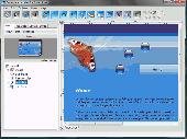
Antenna enables you to design and develop great looking professional web sites rapidly - without any coding or HTML knowledge. Using transparent layers, master pages and pixel accurate positioning, Antenna makes web site building a visual experience - more like using an art or desktop publishing package, instead of programming. Now you can concentrate on aesthetics and design -...
Category: Web Authoring / HTML Editors
Publisher: Stormdance, License: Shareware, Price: USD $59.99, GBP39.99, File Size: 6.1 MB
Platform: Windows
DESA Satellite Tracker allows you to track the International Space Station and other satellites in real time. The built in radar alarm will alert you to satellites that would be visible to you and let you know where to look (although you will only be able to actually see the satellites an hour before sunrise and an hour after sunset).
DESA Satellite Tracker is 100% free
Category: Home & Education / Astrology & Numerology
Publisher: red diligence, License: Freeware, Price: USD $0.00, File Size: 977.8 KB
Platform: Windows
A powerful but very easy-to-use program for modeling and analyzing nearly any kind of Antenna in its actual operating environment.
EZNEC plots azimuth and elevation patterns; tells you gain, feedpoint impedance, SWR, and current distribution; finds and reports beamwidth, 3-dB pattern points, f/b ratio, takeoff angle, sidelobe characteristics; and more.
Category: Business & Finance / Applications
Publisher: Roy W. Lewallen, License: Shareware, Price: USD $89.00, File Size: 5.1 MB
Platform: Windows
Whether you need accurate data for GIS applications or visual simulation applications, GeoGenesis provides you the ability to exploit commercial Satellite or aerial imagery to meet your requirements. For aerial or Satellite imagery, GeoGenesis provides advanced automated tie point extraction to geospatially link multiple images together. Using our bundle adjustment algorithm you...
Category: Home & Education / Miscellaneous
Publisher: IAVO Research And Scientific, License: Freeware, Price: USD $0.00, File Size: 73.9 MB
Platform: Windows
This is a very easy to use desktop application that will alert you whenever new articles are added to Portable Satellite Radio.com. Simply install the software and any time new content is added to the website, you will receive an alert on your desktop letting you know, and showing you part of the article. If you are interested and want to read the rest of the article, simply click on the...
Category: Desktop Enhancements / Misc. Themes
Publisher: Portable Satellite Radio, License: Freeware, Price: USD $0.00, File Size: 656.0 KB
Platform: Windows
Google Satellite SuperGet is a cute tool that help you to get small tile Satellite images from google maps. All downloaded small images are saved on the disk. You can view downloaded maps by offline,you can export them into a big images or tile images. You can easily get the longitude and latitude of each exported images.
Category: Home & Education / Miscellaneous
Publisher: Arceyes, License: Shareware, Price: USD $0.00, File Size: 3.4 MB
Platform: Windows
Satellite Free VST is a free and exclusive VST/AU/RTAS Plug-In Instrument.
Satellite Free VST is a free and exclusive VST/AU/RTAS Plug-In Instrument. It's multi-timbral, has great filters, effects and a built-in mixer.
Use it in your DAW (Logic, Cubase,Pro Tools, Live, etc) to play the sounds you downloaded.
It's easy to download and simple to install.
Category: Audio / Music Creation
Publisher: Samplebase, License: Freeware, Price: USD $0.00, File Size: 1.1 MB
Platform: Windows
Teledyne Paradise Datacom’s Compact Outdoor (C) series SSPAs bring high power solid state transmit amplifiers right to the Antenna’s feed. Designed for Antenna-mount applications, the Compact Outdor series SSPAs deliver the highest uplink powers available per unit volume and weight offered anywhere in solid state technology. Packaged for outdoor use, these amplifiers...
Category: Software Development / Misc. Programming
Publisher: Paradise Datacom LLC, License: Freeware, Price: USD $0.00, File Size: 4.7 MB
Platform: Windows

Dish Network Discounts. Dish Network TV Deals! Dish Network Television Deals and Free Offers! DISH Network installation and service nationwide. Satellite TV systems from Profressional Dealers. Free Dishnet receivers and DVR systems. Satelite Television, DISH, Digital TV, Broadband Internet, HD and DirectTV free satlite deals available. Order for free satalite installation. Dish Network...
Category: Internet / Browsers
Publisher: Dish Network Discounts, License: Freeware, Price: USD $0.00, File Size: 1.5 MB
Platform: Windows
Automatic NCDXF beacon monitor for Radio Amateurs,
SWL'ers and HF communication engineers
Features:
- continuously monitors 18 NCDXF beacons on five bands;
automatically detects the presence of the beacon signals, even in QRM and noise;
- measures the signal-to-noise ratio, the QSB index, and the propagation delay of the signal;
-...
Category: Audio / Utilities & Plug-Ins
Publisher: Afreet Software, Inc., License: Shareware, Price: USD $25.00, File Size: 1.8 MB
Platform: Windows
World Wind lets you zoom from satellite altitude into any place on Earth.
World Wind lets you zoom from Satellite altitude into any place on Earth. Leveraging Landsat Satellite imagery and Shuttle Radar Topography Mission data, World Wind lets you experience Earth terrain in visually rich 3D, just as if you were really there. V
Category: Home & Education / Mathematics
Publisher: worldwind.arc.nasa.gov, License: Freeware, Price: USD $0.00, File Size: 16.0 MB
Platform: Windows
MMANA-GAL is an antenna-analyzing tool based on the moment method, which was introduced in MININEC.
MMANA-GAL is an Antenna-analyzing tool based on the moment method, which was introduced in MININEC. Included is a possibility of user's interruption of extensively prolonged processes of calculation, draw plos or optimisation,Improved is a behaviour in crytical situations such as emergency close down, memory shortage or external interruption which can occur during calculations. From...
Category: Business & Finance / Applications
Publisher: MM HamSoft, License: Freeware, Price: USD $0.00, File Size: 2.6 MB
Platform: Windows
This program was designed to check the installation and optimize placement of the Antenna for your Automatic Identification System (AIS). This program displays received signal, threshold and signal-to-noise ratio (SNR) data for selected AIS targets. The program has been tested with NASA Marine Instrument's AIS Engine using the standard NMEA 0183 interface.
Category: Utilities / Misc. Utilities
Publisher: The Bellwood Group, License: Freeware, Price: USD $0.00, File Size: 2.2 MB
Platform: Windows
SATBUSTER for Windows is especially designed for satellite visual observers and trackers.
SATBUSTER for Windows is especially designed for Satellite visual observers and trackers. Its users, mainly amateur astronomers, radio amateurs and Satellite trackers, appreciate both the accuracy and the simple to use graphical interface. The software is aimed to hobbysts. However a growing number of plain folks are starting to use this tool to recognize and look at the...
Category: Internet / Misc. Plugins
Publisher: PC, License: Freeware, Price: USD $0.00, File Size: 6.0 MB
Platform: Windows
Download the new version of Google Earth satellite with Google Pack.
Download the new version of Google Earth Satellite with Google Pack.Google pack includes 13 totally free software selected by google for your better internet experience.Software included in google pack - Google Earth,Norton Security Scan,Google Desktop,Google Toolbar for Internet Explorer,Spyware Doctor Starter Edition,Picasa photo editor,Mozilla Firefox internet browser,Google Talk,word...
Category: Home & Education / Science
Publisher: www.satelliteimage-of-my-house.com, License: Freeware, Price: USD $0.00, File Size: 589.0 KB
Platform: Windows