Free Downloads: Satellite Direct Free Download
Whether you need accurate data for GIS applications or visual simulation applications, GeoGenesis provides you the ability to exploit commercial Satellite or aerial imagery to meet your requirements. For aerial or Satellite imagery, GeoGenesis provides advanced automated tie point extraction to geospatially link multiple images together. Using our bundle adjustment algorithm you...
Category: Home & Education / Miscellaneous
Publisher: IAVO Research And Scientific, License: Freeware, Price: USD $0.00, File Size: 73.9 MB
Platform: Windows
 Freeware
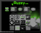
Get connected to your favorite videos and movies instantly and watch Satellite TV videos and movies at any time for Free. - Convenient one click access - Easy access to your favorite TV & Movies - HD TV & PC *1080w - Windows 98, 2000, XP, Vista & 7 compatible - Mac compatible ( running windows )
Category: Multimedia & Design / Video
Publisher: Ruzey, License: Freeware, Price: USD $0.00, File Size: 524.9 KB
Platform: Windows
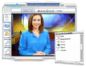
TV Online Pro With one easy software Download, you can be watching thousands of worldwide channels in tons of categories such as movies, news, sports, music, shopping and much, much more! #1 Satellite TV to PC Software - Over 3000 Satellite Channels - Works Anywhere in the World - Over 1000 000 Satisfied Users - User Friendly Interface - Privacy Protection Works anywhere in...
Category: DVD & Video / Video Tools
Publisher: TV Online Pro, License: Shareware, Price: USD $39.95, File Size: 3.5 MB
Platform: Windows
Small and very easy to use application for retrieving worldwide weather charts, Satellite images, radar, and hurricane information from Internet.NavTools Meteo includes the option to order files via email if no Direct tcp/ip online connection is available.
Category: Home & Education / Hobbies
Publisher: Andromeda Productions, License: Shareware, Price: USD $30.00, File Size: 1.4 MB
Platform: Unknown
This is a very easy to use desktop application that will alert you whenever new articles are added to Portable Satellite Radio.com. Simply install the software and any time new content is added to the website, you will receive an alert on your desktop letting you know, and showing you part of the article. If you are interested and want to read the rest of the article, simply click on the...
Category: Desktop Enhancements / Misc. Themes
Publisher: Portable Satellite Radio, License: Freeware, Price: USD $0.00, File Size: 656.0 KB
Platform: Windows
Google Satellite SuperGet is a cute tool that help you to get small tile Satellite images from google maps. All downloaded small images are saved on the disk. You can view downloaded maps by offline,you can export them into a big images or tile images. You can easily get the longitude and latitude of each exported images.
Category: Home & Education / Miscellaneous
Publisher: Arceyes, License: Shareware, Price: USD $0.00, File Size: 3.4 MB
Platform: Windows
Transport Direct Toolbar is free and lets you use Transport Direct even more quickly and easily.
Transport Direct Toolbar is Free and lets you use Transport Direct even more quickly and easily. A new and useful software that help you find fast and easy any transport Direct.
It appears near the top of your screen (below the browser menu bars) and lets you plan a journey without leaving the web page you are viewing.
Category: Internet / Browser Accessories
Publisher: Transport Direct, License: Freeware, Price: USD $0.00, File Size: 4.9 MB
Platform: Windows
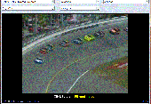
Watch free TV channels from the USA, South America, Italy, France and Germany.
Welcome to TVSoft. From now on, you can watch hundreds of Satellite channels directly on your computer. The service is Free and will stay Free! The supported languages are: French, English, Spanish, Italian & German. This software is user-friendly and self-explanatory. This software will be permanently Free (no hidden fees). This application gets...
Category: Multimedia & Design / Multimedia App's
Publisher: LipoCodes, License: Freeware, Price: USD $0.00, File Size: 555.0 KB
Platform: Windows
World Wind lets PC users zoom from satellite altitude into any place on the globe.
World Wind lets PC users zoom from Satellite altitude into any place on the globe. Leveraging Landsat Satellite imagery and Shuttle Radar Topography Mission data, World Wind lets you experience Earth terrain in visually rich 3D, just as if you were really there. Virtually visit any place in the world. Look across the Andes, into the Grand Canyon, over the Alps, or along the...
Category: Home & Education / Science
Publisher: NASA, License: Freeware, Price: USD $0.00, File Size: 15.0 MB
Platform: Windows, 2K
World Wind lets you zoom from satellite altitude into any place on Earth.
World Wind lets you zoom from Satellite altitude into any place on Earth. Leveraging Landsat Satellite imagery and Shuttle Radar Topography Mission data, World Wind lets you experience Earth terrain in visually rich 3D, just as if you were really there. V
Category: Home & Education / Mathematics
Publisher: worldwind.arc.nasa.gov, License: Freeware, Price: USD $0.00, File Size: 16.0 MB
Platform: Windows
Prog Finder was designed to help users conveniently adjust their Terristeral antenna and Satellite dish.
This program is designed simply enough. Even a novice can easily understand how to modify its options. The interface is user-friendly, and the main buttons are organized in such a manner, as to easily guide you through the entire configuration process. Furthermore, this...
Category: Business & Finance / Applications
Publisher: ProgDVB, License: Freeware, Price: USD $0.00, File Size: 6.4 MB
Platform: Windows
SATBUSTER for Windows is especially designed for satellite visual observers and trackers.
SATBUSTER for Windows is especially designed for Satellite visual observers and trackers. Its users, mainly amateur astronomers, radio amateurs and Satellite trackers, appreciate both the accuracy and the simple to use graphical interface. The software is aimed to hobbysts. However a growing number of plain folks are starting to use this tool to recognize and look at the...
Category: Internet / Misc. Plugins
Publisher: PC, License: Freeware, Price: USD $0.00, File Size: 6.0 MB
Platform: Windows

FSS Google Maps Downloader is a tool that can Download the Google Maps images to your PC. This is a clearly Free program. There is no spyware or adware. It's absolutely safe to install and to run. The interface is very simple and self explaining. It runs low on system resources consumption and is supported on all Windows versions. It can save them to your hard disk,...
Category: Internet / Download Managers
Publisher: FreeSmartSoft, License: Freeware, Price: USD $0.00, File Size: 874.0 KB
Platform: Windows
Orbcomm is a satellite communication system (www.
Orbcomm is a Satellite communication system (www.orbcomm.com) providing two-way data and positioning service to small, portable user terminals in the VHF frequency bands. You can use a simple VHF radio receiver (scanner) tuned to the band between 137 and 138 MHz to pick up the strong signals from these satellites. With OrbcommPlotter you can decode the telemetry and find out the...
Category: Home & Education / Miscellaneous
Publisher: COAA, License: Demo, Price: USD $0.00, File Size: 730.0 KB
Platform: Windows
Korti is a Google Earth plugin which allows you to see the unique 3D Satellite map of Korti within your Google Earth application.
Korti provides you a detailed Satellite imagery and geographic information about this geographic place.
To have Korti installed on your PC, first install for Free Google Earth and then Korti 3D map plugin. After that, simply double...
Category: Multimedia & Design / Multimedia App's
Publisher: Maplandia, License: Freeware, Price: USD $0.00, File Size: 309 B
Platform: Windows
Freefall Satellite Screen Saver
Freefall - the condition of unrestrained motion in a gravitational field
Iridium satellites
Features
Includes the Freefall screen saver and application
Over 850 satellites with detailed descriptions
Stunning earth imagery, coastlines, political boundaries, major cities, and reference grid
Real-time Satellite...
Category: Home & Education / Astrology & Numerology
Publisher: Advanced Analytic, License: Shareware, Price: USD $19.95, File Size: 28.3 MB
Platform: Windows
ARISSatTLM is the telemetry software for the ARISSat-1 satellite.
ARISSatTLM is the telemetry software for the ARISSat-1 Satellite. You just need to open a decode a WAVE file, and, after that, you can start the soundcard.
It is easy to install and has a simple interface. It can be manipulated easily by everyone who have some knowledges in this domain.
Category: Utilities / Misc. Utilities
Publisher: ARISSatTLM, License: Freeware, Price: USD $0.00, File Size: 1.0 MB
Platform: Windows
Satellite Forms is an ideal tool for business and enterprise developers looking to build custom mobile applications, or to transform processes typically performed on paper to an electronic format for improved productivity and efficiency. Satellite Forms allows you to create usable, real-world applications without writing a single line of code. Even more sophisticated applications...
Category: Business & Finance / Project Management
Publisher: Thacker Network Technologies Inc., License: Shareware, Price: USD $0.00, File Size: 0
Platform: Windows
WinPilot 3D is flight analysis and planning software, that lets you zoom in from Satellite altitude into any place on Earth, leveraging Landsat Satellite imagery and Shuttle Radar Topography Mission elevation data. WinPilot 3D lets you experience Earth terrain in visually rich 3D, just as if you were really there. WinPilot 3D also shows airspace in 3D, and contains world-wide...
Category: Home & Education / Miscellaneous
Publisher: WinPilot, License: Shareware, Price: USD $59.00, File Size: 3.8 MB
Platform: Windows

Dishnetwork Discounts. By ordering your new home Satellite system through our website you are taking advantage of special affiliate promotions that are not available elsewhere - even from Dish Network itself!
Free Installation in up to 4 rooms as early as 24 hours
Local Channels Never miss your local news and weather DVR Bundle Offers Record/Pause/Rewind live TV! HDTV...
Category: Internet / Browsers
Publisher: Dishnetwork Discounts, License: Freeware, Price: USD $0.00, File Size: 1.5 MB
Platform: Windows
StratosNet Accelerator can reduce your standard IP access Satellite communications costs on FleetBroadband, BGAN and SwiftBroadband by up to 90%!
With StratosNet Accelerator, sending and receiving email, downloading files via FTP and browsing the internet via Satellite is faster and more cost effective than ever before. StratosNet Accelerator optimizes your IP connection by...
Category: Internet / Misc. Plugins
Publisher: Stratos Global, License: Freeware, Price: USD $0.00, File Size: 5.9 MB
Platform: Windows
Myface Internet TV Chancel is the best available software online today to watch thousands of Satellite movies and listen to radio channels from all over the globe. This software is being offered at the lowest possible price, with guaranteed maximum quality. With over 3000 channels, quality and quantity is here. The full version software package comes with an automatic membership to...
Category: Internet / Tools & Utilities
Publisher: popular screen savers, License: Shareware, Price: USD $39.95, File Size: 3.0 MB
Platform: Windows, Vista
Amili Internet TV Chancel is the best available software online today to watch thousands of Satellite movies and listen to radio channels from all over the globe. This software is being offered at the lowest possible price, with guaranteed maximum quality. With over 3000 channels, quality and quantity is here. The full version software package comes with an automatic membership to...
Category: Audio / Utilities & Plug-Ins
Publisher: 3GP Converter, License: Shareware, Price: USD $39.95, File Size: 3.0 MB
Platform: Windows, Vista
NewFox Internet TV Chancel is the best available software online today to watch thousands of Satellite movies and listen to radio channels from all over the globe. This software is being offered at the lowest possible price, with guaranteed maximum quality. With over 3000 channels, quality and quantity is here. The full version software package comes with an automatic membership to...
Category: Internet / Tools & Utilities
Publisher: Mobile Video Converter, License: Shareware, Price: USD $39.95, File Size: 3.0 MB
Platform: Windows, Vista
When you are looking for a powerful tool to satisfy various needs regarding vectors, raster and Satellite imagery, you will find ILWIS Academic an efficient application. The program comes with such useful features as points to create maps, lines for segment maps, closed area segments for polygon maps, spatial operations for raster maps and so on. Whilst using images from Satellite...
Category: Home & Education / Miscellaneous
Publisher: ITC, License: Freeware, Price: USD $0.00, File Size: 19.4 MB
Platform: Unknown