Free Downloads: Satellite Earth Image
View amazing satellite images of earth with the free version of google earth software.
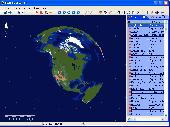
View amazing Satellite images of Earth with the free version of google Earth software.Google Earth is a totally free software which enables you zoom in from Satellite,view,rotate or tilt just like a camera of the entire Earth inside your pc.It works just point and click on any part of Earth or by typing addrees name of city or country and google...
Category: Home & Education / Miscellaneous
Publisher: www.satelliteimage-of-my-house.com, License: Freeware, Price: USD $0.00, File Size: 798.0 KB
Platform: Windows
Satellite earth is a software for viewing satellite and aerial imagery of the Earth.
Satellite Earth is a software for viewing Satellite and aerial imagery of the Earth.Satellite Earth allows you to enjoy virtual travel around the world, look up local information and plan trips, exploring multimedia content and share information about your trips.Explore towns, cities and terrain relief shown in three-dimensional images of high...
Category: Home & Education / Science
Publisher: www.satelliteview-of-my-house.com, License: Freeware, Price: USD $0.00, File Size: 584.0 KB
Platform: Windows
Download the new version of Google Earth satellite with Google Pack.
Download the new version of Google Earth Satellite with Google Pack.Google pack includes 13 totally free software selected by google for your better internet experience.Software included in google pack - Google Earth,Norton Security Scan,Google Desktop,Google Toolbar for Internet Explorer,Spyware Doctor Starter Edition,Picasa photo editor,Mozilla Firefox internet...
Category: Home & Education / Science
Publisher: www.satelliteimage-of-my-house.com, License: Freeware, Price: USD $0.00, File Size: 589.0 KB
Platform: Windows
Korti is a Google Earth plugin which allows you to see the unique 3D Satellite map of Korti within your Google Earth application.
Korti provides you a detailed Satellite imagery and geographic information about this geographic place.
To have Korti installed on your PC, first install for free Google Earth and then Korti 3D map plugin. After that,...
Category: Multimedia & Design / Multimedia App's
Publisher: Maplandia, License: Freeware, Price: USD $0.00, File Size: 309 B
Platform: Windows
World Wind lets you zoom from satellite altitude into any place on Earth.
World Wind lets you zoom from Satellite altitude into any place on Earth. Leveraging Landsat Satellite imagery and Shuttle Radar Topography Mission data, World Wind lets you experience Earth terrain in visually rich 3D, just as if you were really there. V
Category: Home & Education / Mathematics
Publisher: worldwind.arc.nasa.gov, License: Freeware, Price: USD $0.00, File Size: 16.0 MB
Platform: Windows
The Orbit Visualization Tool (OVT) is a software for visualization of Satellite orbits in the Earth's magnetic field. The program can display Satellite orbits in five coordinate systems (GEI, GEO, GSM, SMC, GSE), Satellite footprints projected on the Earth's surface and shown in either geographic (GEO) or geomagnetic (SMC) coordinates. In addition to...
Category: Home & Education / Astrology & Numerology
Publisher: OVT Team, License: Freeware, Price: USD $0.00, File Size: 0
Platform: Windows
Can you imagine how large an Satellite Image is, which has dimensions of 86400 pixels wide and 43200 pixels high?This is a simple article which describes the Worlds Largest Satellite Images.See the largest Satellite images using a free software which is included inside.This free software will enables you to see Satellite images of the entire Earth for...
Category: Home & Education / Miscellaneous
Publisher: www.satelliteimage-of-my-house.com, License: Freeware, Price: USD $0.00, File Size: 590.0 KB
Platform: Windows
Imagenes satelite is a free satelite images slideshow screensaver for your desktop.
Imagenes satelite is a free satelite images slideshow screensaver for your desktop.View high resolution and beautihigh quality satelite images of Earth from space.This screensavers contains full color images that fit automatically on your screen.View Satellite images of Earth from several kilometers from above the sky.Fly above the surface of the Earth and see the...
Category: Desktop Enhancements / Screensavers
Publisher: www.vista-satelite.com, License: Freeware, Price: USD $0.00, File Size: 3.3 MB
Platform: Windows
Beautiful Earth is a Wallpaper generator and Screen Saver.
Beautiful Earth is a Wallpaper generator and Screen Saver. Beautiful Earth shows you how the Earth looks like from the space at this very moment. You can see which parts of the Earth are enjoying the sun light. And in night areas you can see the city lights. Based on NASA's Blue Marble and City Lights Satellite images.
Category: Desktop Enhancements / Screensavers
Publisher: GimmeGoody.com, License: Shareware, Price: USD $24.99, File Size: 2.7 MB
Platform: Windows
WinPilot 3D is flight analysis and planning software, that lets you zoom in from Satellite altitude into any place on Earth, leveraging Landsat Satellite imagery and Shuttle Radar Topography Mission elevation data. WinPilot 3D lets you experience Earth terrain in visually rich 3D, just as if you were really there. WinPilot 3D also shows airspace in 3D, and contains...
Category: Home & Education / Miscellaneous
Publisher: WinPilot, License: Shareware, Price: USD $59.00, File Size: 3.8 MB
Platform: Windows
Earth Orbit Objects is free program which predict Satellite passes for your local or any selected area. Use flat Earth view to display Satellite tracks with visibility circle.
The globe view shows selected satellites around the Earth as a sphere and sky view shows satellites as you would see them in a starry night. The line elements are processed...
Category: Home & Education / Miscellaneous
Publisher: Bluewing Trg, License: Freeware, Price: USD $0.00, File Size: 1.6 MB
Platform: Windows
Manifold Toolbar is a powerful and handy application that allows you to view a map or Satellite Image of any place on Earth directly on your browser without the need of any other program. You just have to type a location (city and country, city and state) in the search bar and it automatically displays Satellite images or street maps, allowing you zoom in and out to...
Category: Internet / Browser Accessories
Publisher: CDA International, License: Freeware, Price: USD $0.00, File Size: 1.5 MB
Platform: Windows
Home Planet is a comprehensive astronomy / space / satellite-tracking package.
Home Planet is a comprehensive astronomy / space / Satellite-tracking package.
It allows you to view an Earth map, showing day and night regions, location of the Moon and current phase, and position of a selected Earth Satellite.
You also see a panel showing detailed position and phase data for the Sun and Moon, panel showing positions of planets and a...
Category: Home & Education / Astrology & Numerology
Publisher: Fourmilab, License: Freeware, Price: USD $0.00, File Size: 13.2 MB
Platform: Windows
CamIQ Satellite - digital recording and reliable image analysis.
CamIQ Satellite - digital recording and reliable Image analysis.
CamIQ Satellite is based on a client-server-architecture which guarantees robustness and security as a basis. It can be extended flexible with modules just as the application requires.Comprehensive producer support for network based and analogue Image sources (megapixelcameras, networkcameras,...
Category: Multimedia & Design / Multimedia App's
Publisher: rosemann software GmbH, License: Demo, Price: USD $0.00, File Size: 112.3 MB
Platform: Windows
Live Satellite Maps or Google maps is a web server mapping applications.
Live Satellite Maps or Google maps is a web server mapping applications.Provides scrolling map images and Satellite photos around the Earth and even the route between different places.Since 6 October 2005, live Satellite Maps is part of local Google.Google live Satellite Map provides the ability to zoom in or zoom out to show the map.The user can control the...
Category: Home & Education / Science
Publisher: www.satelliteview-of-my-house.com, License: Freeware, Price: USD $0.00, File Size: 643.0 KB
Platform: Windows
This educational program brings a plethora of geographic information right to your desktop. After you launch Earth Explorer, you'll be greeted by a 3D rendition of the Earth spinning in space. To the right of the globe sits a table of information on countries, cities, and islands. Simply clicking on one of the entries shows you its location on the globe, and scrolling over the...
Category: Audio
Publisher: Motherplanet, Inc, License: Shareware, Price: USD $59.95, File Size: 7.4 MB
Platform: Windows, Mac
WW2D allows you to explore Earth using Satellite imagery, topographic maps and Image from other data sources also providing large placenames and boundaries database and allowing you to install community-made add-ons for even more info about our planet.
Category: Business & Finance / Business Finance
Publisher: Vitaliy Pronkin, License: Freeware, Price: USD $0.00, File Size: 6.6 MB
Platform: Windows
 Shareware
Google Satellite Maps Downloader is a cute tool that can automatically download Google Maps Satellite tile images and then combine them into one big map Image. It supports multithreads, so the download speed is very fast. And it is very easy to use. All downloaded small images are saved on the disk. You can combine them after downloading or later. Isn't it very cool that...
Category: Internet / Download Managers
Publisher: allmapsoft.com, License: Shareware, Price: USD $39.00, File Size: 30.6 MB
Platform: Windows
Catfood Desktate is an eye catching Earth simulator that combines Satellite imagery, near real time cloud data and optional layers including political borders and place names. The continuously updated result can be set as your desktop wallpaper or used as a screensaver. Desktate features include: The terminator between day and night is continuously calculated; you can see sunrise...
Category: Desktop Enhancements / Wallpaper
Publisher: Catfood Software, License: Shareware, Price: USD $19.95, File Size: 9.8 MB
Platform: Windows
Orbcomm is a satellite communication system (www.
Orbcomm is a Satellite communication system (www.orbcomm.com) providing two-way data and positioning service to small, portable user terminals in the VHF frequency bands. You can use a simple VHF radio receiver (scanner) tuned to the band between 137 and 138 MHz to pick up the strong signals from these satellites. With OrbcommPlotter you can decode the telemetry and find out the...
Category: Home & Education / Miscellaneous
Publisher: COAA, License: Demo, Price: USD $0.00, File Size: 730.0 KB
Platform: Windows
The Swath Acquisition Viewer (SaVoir) is a Windows stand-alone application for analyzing potential remote sensing opportunities from Earth observation satellites.By combining each Satellite's orbit, sensor field of view geometry and the shape and location of a user-defined area of interest, SaVoir can determine the exact times when a Satellite would be capable of...
Category: Business & Finance / MS Office Addons
Publisher: Taitus Software Italia srl, License: Shareware, Price: USD $5247.00, File Size: 44.6 MB
Platform: Windows
Protect your monitor with satellite-eye views of different parts of Europe.
Protect your monitor with Satellite-eye views of different parts of Europe. See pictures of Spain, England, France, Germany, Italy and more. This 32-bit screen-saver engine rotates photos of different locations of Europe as seen on clear days from the Earth's orbit. Over a dozen visual effects can appear between images. Plus, each of the photos can be displayed as your desktop...
Category: Desktop Enhancements / Screensavers
Publisher: Tazmaniacs, License: Shareware, Price: USD $12.95, File Size: 1.9 MB
Platform: Windows
Get a full 3D satellite map view of El Petacon on your PC.
Get a full 3D Satellite map view of El Petacon on your PC. If you have already installed Google Earth, you will be able to view the El Petacón 3D map. You will enjoy a beautiful view of this geographic place and you will have the world's geographic information at your fingertips.
Category: Home & Education / Miscellaneous
Publisher: Maplandia, License: Freeware, Price: USD $0.00, File Size: 331 B
Platform: Windows
JSatTrak is a Satellite tracking program written in Java.
JSatTrak is a Satellite tracking program written in Java. It allows you to predict the position of any Satellite in real time or in the past or future. It uses advanced SGP4/SDP4 algorithms developed by NASA/NORAD or customizable high precision solvers to propagate Satellite orbits. The program also allows for easy updating of current Satellite tracking data via...
Category: Home & Education / Miscellaneous
Publisher: Shawn Gano, License: Freeware, Price: USD $0.00, File Size: 17.6 MB
Platform: Windows
Catfood Earth helps you have a real time Image of our planet as seen from space as desktop wallpaper. The program includes three themes to choose from: Natural, Timezones, and Earthquakes. The Natural theme allows you to see Satellite images of the Earth in real time showing daytime and night, clouds, ice, and snow, among other things. The Timezones theme shows the...
Category: Desktop Enhancements / Misc. Themes
Publisher: Catfood Software, License: Shareware, Price: USD $19.95, File Size: 5.1 MB
Platform: Windows