Free Downloads: Satellite Weather Map Ubuntu
OCENS MetMapper transforms Weather maps, Satellite images, and ocean charts, into dynamic components of your at-sea decision-making tool box. MetMapper offers to all non-GRIB data what our GRIB Explorer software does for the GRIB data. That is, it will take classical Weather data such as Weather charts, ocean charts and Satellite imagery and render them into...
Category: Home & Education / Miscellaneous
Publisher: OCENS, Inc., License: Shareware, Price: USD $169.00, File Size: 23.6 MB
Platform: Windows
Live Satellite Maps or Google maps is a web server mapping applications.
Live Satellite Maps or Google maps is a web server mapping applications.Provides scrolling Map images and Satellite photos around the earth and even the route between different places.Since 6 October 2005, live Satellite Maps is part of local Google.Google live Satellite Map provides the ability to zoom in or zoom out to show the Map.The user can...
Category: Home & Education / Science
Publisher: www.satelliteview-of-my-house.com, License: Freeware, Price: USD $0.00, File Size: 643.0 KB
Platform: Windows

Weather Forecast Studio - Get Instant Weather Reports Directly on Your Desktop. WeatherStudio for Windows displays the current temperature where you live in REAL TIME, right on your desktop and in Internet Explorer. It does not interrupt Start Button functionality or internet browsing. Includes real-time local Weather alerts, multiple display modes, such as tomorrow's...
Category: Utilities
Publisher: FunDesktops, License: Freeware, Price: USD $0.00, File Size: 373.1 KB
Platform: Windows
Orbitron 3.71is a Satellite tracking system for radio amateur and observing purposes.
The program can be also used by Weather professionals, Satellite communication users, astronomers, UFO hobbyist and astrologers.
The program shows the positions of satellites at any moment (in real or simulated time).
Orbitron 3.71 can be installed...
Category: Internet / Communications
Publisher: Sebastian Stoff, License: Freeware, Price: USD $0.00, File Size: 2.0 MB
Platform: Windows
This is a browser toolbar for tokyo Weather Map ,Use this search you can also check the Weather with this toolbar.If you are ever looking for tokyo Weather Map.Visit my web site.This software is free for you to use.
Category: Internet / Browsers
Publisher: Tokyo Weather Map, License: Freeware, Price: USD $0.00, File Size: 1.7 MB
Platform: Windows, Mac, Palm
 Shareware
Google Satellite Maps Downloader is a cute tool that can automatically download Google Maps Satellite tile images and then combine them into one big Map image. It supports multithreads, so the download speed is very fast. And it is very easy to use. All downloaded small images are saved on the disk. You can combine them after downloading or later. Isn't it very cool that...
Category: Internet / Download Managers
Publisher: allmapsoft.com, License: Shareware, Price: USD $39.00, File Size: 30.6 MB
Platform: Windows
Shareware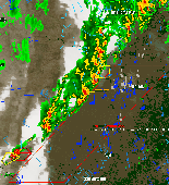
WeatherStudio combines a vast array of live Weather data, products, maps, and charts into a single Map that the user can pan and zoom. GFS/NDFD/NAM/RUC Model Data, Placefiles, Radar Loops, Satellite, Storm Reports, Hurricane Paths, Surface Observations, Watches/Warnings, Buoys, Shapefiles, GPS support, FTP Uploading, etc. Made for Storm Chasers, Mariners, Meteorologists,...
Category: Home & Education / Hobbies
Publisher: PaulMarv Software, License: Shareware, Price: USD $80.00, File Size: 13.0 MB
Platform: Windows
Satellite earth is a software for viewing satellite and aerial imagery of the Earth.
Satellite earth is a software for viewing Satellite and aerial imagery of the Earth.Satellite Earth allows you to enjoy virtual travel around the world, look up local information and plan trips, exploring multimedia content and share information about your trips.Explore towns, cities and terrain relief shown in three-dimensional images of high resolution associated with...
Category: Home & Education / Science
Publisher: www.satelliteview-of-my-house.com, License: Freeware, Price: USD $0.00, File Size: 584.0 KB
Platform: Windows
The Weather Globe screen saver accesses our servers several times an hour for updated Weather information which is automatically uploaded. Weather is downloaded from NOAA (the National Oceanic and Atmospheric Administration) where it is mapped into polar coordinates on our servers and uploaded to the globe that you see in your screen saver. The Weather current within...
Category: Desktop Enhancements / Screensavers
Publisher: PBHLLC, License: Freeware, Price: USD $0.00, File Size: 837.0 KB
Platform: Windows
RealEMWIN monitors the EMWIN Weather wire -- broadcast via GOES Satellite or local radio directly from the National Weather Service. It can also connect to a number of Internet servers set up across the United States to allow anyone with an online connection to get live data
Category: Home & Education / Miscellaneous
Publisher: Skywatch Services, License: Shareware, Price: USD $69.95, File Size: 5.8 MB
Platform: Windows
TerraClient allows viewing and printing of ground level satellite photographs of the United States.
TerraClient allows viewing and printing of ground level Satellite photographs of the United States. Featured is a unique Map overlay option that automatically superimposes a "paper" roadmap over the Satellite photos. This Map overlay option has been designed to help users identify indistinct land features in the Satellite photos. All Map and...
Category: Home & Education / Miscellaneous
Publisher: Bill Friedrich Software, License: Freeware, Price: USD $0.00, File Size: 1.3 MB
Platform: Windows
AniWeather animates weather in vivid animations for worldwide locations worldwide.
AniWeather animates Weather in vivid animations for worldwide locations worldwide. It switches different locations in one click. Aniweather provides flexible Weather reports, from real time current condition, radar/Satellite Map, to 5-day forecast, and to more detailed hourly report. It is quite customizable to fit your preference (temperature unit, location list,...
Category: Internet / Browsers
Publisher: AniWeather, License: Freeware, Price: USD $0.00, File Size: 101.0 KB
Platform: Windows
Get a full 3D satellite map view of El Petacon on your PC.
Get a full 3D Satellite Map view of El Petacon on your PC. If you have already installed Google Earth, you will be able to view the El Petacón 3D Map. You will enjoy a beautiful view of this geographic place and you will have the world's geographic information at your fingertips.
Category: Home & Education / Miscellaneous
Publisher: Maplandia, License: Freeware, Price: USD $0.00, File Size: 331 B
Platform: Windows
SWIFT Mobile provides live Weather radar and other Weather data on your PDA, PocketPC, or SmartPhone. Location-based technology allows custom Weather displays and automatic alerts to severe Weather before it arrives. An indispensable tool for business travelers, outdoorsmen, emergency management teams, or anyone who needs advance notice of severe Weather --...
Category: Home & Education / Miscellaneous
Publisher: SWIFT Weather, License: Shareware, Price: USD $9.95, File Size: 1.2 MB
Platform:
Webmizzle is a simple tool for monitoring current Weather conditions worldwide. It uses data that are available to the public (you can see the same images on countless www pages with any web browser). I wrote this program because I felt sick when I had to launch Internet Explorer and then browse through the ads and other crap just to see a Satellite image or current temperature....
Category: Internet
Publisher: Marek Jablonski, License: Freeware, Price: USD $0.00, File Size: 544.9 KB
Platform: Windows
MyFreeWeather allows you to view the sky in any city in the world and track local weather.
MyFreeWeather allows you to view the sky in any city in the world and track local Weather. Watch the moving storm & Weather patterns via Satellite & Radar. Also, view daily and detailed forecasts, local time and date for any location worldwide, plus alerts to severe Weather.
Category: Home & Education / Miscellaneous
Publisher: MicroSmarts LLC., License: Freeware, Price: USD $0.00, File Size: 606.7 KB
Platform: Windows
Mythbuntu is a community supported add-on for Ubuntu focused upon setting up a standalone MythTV based PVR system. It can be used to prepare a standalone system or for integration with an existing MythTV network. Unlike similar projects, Mythbuntu keeps close ties with Ubuntu and all development is given back to Ubuntu. This architecture allows simple conversions from a...
Category: Internet / Misc. Plugins
Publisher: Ubuntu, License: Freeware, Price: USD $0.00, File Size: 649.3 MB
Platform: Windows
Korti is a Google Earth plugin which allows you to see the unique 3D Satellite Map of Korti within your Google Earth application.
Korti provides you a detailed Satellite imagery and geographic information about this geographic place.
To have Korti installed on your PC, first install for free Google Earth and then Korti 3D Map plugin. After that, simply...
Category: Multimedia & Design / Multimedia App's
Publisher: Maplandia, License: Freeware, Price: USD $0.00, File Size: 309 B
Platform: Windows
The C-Map Chart Catalog allows you to view, navigate, select and order C-Map electronic charts, or various Weather options, in an interactive way. After selection of required items is completed, simply press the 'E-mail order' button, and enter the address of your local C-Map distributor.
Category: Home & Education / Hobbies
Publisher: Jeppesen Marine, License: Freeware, Price: USD $0.00, File Size: 6.1 MB
Platform: Windows
This is a cool, shareware Weather program that sits in your system tray and keeps you posted of current Weather conditions, forecasts, Warnings/Advisories, hundreds of Satellite and Radar images - including State level radar, Weather Cams, Worldwide locations, 1-day, 2-day, 10-Day, 3 Month and 12 Month Outlooks, USDA, Forecast images, Population/Census information,...
Category: Internet / Tools & Utilities
Publisher: Kelly Software, License: Shareware, Price: USD $18.00, File Size: 4.7 MB
Platform: Unknown
Weather1-Lite allows you to track Weather conditions for your zip code, including 5-day forecast and access to popular Satellite and radar imagery. It minimizes neatly in your system tray (near your clock) with an icon of the current Weather conditions, or temperature, or both.
Category: Desktop Enhancements / Shell & Desktop Managers
Publisher: KellySoftware, License: Shareware, Price: USD $12.00, File Size: 1.5 MB
Platform: Windows
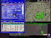
CombiPlotter plots aircraft, spacecraft, Weather balloons and ships in your local area, in real time, on one chart. It retrieves the real time data from ShipPlotter, OrbcommPlotter, SondeMonitor, AprsPlotter and PlanePlotter running on the same machine.
CombiPlotter has the ability to display different views of the same ship, Satellite, Weather balloon or aircraft...
Category: Home & Education / Miscellaneous
Publisher: COAA, License: Shareware, Price: USD $35.41, File Size: 1.1 MB
Platform: Windows
Webmizzle is a simple tool for monitoring current weather conditions worldwide.
Webmizzle is a simple tool for monitoring current Weather conditions worldwide. It uses data that are available to the public (you can see the same images on countless www pages with any web browser). I wrote this program because I felt sick when I had to launch Internet Explorer and then browse through the ads and other crap just to see a Satellite image or current temperature....
Category: Utilities / Network
Publisher: Marek Jablonski, License: Freeware, Price: USD $0.00, File Size: 509.0 KB
Platform: Windows
The WVLT Volunteer TV online station provides interactive Weather maps, regional radar Weather information, State Radar, and an 8 Day Weather Forecast as well as State Satellite Weather information, covering the communities of Tennessee and the wider region. This important coverage enables WVLT-TV to provide up to the minute severe Weather alerts about...
Category: Home & Education / Miscellaneous
Publisher: BIA Information Network, License: Freeware, Price: USD $0.00, File Size: 0
Platform: Windows
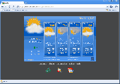
Animated Weather Forecast For Windows: Realistic Weather Forecast on Your Windows Desktop
MobilityFlow announces the release of Animated Weather, a Weather forecast desktop widget app for Windows XP/Vista/7. The exquisitely realistic video effects of cloudiness, rain and snow provide the vivid sensation of current or future Weather conditions for more than...
Category: Home & Education / Miscellaneous
Publisher: MobilityFlow, License: Freeware, Price: USD $0.00, File Size: 4.3 MB
Platform: Windows