Free Downloads: Shapefile
CAD2Shape converts AutoCAD DXF/DWG drawing files to ESRI shapefile format.
CAD2Shape converts AutoCAD DXF/DWG drawing files to ESRI Shapefile format. It can translate holes / islands /donuts from originating CAD drawing to Polygon Shapefile. It can translate 3D surfaces to MultiPatch Shapefile types.
The new version has MPolygon support and has additional XDATA types.
Category: Multimedia & Design / Image Editing
Publisher: Guthrie CAD/GIS Software Pty Ltd., License: Shareware, Price: USD $224.91, File Size: 10.7 MB
Platform: Windows
GeoMerge is a geoprocessing utility that allows you to merge two or more shapefiles or TAB files into a single Shapefile. Select two or more shapefiles or TAB files that are to be merged, and click the 'Merge Files' button. The files will be validated for a common schema. If all of the files selected have exactly the same column definitions in the .dbf file the records and...
Category: Utilities / File & Disk Management
Publisher: VDS Technologies, License: Freeware, Price: USD $0.00, File Size: 587.8 KB
Platform: Windows
JD Rx Converter allows users to easily convert Shapefile prescriptions into a format that is readable by the GreenStar 2 display.
Shapefiles can be dragged and dropped into JD Rx Converter, and batch exported out to the data card to be used in the GS2 display.
RX Converter is for Metric units only and may not operate correctly for U.S.
Category: Utilities / Misc. Utilities
Publisher: Deere & Company., License: Freeware, Price: USD $0.00, File Size: 27.9 MB
Platform: Windows
gSpatial Toolbar allows you to import, display and manipulate ESRI shapefile data in Google Earth.
gSpatial Toolbar allows you to import, display and manipulate ESRI Shapefile data in Google Earth. Annotate your data and perform thematic queries on your Excel spreadsheet data or ODBC data sources, visualize results in Google Earth
Category: Multimedia & Design / Graphics Viewers
Publisher: gSpatial, License: Freeware, Price: USD $0.00, File Size: 686.1 KB
Platform: Windows
 Shareware
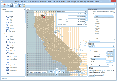
Manco Shapefile Editor is a powerful tool for creating and editing shapefiles, with easy, almost “on the flyâ€, geometry and data editing and possibility of direct creation of the shapefiles from the image files by image processing algorithms. This product is constantly developing and you will receive free updates just when they come. Since it’s only a start of the...
Category: Multimedia & Design / Image Editing
Publisher: Manco Software, License: Shareware, Price: USD $100.00, File Size: 6.1 MB
Platform: Windows
TIGOR is an integrated data product that gives you all the layers of the 2006 First Edition TIGER/Line® in ESRI® Shapefile format! TIGOR files are regrouped in one database per state. Each database contains compressed version of TIGER/Lines data which can be viewed and exported as shapefiles (125,000 layers for all 56 databases). TIGOR Databases are: * Highly Compressed *...
Category: Home & Education / Miscellaneous
Publisher: Nextractor Inc., License: Shareware, Price: USD $39.99, File Size: 2.7 MB
Platform: Windows
Thuban is an Interactive Geographic Data Viewer with the following features:
- Vector Data Support: Shapefile, PostGIS Layer and OGR
- Raster Data Support: GeoTIFF Layer and GDAL
- Comfortable Map Navigation
- Object Identification and Annotation
- Legend Editor and Classification
- Table Queries and Joins
- Projection Support
- Printing...
Category: Utilities / Misc. Utilities
Publisher: Intevation, License: Shareware, Price: USD $0.00, File Size: 772.9 KB
Platform: Windows
Freeware
VSceneGIS Desktop. (GIS) Analysis, Computing and Editing. Customer Project Development, Analysis, Computing and GIS editing. VSceneGIS Desktop applies the concept of Tree and Graph Topology to implement the data model in a GIS. Validation, Editing and Topological Behavior Export and import of data sources: PostgreSQL / PostGIS, Oracle, MySQL, SQLite / SpatiaLite, Shapefile....
Category: Home & Education / Science
Publisher: vscenegis.com, License: Freeware, Price: USD $0.00, File Size: 118.4 MB
Platform: Windows
FloppyGIS runs on Windows. It is a free compact Shapefile Viewer. It also supports image files that have geo-reference from ESRI World Files.
Category: Multimedia & Design / Graphics Viewers
Publisher: ldinakis.googlepages.com, License: Freeware, Price: USD $0.00, File Size: 619.0 KB
Platform: Windows, Vista
DNRGarmin is a smart tool used to directly transfer data between Garmin GPS handheld receivers and various GIS software packages.
DNRGarmin was built to provide users the ability to directly transfer data between Garmin GPS handheld receivers and various GIS software packages. Using DNRGarmin a user can use point features (graphics or Shapefile) and upload them to the GPS as...
Category: Utilities / Misc. Utilities
Publisher: GIS Section, Minnesota Department of Natural Resources, License: Freeware, Price: USD $0.00, File Size: 11.3 MB
Platform: Windows
The HydroDaVE Explorer is an interactive, web-enabled, Windows application that integrates GIS capabilities and allows users to access the SQL database through an internet-connected computer. HDX supports the ESRI Shapefile format and the free OpenStreetMap. The user can select specific monitoring stations (wells or surface water stations) and display them in map view on top of...
Category: Business & Finance / Business Finance
Publisher: Wildermuth Synergies LLC., License: Demo, Price: USD $0.00, File Size: 24.5 MB
Platform: Windows
This is a tool for converting CSV ("Comma Separated Value") files, or any delimited text files, into ESRI Shapefiles, the format used by ArcMap and MapWindow. This software is open source under the MPL and was created using MapWinGIS. This tool works only with Net Framework 2.0.
Category: Multimedia & Design / Media Management
Publisher: Christopher Michaelis, License: Freeware, Price: USD $0.00, File Size: 47.8 MB
Platform: Windows
Geocando is a 3d Viewer for visualisation and querying of geodata and geomodels.
Geocando is a 3d Viewer for visualisation and querying of geodata and geomodels. It is especially developed for Paradigm's GOCAD® objects. Another supported format is the typical GIS exchange format ESRI Shapefile. In Geocando the objects can be visualized with different symbols, colours, scalebars, vertical exaggeration factors,etc. Typical features like get coordinates and...
Category: Multimedia & Design / Graphics Viewers
Publisher: Manuel Feige, License: Freeware, Price: USD $0.00, File Size: 9.4 MB
Platform: Windows
ArcScripts is intended for the free exchange of scripts and tools related to ESRI software products.
ArcScripts is intended for the free exchange of scripts and tools related to ESRI software products. Please alert the moderator if this script is a demo, trial-version, or an advertisement for a retail product.
Akin to the GRIDSPOT AML in workstation ArcInfo, this VB tool overlays a point Shapefile or point coverage on a raster layer and assigns the value of the raster to...
Category: Multimedia & Design / Multimedia App's
Publisher: Dan Rathert, License: Freeware, Price: USD $0.00, File Size: 7.4 KB
Platform: Windows
Shape Viewer is a free tool, which you can use to view ESRI Shape files.
Shape Viewer is a free tool, which you can use to view ESRI Shape files.
Shape Viewer can open (.shp) files that contain the geometry information of the shape file.With Shape Viewer you can also create new (.shx) file, and new empty (.dbf) file for your shape file.
If you have hundreds of shape files, and you want to view their contents rapidly, and you don't want to open each...
Category: Multimedia & Design / Graphics Viewers
Publisher: Mohammed Hammoud, License: Freeware, Price: USD $0.00, File Size: 35.0 KB
Platform: Windows
Shape2Earth leverages freely available and easy to use Geographic Information System (GIS) software to create professional visualizations for viewing in GoogleTM Earth.
Main features:
-Convert Any Shapefile to KML - Shape2Earth reprojects your data on the fly
-Apply Thematic Symbology to your Data - Color code to display information
-Present Data in Custom...
Category: Multimedia & Design / Image Editing
Publisher: Google, License: Demo, Price: USD $0.00, File Size: 9.5 MB
Platform: Windows
ET GeoTools is a set of tools for ArcGIS which purpose is to increase the editing productivity in ArcMap, give enhanced editing functionality to the ArcView users and enable them to create and maintain topologically correct datasets.
- Identifying topology errors – draw nodes and duplicates for polyline layers, gaps and overlaps for polygon layers
-Offers usage of attribute...
Category: Business & Finance / Business Finance
Publisher: ET SpatialTechniques, License: Shareware, Price: USD $245.00, File Size: 3.2 MB
Platform: Windows
You can change the # of objects in the config file.
You can change the # of objects in the config file. However, the trace file is not overwritten/regenerated if it already exists. If you change the # of objects in the config file, but use a trace file that was generated with a different # of objects, some objects might not have traces, which can cause an exception.
Main Features:
- generate mobility traces for mobile...
Category: Web Authoring / Web Design Utilities
Publisher: Georgia Tech, License: Freeware, Price: USD $0.00, File Size: 10.1 MB
Platform: Windows
Spatial Manager Desktop is a desktop application designed to manage spatial data in a simple, fast and inexpensive way. Developed by a group of professionals working in the areas of GIS, Planning, Infrastructure and Civil Engineering, it provides the user with powerful tools to address the most common tasks of management and operation in the world of spatial information. Spatial Manager...
Category: Multimedia & Design / Graphics Viewers
Publisher: Spatial Manager, License: Shareware, Price: USD $149.00, File Size: 114.3 MB
Platform: Windows
SWIFT WX Professional runs on any desktop or laptop computer and provides you with up-to-the-minute Radar, Satellite, Storm Warnings, and Hail Reports. It will even alert you up to an hour in advance of approaching rain or thunderstorms, and predict to the nearest minute when those storms will arrive. FEATURES & BENEFITS: - Track Hurricanes, Tornadoes, Flash Floods, and more- Choose from...
Category: Home & Education / Miscellaneous
Publisher: SWIFT Weather, License: Shareware, Price: USD $159.50, File Size: 20.4 MB
Platform: Windows
Map Suite Desktop Edition is a powerful and feature-rich .NET mapping control that enables C# and VB.NET software developers to build detailed desktop mapping applications. Utilizing Microsoft's .NET Framework, the APIs for Map Suite Desktop Edition incorporate the very latest technology to deliver a powerful, user-friendly mapping control. In addition, ease of coding and intuitive, streamlined...
Category: Software Development
Publisher: ThinkGeo LLC, License: Commercial, Price: USD $4794.00, File Size: 28.4 MB
Platform: Windows
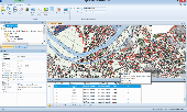
Map Suite Engine is a powerful and feature-rich low level component that enables C# and VB.NET software developers to generate great-looking map images for presentations. At the heart of the Map Suite product line is a non-visual component library designed to generate maps. With this tool in your hands, you will be able to “roll your own” mapping control in Winforms or integrate a mapping...
Category: Software Development
Publisher: ThinkGeo LLC, License: Commercial, Price: USD $4794.00, File Size: 15.1 MB
Platform: Windows
Map Suite Web Edition is a powerful and feature-rich ASP.Net server control that enables C# and VB.NET software developers to build detailed internet mapping applications. Utilizing Microsoft's .NET Framework, the APIs for Map Suite Web Edition incorporate the very latest technology to deliver a powerful, user-friendly .NET component that makes it easy to develop mapping applications in any of...
Category: Software Development
Publisher: ThinkGeo LLC, License: Commercial, Price: USD $4794.00, File Size: 28.8 MB
Platform: Windows
Nevron Map for SharePoint is an advanced web part for all versions Microsoft SharePoint (WSS3.0, SharePoint 2007, 2010, 2013 and 2016). It is designed to provide an easy and powerful way to create choropleth maps that are tightly integrated with your data. The Map Web Part delivers a great set of features including: - Multiple Map Layers - unlimited number of map layers are supported. Each...
Category: Software Development / Components & Libraries
Publisher: Nevron Software LLC, License: Shareware, Price: USD $889.00, File Size: 121.9 MB
Platform: Windows
Shareware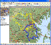
MPSuperShape is a shape manipulation tool for Microsoft MapPoint. MPSuperShape can be used to combine multiple shapes into one large shape, find the intersections (overlaps) between shapes, find boundary shapes around groups of pushpins, simplify shapes, delete multiple shapes, change shape colors, import/export shape files, and to create web pages. Import shape options include ESRI Shape (SHP)...
Category: Business & Finance / Business Finance
Publisher: Winwaed Software Technology LLC, License: Shareware, Price: USD $75.00, File Size: 13.6 MB
Platform: Windows