Free Downloads: Shp File
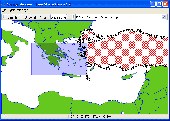
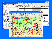
Shape Viewer is a free tool, which you can use to view ESRI Shape files.
Shape Viewer is a free tool, which you can use to view ESRI Shape files.
Shape Viewer can open (.Shp) files that contain the geometry information of the shape File.With Shape Viewer you can also create new (.shx) File, and new empty (.dbf) File for your shape File.
If you have hundreds of shape files, and you want to view their contents rapidly,...
Category: Multimedia & Design / Graphics Viewers
Publisher: Mohammed Hammoud, License: Freeware, Price: USD $0.00, File Size: 35.0 KB
Platform: Windows
It`s a FREE ESRI shape files (*.Shp), MapInfo interchange (*.mif) and AutoCAD *.dxf viewer. Using this utility you can view *.Shp files (ESRI shape files), *.mif files (MapInfo interchange) and AutoDesk AutoCAD *.dxf. No other files are needed.
Category: Multimedia & Design
Publisher: Avangardo, License: Freeware, Price: USD $0.00, File Size: 420.9 KB
Platform: Windows
With this program you can read and then view geographical data contained in SHP files.
With this program you can read and then view geographical data contained in Shp files. With this program you can also view the data in the accompanying DBF database File and can save this information to SVG files. It works on Microsoft Windows 2000/XP/Vista. The program does not run on Windows 98.
Category: Business & Finance / Database Management
Publisher: Pinecoast Software, Inc., License: Freeware, Price: USD $0.00, File Size: 1.4 MB
Platform: Windows
 Shareware
The Advanced points manager imports points to AutoCAD drawing from different data sources. OLE-DB database, Shp (ESRI shape File), GPX (GPS eXchange format), KML (Keyhole Markup Language), GML (Geography Markup Language), TXT, CSV. Additional options: savable configurations, point coordinate transformation from/to any world coordinate system, point can be ACAD point or ACAD block...
Category: Business & Finance / Vertical Markets
Publisher: CADdicted inc., License: Shareware, Price: USD $119.00, File Size: 609.8 KB
Platform: Windows
eCITATION is a cooperative effort with the NC Criminal Justice Information Network (CJIN), the NC State Highway Patrol (Shp) and the NC Administrative Office of the Courts (NCAOC) that automates the transfer of citation data directly from a law enforcement Officer’s patrol car to the courts, with minimal paper record creation and elimination of redundant data entry.
Category: Business & Finance / Business Finance
Publisher: Interplat Solutions, Inc., License: Freeware, Price: USD $0.00, File Size: 52.5 MB
Platform: Windows
Freeware
Convert ESRI ShapeFiles (.Shp) geolocation data into AnyMap format to be used with AnyChart. AnyChart Flash Map Converter allows making use of a wide choice of maps with AnyChart Flash Component, a GIS visualization system that recognizes map data in AnyMap format only. AnyChart Flash Map Converter makes it easy to visualize any geolocation data without hefty expenses associated with...
Category: Web Authoring / Image Mapping Tools
Publisher: AnyChart.Com, License: Freeware, Price: USD $0.00, File Size: 1.6 MB
Platform: Windows
A powerful OCX that allows the user to load and manage TXF/TDB, MID/MI, Shp/DBF, and raster data files as distinct layers. It permits the user to set visibility thresholds, colors, line attributes, label roads, landmarks, etc. A lot of its power lies in its simplicity. Register the control, open your IDE, drop the component on a blank form and you have a simple, fully functional mapping...
Category: Software Development / Tools & Editors
Publisher: TRIUS, Inc., License: Shareware, Price: USD $189.00, File Size: 2.0 MB
Platform: Windows
Shareware
Total GIS Converter is an affordable converter of GIS files. It converts AEP, GRD, ADF, E00, FLT, APR, Shp, DXF, BT, TOC, RT1, DEM, DLG, ECW, IMG, DGF, GML, SID, MIF, TAB, WOR, DNG, DDF, BIL, TIF, JPEG, TTKPS, TTKGP, TTKLS, LFT, PFT, and TFT files. The target formats are TIFF, PNG, JPEG, BMP. The program can scale your GIS files to optimize their size. Besides, it can slice the output...
Category: Multimedia & Design / Graphics Viewers
Publisher: Softplicity, License: Shareware, Price: USD $99.90, File Size: 7.6 MB
Platform: Windows
Shareware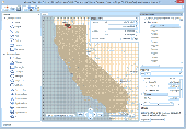
Manco Shapefile Editor is a powerful tool for creating and editing shapefiles, with easy, almost ââ¬Åon the flyââ¬Â, geometry and data editing and possibility of direct creation of the shapefiles from the image files by image processing algorithms. This product is constantly developing and you will receive free updates just when they come. Since itââ¬â¢s only a start of the project,...
Category: Multimedia & Design / Image Editing
Publisher: Manco Software, License: Shareware, Price: USD $100.00, File Size: 6.1 MB
Platform: Windows
ADV comes with tools that allow you to create polygons, lines and points in fields from the comfort of your office.
You also have the option of importing any existing data you have collected from other sources (must be in Shp, MID/MIF or TAB format).
Category: Multimedia & Design / Graphics Viewers
Publisher: GK Technology, License: Shareware, Price: USD $0.00, File Size: 0
Platform: Windows
Shareware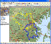
MPSuperShape is a shape manipulation tool for Microsoft MapPoint. MPSuperShape can be used to combine multiple shapes into one large shape, find the intersections (overlaps) between shapes, find boundary shapes around groups of pushpins, simplify shapes, delete multiple shapes, change shape colors, import/export shape files, and to create web pages. Import shape options include ESRI Shape...
Category: Business & Finance / Business Finance
Publisher: Winwaed Software Technology LLC, License: Shareware, Price: USD $75.00, File Size: 13.6 MB
Platform: Windows

Geocode digital images with latitude, longitude, altitude, and direction information when collecting GIS field data. RoboGEO stamps this information onto the actual photo or writes it to the EXIF headers, allowing you to permanently geotag and link your photos to the GPS coordinates. All writing to the EXIF and IPTC headers is lossless and all of the existing comments (including the MakerNote...
Category: Multimedia & Design
Publisher: Pretek, Inc., License: Demo, Price: USD $34.95, File Size: 6.4 MB
Platform: Windows
RW Net pro is an easy to use software tool for developers who need to create routing enabled applications and power users with a need for doing complex network analysis. RW Net is very flexible in terms of giving you access to the results in the way you want: Directly as output to TAB/Shp or you can query the individual part of a route.
Category: Internet / Misc. Plugins
Publisher: Higher Mapping Solutions, License: Shareware, Price: USD $2696.40, File Size: 3.2 MB
Platform: Windows
You can change the # of objects in the config file.
You can change the # of objects in the config File. However, the trace File is not overwritten/regenerated if it already exists. If you change the # of objects in the config File, but use a trace File that was generated with a different # of objects, some objects might not have traces, which can cause an exception.
Main Features:
- generate...
Category: Web Authoring / Web Design Utilities
Publisher: Georgia Tech, License: Freeware, Price: USD $0.00, File Size: 10.1 MB
Platform: Windows
GIS ObjectLand is a universal Geographic Information System for Windows. Key features: - creation of vector-raster maps with arbitrary structure of layers and feature types; - creation of themes. Theme is a user presentation of a map; - control of displaying features depending on the chosen scale; - spatial data input and editing by assigning feature coordinates and also by interactive...
Category: Business & Finance
Publisher: Radom-T, License: Shareware, Price: USD $99.00, File Size: 24.0 MB
Platform: Windows
AnyFound Photo Recovery Free Edition helps you to search, locate and recover all your inaccessible and lost photos due to accidental format, software malfunction, File or directory deletion, virus attack, unexpected system shutdown and sabotage. Its advanced features like advance search, enhanced photo preview, photo recovery from USB devices. Enhanced photo recovery helps you recover...
Category: Utilities / Backup
Publisher: AnyFound Tech Development Co., Ltd., License: Freeware, Price: USD $0.00, File Size: 3.7 MB
Platform: Windows
Freeware
AnyFound Photo Recovery Free Edition helps you to search, locate and recover all your inaccessible and lost photos due to accidental format, software malfunction, File or directory deletion, virus attack, unexpected system shutdown and sabotage. Its advanced features like advance search, enhanced photo preview, photo recovery from USB devices. Enhanced photo recovery helps you recover...
Category: Utilities / File & Disk Management
Publisher: AnyFound Tech Development Co., Ltd., License: Freeware, Price: USD $0.00, File Size: 3.7 MB
Platform: Windows
SWIFT WX Professional runs on any desktop or laptop computer and provides you with up-to-the-minute Radar, Satellite, Storm Warnings, and Hail Reports. It will even alert you up to an hour in advance of approaching rain or thunderstorms, and predict to the nearest minute when those storms will arrive. FEATURES & BENEFITS: - Track Hurricanes, Tornadoes, Flash Floods, and more- Choose from...
Category: Home & Education / Miscellaneous
Publisher: SWIFT Weather, License: Shareware, Price: USD $159.50, File Size: 20.4 MB
Platform: Windows
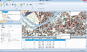
Spatial Manager Desktop is a desktop application designed to manage spatial data in a simple, fast and inexpensive way. Developed by a group of professionals working in the areas of GIS, Planning, Infrastructure and Civil Engineering, it provides the user with powerful tools to address the most common tasks of management and operation in the world of spatial information. Spatial Manager...
Category: Multimedia & Design / Graphics Viewers
Publisher: Spatial Manager, License: Shareware, Price: USD $149.00, File Size: 114.3 MB
Platform: Windows
With the help of AVAX-CAD software you can, create, edit, view manage and print 2D vector drawings.
With the help of AVAX-CAD software you can, create, edit, view manage and print 2D vector drawings. Get AVAX-CAD's VB6 source code and make your own stand alone CAD program based on AVAX Vector ActiveX control. You can export drawings to virtually any File type, including DXF, PDF, XML, SVG, PIC, SWF, PLT, RTF and WMF. You can import files like BMP, JPEG, Shp, ICO, WMF, PCX, RTF...
Category: Multimedia & Design / Multimedia App's
Publisher: Data Recovery Link, License: Shareware, Price: USD $45.00, File Size: 1.9 MB
Platform: Windows

The free AvisMap Viewer opens most GIS/CAD and raster image File types and most ArcView, ArcExplorer, and MapInfo projects. Besides just opening and viewing files, the Viewer supports an extensive list of features including visual layer properties control, legend control, thematic mapping, spatial and attribute querying, custom labeling, on-map measurements, hyper-linking, PDF export...
Category: Software Development / Components & Libraries
Publisher: AvisMap GIS Technologies, License: Freeware, Price: USD $0.00, File Size: 22.3 MB
Platform: Windows
Convenient, powerful, and highly configurable Windows application for converting among nearly all conceivable multimedia formats. Tightly integrated with the Windows interface, ContextConvert Pro provides immediate conversion capability from any Windows context (right-click) menu. Simply right-click on any audio, image, or video File, and you can immediately convert it to any other...
Category: Audio / Rippers & Encoders
Publisher: Mystik Media, License: Shareware, Price: USD $40.00, File Size: 9.2 MB
Platform: Windows
Demo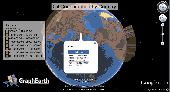
Visualize your data in 3D! Quick, easy and inexpensive. Graph Earth enables management, marketing and other business professionals to create stunning visual representations of their data, all without the time and costs associated with a full-featured GIS. Viewable by Everyone! Create one of a kind deliverables and distribute them to the world, recipients need only install Google Earth to view...
Category: Business & Finance / MS Office Addons
Publisher: Deer Creek Marketing LLC, License: Demo, Price: USD $24.95, File Size: 469.0 KB
Platform: Windows
GeoVisu is a program that displays georeferenced data (images, graphics) and downloads data recorded by some GPS devices.
Category: Multimedia & Design / Graphics Viewers
GeoVisu has a "Moving map" navigation function, which can be used with any NMEA 0183 compatible or Garmin USB GPS device.
Main features:
- Displays georeferenced image formats : GeoTiff, ECW and ECWP, MrSID, OziExplorer Map
Publisher: GeoVisu, License: Freeware, Price: USD $0.00, File Size: 1.7 MB
Platform: Windows
Map Suite Desktop Edition is a powerful and feature-rich .NET mapping control that enables C# and VB.NET software developers to build detailed desktop mapping applications. Utilizing Microsoft's .NET Framework, the APIs for Map Suite Desktop Edition incorporate the very latest technology to deliver a powerful, user-friendly mapping control. In addition, ease of coding and intuitive, streamlined...
Category: Software Development
Publisher: ThinkGeo LLC, License: Commercial, Price: USD $4794.00, File Size: 28.4 MB
Platform: Windows