Free Downloads: Sid Imagery
Weather1-Lite allows you to track weather conditions for your zip code, including 5-day forecast and access to popular satellite and radar Imagery. It minimizes neatly in your system tray (near your clock) with an icon of the current weather conditions, or temperature, or both.
Category: Desktop Enhancements / Shell & Desktop Managers
Publisher: KellySoftware, License: Shareware, Price: USD $12.00, File Size: 1.5 MB
Platform: Windows
 Shareware
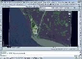
Using advanced mapping techniques, this AutoCAD plug-in gives you the ultimate interface to place your drawings in the real world. Plex.Earth connects your AutoCAD with Google Earth and our Web Services in order to provide you a set of unique features in order to enhance your design, boost your productivity and impress your customers. The must-have AutoCAD plug-in with many unique...
Category: Multimedia & Design / Image Editing
Publisher: Plexscape.com Environmental Web Services, License: Shareware, Price: USD $49.00, EUR39, File Size: 1.6 MB
Platform: Windows
From web to desktop to full dome planetarium, WorldWide Telescope (WWT) enables you to explore the universe, bringing together Imagery from the best ground and space-based telescopes in the world and combining it with 3D navigation. Experience narrated guided tours from astronomers and educators featuring interesting places in the sky. You can research and import your own data and...
Category: Home & Education / Teaching Tools
Publisher: Microsoft Research, License: Freeware, Price: USD $0.00, File Size: 60.7 MB
Platform: Windows
LizardTech GeoViewer is LizardTech's free, standalone application for viewing geospatial Imagery, vector overlays, and LiDAR files. LizardTech GeoViewer enables you to combine, view and export visual layers from varied sources, such as local repositories, Express Server catalogs, and WMS and JPIP servers, and provides tools for visualizing LiDAR data in MrSID and LAS formats....
Category: Multimedia & Design / Graphics Viewers
Publisher: Lizardtech, License: Shareware, Price: USD $0.00, File Size: 422.1 KB
Platform: Windows
We provide powerful tools that help you create complex, dynamic, lyrical forms and animation with ease. All of our tools are designed to keep the creative flow alive. GroBoto generates ultimate quality Imagery in record time with a workspace that doesn't overwhelm you with technical details. Anyone who enjoys fast, fluid 3D imaging and animation will love GroBoto. Ease of use makes...
Category: Multimedia & Design / Animation
Publisher: Braid Art Labs, License: Commercial, Price: USD $79.00, File Size: 0
Platform: Windows
OCULA is a unique collection of plug-in tools that solve common problems with stereoscopic Imagery, boost productivity in post production, and ultimately help to deliver a more rewarding stereoscopic viewing experience.
The plug-ins are designed to automatically replicate key processes on left and right channels and help artists polish and refine stereoscopic material, literally,...
Category: Utilities / Misc. Utilities
Publisher: The Foundry, License: Shareware, Price: USD $0.00, File Size: 36.5 MB
Platform: Windows
Here you will find the World Wind SDK for Java.
Here you will find the World Wind SDK for Java. With this, developers can embed World Wind technology in their own applications.
World Wind Java provides a rich set of features for displaying and interacting with geographic data and representing a wide range of geometric objects.
- Open-source, high-performance 3D Virtual globe API and SDK
- Adds geographic...
Category: Home & Education / Miscellaneous
Publisher: NASA, License: Shareware, Price: USD $0.00, File Size: 73.5 MB
Platform: Windows
Shape2Earth leverages freely available and easy to use Geographic Information System (GIS) software to create professional visualizations for viewing in GoogleTM Earth.
Main features:
-Convert Any Shapefile to KML - Shape2Earth reprojects your data on the fly
-Apply Thematic Symbology to your Data - Color code to display information
-Present Data in Custom...
Category: Multimedia & Design / Image Editing
Publisher: Google, License: Demo, Price: USD $0.00, File Size: 9.5 MB
Platform: Windows
WinPilot 3D is flight analysis and planning software, that lets you zoom in from satellite altitude into any place on Earth, leveraging Landsat satellite Imagery and Shuttle Radar Topography Mission elevation data. WinPilot 3D lets you experience Earth terrain in visually rich 3D, just as if you were really there. WinPilot 3D also shows airspace in 3D, and contains world-wide database of...
Category: Home & Education / Miscellaneous
Publisher: WinPilot, License: Shareware, Price: USD $59.00, File Size: 3.8 MB
Platform: Windows
WW2D allows you to explore Earth using satellite Imagery, topographic maps and image from other data sources also providing large placenames and boundaries database and allowing you to install community-made add-ons for even more info about our planet.
Category: Business & Finance / Business Finance
Publisher: Vitaliy Pronkin, License: Freeware, Price: USD $0.00, File Size: 6.6 MB
Platform: Windows
Catfood Desktate is an eye catching earth simulator that combines satellite Imagery, near real time cloud data and optional layers including political borders and place names. The continuously updated result can be set as your desktop wallpaper or used as a screensaver. Desktate features include: The terminator between day and night is continuously calculated; you can see sunrise and...
Category: Desktop Enhancements / Wallpaper
Publisher: Catfood Software, License: Shareware, Price: USD $19.95, File Size: 9.8 MB
Platform: Windows
Watch as Zen Mandelbrot creates stunning fractal imagery on your computer display!
Watch as Zen Mandelbrot creates stunning fractal Imagery on your computer display! Designed for Windows 7, but will also run great on Vista and XP.
Some screen savers just show a slide show of a limited number of images and can quickly get rather repetitive, but Zen Mandelbrot will continue to find new and interesting sections of the Mandelbrot Set, creating works of fractal...
Category: Home & Education / Miscellaneous
Publisher: Zen Dog Software, License: Freeware, Price: USD $0.00, File Size: 1.3 MB
Platform: Windows
OCENS MetMapper transforms weather maps, satellite images, and ocean charts, into dynamic components of your at-sea decision-making tool box. MetMapper offers to all non-GRIB data what our GRIB Explorer software does for the GRIB data. That is, it will take classical weather data such as weather charts, ocean charts and satellite Imagery and render them into interactive elements that...
Category: Home & Education / Miscellaneous
Publisher: OCENS, Inc., License: Shareware, Price: USD $169.00, File Size: 23.6 MB
Platform: Windows
Amira is the leading software solution that satisfies even your most demanding needs to work with clinical or preclinical image data, nuclear data, optical or electron microscopy Imagery, molecular models, vector and flow data, simulation data on finite element models, and all types of multidimensional image, vector, tensor, and geometry data.
Category: Business & Finance / Applications
Publisher: Visage Imaging GmbH., License: Demo, Price: USD $0.00, File Size: 223.0 MB
Platform: Windows
Shareware
Our Golf screensaver features a large selection of Golf Imagery and brings them stylishly to your computer screen. Full screen high quality pictures are seamlessly and beautifully blended together to create a visually stunning slideshow screensaver for your computer. Each time your screensaver is displayed you will enjoy a smart, elegant and very classy screensaver full of great pictures...
Category: Desktop Enhancements / Shell & Desktop Managers
Publisher: UmBop Screensavers, License: Shareware, Price: USD $7.00, GBP4.49, File Size: 11.3 MB
Platform: Windows
PHOTOMOD GeoMosaic is intended for working with various types of digital images, including aerial and space Imagery as well as digitized raster maps.
The program functionality includes:
- Georeferencing of raster images;
- Transforming images from one coordinate system to another, using an extensive database supplied or custom created coordinate...
Category: Multimedia & Design / Multimedia App's
Publisher: Racurs, License: Freeware, Price: USD $0.00, File Size: 36.5 MB
Platform: Windows
Plan, Estimate, and Manage Your Static Scanning Project
Features:
- Utilize aerial Imagery from multiple online sources including Bing, Google and Yahoo maps
- Place scan positions using automatic control detection and system range
- Import or create control coordinate network
- Identify three possible scan position times based on traffic...
Category: Business & Finance / Project Management
Publisher: Certainty 3D, License: Freeware, Price: USD $0.00, File Size: 17.6 MB
Platform: Windows
Finger numbing action, stunning audio Imagery and a touch of morbid comedy is combined in this brand new title, promising hours of thrilling and challenging game play.
The Q9 Action Game is a typical side scroller, entirely based on sound and audio environments. You assume the role of the little alien Q9 who has had the misfortune to crash on Earth, managing to lose his...
Category: Games / Action
Publisher: Blastbay Studios, License: Shareware, Price: USD $29.95, File Size: 22.8 MB
Platform: Windows
StormLab is the FIRST publicly available software to take advantage of the full National Weather Service Doppler radar Imagery suite. StormLab turns any internet connection into a unique and comprehensive display system for National Weather Service Doppler radars.
With access to over 150 radar sites across the entire US, you will have instant access to nearly 2 dozen...
Category: Business & Finance / Applications
Publisher: Storm Alert Inc., License: Shareware, Price: USD $75.00, File Size: 14.4 MB
Platform: Windows
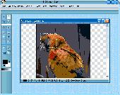
Sid Image In Depth consumer-level photo editor is the professional standard in digital imaging, with an endless selection of drawing tools, filters, and color-adjustment capabilities for manipulating items in almost any way. Offers unique features designed specifically for amateur photographers, hobbyists, and business users who want a simple-to-use yet powerful digital-imaging solution....
Category: Multimedia & Design
Publisher: SoundInDepth.com, License: Freeware, Price: USD $0.00, File Size: 5.0 MB
Platform: Windows
VB64 is a commodore64 emulator vritten in VisualBasic.
VB64 is a commodore64 emulator vritten in VisualBasic. It is a very complex piece of machinery and this would mean a real challenge for even the most accomplished VB. programmer. It's not perfect yet, but you can still play a lot of games on it! DIGI sounds now play properly.. and in sync with Sid oscilators, many games now work that never did, or nearly work
Category: Games / Misc. Games
Publisher: Emuunlim, License: Freeware, Price: USD $0.00, File Size: 2.6 MB
Platform: Windows
Simple and powerful tool to convert your MrSIDs.
Simple and powerful tool to convert your MrSIDs. Rename and organize your photos in subfolders using EXIF/IPTC/XMP tags. Reads MrSID files and saves them into jpg, jpeg2000, gif, png, tiff... Optimized for multi-core processors. Speed up your conversions by using 100% of your CPU.Get one year of update protection and technical support with the purchase of a license.
Category: Audio / Utilities & Plug-Ins
Publisher: Jansoft, License: Shareware, Price: USD $20.00, File Size: 23.4 MB
Platform: Mac
The imagery and messages of the season are demonstrated in 3D with interactive Holiday candles.
The Imagery and messages of the season are demonstrated in 3D with interactive Holiday candles. Candles light in sequence with individual messages. Later you can extinguish or light the flames by clicking on the candles. Press any key to exit interactive screensaver. Contains realistically modeled 3D animated images and MP3 music file. Select from falling poinsettias, sparkles,...
Category: Desktop Enhancements / Screensavers
Publisher: San Diego Screen Savers, License: Demo, Price: USD $10.00, File Size: 2.4 MB
Platform: Windows
T2K Pro integrates the rich world of GIS datasets and transfers your Geographic information data into Google earth. T2K Pro handles rich data types and access large volumes of geographic data stored in files and databases; T2K PRO handles raster (Imagery), Vector Map data and GPS Tracks/ Waypoints/ Routes. Tiles2kml Pro provides a complete suite of conversion tools to easily visualize...
Category: Multimedia & Design / Authoring Tools
Publisher: Tiles2kml, License: Demo, Price: USD $90.00, File Size: 20.9 MB
Platform: Windows
Shareware
Total GIS Converter is an affordable converter of GIS files. It converts AEP, GRD, ADF, E00, FLT, APR, SHP, DXF, BT, TOC, RT1, DEM, DLG, ECW, IMG, DGF, GML, Sid, MIF, TAB, WOR, DNG, DDF, BIL, TIF, JPEG, TTKPS, TTKGP, TTKLS, LFT, PFT, and TFT files. The target formats are TIFF, PNG, JPEG, BMP. The program can scale your GIS files to optimize their size. Besides, it can slice the output...
Category: Multimedia & Design / Graphics Viewers
Publisher: Softplicity, License: Shareware, Price: USD $99.90, File Size: 7.6 MB
Platform: Windows