Free Downloads: South America Gps Maps
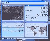
TopoFusion is a GPS Mapping program for Windows.
TopoFusion is a Gps Mapping program for Windows. It downloads Maps (Topo, Aerial Photo and Satellite) automatically from several public map servers.
It seamlessly displays imagery from Terraserver and the OnEarth Server. Maps are downloaded on demand (as the user pans or zooms around the map) and cached on the user's hard drive for faster (and offline) storage.
Category: Utilities / Misc. Utilities
Publisher: TopoFusion, License: Shareware, Price: USD $69.95, File Size: 7.4 MB
Platform: Windows
Gps Navigator with using a scanned Maps and possibility to open a lot of Maps together. - you can show a current Gps data (Speed, Direction, Longitude, Latitude, Time, Date, Height); - you can open any of scanned Maps (in a "bmp" or "dib" format); - you can calibrate the scanned Maps yourself by two calibration points only (left-top and...
Category: Home & Education
Publisher: Valeri Vlassov, License: Demo, Price: USD $19.00, File Size: 4.6 MB
Platform: Windows
MapToaster Topo New Zealand is New Zealand's only topographical mapping suite, with options for your computer and Garmin Gps, including:
- all the rich detail of the LINZ topo Maps - seamless across NZ. Now includes Topo50 and Topo250 map series.
- 1:50,000 though 1:2 million scale Maps on your PC and 1:50,000 on your Gps
- integrated...
Category: Home & Education / Miscellaneous
Publisher: Integrated Mapping Ltd, License: Shareware, Price: USD $0.00, File Size: 38.5 MB
Platform: Windows
Furthermore the Skylab Gps Simulator contains a full featured interoperable OGC WMS client for receiving Maps from a standardized WMS server.
Within a map you are able to navigate (zoom, pan) and to select your favorite layers provided by the WMS server. During the simulation there are realtime debugging helpers like position and raw NMEA-0183 output.
Category: Home & Education / Miscellaneous
Publisher: Skylab Mobilesystems, License: Shareware, Price: USD $99.00, File Size: 4.9 MB
Platform: Windows
CompeGPS Pocket Air is a new software specially designed for Pocket PC mobile devices, with wich you can obtain a new and revolutionary free flight instrument. You will enjoy most of the CompeGPS PC version functions, like the waypoint and routes creation and edition, full Gps and Pocket PC communication, use of digital Maps and moving map (real time navigation), to obtain...
Category: Home & Education
Publisher: CompeGPS TEAM S.L., License: Shareware, Price: USD $105.00, File Size: 5.2 MB
Platform:
GeoBuddy is a complete geocaching solution that can display all of the geocaches in your area, as well as your own personal Gps data, over USGS topo Maps, aerial photos, your own scanned paper trail and road Maps. A built-in Web browser lists all of the information about each geocache, including pictures and hints left by the cache owner, and logs by recent visitors to the...
Category: Internet / Communications
Publisher: TopoGrafix, License: Shareware, Price: USD $49.95, File Size: 10.3 MB
Platform: Windows
ExpertGPS is helpful in viewing map points, Topo Maps, arial photos and many more.
ExpertGPS is helpful in viewing map points, Topo Maps, arial photos and many more. This is a revolutionary product called Expert Gps, Expert Gps is highly useful for people interested in Hunting, Scouting, Mountain biking, Fishing, Tracking, state and local agencies in the US as well as geometric studies.
Category: Internet / Communications
Publisher: TopoGrafix, License: Shareware, Price: USD $200.00, File Size: 9.2 MB
Platform: Windows
The fast track to GPS success.
The fast track to Gps success. The Linx MDEV-Gps-SR contains everything needed to rapidly evaluate the SR Series Gps modules and implement them in record time. This all-inclusive Master Development System features a pre-assembled development board with an on-board OLED display for standalone testing. The system can also be attached to a PC via USB and operated using the...
Category: Software Development / Misc. Programming
Publisher: Linx Technologies, Inc., License: Freeware, Price: USD $0.00, File Size: 98.5 MB
Platform: Windows
OkMap is a Gps and map software that:
-Works with vectorial Maps and calibrates raster Maps
-Organizes paths by creating waypoints, routes and tracks
-Uploads/downloads data to/from your Gps
-Uses altitude DEM data
-Supports Gps real-time navigation
-Sends/receives vehicles position and display tracks on Maps in real time
-Provides...
Category: Business & Finance / Applications
Publisher: Gian Paolo Saliola, License: Freeware, Price: USD $0.00, File Size: 20.2 MB
Platform: Windows
GPSCommunicator is a FREE utility to visually represent NMEA GPS position data in realtime.
GPSCommunicator is a FREE utility to visually represent NMEA Gps position data in realtime. It works with NMEA 0183 Gps receivers connected via a serial port. GPSCommunicator has the following features:
- Vessel position display over moving map.
- User selectable Maps.
- Create and save Waypoints.
- Graphical Gps data display
- .NET...
Category: Internet / Misc. Plugins
Publisher: Panazzolo.Com, License: Freeware, Price: USD $0.00, File Size: 772.5 KB
Platform: Windows
With our locr PC software "locr Gps Photo for Windows" you can manage to automatically geotag numerous photos simultaneously. You just require a digital camera, a Gps data logger and the application "locr Gps Photo for Windows".
There are two ways to geotag your photos: The photos can be tagged manually or automatically. For automatic geotagging...
Category: Multimedia & Design / Multimedia App's
Publisher: locr, License: Freeware, Price: USD $0.00, File Size: 490.8 KB
Platform: Windows
Nokia Map Manager is a program that allows you to manage and transfer GPS maps to mobile phone.
Nokia Map Manager is a program that allows you to manage and transfer Gps Maps to mobile phone. The Map Manager is for the 6110 Navigator only. The program is provided with scan function to search Maps on the computer and DVD. Nokia Map Manager is an additional application and is used together with Nokia PC Suite 6.86 and later versions.
Nokia Map Manager helps you to...
Category: Internet / Communications
Publisher: Nokia, License: Freeware, Price: USD $0.00, File Size: 0
Platform: Windows
Used Magellan toolbar for Internet Explorer.
Used Magellan toolbar for Internet Explorer. Find great deals on used Magellan Gps devices at prices you can afford. Whether your looking for the Magellan Roadmate, Magellan Maestro, or Magellan CrossoverGPS you'll find it here at low prices. We are always searching our networks on a daily basis to bring you the best prices in used Magellan Gps devices for your car. Find a great...
Category: Internet / Browsers
Publisher: Used Magellan, License: Freeware, Price: USD $0.00, File Size: 1.1 MB
Platform: Windows
South Point Poker is the exclusive online poker room of the South Point Hotel, Casino & Spa in Las Vegas, Nevada. Our aim is to provide all poker fans a free online destination to play and to learn poker. Players can win up to $100K in cash and prizes every month, and your wins are 100% guaranteed by the South Point Casino. Please have fun at the tables and enjoy your...
Category: Games / Cards, Casino, Lottery
Publisher: Power Play Development, License: Freeware, Price: USD $0.00, File Size: 4.9 MB
Platform: Windows
Prepare yourself for South Park Mario Brothers - Enhanced Edition.
Prepare yourself for South Park Mario Brothers - Enhanced Edition. Now Bigger and Better than ever! South Park Super Mario Brothers Enhanced Edition featuring Kenny and other pals from South Park with a mission to save the Princess while kicking a lot of butt. Now with additional worlds. Do you think you are ready?
Category: Games / Adventure & RPG
Publisher: MicroSmarts LLC, License: Freeware, Price: USD $0.00, File Size: 1.9 MB
Platform: Windows
A very powerful plugin that seamlessly integrates Gps waypoints and Garmin courses into SportTracks, features for which you would have to use Garmin Mapsource™ and Garmin TrainingCenter™ or similar 3rd party applications otherwise.
Category: Home & Education / Miscellaneous
Some of the outstanding features of this plugin are:
-create courses with autorouting
-create waypoints from addresses
Publisher: Old Man Biking's SportTracks Plugins, License: Shareware, Price: USD $13.08, File Size: 1.4 MB
Platform: Windows
OziPhotoTool combines the technology of a Gps receiver and a digital camera to automatically keep a record of where digital photos were taken. It is designed to be used in conjunction with OziExplorer. Most digital cameras have EXIF metadata stored as part of the photo. This includes is the date and time the photo was taken. Many Gps units have 'tracklogs'. The Gps keeps a...
Category: Utilities
Publisher: OziPhotoTool, License: Shareware, Price: USD $25.00, File Size: 14.3 MB
Platform: Windows
My Gps Logger 1.01 is a program designed to be used with My Fuel Tax 4.0. With My Gps Logger you can log all the locations where your truck has been to a monthly data file. This data file can later be imported into My Fuel Tax 4.0 by calculating the miles in state using Microsoftâ Mappoint. This is what you will need to use My Gps Logger with My Fuel Tax:a laptop with...
Category: Home & Education / Miscellaneous
Publisher: Spinnaker Software Solutions, License: Freeware, Price: USD $0.00, File Size: 477.7 KB
Platform: Windows
KANINE Software has become the most chosen K9 Records software in America.
KANINE Software has become the most chosen K9 Records software in America. KANINE tracks all K-9 requirements, is Windows 7 and Network compatible, and it produces the reports that today’s K-9 teams need for court or other reporting purposes. KANINE Software is cost effective and is the only software application on the market that has the option to include a Gps Data logging...
Category: Business & Finance / Business Finance
Publisher: Code Blue Designs, License: Shareware, Price: USD $175.00, File Size: 21.1 MB
Platform: Windows
You will be able to enjoy many of CompeGPS Landís features such as waypoint and route creation and edition, full communication between PDA and Gps, use of Maps and the moving map (real-time navigation). CompeGPS Pocket Land allows full communication between Gps and PDA (tracks, waypoints and routes). You will be able to create waypoints and routes, use Maps...
Category: Home & Education
Publisher: CompeGPS TEAM S.L., License: Shareware, Price: USD $76.00, File Size: 3.9 MB
Platform:
RouteBuddy is the only modern, advanced digital map application for Windows and Mac OS X.
RouteBuddy is the only modern, advanced digital map application for Windows and Mac OS X. It doesn't matter on which platform you wish to use the application as it sports a universal toolbar and comparable features throughout.
- High resolution Road, Topo and Satellite Maps can be viewed in the same application using our state-of-the-art animated layer technology.
...
Category: Home & Education / Miscellaneous
Publisher: RouteBuddy Ltd, License: Shareware, Price: USD $59.99, File Size: 121.5 MB
Platform: Windows
The only flight planner that allows you to point-and-click on the official Airservices Australia's Maps to plan flights.
Main Features:
- AirNav VFR is the ultimate Australian PC flight planner for both VFR and IFR pilots
- Plan your flights on digitised versions of the official Airservices Maps
- AirNav VFR calculates all your flight...
Category: Home & Education / Miscellaneous
Publisher: Sentient Software, License: Shareware, Price: USD $0.00, File Size: 0
Platform: Windows
Terrain Tools - Create maps quickly and easily!
Terrain Tools - Create Maps quickly and easily!
Terrain Tools is the ideal tool for outdoor recreationists, real-estate professionals, farmers, ecologists, archaeologists and others who need to create basic Maps, calculate areas, lengths, bearings and distances.
Overlay Gps tracks on scanned images such as USGS or Canadian NTS topos. Import and...
Category: Business & Finance / Applications
Publisher: Softree, License: Shareware, Price: USD $124.00, File Size: 15.0 MB
Platform: Windows
South Afircan rugby is a software made for all those who are passionate about their rugby.
South Afircan rugby is a software made for all those who are passionate about their rugby. It contains a lot of interesting info about the sport, such as guidebooks and rulebooks, a schedule of the South African rugby league matches, as well as the next encounters in the Trinations cup for the Soth African National Team.
Raul Steimberg is typing...
Category: Home & Education / Miscellaneous
Publisher: D6 Technology, License: Freeware, Price: USD $0.00, File Size: 5.9 MB
Platform: Windows
The white-tailed deer is an endangered species that lives in most of the US and some parts of Canada and Mexico, and several of its subspecies also live in parts of South America and Europe. Even in the regions where it is supposed to abound, this ruminant is very hard to see. This animated screensaver brings this beautiful species right to your desktop. It features a nice...
Category: Desktop Enhancements / Screensavers
Publisher: Freeze.com, LLC, License: Freeware, Price: USD $0.00, File Size: 1.6 MB
Platform: Windows


