Free Downloads: Spatial Database Engine
 Shareware
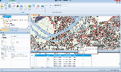
AvisMap GIS Engine is a comprehensive SDK for the development of custom GIS applications and solutions. This SDK provides several ActiveX (OCX) controls which support Visual Basic, VB.NET, C#, Visual C++ and other ActiveX compatible programming languages, with Microsoft Visual Studio versions 6, 2003, 2005, and Express. Supports .NET via COM. While the SDK is excellent for desktop GIS...
Category: Software Development / Components & Libraries
Publisher: AvisMap GIS Technologies, License: Shareware, Price: USD $1199.00, File Size: 57.8 MB
Platform: Windows
Spatial Workshop is mapping software used for Spatial information integration, query, analysis and reporting.
You build Spatial applications with a few clicks or support complex business processes with geospatial and business data from Oracle, Smallworld, ESRI, maps, files, spreadsheets and other sources.
You can combine and model geospatial data,...
Category: Multimedia & Design / Multimedia App's
Publisher: Spatial Eye bv, License: Freeware, Price: USD $0.00, File Size: 176.7 MB
Platform: Windows
PostGIS is unique software that adds support for geographic objects to the PostgreSQL object-relational Database.
In effect, PostGIS "spatially enables" the PostgreSQL server, allowing it to be used as a back-end Spatial Database for geographic information systems (GIS), much like ESRI's SDE or Oracle's Spatial extension. PostGIS...
Category: Business & Finance / Database Management
Publisher: Refractions Research, License: Shareware, Price: USD $0.00, File Size: 11.2 MB
Platform: Windows
SuperGIS Spatial Statistical Analyst is a set of application software integrating geostatistical methods and GIS functions. Besides exploring of Spatial data, query and demonstrating of attribute data, and the basic statistic capabilities, it also allows users to perform geostatistical analysis to obtain a better understanding about the variance and relativity of Spatial...
Category: Multimedia & Design / Multimedia App's
Publisher: SuperGeo Technologies Inc, License: Demo, Price: USD $0.00, File Size: 3.6 MB
Platform: Windows
A computer program for the joint analysis of inter-individual spatial and genetic information.
A computer program for the joint analysis of inter-individual Spatial and genetic information. This program performs a variety of Spatial analyses with genetic data including: Mantel Tests, Spatial Autocorrelation Analyses, Allelic Aggregation Index Analyses (AAIA), Mommonier's Algorithm, and "Genetic Landscape Shape" interpolations.
Category: Business & Finance / Applications
Publisher: Mark P. Miller, License: Freeware, Price: USD $0.00, File Size: 4.0 MB
Platform: Windows
Spatial Manager Desktop is a desktop application designed to manage Spatial data in a simple, fast and inexpensive way. Developed by a group of professionals working in the areas of GIS, Planning, Infrastructure and Civil Engineering, it provides the user with powerful tools to address the most common tasks of management and operation in the world of Spatial...
Category: Multimedia & Design / Graphics Viewers
Publisher: Spatial Manager, License: Shareware, Price: USD $149.00, File Size: 114.3 MB
Platform: Windows
SaTScan is a free software that analyzes Spatial, temporal and space-time data using the Spatial, temporal, or space-time scan statistics.
Main features:
- Perform geographical surveillance of disease, to detect Spatial or space-time disease clusters, and to see if they are statistically significant.
- Test whether a disease is randomly distributed over...
Category: Home & Education / Science
Publisher: SaTScan, License: Freeware, Price: USD $0.00, File Size: 10.7 MB
Platform: Windows
Driving Model Driven Development .
Driving Model Driven Development . Running under Windows, Blueprint is a modelling tool that will become integral to your software development process. The greatest feature of Blueprint is that it gives you the ability to generate any source code or text based on your model. Experience Model Driven Development now. Extremely large systems have been generated entirely from Blueprint templates...
Category: Utilities / Misc. Utilities
Publisher: Geometry Pty Ltd, License: Freeware, Price: USD $0.00, File Size: 2.0 MB
Platform: Windows
Acquiarium is open source software (GPL) for carrying out the common pipeline of many Spatial cell studies using fluorescence microscopy. It addresses image capture, raw image correction, image segmentation, quantification of segmented objects and their Spatial arrangement, volume rendering, and statistical evaluation.
It is focused on quantification of Spatial...
Category: Home & Education / Miscellaneous
Publisher: CBIA, License: Demo, Price: USD $0.00, File Size: 14.8 MB
Platform: Windows
Shareware
AvisMap Desktop Professional 5 is a professional desktop GIS software for map editing, managing, analysis attribute data, aid decision-making transactions and output map, print tables, 3D modeling, and other functions. As a complete analysis management tool, AvisMap Despro 5 is applicable in land management, forestry, electric power, telecom, traffic, city pipe network, resource management,...
Category: Multimedia & Design / Graphics Viewers
Publisher: AvisMap GIS Technologies, License: Shareware, Price: USD $499.00, File Size: 22.2 MB
Platform: Windows
Map Suite Engine is a powerful and feature-rich low level component that enables C# and VB.NET software developers to generate great-looking map images for presentations. At the heart of the Map Suite product line is a non-visual component library designed to generate maps. With this tool in your hands, you will be able to “roll your own” mapping control in Winforms or integrate a...
Category: Software Development
Publisher: ThinkGeo LLC, License: Commercial, Price: USD $4794.00, File Size: 15.1 MB
Platform: Windows
You know X-Tools? Grid Machine is X-Tools for grid themes. In ArcViews Spatial Analyst the options to work with grids are very limited, especially if you have requests for multiple grids. Even simple actions (like copy, rename, import, export) are only provided for single grids. Gridmachine offers a lot of helpful tools for the work with ArcView/Spatial Analyst, like the above...
Category: Business & Finance / Database Management
Publisher: ECOGIS Geomatics, License: Shareware, Price: USD $199.00, File Size: 736.2 KB
Platform: Windows
Geographic databases management and exploitation, attribute-based and Spatial queries, several join types, several classification methods, thematic cartography, statistics and geo-statistics, Spatial analysis, interpolations, digital elevation models, remote-sensing and image processing, simulation, operational research, interactive metric measurements
Category: Home & Education / Miscellaneous
Publisher: IRD, License: Freeware, Price: USD $0.00, File Size: 14.2 MB
Platform: Windows
WellTracking is an ArcGIS based solution for effective management and visualization of 3D Spatial well drilling data on a corporate level.
The program automates all Spatial data management processes related to the life-cycle of the well allowing monitoring and controlling all stages of the drilling process.
Category: Utilities / Misc. Utilities
Publisher: DataEast, LLC, License: Shareware, Price: USD $3905.06, File Size: 55.4 MB
Platform: Windows
KeyDB is a powerful but compact Database Engine which groups multiple tables into a single Database file. The Database Engine compiles into your executable so there are no associated files to distribute. Works with Borland Delphi and Kylix.
KeyDB is a multi-user Database Engine and has a small footprint. KeyDB tables are TDataset...
Category: Software Development / Components: Delphi
Publisher: Congruity, License: Shareware, Price: USD $199.00, File Size: 4.5 MB
Platform: Windows, Linux
Buffalo is an open source, provider agnostic data spatial delivery platform.
Buffalo is an open source, provider agnostic data Spatial delivery platform.
A loosely coupled, message based Spatial data delivery and analytical platform based on free and open source GIS. The platform abstracts the user from the inherent complexity of the platform and provides a wizard based friendly user interface to setup a Spatial data infrastructure. The...
Category: Business & Finance / Business Finance
Publisher: Data World Pty Ltd, License: Freeware, Price: USD $0.00, File Size: 45.7 MB
Platform: Windows
SimpleDB is a simple Database Engine for standalone applications that doesn't need very advanced functionality. Instead of an expensive and monolithic Database Engine, you get a small, fast Database Engine in just 80K! SimpleDB uses a simple API, primarily designed for C/C programmers.
Category: Software Development / Misc. Programming
Publisher: Christoffer Owe, License: Freeware, Price: USD $0.00, File Size: 364.2 KB
Platform: Windows
gvSIG project is a free and open source Geoinformation System (GIS), that enables users to interactively visualize, manage, modify and analyze Spatial information in the form of digital maps, images and Database tables. It is easy to learn, yet versatile and efficient enough for demanding GIS tasks.
Category: Multimedia & Design / Multimedia App's
Publisher: Oxford Archaeology Digital, License: Freeware, Price: USD $0.00, File Size: 273.0 MB
Platform: Windows
AccuGlobe Desktop 2007,a standardized platform for delivering solutions to the global GIS community, offers even more of what you demand in a desktop GIS application. Combining user-friendly design with significantly increased functionality, AccuGlobe Desktop 2007 gives you greater freedom in analyzing Spatial data. In addition to functioning as the core Engine behind many...
Category: Multimedia & Design / Multimedia App's
Publisher: Digital Data Technologies, Inc., License: Freeware, Price: USD $0.00, File Size: 9.8 MB
Platform: Windows
GeoEFM is used in the Spatial analyses phase of the EFM process to help manage and assess Spatial data layers and to quantify the amount and connectivity of ecological habitats generated by different water management or ecosystem restoration scenarios.
In a GeoEFM project, data layers are organized according to management scenario and ecosystem concern.
Category: Multimedia & Design / Multimedia App's
Publisher: HEC, License: Freeware, Price: USD $0.00, File Size: 23.6 MB
Platform: Windows
The PDMT Line Maintenance tool is designed to perform complex centerline maintenance operations on an APDM or PODS ESRI Spatial pipeline centerline.
Allow for specific client customization of these models as needed using accepted ‘best-practices.
Supported Database platforms including Oracle and Microsoft SQL Server.
Category: Business & Finance / MS Office Addons
Publisher: Eagle Information Mapping, Inc., License: Demo, Price: USD $0.00, File Size: 1.0 MB
Platform: Windows
MicroCity is a spatial modeling framework for scientific analyses.
MicroCity is a Spatial modeling framework for scientific analyses. You can use and customize it freely under the agreement without paying anything.Extremely small file size and resource consumption.You can easily build your model based on efficient MicroCity Script and run it on the fly. There are enormous extensible modules can be downloaded from web.
Category: Multimedia & Design / Multimedia App's
Publisher: SUN Zhuo, License: Shareware, Price: USD $0.00, File Size: 3.2 MB
Platform: Windows

The free AvisMap Viewer opens most GIS/CAD and raster image file types and most ArcView, ArcExplorer, and MapInfo projects. Besides just opening and viewing files, the Viewer supports an extensive list of features including visual layer properties control, legend control, thematic mapping, Spatial and attribute querying, custom labeling, on-map measurements, hyper-linking, PDF export...
Category: Software Development / Components & Libraries
Publisher: AvisMap GIS Technologies, License: Freeware, Price: USD $0.00, File Size: 22.3 MB
Platform: Windows
SpatialXL is an add-in to Microsoft Excel 2007 or 2010 which gives Microsoft Excel full mapping and graphics capability, including the ability to link Spatial or graphics elements back to Excel or to other data sources such as a Database.
The example below show colouring of a blockmodel by gold value.
Category: Utilities / Misc. Utilities
Publisher: PrimeThought Software Solutions, License: Shareware, Price: USD $0.00, File Size: 0
Platform: Windows
AvisMap GIS Engine is the basic development platform for AvisMap GIS suites, which is a new generation component GIS development platform for GIS application developers. AvisMap GIS Engine 5 provides powerful GIS functions through Active X controls based on Microsoft COM component technique standards. It allows users to rapidly develop professional GIS applications and increase...
Category: Multimedia & Design / Multimedia App's
Publisher: AvisMap GIS Technologies, License: Freeware, Price: USD $0.00, File Size: 60.5 MB
Platform: Windows