Free Downloads: Stereographic
License: All | Free
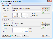
PHOTOMOD GeoCalculator is the software for points coordinates transformation, included in the PHOTOMOD system, as well as a stand-alone free application.
Its installation package includes databases of reference systems used in the world and in Russia (approximately 1500 reference systems). User can also add reference systems on his own by specifying:
-units (coefficient for...
Category: Business & Finance / Applications
Publisher: Racurs, License: Freeware, Price: USD $0.00, File Size: 7.6 MB
Platform: Windows


 Shareware
The Eye4Software Coordinate Calculator is an easy to use tool to perform map or GPS coordinate conversions. The software can be used to transform a single coordinate or a batch of coordinates read from a comma separated, database or ESRI shapefiles. The software is shipped with a MS Access database file, containing more then 3500 ellipsoid, map datum and map grid definitions around the world,...
Category: Business & Finance / Calculators
Publisher: Eye4Software B.V., License: Shareware, Price: USD $49.00, EUR39, File Size: 3.2 MB
Platform: Windows
GEOrient plots and analyses Stereographic projections and rose diagrams of geological structural data, copied and pasted from other applications, or read from text files. Wind rose options include plotting mean wind data (wind speed/wind frequency/wind energy).
Category: Business & Finance / Business Finance
Publisher: R J Holcombe, License: Shareware, Price: USD $110.00, File Size: 775.8 KB
Platform: Windows


 Shareware
Java toolkit to add coordinate conversion functionality to your Java applications and applets. The toolkit offers functionality to perform map grid and datum transformations: latitude and longitude can be converted to various map grids, like Transverse Mercator (TM), Oblique Mercator, Mercator, Oblique Stereographic, Polar Stereographic, Cassini, Albers Equal Area Conal, Gauss...
Category: Software Development / Components & Libraries
Publisher: Eye4Software B.V., License: Shareware, Price: USD $199.00, EUR179, File Size: 155.5 KB
Platform: Unknown


 Shareware
GPS SDK to add GPS and coordinate conversion functionality to your software and scripts). All NMEA0183 protocol versions are supported and can be filtered by NMEA sentence type and talker ID. Garmin USB PVT support. Information on GPS status can also be retrieved: GPS fix quality, satellites used in fix, satellites in view, satellite azimuth, elevation and signal strengths. The toolkit also...
Category: Software Development
Publisher: Eye4Software B.V., License: Shareware, Price: USD $99.00, EUR79, File Size: 2.3 MB
Platform: Windows
SHPTRANS is a fast, high-precision NTv2 datum transformation and projection utility which reads and writes shapefiles. SHPTRANS is intended to complement, not replace, existing projection tools such as those within ArcView GIS 3.x and ArcGIS 8.x.SHPTRANS supports the following projections: UTM (tested for North America; intended to support all 60 zones in both hemispheres), MTM 3-degree (tested...
Category: Utilities / Misc. Utilities
Publisher: Bruce Dodson, License: Shareware, Price: USD $0.00, File Size: 335.0 KB
Platform: Windows
WolfPack software is for educational use.
WolfPack software is for educational use. It includes:
-Wolfpack.exe: The executable program.
-Wolfpack.chm: A compiled help file
-30 sample data files located in the Elementary Surveying subdirectory of My Documents
-6 digital aerial photo files in three resolutions: Only one resolution (low, medium, high) can be loaded with one installation of the software. This also...
Category: Home & Education / Miscellaneous
Publisher: Elementary Surveying, License: Freeware, Price: USD $0.00, File Size: 102.8 MB
Platform: Windows


 Shareware
PANOVOLO is a tool for the precise stitching of drone-captured panoramas.
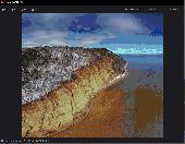
PANOVOLO is a specialized software tool engineered for the precise stitching of drone-captured panoramas. It integrates advanced algorithms with the image location and orientation metadata saved by drones to facilitate rapid and reliable panorama creation. Image Compatibility: Processes both JPEG and DNG (RAW) images, offering users flexibility in image selection. When working with...
Category: Multimedia & Design / Image Editing
Publisher: Simulogic Inc., License: Shareware, Price: USD $29.99, File Size: 38.4 MB
Platform: Windows


 Shareware
Toolkit to add GPS functionality to your software and scripts (GPS SDK). All NMEA0183 protocol versions are supported and can be filtered by NMEA sentence type and talker ID. Information on GPS status can also be retrieved: GPS fix quality, satellites used in fix, satellites in view, satellite azimuth, elevation and signal strengths. The toolkit also offers functionality to perform map grid...
Category: Software Development / ActiveX
Publisher: Eye4Software B.V., License: Shareware, Price: USD $150.81, File Size: 1.6 MB
Platform: Windows
License: All | Free


