Free Downloads: Terrain Autocad
Terrain for AutoCAD is a terrain modeling plug-in for AutoCAD.
Terrain for Autocad is a Terrain modeling plug-in for Autocad. This plug-in gives Autocad the ability to create a Terrain mesh from a set of unordered points, lines, polylines and splines. The Terrain mesh is created as a Delaunay Triangulation, which is regarded as the best method to create a Terrain mesh from unorganized point data....
Category: Multimedia & Design / Multimedia App's
Publisher: SYCODE, License: Commercial, Price: USD $195.00, File Size: 2.6 MB
Platform: Windows
With this FREE Autocad add-on you can create Terrain sections
from geodetic points(heights) in the drawing. You can also
specify position of pipe(cable, road, ...) or set auxiliary
marks in the section.
Text settings, scale in X,Y axis, height of the reference
plane and type of the Terrain section can be set at start-up.
There are two ways how you can...
Category: Multimedia & Design / Multimedia App's
Publisher: Cadhedral, License: Freeware, Price: USD $0.00, File Size: 69.0 KB
Platform: Windows
Introducing you AEC Terrain interface which is designed to simplify Terrain management and 3D-modeling. AEC Terrain creates Digital Elevation Model from multiple input point files on Autocad graphic editor. All purpose multi-level pads, road alignments, mining applications and airfields can be generated on the Terrain on different layers with different slope...
Category: Business & Finance / Project Management
Publisher: AEC Logic Private Limited, License: Shareware, Price: USD $750.00, File Size: 16.3 MB
Platform: Windows
Terrain Generator Terrain Generator allows you to generate terrain for specific games.
Terrain Generator Terrain Generator allows you to generate Terrain for specific games. You can specify almost everything when it's about creating a Terrain which then later can be used aside textures for a beautiful product. The program can export to different file formats for easy integration.
Category: Games / Tools & Editors
Publisher: Ryan Gregg, License: Freeware, Price: USD $0.00, File Size: 522.8 KB
Platform: Windows
SurfMate is a digital Terrain modelling and earthworks design solution giving the designer many enhanced features for use in Digital Terrain Modelling and Earthworks design completely integrated with Autocad.
TECHNoCAD have put great effort into packing as many useful options as possible into the software to make it the most valuable add-on to Autocad...
Category: Multimedia & Design / Image Editing
Publisher: TECHNoCAD, License: Demo, Price: USD $0.00, File Size: 78.5 MB
Platform: Windows
Terrain for Rhino is a terrain modeling plug-in for Rhinoceros (commonly known as Rhino).
Terrain for Rhino is a Terrain modeling plug-in for Rhinoceros (commonly known as Rhino). This plug-in gives Rhino the ability to create a Terrain mesh from a set of unordered points. The Terrain mesh is created as a Delaunay Triangulation, which is regarded as the best method to create a Terrain mesh from unorganized point data. Terrain for Rhino is...
Category: Multimedia & Design / Multimedia App's
Publisher: SYCODE, License: Commercial, Price: USD $95.00, File Size: 2.2 MB
Platform: Windows
In FastTerrain you are able to create, edit and visualize in 3D space digital terrain models.
In FastTerrain you are able to create, edit and visualize in 3D space digital Terrain models. The program includes functionalities for break-lines and holes insertion as well as volume calculations and contours lines creation. With FastTerrain you can estimate excavation volumes by using digital Terrain models (DTMs). Perfect choice for Civil Engineers, Surveyors, Architects in...
Category: Multimedia & Design / Image Editing
Publisher: Diolkos3D, License: Freeware, Price: USD $0.00, File Size: 30.4 MB
Platform: Windows
!SlingShot introduces more than 60 new commands to your Autocad. Make the most of your Autocad LT software.
!Slingshot provides the most popular set of useful enhancemnt tools for use in Autocad and Autocad LT. Maximise your Autocad software with this seamless tool - available for versions 2000 - 2010 and beyond.
!SlingShot offers a generous...
Category: Multimedia & Design / Image Editing
Publisher: drcauto, License: Demo, Price: USD $0.00, File Size: 7.0 MB
Platform: Windows
While the Terrain that ships out-of-the-box with FSX is much-improved over previous versions, the newly-enhanced Terrain engine still leaves much vacant capabilities to fill. So FSGenesis has bumped it up a notch, filling those capabilities while providing our most accurate and detailed Terrain yet, taking advantage of the efficiency of the new all-LODs-in-one-file format...
Category: Home & Education / Miscellaneous
Publisher: FSGenesis, License: Freeware, Price: USD $0.00, File Size: 28.0 MB
Platform: Windows
 Shareware
Google Maps Terrain Downloader is a tool that can automatically download the google Terrain maps images to your PC. It can download the small tiles and save them to your hard disk. After downloading, you can view the maps offline by its tool Maps Viewer, or you can combine the small images into one big map image. If you want to make a map of your city by yourself, it is very...
Category: Internet / Download Managers
Publisher: allmapsoft.com, License: Shareware, Price: USD $29.99, File Size: 305.3 MB
Platform: Windows
Terrain Tools - Create maps quickly and easily!
Terrain Tools - Create maps quickly and easily!
Terrain Tools is the ideal tool for outdoor recreationists, real-estate professionals, farmers, ecologists, archaeologists and others who need to create basic maps, calculate areas, lengths, bearings and distances.
Overlay GPS tracks on scanned images such as USGS or Canadian NTS topos. Import and export...
Category: Business & Finance / Applications
Publisher: Softree, License: Shareware, Price: USD $124.00, File Size: 15.0 MB
Platform: Windows
Autocad Attribute Extractor Help you batch extract attribute data from Autocad attribute blocks without need of Autocad. It supports most DWG formats including Autocad Release 9 thru Autocad Release 2006 Extracting attributes has always been one of the most difficult tasks to accomplish in Autocad. How many of you have actually figured out how to...
Category: Multimedia & Design
Publisher: AutoDWG Software, License: Shareware, Price: USD $150.00, File Size: 2.0 MB
Platform: Windows
Oriantica is the new generation orienteering simulation software.
Oriantica is the new generation orienteering simulation software. Using a map and a compass you have to find your way through the Terrain to locate the controls as fast as possible.
In Oriantica it is possible to compete with other players over a network, or play against the computer.
The map and Terrain is much more flexible than in previous versions, with more...
Category: Games / Misc. Games
Publisher: Melin Software HB, License: Shareware, Price: USD $39.00, File Size: 16.5 MB
Platform: Windows
SC3K Map Editor is the fastest and most accurate Terrain editor currently available for SimCity 3000. It gives you the finest possible control over modifications to your Terrain.
With SC3K Map Editor you can use an interface very similar to that given by SimCity 3000 so that you can see exactly what your Terrain will look like as you create it.
Also you...
Category: Games / Tools & Editors
Publisher: Tenermerx Software, License: Freeware, Price: USD $0.00, File Size: 990.5 KB
Platform: Windows
hvUnlight is a tool which helps you load ObjectARX files into AutoCAD LT.
hvUnlight is a tool which helps you load ObjectARX files into Autocad LT.
hvUnlight can be your vehicle into Autocad LT productivity. It allows you to run standard Autocad ObjectARX applications on Autocad LT.
This addon is free to use and is available for different Autocad lt versions.
Category: Multimedia & Design / Image Editing
Publisher: Streamspace, License: Freeware, Price: USD $0.00, File Size: 1.2 MB
Platform: Windows
Autocad to Flash Converter let you Flash your Autocad DWG files.The best way to share and publish Autocad DWG files on the web,better than DWF.Autocad to Flash Converter is a dwg viewer without need of dwg viewer.NO need of additional viewer or plug-in to view flash.Autocad to Flash Converter is a vector to vector converter. Autocad to Flash Converter...
Category: Multimedia & Design
Publisher: AutoDWG, License: Shareware, Price: USD $198.00, File Size: 3.1 MB
Platform: Windows
A complex 2D/3D CAD application which allows users to work with Autocad DWG files
progeCAD is an Autocad compatible 2D and 3D CAD software which will work with Autocad DWG files, from Autocad 2.5 through Autocad 2007.
progeCAD supports an interface complete with an "Autocad Like" icon menu and "Autocad Like"...
Category: Multimedia & Design / Image Editing
Publisher: progeCAD s.r.l., License: Demo, Price: USD $0.00, File Size: 252.7 MB
Platform: Windows
The Trimble Link Engine is the component that provides the Trimble Link functionality in the Autocad Civil/Civil 3D systems and in other products such as 12d Model, LSS digital Terrain modelling software, Bentley GEOPAK, Bentley InRoads etc. If you have Trimble Access software and wish to use the data from it in a Trimble Link system, you can install this Trimble Link Engine to...
Category: Software Development / Components & Libraries
Publisher: Trimble Navigation Limited, License: Freeware, Price: USD $0.00, File Size: 16.8 MB
Platform: Windows
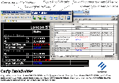
TableBuilder is designed to export Autocad table and the table drawn with lines and text in Autocad (LT)/MicroStation to Excel. Also you can convert the table drawn with lines and text to Autocad native table. == http://www.cadig.com == ======== Key Features ======== .Export the table drawn with lines and text in Autocad (LT) / MicroStation to Excel....
Category: Multimedia & Design
Publisher: cadig.com, License: Shareware, Price: USD $99.00, File Size: 1.6 MB
Platform: Windows
FSGenesis is your one-stop supplier for top-quality terrain mesh products for FS2004 and FSX.
FSGenesis is your one-stop supplier for top-quality Terrain mesh products for FS2004 and FSX. Since 1996 we have provided the world-wide flight simulator community with high-quality products at a low price. If you're looking for Terrain mesh for Microsoft Flight Simulator, look no further.
Category: Games / Simulations
Publisher: FSGenesis, License: Freeware, Price: USD $0.00, File Size: 116.0 MB
Platform: Windows
progeCAD 2008 Smart!, Free for personal use, No learning curve for Autocad users, Industry standard Autocad Commands. Windows 7 32,Windows 7 64, Autocad Menu, Script, Font Compatibility, AutoLISP Compatibility! for architects, building kitchen and bath designers, civil, electrical, AEC, MEP and structural engineers, road, site and town planning etc. 2D and 3D CAD drawing...
Category: Multimedia & Design / Multimedia App's
Publisher: progeCAD USA, License: Freeware, Price: USD $0.00, File Size: 96.7 MB
Platform: Windows
Shareware
DWF to DWG Converter featured with importing DWF files into editable DWG files, very simple to use. This is Autocad add-in, and request Autocad full to run. Works with Autocad 2011 thru R14. Features highlight: Supports the new DWF v6.0 multi page specification; All DWF elements generated by Autocad "plot to DWF" are supported, including true type fonts,...
Category: Multimedia & Design / Graphics Viewers
Publisher: AutoDWG, License: Shareware, Price: USD $120.00, File Size: 3.0 MB
Platform: Windows
Shareware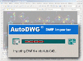
DWF to DWG Converter featured with importing DWF files into editable DWG files, very simple to use. This is Autocad add-in, and request Autocad full to run. Works with Autocad 2012 thru R14. Features highlight: Supports the new DWF v6.0 multi page specification; All DWF elements generated by Autocad "plot to DWF" are supported, including true type fonts,...
Category: Multimedia & Design / Graphics Viewers
Publisher: AutoDWG, License: Shareware, Price: USD $120.00, File Size: 4.6 MB
Platform: Windows
3DM Import for Autocad is a Rhinoceros® 3DM file import plug-in for Autocad®. This plug-in gives Autocad the ability to import geometric data from 3DM files. 3DM Import for Autocad offers seamless conversion of 3DM geometry to Autocad's DWG geometry. The integrity of layers, blocks, block instances or inserts, dimensions, etc. are maintained across the...
Category: Multimedia & Design
Publisher: SYCODE, License: Commercial, Price: USD $195.00, File Size: 3.3 MB
Platform: Windows
Shareware
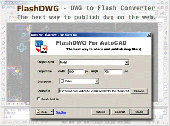
FlashDWG is a DWG to Flash converter. Converting dwg to flash(Autocad to Flash, dwg to swf) is the best way to share and publish Autocad DWG files, better than PDF, better than DWF.no need of additional viewer or plug-in to view flash. FlashDWG is a vector to vector converter, so you can zoom in, zoom out the drawing to see the details of the drawing. FlashDWG is an...
Category: Multimedia & Design / Graphics Viewers
Publisher: AutoDWG, License: Shareware, Price: USD $198.00, File Size: 3.1 MB
Platform: Windows