Free Downloads: Terrain Dxf
Terrain Generator Terrain Generator allows you to generate terrain for specific games.
Terrain Generator Terrain Generator allows you to generate Terrain for specific games. You can specify almost everything when it's about creating a Terrain which then later can be used aside textures for a beautiful product. The program can export to different file formats for easy integration.
Category: Games / Tools & Editors
Publisher: Ryan Gregg, License: Freeware, Price: USD $0.00, File Size: 522.8 KB
Platform: Windows
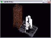
In FastTerrain you are able to create, edit and visualize in 3D space digital terrain models.
In FastTerrain you are able to create, edit and visualize in 3D space digital Terrain models. The program includes functionalities for break-lines and holes insertion as well as volume calculations and contours lines creation. With FastTerrain you can estimate excavation volumes by using digital Terrain models (DTMs). Perfect choice for Civil Engineers, Surveyors, Architects in...
Category: Multimedia & Design / Image Editing
Publisher: Diolkos3D, License: Freeware, Price: USD $0.00, File Size: 30.4 MB
Platform: Windows
Terrain for Rhino is a terrain modeling plug-in for Rhinoceros (commonly known as Rhino).
Terrain for Rhino is a Terrain modeling plug-in for Rhinoceros (commonly known as Rhino). This plug-in gives Rhino the ability to create a Terrain mesh from a set of unordered points. The Terrain mesh is created as a Delaunay Triangulation, which is regarded as the best method to create a Terrain mesh from unorganized point data. Terrain for Rhino is...
Category: Multimedia & Design / Multimedia App's
Publisher: SYCODE, License: Commercial, Price: USD $95.00, File Size: 2.2 MB
Platform: Windows
Terrain for AutoCAD is a terrain modeling plug-in for AutoCAD.
Terrain for AutoCAD is a Terrain modeling plug-in for AutoCAD. This plug-in gives AutoCAD the ability to create a Terrain mesh from a set of unordered points, lines, polylines and splines. The Terrain mesh is created as a Delaunay Triangulation, which is regarded as the best method to create a Terrain mesh from unorganized point data. Terrain for...
Category: Multimedia & Design / Multimedia App's
Publisher: SYCODE, License: Commercial, Price: USD $195.00, File Size: 2.6 MB
Platform: Windows
With this FREE AutoCAD add-on you can create Terrain sections
from geodetic points(heights) in the drawing. You can also
specify position of pipe(cable, road, ...) or set auxiliary
marks in the section.
Text settings, scale in X,Y axis, height of the reference
plane and type of the Terrain section can be set at start-up.
There are two ways how you can create...
Category: Multimedia & Design / Multimedia App's
Publisher: Cadhedral, License: Freeware, Price: USD $0.00, File Size: 69.0 KB
Platform: Windows
DXF Exporter allows programmers to create DXF files as easy as possible.
Dxf Exporter allows programmers to create Dxf files as easy as possible. All you need is to draw image using Windows GDI functions onto Dxf Exporter?s DC or make a metafile and give it to the Exporter. Dxf Exporter reads Windows Metafile structure and makes Dxf file automatically. Hatches supported. Demo available.
Category: Software Development / Compilers & Interpreters
Publisher: Soft Gold Ltd, License: Shareware, Price: USD $190.00, File Size: 356.0 KB
Platform: Windows
While the Terrain that ships out-of-the-box with FSX is much-improved over previous versions, the newly-enhanced Terrain engine still leaves much vacant capabilities to fill. So FSGenesis has bumped it up a notch, filling those capabilities while providing our most accurate and detailed Terrain yet, taking advantage of the efficiency of the new all-LODs-in-one-file format...
Category: Home & Education / Miscellaneous
Publisher: FSGenesis, License: Freeware, Price: USD $0.00, File Size: 28.0 MB
Platform: Windows
DXF Reader is a free software that mainly deals with reading a DXF file.
Dxf Reader is a free software that mainly deals with reading a Dxf file.The data is extracted from the Dxf file and interpreted and then necessary methods of the viewer are called and the result is shown on the screen. The application is an MDI application. You can open multiple Dxf files for viewing.
Category: Software Development / Misc. Programming
Publisher: Evren Daglioglu, License: Freeware, Price: USD $0.00, File Size: 11.9 KB
Platform: Windows
DWG to Dxf Converter is a batch DWG and Dxf bi-directional converter that allows you to convert DWG to Dxf, Dxf to DWG without the need of AutoCAD.It supports AutoCAD version R9 to latest version AutoCAD 2007.
Category: Multimedia & Design
Publisher: DwgConverter, License: Shareware, Price: USD $29.95, File Size: 3.2 MB
Platform: Windows
Dxf 3D .NET library with following features:
- Imports ascii and binary Dxf files (Dxf versions 12, 13 and 14).
- Exports ascii and binary Dxf files (Dxf versions 12, 13 and 14) from code.
- Views ascii and binary Dxf files (3D wire frames drawn with GDI+).
- Utility class for export to .bmp/.jpeg/.png/.tiff/.gif.
- Both 2D and 3D are...
Category: Software Development / Components & Libraries
Publisher: Wout Ware, License: Shareware, Price: USD $475.00, File Size: 1.5 MB
Platform: Windows
Introducing you AEC Terrain interface which is designed to simplify Terrain management and 3D-modeling. AEC Terrain creates Digital Elevation Model from multiple input point files on AutoCAD graphic editor. All purpose multi-level pads, road alignments, mining applications and airfields can be generated on the Terrain on different layers with different slope...
Category: Business & Finance / Project Management
Publisher: AEC Logic Private Limited, License: Shareware, Price: USD $750.00, File Size: 16.3 MB
Platform: Windows
 Shareware
Google Maps Terrain Downloader is a tool that can automatically download the google Terrain maps images to your PC. It can download the small tiles and save them to your hard disk. After downloading, you can view the maps offline by its tool Maps Viewer, or you can combine the small images into one big map image. If you want to make a map of your city by yourself, it is very...
Category: Internet / Download Managers
Publisher: allmapsoft.com, License: Shareware, Price: USD $29.99, File Size: 305.3 MB
Platform: Windows
Shareware
PDF to Dxf Converter Converter has many functions which can make the conversion fast and accurately. Features of PDF to Dxf Converter: 1.Made in the Windows system, so it suppots all the Windows systems. 2.Support output file formats: Dxf R9/10/12/13/14/15/18/21, DWG R12/13/14/15/18/21. 3.Input file formats:all versions of the Adobe PDF specification, from PDF 1.1...
Category: Business & Finance / Business Finance
Publisher: VeryPDF.com Inc, License: Shareware, Price: USD $59.95, AED100, File Size: 9.2 MB
Platform: Windows
A batch DWG/DXF bi-directional converter as well as a version file converter.
A batch DWG/Dxf bi-directional converter as well as a version file converter. It converts DWG to Dxf, Dxf to DWG, DWG to DWG and Dxf to Dxf without the need of AutoCAD. Command line option supports. Easy to use explorer like interface. Supported Dwg R10 ~ R2005 formats.
Category: Multimedia & Design / Multimedia App's
Publisher: Etecad, License: Shareware, Price: USD $39.00, File Size: 1.8 MB
Platform: Windows
Terrain Tools - Create maps quickly and easily!
Terrain Tools - Create maps quickly and easily!
Terrain Tools is the ideal tool for outdoor recreationists, real-estate professionals, farmers, ecologists, archaeologists and others who need to create basic maps, calculate areas, lengths, bearings and distances.
Overlay GPS tracks on scanned images such as USGS or Canadian NTS topos. Import and export...
Category: Business & Finance / Applications
Publisher: Softree, License: Shareware, Price: USD $124.00, File Size: 15.0 MB
Platform: Windows
Easily convert PDF to DXF for editing in CAD.
Easily convert PDF to Dxf for editing in CAD. Aide PDF to Dxf is a powerful windows program that will help you convert your PDF files to usable and editable Dxf files quickly and easily. Features: 1. Convert thousands of PDF files to Dxf files in one easy step. 2. Batch convert all pages in each PDF file. 3. Extract embedded raster images from PDF files. 4. Import...
Category: Multimedia & Design / Multimedia App's
Publisher: Convert PDF to DXF, License: Shareware, Price: USD $180.00, File Size: 2.2 MB
Platform: Windows
Easily convert PDF to DXF for editing in CAD.
Easily convert PDF to Dxf for editing in CAD. Aide PDF to Dxf is a powerful windows program that will help you convert your PDF files to usable and editable Dxf files quickly and easily.
Features:
1. Convert thousands of PDF files to Dxf files in one easy step.
2. Batch convert all pages in each PDF file.
3. Extract embedded raster images from PDF...
Category: Multimedia & Design / Multimedia App's
Publisher: Convert PDF to DXF, License: Shareware, Price: USD $180.00, File Size: 2.2 MB
Platform: Windows
Oriantica is the new generation orienteering simulation software.
Oriantica is the new generation orienteering simulation software. Using a map and a compass you have to find your way through the Terrain to locate the controls as fast as possible.
In Oriantica it is possible to compete with other players over a network, or play against the computer.
The map and Terrain is much more flexible than in previous versions, with more...
Category: Games / Misc. Games
Publisher: Melin Software HB, License: Shareware, Price: USD $39.00, File Size: 16.5 MB
Platform: Windows
DWG Dxf Converter is a bi-directional DWG Dxf batch converter without AutoCAD! Features: Convert from DWG to Dxf. Convert from Dxf to DWG. Batch conversion. Support AutoCAD version from R9 to 2016. Stand-alone utility - AutoCAD NOT required. Easy to use DWG DFX Converter can convert DWG files to DFX and vice versa, singly or in batches, without having to use...
Category: Multimedia & Design / Graphics Viewers
Publisher: 3nity Softwares, License: Shareware, Price: USD $74.00, File Size: 1.5 MB
Platform: Windows
Fast DWG Dxf Converter is a software to convert between AutoCAD DWG, Dxf file formats without the need of AutoCAD. Key features: + Convert from DWG to Dxf, DWG + Convert from Dxf to DWG, Dxf + Support AutoCAD version R9, R10, R12, R13, R14 and from 2000 to 2016 + Stand-alone utility - AutoCAD IS NOT required + Ultra fast conversion using...
Category: Multimedia & Design / Graphics Viewers
Publisher: Fast DWG DXF Converter, License: Shareware, Price: USD $49.00, File Size: 9.7 MB
Platform: Windows, Mac, Linux,
SC3K Map Editor is the fastest and most accurate Terrain editor currently available for SimCity 3000. It gives you the finest possible control over modifications to your Terrain.
With SC3K Map Editor you can use an interface very similar to that given by SimCity 3000 so that you can see exactly what your Terrain will look like as you create it.
Also you...
Category: Games / Tools & Editors
Publisher: Tenermerx Software, License: Freeware, Price: USD $0.00, File Size: 990.5 KB
Platform: Windows
Convert any to any among DXF, DWG, DXF without the need for AutoCAD.
Convert any to any among Dxf, DWG, Dxf without the need for AutoCAD. Upgrade or downgrade Dxf, DWG, Dxf versions click a few mouse clicks!
Easy CAD Converter is more than a file format converter, and you can even upgrade or downgrade your DWG, Dxf, DWF drawing files to a newer or earlier version to answer your specific needs, such as for better...
Category: Multimedia & Design / Media Management
Publisher: Benzsoft Corporation, License: Shareware, Price: USD $89.00, File Size: 2.8 MB
Platform: Windows
FSGenesis is your one-stop supplier for top-quality terrain mesh products for FS2004 and FSX.
FSGenesis is your one-stop supplier for top-quality Terrain mesh products for FS2004 and FSX. Since 1996 we have provided the world-wide flight simulator community with high-quality products at a low price. If you're looking for Terrain mesh for Microsoft Flight Simulator, look no further.
Category: Games / Simulations
Publisher: FSGenesis, License: Freeware, Price: USD $0.00, File Size: 116.0 MB
Platform: Windows
Demo
Dxf Works is an application that allows to extract coordinates and other various data from Dxf files. You can choose which entities to process and which data to extract, creating your own file format. Dxf Works can process several files at one time and lets save your settings in reusable configuration files. Dxf Works can be used for several purposes : extracting...
Category: Multimedia & Design / Graphics Viewers
Publisher: DeliCAD, License: Demo, Price: USD $49.00, EUR49, File Size: 783.4 KB
Platform: Windows
BackToCad Converter is an easy-to-use and powerful converter.
BackToCad Converter is an easy-to-use and powerful converter. It can convert PDF to DWG or Dxf, TIFF to DWG or Dxf, JPEG to DWG or Dxf, PLT to DWG or Dxf, EPS to DWG or Dxf. It supports vectorization of raster pictures. The application supports the multi-language feature.
Category: Multimedia & Design / Media Management
Publisher: Kazmierczak Software, License: Shareware, Price: USD $0.00, File Size: 0
Platform: Windows