Free Downloads: Terrain Obj
Terrain Generator Terrain Generator allows you to generate terrain for specific games.
Terrain Generator Terrain Generator allows you to generate Terrain for specific games. You can specify almost everything when it's about creating a Terrain which then later can be used aside textures for a beautiful product. The program can export to different file formats for easy integration.
Category: Games / Tools & Editors
Publisher: Ryan Gregg, License: Freeware, Price: USD $0.00, File Size: 522.8 KB
Platform: Windows
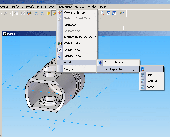
Obj Export for Solid Edge is a Wavefront (.Obj) file export add-in for Solid Edge®. This add-in gives Solid Edge the ability to export 3D solid and surface data from a Solid Edge part or assembly document to 3d polygon meshes in an Obj file. Obj Export for Solid Edge tessellates solid bodies in a Solid Edge document into a set of triangular meshes. These meshes...
Category: Multimedia & Design
Publisher: SYCODE, License: Commercial, Price: USD $195.00, File Size: 1.2 MB
Platform: Windows
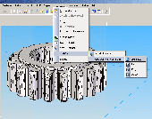
Obj Import for Solid Edge is a Wavefront (.Obj) file import add-in for Solid Edge®. This plug-in gives Solid Edge the ability to import geometric data from Obj files. Obj Import for Solid Edge reads polygon mesh data stored in Obj files and imports it into Solid Edge. A polygon mesh in an Obj file is comprised of a set of triangular and/or quad...
Category: Multimedia & Design
Publisher: SYCODE, License: Commercial, Price: USD $195.00, File Size: 1.3 MB
Platform: Windows
Terrain for Rhino is a terrain modeling plug-in for Rhinoceros (commonly known as Rhino).
Terrain for Rhino is a Terrain modeling plug-in for Rhinoceros (commonly known as Rhino). This plug-in gives Rhino the ability to create a Terrain mesh from a set of unordered points. The Terrain mesh is created as a Delaunay Triangulation, which is regarded as the best method to create a Terrain mesh from unorganized point data. Terrain for Rhino is...
Category: Multimedia & Design / Multimedia App's
Publisher: SYCODE, License: Commercial, Price: USD $95.00, File Size: 2.2 MB
Platform: Windows
Terrain for AutoCAD is a terrain modeling plug-in for AutoCAD.
Terrain for AutoCAD is a Terrain modeling plug-in for AutoCAD. This plug-in gives AutoCAD the ability to create a Terrain mesh from a set of unordered points, lines, polylines and splines. The Terrain mesh is created as a Delaunay Triangulation, which is regarded as the best method to create a Terrain mesh from unorganized point data. Terrain for...
Category: Multimedia & Design / Multimedia App's
Publisher: SYCODE, License: Commercial, Price: USD $195.00, File Size: 2.6 MB
Platform: Windows
This little software allows you to double-click and see the obj files on your hard drive.
This little software allows you to double-click and see the Obj files on your hard drive. It also loads the material information, if the Obj file specifies a mtl file, as well as tga textures. It supports different drawing and lighting modes including fragment lighting, if your graphics card supports fragment shaders.
Category: Multimedia & Design / Graphics Viewers
Publisher: Cem Yuksel, License: Freeware, Price: USD $0.00, File Size: 1019.2 KB
Platform: Windows
With this FREE AutoCAD add-on you can create Terrain sections
from geodetic points(heights) in the drawing. You can also
specify position of pipe(cable, road, ...) or set auxiliary
marks in the section.
Text settings, scale in X,Y axis, height of the reference
plane and type of the Terrain section can be set at start-up.
There are two ways how you can create...
Category: Multimedia & Design / Multimedia App's
Publisher: Cadhedral, License: Freeware, Price: USD $0.00, File Size: 69.0 KB
Platform: Windows
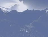
EarthSculptor is a realtime Terrain height-map editor and paint program featuring an easy to use interface designed
exclusively for rapid development of 3D landscapes for visualization, multimedia and game development.
Features:
- Fast 3D hardware accelerated Terrain rendering
- Automatic lighting and shadow map rendering
- High resolution Light,...
Category: Multimedia & Design / Image Editing
Publisher: Ernest Szoka, License: Shareware, Price: USD $49.00, File Size: 10.5 MB
Platform: Windows
Luuv is a plugin that enables import and export of Wavefront .
Luuv is a plugin that enables import and export of Wavefront .Obj files and their corresponding .MTL files directly from trueSpace. If your workflow uses .Obj files there should be no need to use external translation programs.
The Wavefront .Obj file format is nice for this because it does not require the model to be triangulated - perfect for UV mapping sub-division...
Category: Home & Education / Miscellaneous
Publisher: Clinton Grant, License: Freeware, Price: USD $0.00, File Size: 513.2 KB
Platform: Windows
Panorama is a terrain or landscape editor, where beautiful multitextured landscapes are made easy.
Panorama is a Terrain or landscape editor, where beautiful multitextured landscapes are made easy. Landscapes can be created, painted, lightmapped and exported. The program features: Easy to use windows interface Create nice looking terrains in no time Up to 8x8 64x64 segments terrains (huge terrains) Currently exports to Blitz3D (.b3d), Directx (.x) and Wavefront (.Obj) formats...
Category: Games / Tools & Editors
Publisher: Jeppe Nielsen, License: Shareware, Price: USD $24.00, File Size: 4.6 MB
Platform: Windows
While the Terrain that ships out-of-the-box with FSX is much-improved over previous versions, the newly-enhanced Terrain engine still leaves much vacant capabilities to fill. So FSGenesis has bumped it up a notch, filling those capabilities while providing our most accurate and detailed Terrain yet, taking advantage of the efficiency of the new all-LODs-in-one-file format...
Category: Home & Education / Miscellaneous
Publisher: FSGenesis, License: Freeware, Price: USD $0.00, File Size: 28.0 MB
Platform: Windows
LdrDat2Obj - a Windows program written by Rolf Redford that can be used to convert LDraw models into Alias|Wavefront Obj files.
Obj have much more support for textures and alpha so clear/transparent pieces are possible without having to set colors again like with dxf format. I will note differences between dxf and Obj export when needed.
Category: Multimedia & Design / Media Management
Publisher: Rolf, License: Freeware, Price: USD $0.00, File Size: 122.5 KB
Platform: Windows
Introducing you AEC Terrain interface which is designed to simplify Terrain management and 3D-modeling. AEC Terrain creates Digital Elevation Model from multiple input point files on AutoCAD graphic editor. All purpose multi-level pads, road alignments, mining applications and airfields can be generated on the Terrain on different layers with different slope...
Category: Business & Finance / Project Management
Publisher: AEC Logic Private Limited, License: Shareware, Price: USD $750.00, File Size: 16.3 MB
Platform: Windows
 Shareware
Google Maps Terrain Downloader is a tool that can automatically download the google Terrain maps images to your PC. It can download the small tiles and save them to your hard disk. After downloading, you can view the maps offline by its tool Maps Viewer, or you can combine the small images into one big map image. If you want to make a map of your city by yourself, it is very...
Category: Internet / Download Managers
Publisher: allmapsoft.com, License: Shareware, Price: USD $29.99, File Size: 305.3 MB
Platform: Windows
Terrain Tools - Create maps quickly and easily!
Terrain Tools - Create maps quickly and easily!
Terrain Tools is the ideal tool for outdoor recreationists, real-estate professionals, farmers, ecologists, archaeologists and others who need to create basic maps, calculate areas, lengths, bearings and distances.
Overlay GPS tracks on scanned images such as USGS or Canadian NTS topos. Import and export...
Category: Business & Finance / Applications
Publisher: Softree, License: Shareware, Price: USD $124.00, File Size: 15.0 MB
Platform: Windows
Oriantica is the new generation orienteering simulation software.
Oriantica is the new generation orienteering simulation software. Using a map and a compass you have to find your way through the Terrain to locate the controls as fast as possible.
In Oriantica it is possible to compete with other players over a network, or play against the computer.
The map and Terrain is much more flexible than in previous versions, with more...
Category: Games / Misc. Games
Publisher: Melin Software HB, License: Shareware, Price: USD $39.00, File Size: 16.5 MB
Platform: Windows
SC3K Map Editor is the fastest and most accurate Terrain editor currently available for SimCity 3000. It gives you the finest possible control over modifications to your Terrain.
With SC3K Map Editor you can use an interface very similar to that given by SimCity 3000 so that you can see exactly what your Terrain will look like as you create it.
Also you...
Category: Games / Tools & Editors
Publisher: Tenermerx Software, License: Freeware, Price: USD $0.00, File Size: 990.5 KB
Platform: Windows
FSGenesis is your one-stop supplier for top-quality terrain mesh products for FS2004 and FSX.
FSGenesis is your one-stop supplier for top-quality Terrain mesh products for FS2004 and FSX. Since 1996 we have provided the world-wide flight simulator community with high-quality products at a low price. If you're looking for Terrain mesh for Microsoft Flight Simulator, look no further.
Category: Games / Simulations
Publisher: FSGenesis, License: Freeware, Price: USD $0.00, File Size: 116.0 MB
Platform: Windows
The com component will quickly tell you how much disk space a folder is taking up, this also includes subfolders under the root folder, ideal for web sites that serve document/image content.
Example .asp code included
simple ASP example of usage:-
Set Obj = Server.CreateObject("GETFOLDERSIZE.GetSize.1")
dim sz, files, folders
sz =...
Category: Software Development / Components & Libraries
Publisher: Traction Software, License: Shareware, Price: USD $49.95, File Size: 933.0 KB
Platform: Windows
Creeper World 2 thrusts you into the 14th millennium fighting an enemy that flows and oozes through the Terrain. Employ advanced weapons, gravity manipulating repulsors, wormhole like rifts, and your own wit against this never yielding enemy.
Excavate Terrain, unearth techs, crystals, remnants and other artifacts. Face a new mechanical enemy that employs gravity manipulation...
Category: Games / Kids
Publisher: Knuckle Cracker, LLC, License: Shareware, Price: USD $9.95, File Size: 30.1 MB
Platform: Windows

Visual Terrain Maker is a 3D-Modeling program allows visually create landscapes (maps) for games or other purposes. Works in XP/NT/2k. The program can export to Direct X file format(*.x). The program is not critical to the video adapters and drivers. Suitable for Dark Basic developers. No special software and hardware required (just OpenGL v1.1). Visual Terrain Maker can export to...
Category: Multimedia & Design
Publisher: UNGSoft Developers Group, License: Freeware, Price: USD $0.00, File Size: 321.2 KB
Platform: Windows
Freeworld3D 2.4 is a fully interactive real-time 3D Terrain editor and world editor specifically designed for game development. FreeWorld3D gives you the ability to produce complete 3D Terrain, worlds and environments in a matter of no time. FreeWorld3D's ease of use and intuitive interface makes it extremely easy to use.
Category: Games / Tools & Editors
Publisher: Pariman, License: Freeware, Price: USD $0.00, File Size: 5.2 MB
Platform: Windows
JointMetriX3D is an innovative system for measuring and assessing rock and Terrain surfaces used in geotechnics, engineering geology, and surveying. It delivers outstanding detailed 3D images and provides 3D software for getting measurements.
The system has significant influence on safety when applied in tunnelling, mining, Terrain assessments, or various documentation...
Category: Software Development / Help File Utilities
Publisher: 3GSM, License: Demo, Price: USD $0.00, File Size: 2.3 KB
Platform: Windows
Overview of Purpose: T.Ed is a complete solution for making huge outdoor worlds: The technique behind designing and using Terrain objects can be a minefield of choices, as there are so many different ways of doing it! T.Ed is designed primarily for games programmers and 3D artists to make those choices easier. There are 2 main categories regarding terrains in games, 'Mesh' and...
Category: Multimedia & Design
Publisher: D-Grafix, License: Freeware, Price: USD $0.00, File Size: 7.6 MB
Platform: Windows
Freeware
Spin 3D Mesh Converter Software Fre can convert STL, 3DP, 3MF, OBJ and PLY 3D file formats.
Spin 3D Converter Software Free is an easy to use 3D file converter. Spin 3D Mesh Converter Software can convert STL, 3DP, 3MF, Obj and PLY 3D file formats. Convert 3D files within minutes of downloading. Fast and easy one-click file conversion process. Quickly convert multiple files with batch conversion. Spin 3D features: * Supported file formats: STL, 3DP, 3MF, Obj,...
Category: Multimedia & Design / Graphics Viewers
Publisher: NCH Software, License: Freeware, Price: USD $0.00, File Size: 1.1 MB
Platform: Windows