Free Downloads: Tomtom Radar Map
Holdem Radar is an award winning FREEWARE No Limit Texas Hold'em Winning Strategy Calculator.
Holdem Radar is an award winning FREEWARE No Limit Texas Hold'em Winning Strategy Calculator.
It automatically analyzes your cards and your opponent's moves while you play and provides you with wealth of information and accurate poker strategy advice in real time based on exact odds calculation.
Use Holdem Radar to gain a competitive advantage...
Category: Games / Cards, Casino, Lottery
Publisher: HoldemRadar, License: Freeware, Price: USD $0.00, File Size: 62.0 KB
Platform: Windows
FlightSim Commander is a professional flight planner, GPS, Moving Map and navigation tool for Flight Simulator 2004 and Flight Simulator X. Plan a flight professionally using entire routes or route segments. Insert North Atlantic Tracks, PACOTs and SID´s and STAR´s. Save or convert your flight plans in various formats such as FSX, PMDG, Radar Contact, Sqawk Box, IVAO...
Category: Games / Simulations
Publisher: aerosoft, License: Shareware, Price: USD $0.00, File Size: 0
Platform: Windows
 Freeware
AirGrab WiFi Radar is a tool to display information about Apple Airport base stations and other WiFi (802.11b/g/n) wireless access points. Using AirGrab WiFi Radar you can determine most popular WiFi channels and select optimal channel for your WiFi network. Signal level and Noise level helps to diagnose common wireless network problems and optimally position your base station and...
Category: Internet / Monitoring
Publisher: AirGrab, License: Freeware, Price: USD $0.00, File Size: 3.1 MB
Platform: Mac
Trade-Radar Stock Inspector evaluates a total of 40 indicators and flashes a simple go/no-go/caution signal for each one. See at a glance whether a stock is over-valued, whether it's in a down-trend or an up-trend or whether a reversal may be playing out.
Category: Business & Finance / Vertical Markets
Publisher: Trade-Radar, License: Shareware, Price: USD $39.35, File Size: 21.8 MB
Platform: Windows
Why pay for WIFI on the go? Easy WiFi Radar helps you to find and connect to open wireless access points with a single mouseclick. Connect to free hotspots without the hassle. It's WiFi for Dummies. And it has the coolest design. WiFi is everywhere. There are paid hotspots, but also an growing number of free access points. This software helps you get your mail and browse the web...
Category: Internet / Tools & Utilities
Publisher: Makayama Interactive, License: Shareware, Price: USD $19.95, File Size: 2.1 MB
Platform: Unknown
Main Features:
- 3D and 2D Map based user interface
- Units are individual, section, or platoon/battery sized units
- Click on the 3D Map to issue unit movement waypoints
- Multiple players over LAN and Internet, each controlling specific forces
- Real time with 30 second time steps, time compression adjustable up to x1,000
- Detailed...
Category: Games / Strategy & War
Publisher: Historical Software Corporation, License: Freeware, Price: USD $0.00, File Size: 173.0 MB
Platform: Windows
Basestation application provides an on-screen virtual radar display.
Basestation application provides an on-screen virtual Radar display. This powerful application provides functionality including identification of aircraft by callsign, altitude, speed and other parameters where such information is transmitted. All flights and sessions are recorded in a database, which can be separately browsed (and reported on) by a new application, the BaseStation...
Category: Business & Finance / Business Finance
Publisher: Kinetic Avionics Products Ltd, License: Freeware, Price: USD $0.00, File Size: 24.8 MB
Platform: Windows
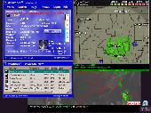
This is a cool, shareware weather program that sits in your system tray and keeps you posted of current weather conditions, forecasts, Warnings/Advisories, hundreds of Satellite and Radar images - including State level Radar, Weather Cams, Worldwide locations, 1-day, 2-day, 10-Day, 3 Month and 12 Month Outlooks, USDA, Forecast images, Population/Census information, and much more!...
Category: Internet / Tools & Utilities
Publisher: Kelly Software, License: Shareware, Price: USD $18.00, File Size: 4.7 MB
Platform: Unknown
This little program displays LIVE radar images from a different number of countries.
This little program displays LIVE Radar images from a different number of countries. The way of viewing is provided by the included VNC VIEWER software. The program is simple to use: you just click those 1st three buttons and you're ready to go. In a couple of seconds you'll see live streaming
Category: Utilities / Misc. Utilities
Publisher: Hakkie, License: Freeware, Price: USD $0.00, File Size: 1.6 MB
Platform: Windows
Remere's Map Editor is a map editor for the OpenTibia Project which was created by Remere.
Remere's Map Editor is a Map editor for the OpenTibia Project which was created by Remere.
Remere's Map Editor is a Map editor coded in C to be used with OpenTibia. It supports many advanced features such as autobordering and placing of composite objects. Runs under both Linux and Windows using wxWidgets and OpenGL.
Category: Games / Tools & Editors
Publisher: Remere, License: Shareware, Price: USD $0.00, File Size: 4.2 MB
Platform: Windows
vSTARS is an air traffic control radar simulation program for use on the VATSIM network.
vSTARS is an air traffic control Radar simulation program for use on the VATSIM network. It is a high-fidelity simulation of the real ATC system used in many approach control facilities in the United States.
vSTARS aims to be a high-fidelity simulation of the real-world STARS system. Technical limitations of the VATSIM infrastructure limit the number of real-world STARS features...
Category: Business & Finance / Applications
Publisher: Metacraft, License: Freeware, Price: USD $0.00, File Size: 5.3 MB
Platform: Windows
StormLab is the FIRST publicly available software to take advantage of the full National Weather Service Doppler Radar imagery suite. StormLab turns any internet connection into a unique and comprehensive display system for National Weather Service Doppler radars.
With access to over 150 Radar sites across the entire US, you will have instant access to nearly 2 dozen...
Category: Business & Finance / Applications
Publisher: Storm Alert Inc., License: Shareware, Price: USD $75.00, File Size: 14.4 MB
Platform: Windows
Freeware
An interactive Flash USA Map with all the features you need for your web site or project. This is the ideal solution for dealer maps, real-estate listings, or visualizing state statistics. Nearly every aspect of the Map is customizable. However, unlike competing products, our Map is very simple to install and edit. Just upload XML and SWF files and embed.
Category: Internet / Flash Tools
Publisher: http://www.flashusamap.com/trial/flashus, License: Freeware, Price: USD $0.00, File Size: 93.8 KB
Platform: Unknown
Map of Africa is one of the many maps created for GPS TrackMaker.
Map of Africa is one of the many maps created for GPS TrackMaker. You are able to download the installation package from the TrackMaker website. In order to preview the contents of this package, you need to install GPS TrackMaker.
Using the above mentioned application, you will be able to see the Map of Africa. Just click on the "Open Temporary...
Category: Home & Education / Miscellaneous
Publisher: Geo Studio Technology, License: Freeware, Price: USD $0.00, File Size: 18.3 MB
Platform: Windows
A photo slideshow screen saver with beautiful NASA/JPL Radar images of cities and places around the world. The false-color palettes used in these images make them beautiful to look at as well as interesting to study. All photos are 800x600 high-quality images(a 1024x768 version is also available, see our web site). Cities included in this Lite version are:- New Orleans- New York- Hong...
Category: Desktop Enhancements / Screensavers
Publisher: Cottonwood Software, License: Shareware, Price: USD $9.95, File Size: 1.5 MB
Platform: Windows
The Virtual CHILL, or VCHILL system allows remote users to display data both from the CHILL archives as well as from realtime operations. Users with sufficient permissions may even control the Radar operation.
The Java VCHILL display client software is a cross-platform tool to allow Radar access from a variety of computer systems running various operating systems....
Category: Business & Finance / Business Finance
Publisher: Colorado State University, License: Freeware, Price: USD $0.00, File Size: 1.3 KB
Platform: Windows
Free Wallpaper Radar (WallRadar) is a small and easy-to-use tool to change your wallpaper, with the distinguished character that it can download new wallpapers from Internet automatically every day!
Wallradar has the following features:
Automatically download new wallpapers from Internet without opening web browser(No virus! No Pop-up ads!).
Create collections...
Category: Desktop Enhancements / Skins
Publisher: wallradar.com, License: Shareware, Price: USD $19.95, File Size: 1.4 MB
Platform: Windows
FREE Definitive Desktop Weather Manager with hourly weather updates, daily, weekend and extended weather forecasts, dopplar Radar and forecast maps. Store multiple cities with detailed weather conditions. Condtions available via system tray ToolTip. Weather history records weather conditions for reference. Radar display includes optional animation. Friendly and customizable user...
Category: Utilities / Network
Publisher: TPA Software, License: Freeware, Price: USD $0.00, File Size: 6.2 MB
Platform: Windows
Program shows you an actual X3 sector-map, with detailed information about most in-game objects.
Program shows you an actual X3 sector-Map, with detailed information about most in-game objects. The Map is based on a log-file that is created with an in-game script (by Andrei[<>Ace]). If you just want to view the standard Map (or if you don’t have the game) the program will work with the included default Map, which was created with an English X3 game...
Category: Games / Misc. Games
Publisher: SUU Design, License: Freeware, Price: USD $0.00, File Size: 1.4 MB
Platform: Windows
New Zealand Map Reference Converter (NZMapConv) is software that LINZ provides to convert Map references between the old NZMS260 Map series and the new NZTopo50 Map series.NZMapConv is a Windows programme designed to convert individual coordinates entered manually.
Category: Multimedia & Design / Media Management
Publisher: Land Information New Zealand, License: Freeware, Price: USD $0.00, File Size: 2.4 MB
Platform: Windows
When the XMAP software is communicating with an XEDE via the comms cable each Map will show, at the top of the Map display, an RPM and load value (x and y axis for the Map) in real time. Also in each Map a yellow highlighted block will show the current position within the Map. Beside the real-time display on each Map are the undo and redo buttons which...
Category: Home & Education / Miscellaneous
Publisher: ChipTorque, License: Freeware, Price: USD $0.00, File Size: 1.7 MB
Platform: Windows
Sig Panama Has :
Digital maps of Panama, Digital Map of Panama-City, digital Map of Taboga, digital Map of Bocas del Toro, digital Map of Colon and Free Zone, digital Map of Contadora Island, digital Map of Coronado, Panama, Zona Libre, Map of Panama, Map of Panama City, Map of Colon, Map of Zona Libre, Map of...
Category: Internet / Misc. Plugins
Publisher: DP Imperial, LLC., License: Freeware, Price: USD $0.00, File Size: 44.9 MB
Platform: Windows
MyRouteOnline is an easy to use route planner that that allows you to plan routes from Excel spreadsheet. Excel Add-in that uploads addresses and saves time, fuel and money by helping you Map multiple locations and find the best route. Online route planning goes far beyond paper maps or a GPS system, it is the only way to find the optimal route for your needs, giving your business a...
Category: Business & Finance / Business Finance
Publisher: MyRouteOnline, License: Freeware, Price: USD $0.00, File Size: 3.1 MB
Platform: Windows
This program works 'under the radar' and programs your mind for immense success.
This program works 'under the Radar' and programs your mind for immense success. It is really easy to install and use it, there is no effort needed from the user, it works with any of the windows operative systems. It sends positive subliminal messages to the brain, so the users will attract success into their lives.
Category: Home & Education / Miscellaneous
Publisher: VXite Inc., License: Freeware, Price: USD $0.00, File Size: 1.5 MB
Platform: Windows
Freeware
Arm Map Explorer recreates all the functionalities of Google Maps on your desktop while expanding them with new extras. Map Explorer lets you locate and view any place on the planet using dynamic interactive maps. These maps are draggable, which means there is no need for you to click and wait for graphics to reload each time you want to view adjacent parts of a Map....
Category: Internet / Flash Tools
Publisher: ArmCode, License: Freeware, Price: USD $0.00, File Size: 5.5 MB
Platform: Windows