Free Downloads: Ubuntu Net Map
CodeLite is a powerful open-source, cross platform code editor for the C/C++ programming languages (regulary tested on Windows XP sp2, Ubuntu 7.10 Gutsy Gibbon, Fedora Core 6 and Debian lenny/sid). CodeLite is distributed under the terms of the GPL licens
Category: Software Development / Tools & Editors
Publisher: codelite.org, License: Freeware, Price: USD $0.00, File Size: 12.9 MB
Platform: Windows, Mac, Vista
Program shows you an actual X3 sector-map, with detailed information about most in-game objects.
Program shows you an actual X3 sector-Map, with detailed information about most in-game objects. The Map is based on a log-file that is created with an in-game script (by Andrei[<>Ace]). If you just want to view the standard Map (or if you don’t have the game) the program will work with the included default Map, which was created with an English X3 game...
Category: Games / Misc. Games
Publisher: SUU Design, License: Freeware, Price: USD $0.00, File Size: 1.4 MB
Platform: Windows
New Zealand Map Reference Converter (NZMapConv) is software that LINZ provides to convert Map references between the old NZMS260 Map series and the new NZTopo50 Map series.NZMapConv is a Windows programme designed to convert individual coordinates entered manually.
Category: Multimedia & Design / Media Management
Publisher: Land Information New Zealand, License: Freeware, Price: USD $0.00, File Size: 2.4 MB
Platform: Windows
 Shareware
Offline Map Maker is a tool that help you to get offline tile images from Google Maps, Openstreetmap, Yandex Maps, Yahoo Maps, Mapquest, Gaode Map, Tencent Maps, Baidu Maps, Tianditu, Arcgis Online, OneMap, Whereis, mapy.cz, Mappy, Waze, Sentinel-2 Map, Strava Gloabal Heatmap, Wikimapia, GoMap.Az, Longdo Map, Bhuvan, National Map Australia, New Zealand...
Category: Internet / Download Managers
Publisher: allmapsoft.com, License: Shareware, Price: USD $79.00, File Size: 31.1 MB
Platform: Windows
When the XMAP software is communicating with an XEDE via the comms cable each Map will show, at the top of the Map display, an RPM and load value (x and y axis for the Map) in real time. Also in each Map a yellow highlighted block will show the current position within the Map. Beside the real-time display on each Map are the undo and redo buttons which...
Category: Home & Education / Miscellaneous
Publisher: ChipTorque, License: Freeware, Price: USD $0.00, File Size: 1.7 MB
Platform: Windows
Sig Panama Has :
Digital maps of Panama, Digital Map of Panama-City, digital Map of Taboga, digital Map of Bocas del Toro, digital Map of Colon and Free Zone, digital Map of Contadora Island, digital Map of Coronado, Panama, Zona Libre, Map of Panama, Map of Panama City, Map of Colon, Map of Zona Libre, Map of...
Category: Internet / Misc. Plugins
Publisher: DP Imperial, LLC., License: Freeware, Price: USD $0.00, File Size: 44.9 MB
Platform: Windows
Freeware
Arm Map Explorer recreates all the functionalities of Google Maps on your desktop while expanding them with new extras. Map Explorer lets you locate and view any place on the planet using dynamic interactive maps. These maps are draggable, which means there is no need for you to click and wait for graphics to reload each time you want to view adjacent parts of a Map....
Category: Internet / Flash Tools
Publisher: ArmCode, License: Freeware, Price: USD $0.00, File Size: 5.5 MB
Platform: Windows
Map Suite Winforms Edition is a powerful set of user controls enabling you to build compelling mapping applications. Leveraging Microsoft's .Net framework, our APIs incorporate the latest technology to deliver ease of coding and intuitive streamlined interfaces. Developers using any .Net compatible language (VB.Net, C# ect...) can easily build mapping applications...
Category: Software Development / Misc. Programming
Publisher: Spatially Aware, License: Demo, Price: USD $3995.00, File Size: 9.6 MB
Platform: Windows
Commercial
BarCode .Net offers powerful barcode generator features in a clean and clear Java programming interface. BarCode .Net consists of the following barcode generator components including Barcode .Net for ASP.Net, Barcode .Net for WinForms Control, Barcode.NETfor reporting service, .Net barcoder for crystal reports.
Category: Software Development / Components & Libraries
Publisher: Pefetic.com, License: Commercial, Price: USD $199.00, File Size: 4.0 MB
Platform: Windows
With Geodesy.Net, you can quickly and easily convert geographic coordinates from one system to another. Several hundred coordinate system conversions are supported, and all conversions can be done in under three lines of code. Full support is included for both desktops as well as mobile devices! This software is included FREE with any purchase of our GIS.Net 3.0 mapping component...
Category: Software Development / Components & Libraries
Publisher: GeoFrameworks, LLC, License: Commercial, Price: USD $799.00, File Size: 123.7 MB
Platform: Windows,
Time Zones Map is the flash world time Map featuring the time peculiarities of more then 50 cities all over the world. Its eye-catching but still pleasant design, varied functions and multiple application abilities combine everything the ultra-modern flash world time Map must have. You can put our Time Zone Map either on one of your website?s pages or put a banner,...
Category: Web Authoring / Flash Utilities
Publisher: USFlashMap.com, License: Shareware, Price: USD $249.00, File Size: 45.0 KB
Platform: Windows, Mac, Linux, Unix, MS-DOS, AS, 400
Shareware
GPS SDK to add GPS and coordinate conversion functionality to your software and scripts). All NMEA0183 protocol versions are supported and can be filtered by NMEA sentence type and talker ID. Garmin USB PVT support. Information on GPS status can also be retrieved: GPS fix quality, satellites used in fix, satellites in view, satellite azimuth, elevation and signal strengths. The toolkit also...
Category: Software Development
Publisher: Eye4Software B.V., License: Shareware, Price: USD $99.00, EUR79, File Size: 2.3 MB
Platform: Windows
Shareware
IntelligenceLab is a set of .Net 2.0-4.5 components for Artificial Intelligence. Also includes a visual graphical editor for codeless development. Contains: - Neural Network - Feed forward Neural Network classifier. - Naive Bayes - Naive Bayes classifier. - K Nearest Neighbor - K Nearest Neighbor classifier. - Self Organizing Map - Self Organizing Map...
Category: Software Development / Components: VB
Publisher: Mitov Software, License: Shareware, Price: USD $160.00, File Size: 236.0 MB
Platform: Windows
Nevron Map for SharePoint is an advanced web part for all versions Microsoft SharePoint (WSS3.0, SharePoint 2007, 2010, 2013 and 2016). It is designed to provide an easy and powerful way to create choropleth maps that are tightly integrated with your data. The Map Web Part delivers a great set of features including: - Multiple Map Layers - unlimited number of Map...
Category: Software Development / Components & Libraries
Publisher: Nevron Software LLC, License: Shareware, Price: USD $889.00, File Size: 121.9 MB
Platform: Windows
The easiest way to get a paper map with MapPlot is the Plot Map menu.
The easiest way to get a paper Map with MapPlot is the Plot Map menu.
On the following dialog, simply paper size and scale have to be chosen - the result is ready to be printed directly, edited (e.g. for additional entries) or to be displayed as a preview.
Category: Utilities / Misc. Utilities
Publisher: AGIS GmbH, License: Freeware, Price: USD $0.00, File Size: 5.4 MB
Platform: Windows
Offtype.Net Painter is a fast, fun, free and easy way to create and share your own images online. It allows to draw sketch or road Map, to create graffiti, pixel art, drawing, to paint ecard, handwrite message or note. The resulting image will be saved on the offtype.Net free web server and can be used anywhere on the Web. You can share it in your blog, journal, newsletter,...
Category: Multimedia & Design / Multimedia App's
Publisher: Offtype.Net, License: Freeware, Price: USD $0.00, File Size: 0
Platform: Windows
With LocationWizard you can easily map multiple addresses on a map.
With LocationWizard you can easily Map multiple addresses on a Map. LocationWizard helps you visualize the locations of customers or shops. LocationWizard supports the following database formats: MySQL, PostgreSQL, SQLite, FireBird, InterBase, Microsoft Access, Microsoft Excel and CSV.
Category: Business & Finance / Business Finance
Publisher: Location Wizard team, License: Shareware, Price: USD $85.00, File Size: 7.3 MB
Platform: Windows
OziExplorer3D is an impeccable application for viewing Map images in 3D, along with the options of rotating it in every possible direction, zoom in/out and lots more. The application actually creates grid of heights using the height data that has been obtained and writes it to a file, along with the other required information, loads the file and the Map image or the image section...
Category: Multimedia & Design / Multimedia App's
Publisher: Des Newman, License: Shareware, Price: USD $30.00, File Size: 1.9 MB
Platform: Windows
MiniSipServer is a professional cross-platform VOIP server which can run on Windows system, such as Windows 200x/XP/Vista/Windows7, and Linux/Ubuntu system. miniSipServer is based on SIP standard which is an open standard supported by 3GPP and lots of VOIP manufacturers.
Category: Internet / Misc. Servers
Publisher: MyVoipApp., License: Shareware, Price: USD $89.00, File Size: 9.4 MB
Platform: Windows
Tibia Map Viewer is a useful freeware and Open Source application that allows you to view maps generated by Tibia game client and create or edit Map symbols.
You can view the entire Tibia Map you have explored, both upper and lower levels of the Map, with zoom ratio from 25 to 400 percents. It also allows you to export to BMP file.
Category: Games / Tools & Editors
Publisher: Yury Sidorov, License: Freeware, Price: USD $0.00, File Size: 193.7 KB
Platform: Windows
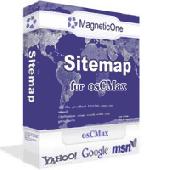
Site Map for osCMax - osCMax Module - is very powerful and flexible module for dynamic site Map generation. With help of this module you will achieve two important goals: 1.your customers always will be able to find correct page on your site without any problem. Your visitors will like your site! 2.Search Engine Optimization. If you will use this module in conjunction with SEO...
Category: Software Development
Publisher: MagneticOne, License: Commercial, Price: USD $39.00, File Size: 70.3 KB
Platform: Windows, Linux, Unix, BEOS
Spinning Gobe Sample demonstrates how to manipulate the navigation, Map style, Map font size, and view of the Map programmatically through the MapPoint ActiveX Control. Using this simple Visual Basic project, you will learn the objects, methods, and properties that are used to navigate a MapPoint Map or change how it looks.
Category: Home & Education / Miscellaneous
Publisher: Microsoft, License: Freeware, Price: USD $0.00, File Size: 3.4 MB
Platform: Windows

World Map Pro in Flash is a dynamic mapping solution to show any information worldwide Use our Map: - to show international offices (international affiliates, hotel networks, etc) - to show worldwide communities and information on them - to improve search by providing information on any country or region - as a real estate or any other Map/catalogue - to show zones...
Category: Internet
Publisher: USFlashMap.com, License: Shareware, Price: USD $199.00, File Size: 120.0 KB
Platform: Windows, Mac, Linux, Unix, MS-DOS, AS/400, OS/2
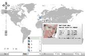
Diamond Map of the World. Selector area interactive Map of the World with zoom and hotspots!Easy adjustment.Variants of using a Map locator:- Real-Estate websites- Quick access to contact organization data, having affiliated network in IrelandWith this fully-clickable Map you will be able to improve navigation and provide visitors with a better and faster means of...
Category: Web Authoring / Flash Utilities
Publisher: Fla-shop.com Inc., License: Demo, Price: USD $249.00, File Size: 583.7 KB
Platform: Windows
Travel Time Map. This software allow you to show Isochrones and Isodistances polygons. Support for walk, car, bike isolines. Predefined speed levels and customizable speed value. Flags to reduce queue time and avoid tolls. This software is based on www.iso4app.Net services.
Category: Business & Finance / Business Finance
Publisher: K-SOL S.r.l., License: Freeware, Price: USD $0.00, File Size: 41.6 MB
Platform: Windows