Free Downloads: Updates For Tomtom Gps Systems Free
The OSTN02 extension for ArcPad is a Free tool that automatically transforms Gps data and aligns it with Ordnance Survey (OS) background map. This easy-to-use extension removes the need to manually post-process Gps data by providing’ on the fly’ transformation of WGS84 latitude and longitude into OSTN02 corrected British National Grid coordinate. Data capture...
Category: Home & Education / Miscellaneous
Publisher: ESRI (UK) Ltd, License: Freeware, Price: USD $0.00, File Size: 8.0 MB
Platform: Windows
Eye4Software Gps Mapping is a professional Gps mapping software tool that can be used in numerous applications. Use the software to load, view and edit your maps, display your position realtime and record all your movements.
The software will work with almost any Gps and can be used on any desktop, laptop or needbook computer running Windows XP or higher. The...
Category: Home & Education / Miscellaneous
Publisher: Eye4Software B.V., License: Shareware, Price: USD $130.61, File Size: 14.6 MB
Platform: Windows
Are you looking for a Gps tracking system or a Gps tracker but haven't found the one that is ideal for you? Then, look no further as our site has the best deals and information about the kind of Gps tracker you should buy.
Category: Security & Privacy / Other
Publisher: Top GPS Tracking Srl., License: Freeware, Price: USD $0.00, File Size: 722.0 KB
Platform: Windows
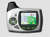
Improve your golf game with a handheld Gps that gives distance to pin, club suggestions, locations of hazards and much more. Wherever in the world you play golf, the sureshotgps will allow you to obtain distances from tee to green. Experience the difference with better club selection, speedier play and statistical information per round of golf. The sureshotgps relies on Gps...
Category: Home & Education
Publisher: Absolute Software Pty Ltd, License: Shareware, Price: USD $399.00, File Size: 3.8 MB
Platform: Windows
Gps Software for Garmin. Download waypoints, routes and tracks from Garmin Gps. Upload waypoints, routes and tracks to Garmin Gps. Excel and Text files supported! This software is very easy to use!
Category: Utilities / System Utilities
Publisher: Oy Frontbase Ltd, License: Shareware, Price: USD $29.95, File Size: 1.4 MB
Platform: Windows


 Shareware
MarshallSoft Gps Component Visual Basic and .NET toolkit to read and decode industry standard Gps NMEA 183 navigation sentences from the RS232 serial port as well as computes great circle distances and bearings. Features include: - Supports both 32-bit and 64-bit Windows. - Uses the Windows API for serial port input. No special Windows driver is required. - Runs as a...
Category: Software Development / Components & Libraries
Publisher: MarshallSoft Computing, License: Shareware, Price: USD $115.00, File Size: 476.8 KB
Platform: Windows
To integrate these objects into your own customized Gps application you can use
programming environments such as the following Microsoft development Systems:
- Visual Studio® 2005
- Visual C#®
- Visual C ®
- Visual Basic®
The applications you develop can be used on any computer running one of the
following operating...
Category: Utilities / Misc. Utilities
Publisher: Trimble, License: Freeware, Price: USD $0.00, File Size: 25.4 MB
Platform: Windows
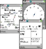
Gps/J is a console for all Bluetooth-enabled Gps receivers (now with 20000 European towns and cities!), a mobile navigation tool for cellular phone owners and the most affordable and convenient way to use location services.
It is a J2ME application for JSR82-compliant devices, which means "devices with a programmable Bluetooth interface".
Saying...
Category: Home & Education / Miscellaneous
Publisher: GPS/J Project, License: Demo, Price: USD $0.00, File Size: 281.0 KB
Platform: Windows
GPSCommunicator is a FREE utility to visually represent NMEA GPS position data in realtime.
GPSCommunicator is a Free utility to visually represent NMEA Gps position data in realtime. It works with NMEA 0183 Gps receivers connected via a serial port. GPSCommunicator has the following features:
- Vessel position display over moving map.
- User selectable maps.
- Create and save Waypoints.
- Graphical Gps data display
- .NET...
Category: Internet / Misc. Plugins
Publisher: Panazzolo.Com, License: Freeware, Price: USD $0.00, File Size: 772.5 KB
Platform: Windows
GPS Tuner was first launched in 2003.
Gps Tuner was first launched in 2003. Success followed introduction shortly. Over the years it became a best-selling favourite Gps software among off-roaders as a reliable, versatile feature-packed application suiting the needs of outdoor enthusiasts and professional off-road users alike. After five years of continuous development of previous Gps Tuner versions Gps...
Category: Web Authoring / Web Design Utilities
Publisher: GPS Tuner Ltd., License: Freeware, Price: USD $0.00, File Size: 4.5 MB
Platform: Windows
GPS PLUS Collar Manager for your PC is a powerful tool to manage your collars.
Gps PLUS Collar Manager for your PC is a powerful tool to manage your collars. It is designed to communicate with your collars, the UHF/VHF handheld terminal and GSM ground station and is the basic tool to design your study. You can:
- manage collars and GSM/email communication details,
- read out data from collar, handheld terminal and GSM ground station,
- store,...
Category: Home & Education / Miscellaneous
Publisher: VECTRONIC Aerospace GmbH, License: Freeware, Price: USD $0.00, File Size: 8.4 MB
Platform: Windows
The Gps Detector software is used to update the Gps detector's database , updating maps , routes and camera locations . The device itself is based on pre-installed Gps coordinates, the device can indicate various road hazards like: Fixed cameras, Red light speed cameras and bus lane cameras, Usual speed measurement places and dangerous zones.
Category: Business & Finance / Business Finance
Publisher: Euro Noliker Kft., License: Freeware, Price: USD $0.00, File Size: 5.5 MB
Platform: Windows
SynTAC for Windows is a Synergy Systems, LLC software product for test and evaluation of i-Lotus ONCORE™ Gps products using Windows™ 95, 98, NT, 2000, and XP.SynTac is the precision time control and display software for your Gps receiver and so much more.
Category: Business & Finance / Applications
Publisher: Synergy Systems, LLC., License: Shareware, Price: USD $59.00, File Size: 4.8 MB
Platform: Windows
GPS-CCD:is a novel computational program for the
Prediction of Calpain Cleavage Sites.
Gps-CCD:is a novel computational program for the
Prediction of Calpain Cleavage Sites.
The online service and local packages of Gps-CCD 1.0 were
implemented in JAVA/. For the online service, we tested the Gps-CCD1.0 on a variety of internet browsers, including Internet Explorer 6.0, Netscape Browser 8.1.3 and Firefox 2 under the Windows XPOperating System...
Category: Web Authoring / JavaScript
Publisher: The CUCKOO Workgroup, License: Freeware, Price: USD $0.00, File Size: 19.2 MB
Platform: Windows
ThinkVantage Gps (Global Positioning System) receives signals from the Gps satellites and determines the location of your ThinkPad. This program is easy to install and easy to manipulate.
This package installs the software (Gps driver) to enable the following devices:
- Ericsson F3507g
- Ericsson F3607gw
- Ericsson F5521gw
-...
Category: Utilities / System Utilities
Publisher: Lenovo, License: Freeware, Price: USD $0.00, File Size: 20.6 MB
Platform: Windows
All measurements, GPS-protocols and own informations in a single map.
All measurements, Gps-protocols and own informations in a single map.
Several enterprise maps in one program without additional costs.
No limitation of the area quantity
Tile and join fields.
Multilingual: currently in english, german, spanish, french, greek, polish.
International: over 80 coordinate reference Systems of 26 european countries...
Category: Audio / Utilities & Plug-Ins
Publisher: GPSur Dr. Erhard Regener, License: Shareware, Price: USD $449.00, File Size: 7.9 MB
Platform: Windows
Overview Gps Simulator is software that generates a virtual Gps data Used to develop and simulation of Gps applications -Save testing and development time -No location restriction or work everywhere -No Gps device needed Feature Easy routing Selectable map(7EA Map) Support speed control Support 10EA NMEA protocol messages(GGA, GNS, GLL, RMC, VTG,...
Category: Desktop Enhancements / Shell & Desktop Managers
Publisher: NMEAsoft, License: Demo, Price: USD $150.00, File Size: 3.3 MB
Platform: Windows
Have a Gps and a laptop? Use this to find your way. Make patterns or a trail to share with others. When the application starts, you may pick your area of operations - be it North America, South America, Europe and Asia, or Australia. Your quadrant is determined by where you are in relation to the Equator and the Prime Meridian. Tracking of your position is automatically enabled when the...
Category: Home & Education / Miscellaneous
Publisher: LogicAll Solutions, LLC, License: Freeware, Price: USD $0.00, File Size: 4.6 MB
Platform: Windows
With PixGPS it's easy to track the exact positioin where you took your photos.
With PixGPS it's easy to track the exact positioin where you took your photos. You need a Gps Receiver. All you need to do is to have the Gps turned on when you ake the photos. After your photo session, download the photos from your camera and the track file from the Gps. PixGPS will calculate the position of each photo and insert this in the EXIF data of each photo....
Category: Multimedia & Design / Multimedia App's
Publisher: BR Software, License: Shareware, Price: USD $0.00, File Size: 1.5 MB
Platform: Windows
Develop precise, efficient, and reliable Gps software in record time with this multithreaded component for desktop and mobile devices, including PocketPC, Windows CE, Tablet PC, Smartphone and now Windows Mobile! Over fifty classes in one lightweight assembly give you unparalleled features while saving you hundreds of dollars in Gps device testing. Gps.NET is loaded...
Category: Software Development
Publisher: GeoFrameworks, LLC, License: Commercial, Price: USD $199.00, File Size: 8.5 MB
Platform: Windows,
V-Clinic GPS lets you track your training routes and upload the data back to your V-Clinic account.
V-Clinic Gps lets you track your training routes and upload the data back to your V-Clinic account. Then use V-Clinic to share your route with your training buddies. V-Clinic Gps is ideal for cyclists, joggers and outdoor enthusiasts. V-Clinic Gps runs on Gps & Java enabled phones. Use V-Clinic Gps on your own or get professional fitness analysis and...
Category: Home & Education / Health & Nutrition
Publisher: V-CLINIC MOBILE CIRCLES, License: Freeware, Price: USD $0.00, File Size: 235.0 KB
Platform: Unknown
GPSCAD Transfer is an application for transferring points between a gps device and autocad.
GPSCAD Transfer is an application for transferring points between a Gps device and autocad. The present version works with a Magellan Gps device, but the next release will also work with a Garmin Gps device. It allows you to convert latitude and longitude to utm zone nad 83 in either the US or in metric measurement system.
Category: Multimedia & Design / Image Editing
Publisher: Timberwolf Software Solutions, LLC, License: Shareware, Price: USD $0.00, File Size: 2.6 MB
Platform: Windows
TRANSDATpro can prove a helpful tool for professionals, providing them with the possibility to perform coordinate transformations fast and easy by use of the coordinate reference Systems of their choice. TRANSDATpro performs Coordinate Transformations fast and with high accuracy. The coordinate conversion software supports worldwide thousands of Coordinate Systems, geodetic...
Category: Home & Education / Science
Publisher: Killet GeoSoftware Ing.-GbR, License: Shareware, Price: USD $270.00, EUR240, File Size: 5.3 MB
Platform: Windows
GPS Send Map is a Windows interface program which uses (sendmap.
Gps Send Map is a Windows interface program which uses (sendmap.exe) to load the IMG maps to the Gps.This program works well and setup is easy, although there seams to be minor issues in some windows OS.The Gps acted as usual and my maps appeared on the screen as usual. NICE.
Category: Security & Privacy / Other
Publisher: DougsBrat, License: Freeware, Price: USD $0.00, File Size: 1.5 MB
Platform: Windows
OziExplorer is a flamboyant Gps Mapping Software that runs on the PC and works with varieties of Gps receivers such as Garmin, Lowrance, Magellan, Eagle, Brunton, Silva and MLR for the uploading or downloading the waypoints, routes and tracks and most brands of Gps receivers for real time tracking of Gps position.
Using this software, the user can use...
Category: Internet / Communications
Publisher: Des Newman, License: Shareware, Price: USD $95.00, File Size: 6.8 MB
Platform: Windows

