Free Downloads: Uploading Waypoints To Garmin Etrex


 Shareware
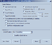
The RouteWriter add-in imports and exports Waypoints for Microsoft MapPoint routes whilst maintaining their route order. Although MapPoint can import and export Waypoints as pushpins, their order is usually re-arranged. RouteWriter exports Waypoints and their matching pushpins to Excel with their waypoint distance, time, coordinate, address data, and all available...
Category: Business & Finance / Document Management
Publisher: Winwaed Software Technology LLC, License: Shareware, Price: USD $75.00, File Size: 3.0 MB
Platform: Windows
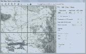
OkCustomMap is a software to produce Garmin Custom Maps.
OkCustomMap is a software to produce Garmin Custom Maps.
Supports many map formats:
- OkMap
- Ecw
- GeoTiff
- World files
- OziExplorer
- GpsTuner
You can customize:
- The quality of the output JPEG images (0=Bad, 100=Good)
- The KML transparency (0=Transparent, 255=Opaque)
- The KML draw order (0=Invisible, 1-49=Under the vectorial data,...
Category: Business & Finance / Applications
Publisher: Gian Paolo Saliola, License: Freeware, Price: USD $0.00, File Size: 3.2 MB
Platform: Windows


 Freeware
org, uses file and position names that suit to the display of the TomTom Rider, uses file, route and position names that suit to the display of the Map&Guide Motorrad Tourenplaner, remembers language, paths, window size and position. . .
Category: Business & Finance / Conversion Applications
Publisher: Christian Pesch, License: Freeware, Price: USD $0.00, File Size: 6.6 MB
Platform: Windows, Mac, Linux, Solaris, FreeBSD, OpenBSD, Java
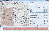
QuakeMap is a powerful GPS/mapping program for your Windows computer.
QuakeMap is a powerful GPS/mapping program for your Windows computer. It can be downloaded here for free. The trial mode allows you to use most features indefinitely. When you need to unlock certain powerful features, a License Key can be ordered here. QuakeMap is designed for ease of use. It eatures intuitive user interface, supports most popular Garmin and Magellan receivers, reads and...
Category: Utilities / Misc. Utilities
Publisher: quakemap.com, License: Freeware, Price: USD $0.00, File Size: 821.2 KB
Platform: Windows
Garmin MapConverter was developed to be a tool that will allow you to convert maps and unlock codes on your Windows PC to the Macintosh format. Transferred maps will remain fully accessible on your Windows PC. It works on Windows XP, Windows Vista, Windows 7.
Category: Utilities / Misc. Utilities
Publisher: Garmin Ltd or its subsidiaries, License: Freeware, Price: USD $0.00, File Size: 2.6 MB
Platform: Windows
The MPRouteWriter add-in imports and exports Waypoints for Microsoft MapPoint routes whilst maintaining their route order. Although MapPoint can import and export Waypoints as pushpins, their order is usually re-arranged. MPRouteWriter exports Waypoints and their matching pushpins to Excel (or a text file) with their waypoint distance, time, coordinate, address data,...
Category: Business & Finance / MS Office Addons
Publisher: Winwaed Software Technology LLC, License: Shareware, Price: USD $75.00, File Size: 3.3 MB
Platform: Windows
Turtle Sport is a free software developed to communicate with Garmin fitness products (forerunner and edge).
Turtle Sport retrieves yours training sessions from your Garmin and it makes diagram. You can also order your training sessions by category and training mode. With Turtle Sport, it is also possible to map your GPS training paths in Google Earth.
Athlete...
Category: Home & Education / Miscellaneous
Publisher: TurtleSport, License: Freeware, Price: USD $0.00, File Size: 6.9 MB
Platform: Windows
Palm Desktop for Garmin iQue 3600 is one of the first PDAs to offer built-in GPS, as opposed to the jackets often used with other models.
Mapping integrates well - you can add a location to any address book entry, for example - but you can only route to an address from your present location, not from one distant one to another.
Category: Multimedia & Design / Multimedia App's
Publisher: Garmin Ltd or its subsidiaries, License: Freeware, Price: USD $0.00, File Size: 11.7 MB
Platform: Windows
This software will not work unless you already own a MapSource product.
This software will not work unless you already own a MapSource product.
Main Features:
- Improved memory issues when running on Windows 7.
- Improved map projection for many map products.
- Changed mouse-wheel functionality to zoom in and out.
- Added support for enhanced map security.
- Fixed unlocking issue.
...
Category: Home & Education / Miscellaneous
Publisher: Garmin Ltd or its subsidiaries, License: Freeware, Price: USD $0.00, File Size: 8.4 MB
Platform: Windows
This program converts from GPX format to CSV format or vice versa.
This program converts from GPX format to CSV format or vice versa. You can create Waypoints in MapSource and then convert them to POI (CSV) files for download or sharing with others.
You can also convert POI (CSV) files that others have created, and then edit them in MapSource. Now that the Garmin POI loader supports GPX files, GPXtoPOI's most important role is...
Category: Business & Finance / Calculators
Publisher: MasterClass, License: Freeware, Price: USD $0.00, File Size: 1.4 MB
Platform: Windows
An easy to use GPS downloading utility that lets you download your GPS Waypoints easily and export them into a variety of formats useful for editing, display and importing into many different mapping programs.
Use Lobal to save GPS Waypoints as:
- Text Files
- HTML Tables
- Shape Files
- Google Earth KML
- DBase Files.
Category: Utilities / Misc. Utilities
Publisher: Ecological Software Solutions, License: Freeware, Price: USD $0.00, File Size: 2.2 MB
Platform: Windows
GeePeeEx Editor is specifically designed to produce and edit GPX files destined for Garmin's® Automotive Satnav (GPSr) systems. These files can be used as input to Garmin's® POI Loader to produce enhanced Custom POI's (Points of Interest).
Convert CSV files to GPX. Optionally and uniquely, GeePeeEx Editor will search for valid telephone numbers...
Category: Audio / Rippers & Encoders
Publisher: Them, License: Freeware, Price: USD $0.00, File Size: 2.6 MB
Platform: Windows
GSAK is the all in one Geocaching and waypoint management tool.
GSAK is the all in one Geocaching and waypoint management tool. Major features include: Multiple databases, sending/receiving Waypoints to GPSr, Google maps, conversion to many mapping formats, PDA output (including CacheMate support), HTML output, extensive searching, macro support, backup and restore, distance/direction from other Waypoints (including caches, locations, post...
Category: Business & Finance / Project Management
Publisher: CWE computer services, License: Shareware, Price: USD $30.00, File Size: 18.2 MB
Platform: Windows
Geocode digital images with latitude, longitude, altitude, and direction information when collecting GIS field data. RoboGEO stamps this information onto the actual photo or writes it to the EXIF headers, allowing you to permanently geotag and link your photos to the GPS coordinates. All writing to the EXIF and IPTC headers is lossless and all of the existing comments (including the MakerNote...
Category: Multimedia & Design
Publisher: Pretek, Inc., License: Demo, Price: USD $34.95, File Size: 6.4 MB
Platform: Windows
Easy way to convert Waypoints from KMZ or KML to GPX file format with the KML/KMZ to GPX Converter free.
Easy Steps :
- Save your Waypoints in KMZ or KML format with google earth
- Import that format in the KML/KMZ to GPX Converter free
- Then select waypoint you want to convert to GPX format
- Export the GPX format
- Upload the GPX format in...
Category: Audio / Rippers & Encoders
Publisher: HotelResortClub.com, License: Freeware, Price: USD $0.00, File Size: 656.6 KB
Platform: Windows
KMLCSV Converter is a tool that enables you to convert the KML file generated from Google Earth (free version) into a formatted CSV file (and vice versa). This CSV file can then be uploaded into your Garmin GPS by using Garmin POI Loader, which can be downloaded for free. This allows you to plot all the custom point of interests (POI) with Google Earth first. Then, you can...
Category: Business & Finance / Calculators
Publisher: Choon-Chern Lim, License: Freeware, Price: USD $0.00, File Size: 2.3 MB
Platform: Windows
Moagu: The Mother Of All GPS Utilities.
Moagu: The Mother Of All GPS Utilities.
You can convert USGS topographic maps, aerial/satellite imagery, and any other raster map imagery for use on Garmin handled GPS units.
Garmin maps have been in a "vector" format; Moagu creates maps using a "bitmap" format.
Category: Home & Education / Miscellaneous
Publisher: Moagu, License: Shareware, Price: USD $19.95, File Size: 38.2 MB
Platform: Windows
If you want to enable your visitors to upload files to your website Easley Uploader is the answer for you, using this script your visitors can easily upload files with any size to your website (without the use of FTP) and you will be in control of every thing!
The script contains three main parts a control panel , a file manager and an Uploading form, Through the control...
Category: Web Authoring / Web Design Utilities
Publisher: PHPscriptz, License: Shareware, Price: USD $0.00, File Size: 0
Platform: Windows
The GPS map will help you give you with turn by turn directions to your destination using a POI, city point and/or longitude and latitude.It has the ability to preplan driving destinations before getting into your car. Compatible with ALL Garmin GPS units. Don't pay more than US$10 per day when you already own a Garmin, this is the most comprehensive GPS map available at such...
Category: Home & Education / Miscellaneous
Publisher: GPSTravelMaps.com, License: Shareware, Price: USD $0.00, File Size: 0
Platform: Windows
MetroGold is a Windows tool with which you can upgrade your Garmin MetroGuide Europe or Metroguide North America installation. After the upgrade it's possible to include routing calculation data in your upload of maps to your GPS. No extra software, apart from Mapsource, is needed, you can transfer the maps with Mapsource.
Category: Utilities / Misc. Utilities
Publisher: Geodude, License: Shareware, Price: USD $0.00, File Size: 0
Platform: Windows
CompeGPS is an essential software to make the most of your GPS. With this PC software you will be able to download a wide variety of cartography from the internet and also analyse your routes. This software has been specially designed for free flight and motor flight pilots they use GPS and likes to create and accomplish their own routes and then later on analyse. CompeGPS allows you to...
Category: Home & Education
Publisher: CompeGPS TEAM S.L., License: Shareware, Price: USD $106.00, File Size: 14.9 MB
Platform: Windows


 Shareware
GPS Mapping Software for Windows, Loading topographic maps, manage GPS devices and more. The software can be used with various map formats including: GeoTiff, BSB Nautical Charts, AutoCad DXF files, ESRI Shapefiles. Using calibration you can also use scanned or downloaded JPG, BMP, GIF, PNG and TIF maps. The software can be used for survey, research, track and trace, real time positioning and...
Category: Home & Education / Science
Publisher: Eye4Software B.V., License: Shareware, Price: USD $75.04, EUR49, File Size: 6.7 MB
Platform: Windows
PoiEditor is a software solution package for downloading and customizing road safety data.
PoiEditor is a software solution package for downloading and customizing road safety data. The software makes it easy to stay up to date with the latest road safety data also know as POI's(Points of interest), it also applies your personal preferences to the downloaded data. The PoiEditor also sends the data to your Garmin device or SSD Card by utilizing the Garmin Poi loader...
Category: Internet / Misc. Plugins
Publisher: Tinus Strauss, License: Shareware, Price: USD $12.59, File Size: 2.7 MB
Platform: Windows
CompeGPS is an essential software to make the most of your GPS. With this PC software you will be able to download a wide variety of cartography from the internet and also analyse your routes. This software has been specially designed for 4x4 lovers, bike tourists, excursionists and, in general, everyone who uses GPS, likes to create and accomplish their own routes and then later on...
Category: Home & Education
Publisher: CompeGPS TEAM S.L., License: Shareware, Price: USD $106.00, File Size: 14.9 MB
Platform: Windows
Remote surveillance on the local webcam by FTP Uploading or by the internet browser.
Remote surveillance on the local webcam by FTP Uploading or by the internet browser. It supports to monitor mult webcam at the same time. Different webcams could have the different FTP setting . The alert of FTP Uploading could be fired by motion detection,schedulers,periods.
Category: Internet / Communications
Publisher: Unisonosoft.com Software Laboratory, License: Shareware, Price: USD $12.00, File Size: 6.1 MB
Platform: Windows

