Free Downloads: Utm Coordinate Conversion
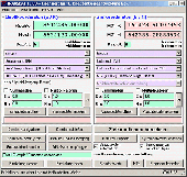
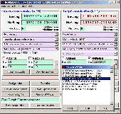
MMS Coordinate Converter is a free utility with which you can convert a survey Coordinate between different systems and datums.
The utility will convert between the Cape (Clarke) / Wgs84 datums with coordinates in Geographical / Utm / LO formats similar to the functions available in Model- and Survey-Maker.
Category: Multimedia & Design / Media Management
Publisher: Model Maker Systems, License: Freeware, Price: USD $0.00, File Size: 6.8 MB
Platform: Windows
GPS Sway is a simple coordinate conversion program.
GPS Sway is a simple Coordinate Conversion program. It handles all forms of latitude and longitude (degrees, degrees minutes, degrees minutes seconds) as well as Utm coordinates and will convert from any form to another. It also handles signs or character direction.
Category: Multimedia & Design / Media Management
Publisher: GPSFileDepot, License: Freeware, Price: USD $0.00, File Size: 154.2 KB
Platform: Windows
DatumPro is the most comprehensive and accurate co-ordinate Conversion package available, handling thousands of Coordinate systems, including Gauss Kruger, Utm, and Lambert Conic grids With over 600 datum conversions and over 450 Grid Projections, and hundreds of specific TM and Lambert conic conformal grids and all the latest EPSG transformations. DatumPro not only...
Category: Home & Education / Miscellaneous
Publisher: Geomatix Ltd, License: Shareware, Price: USD $119.00, File Size: 5.6 MB
Platform: Windows
 Shareware
The Eye4Software Coordinate Calculator is an easy to use tool to perform map or GPS Coordinate conversions. The software can be used to transform a single Coordinate or a batch of coordinates read from a comma separated, database or ESRI shapefiles. The software is shipped with a MS Access database file, containing more then 3500 ellipsoid, map datum and map grid...
Category: Business & Finance / Calculators
Publisher: Eye4Software B.V., License: Shareware, Price: USD $49.00, EUR39, File Size: 3.2 MB
Platform: Windows
Shareware
GPS SDK to add GPS and Coordinate Conversion functionality to your software and scripts). All NMEA0183 protocol versions are supported and can be filtered by NMEA sentence type and talker ID. Garmin USB PVT support. Information on GPS status can also be retrieved: GPS fix quality, satellites used in fix, satellites in view, satellite azimuth, elevation and signal strengths....
Category: Software Development
Publisher: Eye4Software B.V., License: Shareware, Price: USD $99.00, EUR79, File Size: 2.3 MB
Platform: Windows

TRANSDATpro can prove a helpful tool for professionals, providing them with the possibility to perform Coordinate transformations fast and easy by use of the Coordinate reference systems of their choice. TRANSDATpro performs Coordinate Transformations fast and with high accuracy. The Coordinate Conversion software supports worldwide thousands of...
Category: Home & Education / Science
Publisher: Killet GeoSoftware Ing.-GbR, License: Shareware, Price: USD $270.00, EUR240, File Size: 5.3 MB
Platform: Windows
Shareware
Java toolkit to add Coordinate Conversion functionality to your Java applications and applets. The toolkit offers functionality to perform map grid and datum transformations: latitude and longitude can be converted to various map grids, like Transverse Mercator (TM), Oblique Mercator, Mercator, Oblique Stereographic, Polar Stereographic, Cassini, Albers Equal Area Conal, Gauss...
Category: Software Development / Components & Libraries
Publisher: Eye4Software B.V., License: Shareware, Price: USD $199.00, EUR179, File Size: 155.5 KB
Platform: Unknown
CoordTrans converts geographic coordinates between different coordinate systems.
CoordTrans converts geographic coordinates between different Coordinate systems.
CoordTrans is very easy to use, and full of Wizards to help you with more complex tasks.
Convert between Utm, WGS84 and NAD27 / NAD83, and more... almost all projections and datums on Earth are supported. See complete list..
You can convert single coordinates, or...
Category: Business & Finance / Business Finance
Publisher: Franson, License: Shareware, Price: USD $49.00, File Size: 6.5 MB
Platform: Windows

TRANSDAT geosoftware executes Coordinate transformations and geodetic datum shifts between many Coordinate and reference systems of America, Australasia, Europe, Germany special and world-wide, with high precision and high speed: 1.The current and historical Coordinate and reference systems of all countries of the European Union (EU) including the eastern extensions and the...
Category: Home & Education / Science
Publisher: Killet Software Ing.-GbR, License: Shareware, Price: USD $170.00, EUR160, File Size: 4.4 MB
Platform: Windows
Coordinate Conversion for Object Oriented Programming!
Coordinate Conversion for Object Oriented Programming! GeoCalc.NET is the latest drag-and-drop component for .NET application development. GeoCalc.NET provides .NET developers seamless Coordinate Conversion when creating custom GIS software for said development platform.
The latest version of GeoCalc.NET has full support for HTDP Reference Frames and...
Category: Software Development / Misc. Programming
Publisher: Blue Marble Geographics, License: Demo, Price: USD $0.00, File Size: 48.8 MB
Platform: Windows
In the Dynamic Link Library GeoDLL geodesic functions like Coordinate transformation, datum changes, meridian strip changes, user defined Coordinate and reference systems, distance calculation, maps functions, Digital Elevation Models and more geodesic functions are contained to bind them into own applications. WINDOWS operating system allows building of function libraries...
Category: Software Development
Publisher: Killet Softwareentwicklung GbR, License: Shareware, Price: USD $290.00, File Size: 999.9 KB
Platform: Windows
GEOPosCalc is an easy to use and powerfull tool for coordinate systems (grid) and datum conversion.
GEOPosCalc is an easy to use and powerfull tool for Coordinate systems (grid) and datum Conversion. It does support more than 200 predefined datums, 20 ellipsoids and 10 Coordinate systemsand the ability to define your own datums and ellipsoids.
Category: Home & Education / Science
Publisher: American Outland, License: Shareware, Price: USD $40.00, File Size: 4.7 MB
Platform: Windows
ProLat DLL is a complete coordinate conversion toolkit for most programming languages and Excel.
ProLat DLL is a complete Coordinate Conversion toolkit for most programming languages and Excel. Its ease-of-use and industry standard accuracy make it an ideal solution. ProLat DLL software requires one license for each developer work-station where it is used for development even if the software is installed on a server.
Category: Software Development / Misc. Programming
Publisher: Effective Objects, License: Shareware, Price: USD $250.00, File Size: 2.6 MB
Platform: Windows
SEVENPAR is a tool for the calculation of highly exact transformation parameters for the Spatial Helmert and Molodensky Transformation, which make possible precise Coordinate transformations from one reference system into another. The determined transformation parameters can be entered directly into suitable transformation software, e.g. TRANSDAT Coordinate Transformations, or...
Category: Home & Education / Science
Publisher: Killet GeoSoftware Ing.-GbR, License: Shareware, Price: USD $285.00, EUR240, File Size: 7.6 MB
Platform: Windows
PrimaCode Transform for Windows is a Windows based computer solution built using the Microsoft .
PrimaCode Transform for Windows is a Windows based computer solution built using the Microsoft .Net Framework and designed to best-fit one Coordinate system to another using a least-squares two-dimensional conformal Coordinate transformation.
When the transformation is complete, the two surveys (Coordinate systems) share the same meridian and the same origin, that is...
Category: Business & Finance / Business Finance
Publisher: PrimaCode Technologies, License: Shareware, Price: USD $445.00, File Size: 11.0 MB
Platform: Windows
DraftSight is a drafting automation software tool.
DraftSight is a drafting automation software tool.A Coordinate system determines each point of a drawing surface or entity unambiguosly.DraftSight uses the Cartesian Coordinate system consisting of three Coordinate axes.Axes are arranged orthogonally crossing at the origin.
Category: Multimedia & Design / Image Editing
Publisher: Dassault Systemes, License: Freeware, Price: USD $0.00, File Size: 66.5 MB
Platform: Windows
Shareware
TOPOWIN is a state-wide register of the German Topographic Cartographies, the German Basic Cartography and of localities with geo references in different Coordinate systems. It is also a topographic information system. In the division of planning and execution of economical and scientific projects frequently topographic documents are used. The program TOPOWIN makes information available...
Category: Home & Education / Miscellaneous
Publisher: Killet GeoSoftware Ing.-GbR, License: Shareware, Price: USD $125.00, EUR110, File Size: 4.5 MB
Platform: Windows
For many countries house coordinates are present with coverage degrees upto 100 percent. The geo data offered here are in high-precision quality and are present in different Coordinate and reference systems. House Coordinates or also called Geo Coded Building Addresses are meaning the connection between the postal addresses of buildings and their accurate positions. The house coordinates...
Category: Business & Finance
Publisher: C. Killet Software Ing.-GbR, License: Demo, Price: USD $1250.00, File Size: 111.7 KB
Platform: Unknown
GeoDataSource Cities Database Gold Edition contains 2.9+ million entries with city names in original language and English, feature type classifications, country names in FIPS and ISO, regions, sub-regions, state or First-Order Administrative Division, county or Second-Order Administrative Division, longitude and latitude in degree and decimal, Univeral Transverse Mercator Coordinate grid...
Category: Security & Privacy / Other
Publisher: GeoDataSource.com, License: Data Only, Price: USD $1049.95, File Size: 160.3 KB
Platform: Windows, Mac, Linux, Palm,
Do you have coordinates for some places of interest?
Do you have coordinates for some places of interest? Do you want to find them on Earth's surface? There are more than 2,000 Coordinate systems available to make Google Earth follow your interests! Plex.Mark! simply placemarks your world!
Have you found a place in Google Earth and you would like to have the coordinates in your Coordinate system? Plex.Mark! will now make...
Category: Internet / Browser Accessories
Publisher: Plexscape, License: Freeware, Price: USD $0.00, File Size: 601.9 KB
Platform: Windows
Shareware
GeoDLL is a Geodetic Development Kit / Geodetic Function Library with worldwide 2D and 3D Coordinate Transformation, Datum Shift, Meridian Convergence and Extra Parameter with highest accuracy. Furthermore: Helmert and Molodensky Parameters, NTv2, HARN, INSPIRE, EPSG, Digital Elevation Model (DEM), distance and Time Zone calculations and much more. GeoDLL for geodetic and GIS development...
Category: Software Development / Components & Libraries
Publisher: Killet GeoSoftware Ing.-GbR, License: Shareware, Price: USD $560.00, EUR500, File Size: 5.4 MB
Platform: Windows
For the area of the Federal Republic of Germany more than 2,7 million street coordinates with a coverage of 100% are available. The geo data offered here are in high-precision quality and are present in different Coordinate and reference systems. Street coordinates or also called street section coordinates are meaning the summary of several postal house addresses to an averaged position...
Category: Business & Finance
Publisher: C. Killet Software Ing.-GbR, License: Demo, Price: USD $625.00, File Size: 68.4 KB
Platform: Unknown

For the area of the Federal Republic of Germany more than 19 million House Coordinates with a coverage of 100% are available. The geo data offered here are in high-precision quality and are present in different Coordinate and reference systems. House Coordinates are the cartographically representable positions of buildings, which are defined by their postal addresses. They are also...
Category: Software Development
Publisher: C. Killet Software Ing.-GbR, License: Demo, Price: USD $1250.00, File Size: 111.7 KB
Platform: Unknown