Free Downloads: Utm
UTM (Universal Traffic Manager) is a professional billing system for Internet Service Providers.
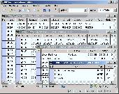
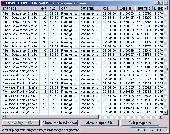
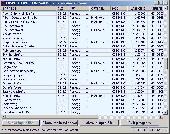
Utm (Universal Traffic Manager) is a professional billing system for Internet Service Providers. The core of the system, written in C++, is a smart and reliable accounting engine working directly with network equipment. It supports up to 100,000 users at a total speed of up to 3 Gbps.
All calculations are made in real-time and (if necessary) immediately block services when a...
Category: Internet / News Applications
Publisher: NetUP, License: Demo, Price: USD $700.00, File Size: 16.8 MB
Platform: Linux
UTM (Universal Traffic Manager) is a professional billing system for Internet Service Providers.
Utm (Universal Traffic Manager) is a professional billing system for Internet Service Providers. The core of the system, written in C++, is a smart and reliable accounting engine working directly with network equipment. It supports up to 100,000 users at a total speed of up to 3 Gbps. All calculations are made in real-time and (if necessary) immediately block services when a user's...
Category: Internet / Monitoring
Publisher: NetUP, License: Demo, Price: USD $700.00, File Size: 60.6 MB
Platform: Windows
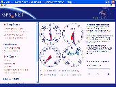
Develop precise, efficient, and reliable location-based services with this multithreaded framework for desktop and mobile devices, including PocketPC, Tablet PC and now Smartphone! Over fifty classes in one lightweight assembly gives you unparalleled features while saving you hundreds of dollars in development and testing.
GPS.NET is loaded with features, including:
NEW: now...
Category: Software Development / Components & Libraries
Publisher: StormSource Software, LLC, License: Commercial, Price: USD $98.00, File Size: 4.6 MB
Platform: Windows
DatumPro is the most comprehensive and accurate co-ordinate conversion package available, handling thousands of coordinate systems, including Gauss Kruger, Utm, and Lambert Conic grids With over 600 datum conversions and over 450 Grid Projections, and hundreds of specific TM and Lambert conic conformal grids and all the latest EPSG transformations. DatumPro not only converts isolated...
Category: Home & Education / Miscellaneous
Publisher: Geomatix Ltd, License: Shareware, Price: USD $119.00, File Size: 5.6 MB
Platform: Windows
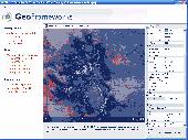
Develop precise, efficient, and reliable GPS software in record time with this multithreaded component for desktop and mobile devices, including PocketPC, Windows CE, Tablet PC, Smartphone and now Windows Mobile! Over fifty classes in one lightweight assembly give you unparalleled features while saving you hundreds of dollars in GPS device testing. GPS.NET is loaded with features,...
Category: Software Development
Publisher: GeoFrameworks, LLC, License: Commercial, Price: USD $199.00, File Size: 8.5 MB
Platform: Windows,
Geodata International - World-wide database of countries with georeferenced towns, municipalities, postal codes and administrative units with WGS84 and Utm coordinates and elevations for geocoding, proximity search, navigation, distance calculation. Often is it necessarily, for an address characteristic, e.g. the place name or the postal code, to establish a local relationship - a...
Category: Software Development / Databases & Networks
Publisher: Killet GeoSoftware Ing.-GbR, License: Data Only, Price: USD $165.00, EUR150, File Size: 2.3 MB
Platform: Windows, Mac, Linux,
Geodata of international countries with locals, municipalities and postal codes. Georeferences as Utm- and geographic coordinates (WGS84, ETRS89). Suitable for branch searches, periphery searches and distance computations. These countries are available: Albania, Andorra, Belgium, Bosnia, Bulgaria, Denmark, Estonia, Finland, France, Georgia, Gibraltar, Greece, Great Britain, Ireland,...
Category: Software Development
Publisher: Killet Software Ing.-GbR, License: Demo, Price: USD $195.00, File Size: 151.6 KB
Platform: Windows, Linux, Unix

Geodata of international countries with locals, municipalities and postal codes. Georeferences as Utm- and geographic coordinates (WGS84, ETRS89). Suitable for branch searches, periphery searches and distance computations. These countries are available: Albania, Andorra, Belgium, Bosnia, Bulgaria, Denmark, Estonia, Finland, France, Georgia, Gibraltar, Greece, Great Britain, Ireland,...
Category: Business & Finance
Publisher: Killet Software Ing.-GbR, License: Demo, Price: USD $195.00, File Size: 151.6 KB
Platform: Windows, Linux, Unix, Not Applicable
Develop high-performance mapping software with GIS.NET. This component uses state-of-the-art vector rendering technology to draw complicated maps of anywhere in the world. Supports desktops, PocketPC, Tablet PC, Smartphone, and Windows Mobile 5! Download a free 30-day trial now and see just how fast GIS.NET can get your location-based software to market! GIS.NET is loaded with features,...
Category: Software Development
Publisher: GeoFrameworks, LLC, License: Commercial, Price: USD $399.00, File Size: 10.9 MB
Platform: Windows
Geodata of the Federal Republic Germany with municipalities, postal codes, telefone preselections. Suitable for branch searches, periphery searches and distance computations. Georeferences as Gauss Krueger, Utm and Geographic Coordinates and also Ground Level Elevations. ORTREF: 12.500 geocoded cities and municipalities. ORTGEM: Allocation of 12.500 cities and municipalities to the...
Category: Business & Finance
Publisher: C. Killet Software Ing.-GbR, License: Demo, Price: USD $195.00, File Size: 313.3 KB
Platform: Unknown
UserGate Proxy & Firewall is a Utm (Unified Threat Management) class solution for sharing and monitoring employees' access to the local and Internet resources, for filtering FTP and HTTP traffic, as well as for administrating the network in your Company. UserGate provides complex LAN security due to three integrated antivirus modules - Kaspersky Lab, Avira and Panda Security. These...
Category: Internet / Proxy Servers
Publisher: Entensys, License: Shareware, Price: USD $194.00, RUB6900, File Size: 78.0 MB
Platform: Windows
GPSCAD Transfer is an application for transferring points between a gps device and autocad.
GPSCAD Transfer is an application for transferring points between a gps device and autocad. The present version works with a Magellan GPS device, but the next release will also work with a Garmin gps device. It allows you to convert latitude and longitude to Utm zone nad 83 in either the US or in metric measurement system.
Category: Multimedia & Design / Image Editing
Publisher: Timberwolf Software Solutions, LLC, License: Shareware, Price: USD $0.00, File Size: 2.6 MB
Platform: Windows
GPS Sway is a simple coordinate conversion program.
GPS Sway is a simple coordinate conversion program. It handles all forms of latitude and longitude (degrees, degrees minutes, degrees minutes seconds) as well as Utm coordinates and will convert from any form to another. It also handles signs or character direction.
Category: Multimedia & Design / Media Management
Publisher: GPSFileDepot, License: Freeware, Price: USD $0.00, File Size: 154.2 KB
Platform: Windows
 Shareware
The Eye4Software Coordinate Calculator is an easy to use tool to perform map or GPS coordinate conversions. The software can be used to transform a single coordinate or a batch of coordinates read from a comma separated, database or ESRI shapefiles. The software is shipped with a MS Access database file, containing more then 3500 ellipsoid, map datum and map grid definitions around the world,...
Category: Business & Finance / Calculators
Publisher: Eye4Software B.V., License: Shareware, Price: USD $49.00, EUR39, File Size: 3.2 MB
Platform: Windows
CoordTrans converts geographic coordinates between different coordinate systems.
CoordTrans converts geographic coordinates between different coordinate systems.
CoordTrans is very easy to use, and full of Wizards to help you with more complex tasks.
Convert between Utm, WGS84 and NAD27 / NAD83, and more... almost all projections and datums on Earth are supported. See complete list..
You can convert single coordinates, or...
Category: Business & Finance / Business Finance
Publisher: Franson, License: Shareware, Price: USD $49.00, File Size: 6.5 MB
Platform: Windows
MMS Coordinate Converter is a free utility with which you can convert a survey coordinate between different systems and datums.
The utility will convert between the Cape (Clarke) / Wgs84 datums with coordinates in Geographical / Utm / LO formats similar to the functions available in Model- and Survey-Maker.
Category: Multimedia & Design / Media Management
Publisher: Model Maker Systems, License: Freeware, Price: USD $0.00, File Size: 6.8 MB
Platform: Windows
Shareware
GPS SDK to add GPS and coordinate conversion functionality to your software and scripts). All NMEA0183 protocol versions are supported and can be filtered by NMEA sentence type and talker ID. Garmin USB PVT support. Information on GPS status can also be retrieved: GPS fix quality, satellites used in fix, satellites in view, satellite azimuth, elevation and signal strengths. The toolkit also...
Category: Software Development
Publisher: Eye4Software B.V., License: Shareware, Price: USD $99.00, EUR79, File Size: 2.3 MB
Platform: Windows
This requires client installation on the user’s computer.
This requires client installation on the user’s computer. On every log on attempt, SSCyberoamSetup.exe is executed automatically and installs the Cyberoam SSO Client if Client is not available on the user machine. It works with Windows 2000 Professional / XP / Server 2008 / Vista and Windows 7. Cyberoam Transparent Authentication Suite (CTAS) is the Single Sign On (SSO) for Cyberoam...
Category: Business & Finance / Business Finance
Publisher: Elitecore, License: Freeware, Price: USD $0.00, File Size: 500.2 KB
Platform: Windows
For many countries house coordinates are present with coverage degrees upto 100 percent. The geo data offered here are in high-precision quality and are present in different coordinate and reference systems. House Coordinates or also called Geo Coded Building Addresses are meaning the connection between the postal addresses of buildings and their accurate positions. The house coordinates are...
Category: Business & Finance
Publisher: C. Killet Software Ing.-GbR, License: Demo, Price: USD $1250.00, File Size: 111.7 KB
Platform: Unknown
For the area of the Federal Republic of Germany more than 2,7 million street coordinates with a coverage of 100% are available. The geo data offered here are in high-precision quality and are present in different coordinate and reference systems. Street coordinates or also called street section coordinates are meaning the summary of several postal house addresses to an averaged position on...
Category: Business & Finance
Publisher: C. Killet Software Ing.-GbR, License: Demo, Price: USD $625.00, File Size: 68.4 KB
Platform: Unknown
For the area of the Federal Republic of Germany more than 19 million House Coordinates with a coverage of 100% are available. The geo data offered here are in high-precision quality and are present in different coordinate and reference systems. House Coordinates are the cartographically representable positions of buildings, which are defined by their postal addresses. They are also called "Geo...
Category: Business & Finance
Publisher: C. Killet Software Ing.-GbR, License: Demo, Price: USD $1250.00, File Size: 111.7 KB
Platform: Unknown

For the area of the Federal Republic of Germany more than 19 million House Coordinates with a coverage of 100% are available. The geo data offered here are in high-precision quality and are present in different coordinate and reference systems. House Coordinates are the cartographically representable positions of buildings, which are defined by their postal addresses. They are also called "Geo...
Category: Software Development
Publisher: C. Killet Software Ing.-GbR, License: Demo, Price: USD $1250.00, File Size: 111.7 KB
Platform: Unknown
For the area of the Federal Republic of Germany more than 2,7 million street coordinates with a coverage of 100% are available. The geo data offered here are in high-precision quality and are present in different coordinate and reference systems. Street coordinates or also called street section coordinates are meaning the summary of several postal house addresses to an averaged position on...
Category: Business & Finance
Publisher: C. Killet Software Ing.-GbR, License: Demo, Price: USD $625.00, File Size: 68.4 KB
Platform: Unknown