Free Downloads: Waypoint
OCENS MetMapper transforms weather maps, satellite images, and ocean charts, into dynamic components of your at-sea decision-making tool box. MetMapper offers to all non-GRIB data what our GRIB Explorer software does for the GRIB data. That is, it will take classical weather data such as weather charts, ocean charts and satellite imagery and render them into interactive elements that carry a...
Category: Home & Education / Miscellaneous
Publisher: OCENS, Inc., License: Shareware, Price: USD $169.00, File Size: 23.6 MB
Platform: Windows
 Shareware
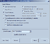
The RouteWriter add-in imports and exports waypoints for Microsoft MapPoint routes whilst maintaining their route order. Although MapPoint can import and export waypoints as pushpins, their order is usually re-arranged. RouteWriter exports waypoints and their matching pushpins to Excel with their Waypoint distance, time, coordinate, address data, and all available pushpin data...
Category: Business & Finance / Document Management
Publisher: Winwaed Software Technology LLC, License: Shareware, Price: USD $75.00, File Size: 3.0 MB
Platform: Windows
The MPRouteWriter add-in imports and exports waypoints for Microsoft MapPoint routes whilst maintaining their route order. Although MapPoint can import and export waypoints as pushpins, their order is usually re-arranged. MPRouteWriter exports waypoints and their matching pushpins to Excel (or a text file) with their Waypoint distance, time, coordinate, address data, and all...
Category: Business & Finance / MS Office Addons
Publisher: Winwaed Software Technology LLC, License: Shareware, Price: USD $75.00, File Size: 3.3 MB
Platform: Windows
Digital Image To Icon Converter is a helpful tool that allows you to convert images or digital photos in to Windows Icons. You can include different sizes 8x8, 16x16, 24x24, 32x32, 48x48, ad 64x64, also you can use transparent color for the image by marking the option "Transparent Color" and clicking in the image the color you wish to make transparent. The icons can be used for many...
Category: Desktop Enhancements / Icon Tools
Publisher: TheLittleCalorie.com., License: Shareware, Price: USD $19.00, File Size: 0
Platform: Windows

Overview GPS Simulator is software that generates a virtual GPS data Used to develop and simulation of GPS applications -Save testing and development time -No location restriction or work everywhere -No GPS device needed Feature Easy routing Selectable map(7EA Map) Support speed control Support 10EA NMEA protocol messages(GGA, GNS, GLL, RMC, VTG, HDT, ZDA, GSA, GSV, DTM)...
Category: Desktop Enhancements / Shell & Desktop Managers
Publisher: NMEAsoft, License: Demo, Price: USD $150.00, File Size: 3.3 MB
Platform: Windows
You can change the # of objects in the config file.
You can change the # of objects in the config file. However, the trace file is not overwritten/regenerated if it already exists. If you change the # of objects in the config file, but use a trace file that was generated with a different # of objects, some objects might not have traces, which can cause an exception.
Main Features:
- generate mobility traces for mobile...
Category: Web Authoring / Web Design Utilities
Publisher: Georgia Tech, License: Freeware, Price: USD $0.00, File Size: 10.1 MB
Platform: Windows
Active Media Storm is the most powerful way to create and distribute your own Screen Savers.
Active Media Storm is the most powerful way to create and distribute your own Screen Savers. A software package for Professionals. Incorporating a range of advanced Transitions, Active Media Storm provides the platform for you to create the most outstanding professionally developed Screen Savers using your own images, pictures and sounds. Multiple effects can be created on screen at the same...
Category: Desktop Enhancements / Screensavers
Publisher: Active Media Technology Ltd, License: Shareware, Price: USD $295.00, File Size: 2.4 MB
Platform: Windows
Modular PC-Software package for planning and controlling of arbitrary sea routes with integrated calculation of time-schedules and manifold applications (Data exchange with Diesel Diagnostic System DDM 40) The Software package GLOBAL FLEET CONTROL - GFC40 is suitable for the application on your fleet. Application Profile: + Planning and controlling of arbitrary worldwide sea routes +...
Category: Business & Finance / Project Management
Publisher: Ingenieurbuero Richter, License: Freeware, Price: USD $0.00, File Size: 42.9 MB
Platform: Windows
Flight Planner 3000 is a comprehensive flight planning tool which produces detailed, accurate flight plans plus provides the pilot with additional information relating to the flight. It does the weight & balance, calculates CP & PNR’s, first and last light, does all the fuel calculations, draws detailed maps of your route, displays the different (NAS) airspace on the maps,...
Category: Business & Finance / Business Finance
Publisher: Champagne PC Services, License: Shareware, Price: USD $255.00, File Size: 5.4 MB
Platform: Windows

Geocode digital images with latitude, longitude, altitude, and direction information when collecting GIS field data. RoboGEO stamps this information onto the actual photo or writes it to the EXIF headers, allowing you to permanently geotag and link your photos to the GPS coordinates. All writing to the EXIF and IPTC headers is lossless and all of the existing comments (including the MakerNote...
Category: Multimedia & Design
Publisher: Pretek, Inc., License: Demo, Price: USD $34.95, File Size: 6.4 MB
Platform: Windows
Features
- Easy-to-learn WINDOWS™ based user interface
- Easy-to-use thanks to single key functions
- Fully automatic (no user interface needed... suited for mobile applications)
- Very fast because of a special file format (XIM file format)
- Imperial or international units or mixture of both
- Rich, detailed configuration
- Utilizes most...
Category: Multimedia & Design / Multimedia App's
Publisher: Sapper Oy, Finland, License: Freeware, Price: USD $0.00, File Size: 1.6 MB
Platform: Windows