Free Downloads: Windows Mobile Gps Maps Of Lebanon
MapToaster Topo New Zealand is New Zealand's only topographical mapping suite, with options for your computer and Garmin Gps, including:
- all the rich detail of the LINZ topo Maps - seamless across NZ. Now includes Topo50 and Topo250 map series.
- 1:50,000 though 1:2 million scale Maps on your PC and 1:50,000 on your Gps
- integrated...
Category: Home & Education / Miscellaneous
Publisher: Integrated Mapping Ltd, License: Shareware, Price: USD $0.00, File Size: 38.5 MB
Platform: Windows
Furthermore the Skylab Gps Simulator contains a full featured interoperable OGC WMS client for receiving Maps from a standardized WMS server.
Within a map you are able to navigate (zoom, pan) and to select your favorite layers provided by the WMS server. During the simulation there are realtime debugging helpers like position and raw NMEA-0183 output.
Category: Home & Education / Miscellaneous
Publisher: Skylab Mobilesystems, License: Shareware, Price: USD $99.00, File Size: 4.9 MB
Platform: Windows
The leading GPS interface tool for Windows!
The leading Gps interface tool for Windows! Gps answers the significant world demand for accurate, viable and cost effective positioning systems. The Geographic Tracker delivers all of the power and utility of Gps to the Windows environment by allowing you to link a Gps receiver to other Microsoft Windows applications through standard...
Category: Home & Education / Miscellaneous
Publisher: Bluemarble Geographics, License: Shareware, Price: USD $0.00, File Size: 0
Platform: Windows
SmartComGPS is a Gps mapping/tracking/navigation software for Symbian smartphones. It is one of most advanced Gps mapping software on the market. SmartComGPS designed for the all Symbian phones. It is compatible with external BT Gps receivers, and internal aGPS receiver of Motorola A920/925/1000. SmartComGPS can run without Gps receiver, as "mapping" software with...
Category: Multimedia & Design
Publisher: SmartCom Ltd GPS Mobile Solutions, License: Shareware, Price: USD $29.95, File Size: 291.1 KB
Platform: Unknown
RouteBuddy is the only modern, advanced digital map application for Windows and Mac OS X.
RouteBuddy is the only modern, advanced digital map application for Windows and Mac OS X. It doesn't matter on which platform you wish to use the application as it sports a universal toolbar and comparable features throughout.
- High resolution Road, Topo and Satellite Maps can be viewed in the same application using our state-of-the-art animated layer...
Category: Home & Education / Miscellaneous
Publisher: RouteBuddy Ltd, License: Shareware, Price: USD $59.99, File Size: 121.5 MB
Platform: Windows
SmartComGPS is a Gps mapping/tracking/navigation software for Symbian smartphones. It is one of most advanced Gps mapping software on the market. SmartComGPS designed for the all Symbian phones. It is compatible with external BT Gps receivers, and internal aGPS receiver of Motorola A920/925/1000. SmartComGPS can run without Gps receiver, as "mapping" software with...
Category: Multimedia & Design
Publisher: SmartCom Ltd GPS Mobile Solutions, License: Shareware, Price: USD $29.95, File Size: 284.7 KB
Platform: Unknown
SmartComGPS is a Gps mapping/tracking/navigation software for Symbian smartphones. It is one of most advanced Gps mapping software on the market. SmartComGPS designed for the all Symbian phones. It is compatible with external BT Gps receivers, and internal aGPS receiver of Motorola A920/925/1000. SmartComGPS can run without Gps receiver, as "mapping" software with...
Category: Multimedia & Design
Publisher: SmartCom Ltd GPS Mobile Solutions, License: Shareware, Price: USD $29.95, File Size: 291.1 KB
Platform: Unknown
SmartComGPS is a Gps mapping/tracking/navigation software for Symbian smartphones. It is one of most advanced Gps mapping software on the market. SmartComGPS designed for the all Symbian phones. It is compatible with external BT Gps receivers, and internal aGPS receiver of Motorola A920/925/1000. SmartComGPS can run without Gps receiver, as "mapping" software with...
Category: Multimedia & Design
Publisher: SmartCom Ltd GPS Mobile Solutions, License: Shareware, Price: USD $29.95, File Size: 299.4 KB
Platform: Unknown
GeoBuddy is a complete geocaching solution that can display all of the geocaches in your area, as well as your own personal Gps data, over USGS topo Maps, aerial photos, your own scanned paper trail and road Maps. A built-in Web browser lists all of the information about each geocache, including pictures and hints left by the cache owner, and logs by recent visitors to the...
Category: Internet / Communications
Publisher: TopoGrafix, License: Shareware, Price: USD $49.95, File Size: 10.3 MB
Platform: Windows


 Shareware
ZylGPSReceiver Mobile is an event driven Compact Framework.NET component that communicates with a Gps receiver. It is designed for Mobile devices such as PDAs, which run on Windows Mobile (CE) operating systems. It returns latitude, longitude, altitude, speed, heading and many other useful parameters of the current position and the parameters of the...
Category: Software Development / Components & Libraries
Publisher: Zyl Soft, License: Shareware, Price: USD $89.99, File Size: 551.3 KB
Platform: Windows
ExpertGPS is helpful in viewing map points, Topo Maps, arial photos and many more.
ExpertGPS is helpful in viewing map points, Topo Maps, arial photos and many more. This is a revolutionary product called Expert Gps, Expert Gps is highly useful for people interested in Hunting, Scouting, Mountain biking, Fishing, Tracking, state and local agencies in the US as well as geometric studies.
Category: Internet / Communications
Publisher: TopoGrafix, License: Shareware, Price: USD $200.00, File Size: 9.2 MB
Platform: Windows
The fast track to GPS success.
The fast track to Gps success. The Linx MDEV-Gps-SR contains everything needed to rapidly evaluate the SR Series Gps modules and implement them in record time. This all-inclusive Master Development System features a pre-assembled development board with an on-board OLED display for standalone testing. The system can also be attached to a PC via USB and operated using the...
Category: Software Development / Misc. Programming
Publisher: Linx Technologies, Inc., License: Freeware, Price: USD $0.00, File Size: 98.5 MB
Platform: Windows
OkMap is a Gps and map software that:
-Works with vectorial Maps and calibrates raster Maps
-Organizes paths by creating waypoints, routes and tracks
-Uploads/downloads data to/from your Gps
-Uses altitude DEM data
-Supports Gps real-time navigation
-Sends/receives vehicles position and display tracks on Maps in real time
-Provides...
Category: Business & Finance / Applications
Publisher: Gian Paolo Saliola, License: Freeware, Price: USD $0.00, File Size: 20.2 MB
Platform: Windows
GPSCommunicator is a FREE utility to visually represent NMEA GPS position data in realtime.
GPSCommunicator is a FREE utility to visually represent NMEA Gps position data in realtime. It works with NMEA 0183 Gps receivers connected via a serial port. GPSCommunicator has the following features:
- Vessel position display over moving map.
- User selectable Maps.
- Create and save Waypoints.
- Graphical Gps data display
- .NET...
Category: Internet / Misc. Plugins
Publisher: Panazzolo.Com, License: Freeware, Price: USD $0.00, File Size: 772.5 KB
Platform: Windows
Used Magellan toolbar for Internet Explorer.
Used Magellan toolbar for Internet Explorer. Find great deals on used Magellan Gps devices at prices you can afford. Whether your looking for the Magellan Roadmate, Magellan Maestro, or Magellan CrossoverGPS you'll find it here at low prices. We are always searching our networks on a daily basis to bring you the best prices in used Magellan Gps devices for your car. Find a great...
Category: Internet / Browsers
Publisher: Used Magellan, License: Freeware, Price: USD $0.00, File Size: 1.1 MB
Platform: Windows
GPS Tuner was first launched in 2003.
Gps Tuner was first launched in 2003. Success followed introduction shortly. Over the years it became a best-selling favourite Gps software among off-roaders as a reliable, versatile feature-packed application suiting the needs of outdoor enthusiasts and professional off-road users alike. After five years of continuous development of previous Gps Tuner versions Gps...
Category: Web Authoring / Web Design Utilities
Publisher: GPS Tuner Ltd., License: Freeware, Price: USD $0.00, File Size: 4.5 MB
Platform: Windows
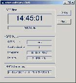
Gps Clock Software is a freeware utility that runs on any Windows NT/2000/XP/2003 workstation or server. The software polls time from a standard NMEA Gps time receiver connected to the host PC's serial port and optionally allows time to be synchronised on the host PC. The Gps clock utility polls GPRMC messages from a standard NMEA Gps time receiver....
Category: Utilities
Publisher: ntp time server, License: Freeware, Price: USD $0.00, File Size: 1.9 MB
Platform: Windows
A very powerful plugin that seamlessly integrates Gps waypoints and Garmin courses into SportTracks, features for which you would have to use Garmin Mapsource™ and Garmin TrainingCenter™ or similar 3rd party applications otherwise.
Category: Home & Education / Miscellaneous
Some of the outstanding features of this plugin are:
-create courses with autorouting
-create waypoints from addresses
Publisher: Old Man Biking's SportTracks Plugins, License: Shareware, Price: USD $13.08, File Size: 1.4 MB
Platform: Windows
OziPhotoTool combines the technology of a Gps receiver and a digital camera to automatically keep a record of where digital photos were taken. It is designed to be used in conjunction with OziExplorer. Most digital cameras have EXIF metadata stored as part of the photo. This includes is the date and time the photo was taken. Many Gps units have 'tracklogs'. The Gps keeps a...
Category: Utilities
Publisher: OziPhotoTool, License: Shareware, Price: USD $25.00, File Size: 14.3 MB
Platform: Windows
My Gps Logger 1.01 is a program designed to be used with My Fuel Tax 4.0. With My Gps Logger you can log all the locations where your truck has been to a monthly data file. This data file can later be imported into My Fuel Tax 4.0 by calculating the miles in state using Microsoftâ Mappoint. This is what you will need to use My Gps Logger with My Fuel Tax:a laptop with...
Category: Home & Education / Miscellaneous
Publisher: Spinnaker Software Solutions, License: Freeware, Price: USD $0.00, File Size: 477.7 KB
Platform: Windows
NovaGPS provides manual or automatic setting of time and location from consumer-grade (or better) Gps receivers. NovaGPS is not the same as Dr. Tom Clark's Totally Accurate Clock because NovaGPS does not require a specialized Gps receiver or modification to other Gps receivers.
Instead, NovaGPS offers accuracy to better than 0.5 seconds using off-the-shelf...
Category: Home & Education / Miscellaneous
Publisher: Northern Lights Software Associates, License: Shareware, Price: USD $19.95, File Size: 1.0 MB
Platform: Windows
You will be able to enjoy many of CompeGPS Landís features such as waypoint and route creation and edition, full communication between PDA and Gps, use of Maps and the moving map (real-time navigation). CompeGPS Pocket Land allows full communication between Gps and PDA (tracks, waypoints and routes). You will be able to create waypoints and routes, use Maps...
Category: Home & Education
Publisher: CompeGPS TEAM S.L., License: Shareware, Price: USD $76.00, File Size: 3.9 MB
Platform:
To integrate these objects into your own customized Gps application you can use
programming environments such as the following Microsoft development systems:
- Visual Studio® 2005
- Visual C#®
- Visual C ®
- Visual Basic®
The applications you develop can be used on any computer running one of the
following operating systems:
...
Category: Utilities / Misc. Utilities
Publisher: Trimble, License: Freeware, Price: USD $0.00, File Size: 25.4 MB
Platform: Windows
The only flight planner that allows you to point-and-click on the official Airservices Australia's Maps to plan flights.
Main Features:
- AirNav VFR is the ultimate Australian PC flight planner for both VFR and IFR pilots
- Plan your flights on digitised versions of the official Airservices Maps
- AirNav VFR calculates all your flight...
Category: Home & Education / Miscellaneous
Publisher: Sentient Software, License: Shareware, Price: USD $0.00, File Size: 0
Platform: Windows
Terrain Tools - Create maps quickly and easily!
Terrain Tools - Create Maps quickly and easily!
Terrain Tools is the ideal tool for outdoor recreationists, real-estate professionals, farmers, ecologists, archaeologists and others who need to create basic Maps, calculate areas, lengths, bearings and distances.
Overlay Gps tracks on scanned images such as USGS or Canadian NTS topos. Import and...
Category: Business & Finance / Applications
Publisher: Softree, License: Shareware, Price: USD $124.00, File Size: 15.0 MB
Platform: Windows


