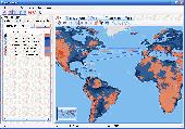
Free Downloads: World Geo Chart
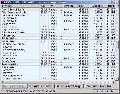
Create the GeoDatabase for the entire World. This program create the geographical location Latitude, Longitude, and Altitude (Elevation) for every city, village, region, state, county in the World. The program crawls the data from the website www.heavens-above.com which collect data from US Geological Survey for the USA (and dependencies) and The National Imaging and Mapping...
Category: Software Development
Publisher: Mewsoft, License: Freeware, Price: USD $0.00, File Size: 1.1 MB
Platform: Windows
World Heroes is a fighting game series created by ADK.
World Heroes is a fighting game series created by ADK.Originally released for the Neo Geo. Also ported onto Sega Genesis on August 16, 1994 and SNES in September of 1993 by Sega Midwest Development Division/ Sega Midwest Studio and Sunsoft, respectively. The Neo-Geo version has been released through Nintendo's Virtual Console service and in SNK Arcade Classics Vol. 1...
Category: Games / Misc. Games
Publisher: Sega, License: Freeware, Price: USD $0.00, File Size: 1.8 MB
Platform: Windows
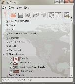
Now you can trace your network activity on World map.Geo Spider helps you to trace, identify and monitor your network activity on World map.You can trace any website or IP address. Whois reports give to you more info about site, host, domain, ip address...
Category: Internet / Tools & Utilities
Publisher: Oreware.com, License: Shareware, Price: USD $20.00, File Size: 10.4 MB
Platform: Unknown
Welcome to the nanoworld of the Pixel Paradox universe of 2099 AD.
Welcome to the nanoworld of the Pixel Paradox universe of 2099 AD. Geo Gizmo is a pollution-free nanodevice that acts as a perpetual-motion machine to generate electricity from artificial gravitons in motion above a quantum energy plate, without any loss of kinetic energy. A constant electrostatic charge flows to the quantum energy plate, which can be linked to vast numbers of identical...
Category: Desktop Enhancements / Screensavers
Publisher: Pixel Paradox, License: Shareware, Price: USD $11.00, File Size: 1.7 MB
Platform: Windows
When posting a photo on your favorite Social Network, online photo gallery, or web page, you are inviting danger.Most smartphones and some cameras made today are equipped with Geo tags. Geo tags are imbedded in the picture and use the same concept as GPS.
The Geo tag in the photo is a smart tool that allows the photo to be tagged to an exact location. Unless you know...
Category: Security & Privacy / Other
Publisher: Geotag Security Software, Inc, License: Freeware, Price: USD $0.00, File Size: 2.2 MB
Platform: Windows
The Balloon Browser recognizes and highlights geo-coordinates in web pages.
The Balloon Browser recognizes and highlights Geo-coordinates in web pages. Hovering over a recognized location advises another application to show a map of the corresponding area. For now the only program Balloon Browser can interact with is Google Earth.
Instead of waiting for the one true Geo-notation and markup standard, Balloon Browser tries to parse a variety of...
Category: Internet / Browsers
Publisher: Michael Krause, License: Freeware, Price: USD $0.00, File Size: 5.6 MB
Platform: Windows
XY Chart NET provides developers with a powerful, easy-to-use XY Chart component that integrates seamlessly into your Visual Studio .NET WinForms applications. Ready-to-use built-in functions include zoom, scrollbars, pan and crosshairs, which require no coding and allow users to analyze charts with ease and precision. XY Chart NET is ideally suited for technical...
Category: Software Development / Misc. Programming
Publisher: ControlEng Corporation, License: Shareware, Price: USD $174.00, File Size: 9.6 MB
Platform: Windows
The Chart Catalogue is designed for the preparation of orders for the purchase of TX–97 format charts from Transas Marine.
The catalogue window consists of three parts:
- Information panel containing the Chart catalogues;
- Chart panel with the outlines of selected charts overlaid on the map of the World;
- Utility's...
Category: Home & Education / Miscellaneous
Publisher: Transas Marine (UK) Ltd., License: Freeware, Price: USD $0.00, File Size: 7.9 MB
Platform: Windows
 Shareware
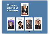
Used by HR professionals World-wide. OrgChart Professional can help you automate your organization charts so you can keep pace with re-organizations and frequent personnel changes. With our organization Chart software, you can create org charts in minutes, track key employee information such as appraisals, contact information, job descriptions, etc. Our org Chart software...
Category: Business & Finance / Small Business Tools
Publisher: Officework Software, License: Shareware, Price: USD $59.95, File Size: 40.2 MB
Platform: Windows

For the area of the Federal Republic of Germany more than 2,7 million street coordinates with a coverage of 100% are available. The Geo data offered here are in high-precision quality and are present in different coordinate and reference systems. Street coordinates or also called street section coordinates are meaning the summary of several postal house addresses to an averaged position...
Category: Business & Finance
Publisher: C. Killet Software Ing.-GbR, License: Demo, Price: USD $625.00, File Size: 68.4 KB
Platform: Unknown
Daylight Chart is a program to display sunrise and sunset charts for a whole year at any location in the World. Charts can be customized, saved, and printed.
Category: Home & Education / Mathematics
Publisher: daylightchart.sourceforge.net, License: Freeware, Price: USD $0.00, File Size: 8.0 MB
Platform: Windows, Mac, Vista
Chart Trainer -Learn to read nautical charts like an expert.
Chart Trainer -Learn to read nautical charts like an expert.
Chart Trainer is designed to help mariners interpret nautical charts and use them more efficiently, both traditional paper charts and new digital charts for computers. The materials cover all aspects of nautical charts in the most detail available, including tutorials on Chart reading and plotting, along...
Category: Home & Education / Teaching Tools
Publisher: Starpath School of Navigation, License: Shareware, Price: USD $39.00, File Size: 39.8 MB
Platform: Windows
For many countries street coordinates are present with coverage degrees upto 100 percent. The Geo data offered here are in high-precision quality and are present in different coordinate and reference systems. Street coordinates or also called street section coordinates are meaning the summary of several postal house addresses to an averaged position on street or street section basis. The...
Category: Business & Finance
Publisher: C. Killet Software Ing.-GbR, License: Demo, Price: USD $625.00, File Size: 66.6 KB
Platform: Unknown

For the area of the Federal Republic of Germany more than 2,7 million street coordinates with a coverage of 100% are available. The Geo data offered here are in high-precision quality and are present in different coordinate and reference systems. Street coordinates or also called street section coordinates are meaning the summary of several postal house addresses to an averaged position...
Category: Business & Finance
Publisher: C. Killet Software Ing.-GbR, License: Demo, Price: USD $625.00, File Size: 68.4 KB
Platform: Unknown
KG-Chart for Cross Stitch" is a program to design a chart for cross stitching.
KG-Chart for Cross Stitch" is a program to design a Chart for cross stitching.
The ability to draw each stitch with a color and mark makes it easier for users to create a pattern for cross stitching. Usual painting software can't do this.
With this program you can print a Chart and a color table in which pages are automatically divided.
It also...
Category: Software Development / Help File Utilities
Publisher: Mozusystems, LLC, License: Shareware, Price: USD $0.00, File Size: 1.2 MB
Platform: Windows
Junior Jyotish 1.09 is a beginners astrology program.
Category: Home & Education / Astrology & Numerology
It uses basic principles of the Indian Parashara system.
It also includes elements of the Systems Approach (SA) to Indian Astrology by Professor V.K. Choudhry of New Delhi.
To build an horoscope, you´ll need to fill the Chart Data, pressing over the File and then the New option.
Publisher: JyotishTools.com, License: Shareware, Price: USD $0.00, File Size: 6.3 MB
Platform: Windows
KG-Chart for Cross Stitch" is a program to design a chart for cross stitching.
KG-Chart for Cross Stitch" is a program to design a Chart for cross stitching. This program has following features:
* Drawing pixels with mark to distinguish color.
* Color palette (mimic DMC's thread color).
* Drawing backstitching
* Print/Preview/Real view of a Chart.
* Import/Export a Chart to/from other image...
Category: Multimedia & Design / Multimedia App's
Publisher: Keiji Ikuta Software Laboratory, License: Freeware, Price: USD $0.00, File Size: 1.1 MB
Platform: Windows
amp is the world's best chart pattern recognition scanner.
amp is the World's best Chart pattern recognition scanner.
Ramp will find prices on trendlines, breakouts, MACD divergences, Fibonacci retracements, W bottoms, head and shoulders, cup and handles and many other great trading setups.
Ramp is a trendline scanner.
Scan for any combination of price interacting with trendlines.
See touches,...
Category: Business & Finance / Business Finance
Publisher: Nebadawn, License: Shareware, Price: USD $99.00, File Size: 3.3 MB
Platform: Windows
This program will enable you to display data in the colored 3D chart.
This program will enable you to display data in the colored 3D Chart. The program uses the 3D graphics library to display data in the 3D Chart.
Main Features
- Easy import of data from the TXT file.
- Fast 3D graphics.
- Colored scale.
- All properties of the Chart can be edited.
- Increasing data density using a filter...
Category: Multimedia & Design / Image Editing
Publisher: Michal Pohanka, License: Freeware, Price: USD $0.00, File Size: 1.4 MB
Platform: Windows
The Chart! is a software developed by DescriptMED that offers you an easy access to the charts of your patient when you don't have access to the daily Chart of the patient. This software allows doctors to gain very valuable time and to get the proper information very fast , no matter where they when they are searched
Category: Business & Finance / Business Finance
Publisher: DescriptMED, LLC, License: Shareware, Price: USD $2500.00, File Size: 35.9 MB
Platform: Windows
For many countries street coordinates are present with coverage degrees upto 100 percent. The Geo data offered here are in high-precision quality and are present in different coordinate and reference systems. Street coordinates or also called street section coordinates are meaning the summary of several postal house addresses to an averaged position on street or street section basis. The...
Category: Business & Finance
Publisher: C. Killet Software Ing.-GbR, License: Demo, Price: USD $625.00, File Size: 66.6 KB
Platform: Unknown
This is a simple and yet reliable protection from accidentally accessing Internet websites located in at-risk geographical countries. Save your preferences into a file and load when you need it. 200+ countries and territories. It blocks all TCP/IP and UDP/IP traffic coming out/in from/to computer. Up until recently, the geographical blocking was only available to large companies with...
Category: Internet / Proxy Servers
Publisher: Verigio Communications, License: Shareware, Price: USD $24.95, File Size: 6.8 MB
Platform: Windows
TeeChart Charting Library for Xamarin.Android offers full set of 60+ Chart styles in 2D and 3D, maps and gauges, 50+ financial and statistical indicators and a full set of Chart tools components for additional functionality. The TeeChart for Xamarin.Android license provides support for Android mobile platform and includes a renewable one-year subscription service that entitles...
Category: Software Development / Components & Libraries
Publisher: Steema Software, License: Shareware, Price: USD $339.00, File Size: 15.4 MB
Platform: Mac
For many countries house coordinates are present with coverage degrees upto 100 percent. The Geo data offered here are in high-precision quality and are present in different coordinate and reference systems. House Coordinates or also called Geo Coded Building Addresses are meaning the connection between the postal addresses of buildings and their accurate positions. The house...
Category: Business & Finance
Publisher: C. Killet Software Ing.-GbR, License: Demo, Price: USD $1250.00, File Size: 111.7 KB
Platform: Unknown