Free Downloads: Aerial View Map
License: All | Free
USAPhotoMaps downloads USGS aerial photo and topo map data from Microsoft?
USAPhotoMaps downloads USGS Aerial photo and topo Map data from Microsoft?s free TerraServer Web site, saves it on your hard drive, and creates seamless maps from it.
Category: Home & Education / Miscellaneous
Publisher: jdmcox.com, License: Freeware, Price: USD $0.00, File Size: 598.4 KB
Platform: Windows, Mac, 2K, 2K3, Vista
Holding Pattern turns your idle computer screen into an airplane window, complete with a moving Aerial View. Each time it plays, the screensaver creates a unique flight sequence. Realistic, gentle animation and superb photography make it a truly distinctive screensaver. Enjoy the visual splendor of 15 fresh Aerial locations, from the majestic American West to lush Hawaii....
Category: Desktop Enhancements / Screensavers
Publisher: Idle Time Software, License: Freeware, Price: USD $0.00, File Size: 6.0 KB
Platform: Windows
Satellite earth is a software for viewing satellite and aerial imagery of the Earth.
Satellite earth is a software for viewing satellite and Aerial imagery of the Earth.Satellite Earth allows you to enjoy virtual travel around the world, look up local information and plan trips, exploring multimedia content and share information about your trips.Explore towns, cities and terrain relief shown in three-dimensional images of high resolution associated with related...
Category: Home & Education / Science
Publisher: www.satelliteview-of-my-house.com, License: Freeware, Price: USD $0.00, File Size: 584.0 KB
Platform: Windows
Get a full 3D satellite map view of El Petacon on your PC.
Get a full 3D satellite Map View of El Petacon on your PC. If you have already installed Google Earth, you will be able to View the El Petacón 3D Map. You will enjoy a beautiful View of this geographic place and you will have the world's geographic information at your fingertips.
Category: Home & Education / Miscellaneous
Publisher: Maplandia, License: Freeware, Price: USD $0.00, File Size: 331 B
Platform: Windows
Whether you need accurate data for GIS applications or visual simulation applications, GeoGenesis provides you the ability to exploit commercial satellite or Aerial imagery to meet your requirements. For Aerial or satellite imagery, GeoGenesis provides advanced automated tie point extraction to geospatially link multiple images together. Using our bundle adjustment algorithm you...
Category: Home & Education / Miscellaneous
Publisher: IAVO Research And Scientific, License: Freeware, Price: USD $0.00, File Size: 73.9 MB
Platform: Windows
 Freeware
Arm Map Explorer recreates all the functionalities of Google Maps on your desktop while expanding them with new extras. Map Explorer lets you locate and View any place on the planet using dynamic interactive maps. These maps are draggable, which means there is no need for you to click and wait for graphics to reload each time you want to View adjacent parts of a...
Category: Internet / Flash Tools
Publisher: ArmCode, License: Freeware, Price: USD $0.00, File Size: 5.5 MB
Platform: Windows
Tibia Map Viewer is a useful freeware and Open Source application that allows you to View maps generated by Tibia game client and create or edit Map symbols.
You can View the entire Tibia Map you have explored, both upper and lower levels of the Map, with zoom ratio from 25 to 400 percents. It also allows you to export to BMP file.
Category: Games / Tools & Editors
Publisher: Yury Sidorov, License: Freeware, Price: USD $0.00, File Size: 193.7 KB
Platform: Windows
The C-Map Chart Catalog allows you to View, navigate, select and order C-Map electronic charts, or various weather options, in an interactive way. After selection of required items is completed, simply press the 'E-mail order' button, and enter the address of your local C-Map distributor.
Category: Home & Education / Hobbies
Publisher: Jeppesen Marine, License: Freeware, Price: USD $0.00, File Size: 6.1 MB
Platform: Windows
Spinning Gobe Sample demonstrates how to manipulate the navigation, Map style, Map font size, and View of the Map programmatically through the MapPoint ActiveX Control. Using this simple Visual Basic project, you will learn the objects, methods, and properties that are used to navigate a MapPoint Map or change how it looks.
Category: Home & Education / Miscellaneous
Publisher: Microsoft, License: Freeware, Price: USD $0.00, File Size: 3.4 MB
Platform: Windows
Microsoft Location Finder 3.0 is a handy tool, which using the current location of the computer, generates orientation maps, distances and optimal routes between two cities, and 3D visual tours.
The program generates this information using Wi-Fi signals detected within the area near the PC. However this PC does not need Wi-Fi, but any type of Internet connection. It runs on Windows 2000...
Category: Home & Education / Miscellaneous
Publisher: Microsoft, License: Freeware, Price: USD $0.00, File Size: 3.9 MB
Platform: Windows
Program shows you an actual X3 sector-map, with detailed information about most in-game objects.
Program shows you an actual X3 sector-Map, with detailed information about most in-game objects. The Map is based on a log-file that is created with an in-game script (by Andrei[<>Ace]). If you just want to View the standard Map (or if you don’t have the game) the program will work with the included default Map, which was created with an English X3...
Category: Games / Misc. Games
Publisher: SUU Design, License: Freeware, Price: USD $0.00, File Size: 1.4 MB
Platform: Windows
LODAR can be mounted almost anywhere on the vehicle as there are no external Aerial to worry about - extra wiring is unnecessary. It has a powerful Receiver that even accepts signals under the chassis, although we would suggest that you position the Receiver in a more sensible place for the best possible reception. There are only four wires to connect the 2 Function Receiver; ground,...
Category: Business & Finance / Business Finance
Publisher: AM Software Solutions Limited, License: Freeware, Price: USD $0.00, File Size: 2.0 MB
Platform: Windows
Download this free updater for your desktop:
- Maps, voices, Aerial photography, TTS, funny voices
- Better interface
- Faster and easier NDrive
- Safer backup to avoid loss of info
- Deeper View on the status of your device
- Clean and safe payment flow
Category: Utilities / Misc. Utilities
Publisher: NDrive, License: Freeware, Price: USD $0.00, File Size: 25.5 MB
Platform: Windows
With links and additional information on important topics for geography lessons.
With links and additional information on important topics for geography lessons. 3D-View of atlas (book) maps on a virtual globe, high resolution physical Map, political Map, satellite images, land coverage and earth-at-night Map. Create your own Map legend, use the drawing tool, move and insert atlas symbols and much more.
Category: Multimedia & Design / Fonts
Publisher: Imagon GmbH, License: Freeware, Price: USD $0.00, File Size: 6.1 MB
Platform: Windows
Getmapping Viewer is an easy to use Aerial photo and mapping viewer featuring interactive roaming, zooming, measuring tools and more.
Main features:
- Save imagery as TIFF, JPEG, BMP, ERS, and BIL directly from ER Viewer.
- View ECW images served by an Image Web Server. See www.EarthEtc.com for demo images.
- View local images larger...
Category: Multimedia & Design / Graphics Viewers
Publisher: Getmapping plc, License: Freeware, Price: USD $0.00, File Size: 3.4 MB
Platform: Windows
Gismaps Viewer is a GIS viewer that can be used for geospatial analysis and map production.
Gismaps Viewer is a GIS viewer that can be used for geospatial analysis and Map production.
The main features are:
- read Shape files using geographic coordinate system
- View satellite images (MrSid, jpeg, bmp and tiff file formats)
- generate thematic maps, queries and labels
- export do Google Earth KML (shp2kml)
- configure Map...
Category: Multimedia & Design / Graphics Viewers
Publisher: Gismaps Sistemas Ltda., License: Freeware, Price: USD $0.00, File Size: 10.2 MB
Platform: Windows
Freeware
An interactive Flash USA Map with all the features you need for your web site or project. This is the ideal solution for dealer maps, real-estate listings, or visualizing state statistics. Nearly every aspect of the Map is customizable. However, unlike competing products, our Map is very simple to install and edit. Just upload XML and SWF files and embed.
Category: Internet / Flash Tools
Publisher: http://www.flashusamap.com/trial/flashus, License: Freeware, Price: USD $0.00, File Size: 93.8 KB
Platform: Unknown
Map of Africa is one of the many maps created for GPS TrackMaker.
Map of Africa is one of the many maps created for GPS TrackMaker. You are able to download the installation package from the TrackMaker website. In order to preview the contents of this package, you need to install GPS TrackMaker.
Using the above mentioned application, you will be able to see the Map of Africa. Just click on the "Open Temporary...
Category: Home & Education / Miscellaneous
Publisher: Geo Studio Technology, License: Freeware, Price: USD $0.00, File Size: 18.3 MB
Platform: Windows
Plan, Estimate, and Manage Your Static Scanning Project
Features:
- Utilize Aerial imagery from multiple online sources including Bing, Google and Yahoo maps
- Place scan positions using automatic control detection and system range
- Import or create control coordinate network
- Identify three possible scan position times based on traffic...
Category: Business & Finance / Project Management
Publisher: Certainty 3D, License: Freeware, Price: USD $0.00, File Size: 17.6 MB
Platform: Windows
Geosoft Plug-In for ER Viewer enables users to view and use Geosoft grid (.
Geosoft Plug-In for ER Viewer enables users to View and use Geosoft grid (.grd) and Map (.Map) files in the ER Viewer application.
This plug-in use a globe explorer, to find, View, and extract data from a variety of data servers. You can use internal servers as well as public servers including DAP servers, WMS servers, ArcIMS servers, and Tile Servers.
Category: Home & Education / Miscellaneous
Publisher: Geosoft Inc., License: Freeware, Price: USD $0.00, File Size: 50.3 MB
Platform: Windows
New Zealand Map Reference Converter (NZMapConv) is software that LINZ provides to convert Map references between the old NZMS260 Map series and the new NZTopo50 Map series.NZMapConv is a Windows programme designed to convert individual coordinates entered manually.
Category: Multimedia & Design / Media Management
Publisher: Land Information New Zealand, License: Freeware, Price: USD $0.00, File Size: 2.4 MB
Platform: Windows
When the XMAP software is communicating with an XEDE via the comms cable each Map will show, at the top of the Map display, an RPM and load value (x and y axis for the Map) in real time. Also in each Map a yellow highlighted block will show the current position within the Map. Beside the real-time display on each Map are the undo and redo buttons which...
Category: Home & Education / Miscellaneous
Publisher: ChipTorque, License: Freeware, Price: USD $0.00, File Size: 1.7 MB
Platform: Windows
Sig Panama Has :
Digital maps of Panama, Digital Map of Panama-City, digital Map of Taboga, digital Map of Bocas del Toro, digital Map of Colon and Free Zone, digital Map of Contadora Island, digital Map of Coronado, Panama, Zona Libre, Map of Panama, Map of Panama City, Map of Colon, Map of Zona Libre, Map of...
Category: Internet / Misc. Plugins
Publisher: DP Imperial, LLC., License: Freeware, Price: USD $0.00, File Size: 44.9 MB
Platform: Windows
CitySurfGlobe is an application that allows users to view places on Earth in 3D mode.
CitySurfGlobe is an application that allows users to View places on Earth in 3D mode. It provides quick navigation tools for the identification of specific points of interest on the Map.
The application stands as a good touristic guide, as it allows users to access a great amount of information about cities, buildings, parks, means of transport, etc. from specific...
Category: Home & Education / Miscellaneous
Publisher: PiriReis Bilisim Teknolojileri LTD.STI., License: Freeware, Price: USD $0.00, File Size: 11.4 MB
Platform: Windows
WolfPack software is for educational use.
WolfPack software is for educational use. It includes:
-Wolfpack.exe: The executable program.
-Wolfpack.chm: A compiled help file
-30 sample data files located in the Elementary Surveying subdirectory of My Documents
-6 digital Aerial photo files in three resolutions: Only one resolution (low, medium, high) can be loaded with one installation of the software. This...
Category: Home & Education / Miscellaneous
Publisher: Elementary Surveying, License: Freeware, Price: USD $0.00, File Size: 102.8 MB
Platform: Windows
With HD View, you can view and interact with very large images on the Web.
With HD View, you can View and interact with very large images on the Web. HD View supports smooth panning and zooming, as well as appropriate viewing perspectives as you zoom in and out. HD View also makes creating and hosting your own HD View images easy. HD View is available as a plug-in for Windows-based browsers.Recent advances in camera and sensor...
Category: Audio / Utilities & Plug-Ins
Publisher: Microsoft Research, License: Freeware, Price: USD $0.00, File Size: 1.2 MB
Platform: Windows
The easiest way to get a paper map with MapPlot is the Plot Map menu.
The easiest way to get a paper Map with MapPlot is the Plot Map menu.
On the following dialog, simply paper size and scale have to be chosen - the result is ready to be printed directly, edited (e.g. for additional entries) or to be displayed as a preview.
Category: Utilities / Misc. Utilities
Publisher: AGIS GmbH, License: Freeware, Price: USD $0.00, File Size: 5.4 MB
Platform: Windows
High resolution 1 meter-per-pixel photographic day time scenery textures (from 1 meter-per-pixel Aerial photographic source).
Computer generated night time scenery (1 meter-per-pixel).
High resolution 25 meters terrain mesh (upsampled to 19 meters).
Extensive water body definition including inland lakes and rivers for water takeoffs and landings.
Full area...
Category: Home & Education / Miscellaneous
Publisher: SIMSCENERY PTY LTD, License: Freeware, Price: USD $0.00, File Size: 72.2 MB
Platform: Windows
EaziTRAC System 2000 is a PC based tracking application software that uses the Google Map to present the
real time tracking of EaziTRAC 1000 and EaziTRAC 2000 devices on a Map. It can be used world wide and
at the privacy of your home on an internet enabled PC. The EaziTRAC System 2000 features include instant
or continuous tracking with data log and playback...
Category: Security & Privacy / Other
Publisher: Daviscomms (S) PTE LTD, License: Freeware, Price: USD $0.00, File Size: 3.4 MB
Platform: Windows
GlobeXplorer's ImageConnect for MapInfo is a unique extension that instantly brings georeferenced satellite and Aerial photos into your desktop or mobile project from our online database. ImageConnect takes away the time, cost and hassle of locating an image provider, waiting for delivery, and managing large image files.
Category: Internet / Misc. Plugins
Publisher: GlobeXplorer, LLC, License: Freeware, Price: USD $0.00, File Size: 2.0 MB
Platform: Windows
The MapMart On-Demand™ toolbar enables a user to access Aerial, satellite, DEM, topography and vector data from within the ArcMap application. Once a user installs the plug-in within ESRI ArcMap 9.2 or 9.3, users will be able to research, preview, purchase and download imagery and data for their projects inside ArcMap
Category: Software Development / Misc. Programming
Publisher: MapMart, License: Freeware, Price: USD $0.00, File Size: 954.8 KB
Platform: Windows
CacheMagnet is a free, open source geocaching waypoint management program.
CacheMagnet is a free, open source geocaching waypoint management program.
With CacheMagnet, you can read and display contents of .GPX or .LOC files, download waypoints to your GPSr, load .ZIP files from geocaching.com pocket queries, edit cache descriptions and waypoint locations (great for puzzle caches), save changes to GPX files, print reports and maps, combine waypoint files...
Category: Home & Education / Miscellaneous
Publisher: Brian Erickson, License: Freeware, Price: USD $0.00, File Size: 609.0 KB
Platform: Windows
Site Mapper will analyze the contents of a web site, and create a detailed Map with an indexed listing of all resources by page and category.
Features:
- Spellcheck documents as they are mapped
- Built in document preview functionality
- Integrates with your favorite document editor
- Functions with local and online files
- Save files to...
Category: Web Authoring / Web Design Utilities
Publisher: Trellian, License: Freeware, Price: USD $0.00, File Size: 2.4 MB
Platform: Windows
The goal is to get a logic and a topographic view on the network.
The goal is to get a logic and a topographic View on the network. The prototype Jisio (OBST Network Visualization based on platform independent Java) can collect GPS-data to generate a Map of your network area. The topographic View is for setting the position of your network sites. In the other View you can get them in a network-relationship.
All 2D- Icons are...
Category: Internet / Misc. Plugins
Publisher: chelys, License: Freeware, Price: USD $0.00, File Size: 2.9 KB
Platform: Windows
C&C 3 Map Manager streamlines the process of installing custom maps for C&C 3: Tiberium Wars and Kane's Wrath. Now you can install fan maps from C&C fansites without having to delve into your computer's folders to find the right place to put them: Map Manager handles this for you. Map Manager also allows you to delete fan maps after you get sick of...
Category: Games / Tools & Editors
Publisher: CNC Generals World, License: Freeware, Price: USD $0.00, File Size: 612.3 KB
Platform: Windows
Karnaugh map minimalizator - for minimalize logical functions for 3-8 variables.
Karnaugh Map minimalizator - for minimalize logical functions for 3-8 variables. This program help you safe logical circuits. This program is special for students. On left you can see a full Map of your function. Negation of variable is big capital.
Category: Home & Education / Mathematics
Publisher: Vaclav Kozak, License: Freeware, Price: USD $0.00, File Size: 253.0 KB
Platform: Windows
The D2D Map Editor enables the rapid creation of multilayered tile based map grids.
The D2D Map Editor enables the rapid creation of multilayered tile based Map grids. It’s easy to learn and can be used by programmers and non-programmers alike. The maps generated can be deployed in games and applications developed in C++, C#, Actionscript and XML.
D2D Map Editor has been developed in C# and is currently released as a Beta version.
Category: Games / Tools & Editors
Publisher: D2D Map Editor, License: Freeware, Price: USD $0.00, File Size: 2.5 MB
Platform: Windows
Character Map displays all of the characters for a selected font.
Character Map displays all of the characters for a selected font. Features:
- Pastes any character into your current document.
- Special characters can be translated into their HTML-equivalents.
- More than a replacement for the Windows (9x/NT) character Map "charmap".
- Many additional features
- Ready for €
- Uncrippled...
Category: Utilities / Misc. Utilities
Publisher: Thomas Bigler, License: Freeware, Price: USD $0.00, File Size: 88.5 KB
Platform: Windows
If you don't have internet access on your phone, or you want to self-select a larger region of mapping, then the Map Chooser tool can be used to make Map tile selections. Choose your own mapping areas with the flexible select tool that lets you select unlimited areas of mapping. Based on a grid, you can choose any grid squares you like - so you can pick an area in Sussex and...
Category: Home & Education / Miscellaneous
Publisher: ViewRanger, License: Freeware, Price: USD $0.00, File Size: 213.2 MB
Platform: Windows
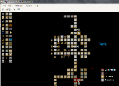
MUD Map Designer is a tool that was developed for MUD programmers that wish to make maps for plotting or simply beneficial reasons. All files can be exported to several different image types. You can create your own setup files and Map icons to use to customize each game!
Here are some key features:
-You can save, load, or export maps. You can export maps into one of the...
Category: Software Development / Help File Utilities
Publisher: Stonefall Studios, License: Freeware, Price: USD $0.00, File Size: 455.0 KB
Platform: Windows
Freeware
org, uses file and position names that suit to the display of the TomTom Rider, uses file, route and position names that suit to the display of the Map&Guide Motorrad Tourenplaner, remembers language, paths, window size and position. . .
Category: Business & Finance / Conversion Applications
Publisher: Christian Pesch, License: Freeware, Price: USD $0.00, File Size: 6.6 MB
Platform: Windows, Mac, Linux, Solaris, FreeBSD, OpenBSD, Java
MapCreator 2.0 is a software to create maps and animated maps with a good quality.
MapCreator can be used in presentations because is versatile and can be adequate for any kind of presentation, from travel presentations to professional presentations.
MapCreator is geo-referenced so any Map or portion of the Map will have the exactly portions of latitude and longitude,...
Category: Home & Education / Miscellaneous
Publisher: primap software, License: Freeware, Price: USD $0.00, File Size: 103.3 MB
Platform: Windows
Create custom maps. Load Z-Chip Tuner Map files.
View engine RPM and Load in Real time. This tool allows customization of of Map files with ease. ZChip Tuner is a useful tool especially in the hand of an advanced user, but can work efficiently in the hand of a beginners aswel.
Category: Desktop Enhancements / Shell & Desktop Managers
Publisher: Zeitronix, License: Freeware, Price: USD $0.00, File Size: 611.2 KB
Platform: Windows
Nokia Map Manager is a program that allows you to manage and transfer GPS maps to mobile phone.
Nokia Map Manager is a program that allows you to manage and transfer GPS maps to mobile phone. The Map Manager is for the 6110 Navigator only. The program is provided with scan function to search maps on the computer and DVD. Nokia Map Manager is an additional application and is used together with Nokia PC Suite 6.86 and later versions.
Nokia Map Manager helps...
Category: Internet / Communications
Publisher: Nokia, License: Freeware, Price: USD $0.00, File Size: 0
Platform: Windows
CaddyConnect is a software that helps you to connect the Caddy devices to your computer and download the required course Map (subject to a valid Golf Plus membership or Map Credit being available). Once the Map has been successfully downloaded onto the Caddy Lite, it is ready for use when the device is switched on and the course selected when the player arrives at the golf...
Category: Business & Finance / Business Finance
Publisher: GolfPlus UK Limited, License: Freeware, Price: USD $0.00, File Size: 10.2 MB
Platform: Windows
In this game there will be a map filled with colored grids.
In this game there will be a Map filled with colored grids. Your colony starts with the home grid in the center of the Map marked by a flag. The goal of the game is to turn all the grids into the same color. You can change the color of your home grid and all connected grids by clicking on other colored grids in the Map. Continue the process and you will be able to turn all...
Category: Games / Misc. Games
Publisher: Novel Games Limited, License: Freeware, Price: USD $0.00, File Size: 264.5 KB
Platform: Windows
NetBrain Map Edition Lite is a free software designed to help network professionals to learn network skills easier and faster. For instance, you can use this software to document your learning process toward CCIE, CCNP or CCNA with a data-driven Map. Using NetBrain Map Edition Lite, dynamic network diagrams can be created instantly in many different ways. For example, you...
Category: Internet / News Applications
Publisher: NetBrain Technologies,Inc., License: Freeware, Price: USD $0.00, File Size: 53.0 MB
Platform: Windows
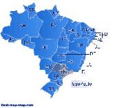
Dongsoft Interactive Brazil Flash Maps for websites, interactive Map applications, presentations, and more.
The innovation of this fully-clickable Map will revolutionize your website navigation and provide visitors with a simple and seamless method of accessing information. Using the Map as a central navigation tool, information can be accessed with greater speed,...
Category: Software Development / Help File Utilities
Publisher: maps flash, License: Freeware, Price: USD $0.00, File Size: 156.0 KB
Platform: Windows
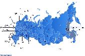
Dongsoft Interactive Russia Flash Maps for websites, interactive Map applications, presentations, and more.
The innovation of this fully-clickable Map will revolutionize your website navigation and provide visitors with a simple and seamless method of accessing information. Using the Map as a central navigation tool, information can be accessed with greater speed,...
Category: Software Development / Help File Utilities
Publisher: clickable map, License: Freeware, Price: USD $0.00, File Size: 156.0 KB
Platform: Windows
This application was written for importing .
This application was written for importing .Map files created with editors such as Hammer into Cartography Shop. It will scan a .Map file and generate a .CSM file with all dependent textures required by the .CSM file. All brushes are separated for easier level modification.
Category: Utilities / Misc. Utilities
Publisher: Apex, License: Freeware, Price: USD $0.00, File Size: 1.4 MB
Platform: Windows