Free Downloads: Arcgis Arcsde For Informix
License: All | Free
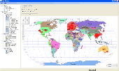
Arcgis Explorer is a free, downloadable GIS viewer that gives you an easy way to explore, visualize and share GIS information. Arcgis Explorer adds value to any GIS because it helps you deliver your authoritative data to a broad audience.
The Arcgis Explorer Desktop Current User setup is intended for users who do not have administrator access on their computers and...
Category: Desktop Enhancements / Shell & Desktop Managers
Publisher: Environmental Systems Research Institute, Inc., License: Freeware, Price: USD $0.00, File Size: 94.0 MB
Platform: Windows
SDEMonitor, the utility that lets systems administrators monitor the activities of any Arcsde server on a network.
When SDEMonitor is running, each monitor session is multithreaded and all calls to the Arcsde C-API are multithreaded. Multithreading protects each session and allows a session to recover from failed or hung process calls. SDEMonitor can also now be installed...
Category: Security & Privacy / Other
Publisher: Paul Dodd, License: Freeware, Price: USD $0.00, File Size: 1.3 MB
Platform: Windows
Projection Engine Expansion Pack - Adds more projections and geotransformations for use with Arcgis Explorer Desktop.
Arcgis Explorer Desktop adds value to any GIS because it helps you deliver your authoritative data to a broad audience.
With Arcgis Explorer Desktop, you can access ready-to-use Arcgis Online basemaps and layers.
Category: Multimedia & Design / Multimedia App's
Publisher: Environmental Systems Research Institute, Inc., License: Freeware, Price: USD $0.00, File Size: 69.9 MB
Platform: Windows
The Arcgis Military Analyst extension incorporates a suite of display and analysis tools tailored to meet the special needs of the defense and intelligence user. With Arcgis Military Analyst, you can create, query, analyze, and display spatial data in a variety of formats.
Arcgis Military Analyst maximizes the use of the standard suite of the Department of...
Category: Multimedia & Design / Multimedia App's
Publisher: Environmental Systems Research Institute, Inc., License: Freeware, Price: USD $0.00, File Size: 31.9 MB
Platform: Windows
The Arcgis Editor for OpenStreetMap is designed to help Arcgis Desktop users to become active members in the growing community of users building an open and freely available database of geographic data.
The provided tools allow you to download data from the OSM servers and store it locally in a geodatabase. You can then use the familiar editing environment of...
Category: Business & Finance / Business Finance
Publisher: ESRI, License: Freeware, Price: USD $0.00, File Size: 3.6 MB
Platform: Windows
Arcgis Image Server is designed to be open, enabling developers to expand its functionality and integrate it with their applications. The core structures that Arcgis Image Server uses are a combination of Extensible Markup Language (XML) and simple tables stored as shapefiles. The Service Editor component provides a graphic user interface (GUI) that enables you to create services...
Category: Utilities / Misc. Utilities
Publisher: Environmental Systems Research Institute, Inc., License: Freeware, Price: USD $0.00, File Size: 3.8 MB
Platform: Windows
Arcgis Explorer Desktop is a free GIS viewer that gives you an easy way to explore, visualize, and share GIS information. Arcgis Explorer adds value to any GIS because it helps you deliver your authoritative data to a broad audience.
Easy and intuitive to use it's easy for anyone to begin working with Arcgis Explorer, with its intuitive and easy to use...
Category: Home & Education / Miscellaneous
Publisher: Environmental Systems Research Institute, Inc., License: Freeware, Price: USD $0.00, File Size: 100.5 MB
Platform: Windows
This utility adds LAS file read capability to ArcGIS.
This utility adds LAS file read capability to Arcgis. Point x, y, z, intensity, return and classification values are read from the file and presented as a standard 3-D point data layer which can then be used as input to extensions such as 3-D Analyst.
Category: Multimedia & Design / Multimedia App's
Publisher: GeoCue, License: Freeware, Price: USD $0.00, File Size: 8.4 MB
Platform: Windows
The API is built on the Microsoft Silverlight platform which is integrated with Visual Studio 2010 and Expression Blend 4. The Arcgis API for Silverlight enables you to create rich internet and desktop applications that utilize the powerful mapping, geocoding, and geoprocessing capabilities provided by Arcgis Server and Bing™ services.
To use the API, simply download...
Category: Software Development / Misc. Programming
Publisher: ESRI, License: Freeware, Price: USD $0.00, File Size: 7.7 MB
Platform: Windows
G2G is a P2P (peer to peer) extension for ArcGIS Desktop.
G2G is a P2P (peer to peer) extension for Arcgis Desktop. The extension allows two or more users to collaborate without any intermediate server. G2G (gis to gis) supports:
1) Text chatting,
2) Exchange of map content (geo-referenced screenshots),
3) Ink and graphics collaboration (shared editing),
4) Share navigation (one person can pan the map display of other...
Category: Internet / Misc. Servers
Publisher: ESRI, License: Freeware, Price: USD $0.00, File Size: 1.3 MB
Platform: Windows
Informix ODBC Driver Install is a driver that makes possible that any tool connect to the Connection 2.1(1) or later database. It's only necessary to install this once on each Windows box you intend to use to run remote Unity Connection tools. Now you can configure the remote ODBC access from off box.
Category: Utilities / Misc. Utilities
Publisher: Cisco Systems, License: Freeware, Price: USD $0.00, File Size: 6.9 MB
Platform: Windows
The Geosoft Plug-in for Arcgis is an extension to the Arcgis desktop software that provides data retrieval using DAP and also support for reading Geosoft file formats. The plug-in enables users to view Geosoft grid files as a raster layer inside ArcMap. The plug-in also enables users to view Geosoft Maps as layers.
Geosoft plug-in for Arcgis includes access to Seeker,...
Category: Utilities / Misc. Utilities
Publisher: Geosoft Inc., License: Freeware, Price: USD $0.00, File Size: 133.5 MB
Platform: Windows
SDE Remote MON allows an SDE Administrator to remotely monitor and manage ArcSDE services.
SDE Remote MON allows an SDE Administrator to remotely monitor and manage Arcsde services.SDE Remote MON uses the command line utility "SDEMON.EXE" to manage the remote SDE Server.
However, a DOS window is not required to view the command output. It is all done through windows.
SDE Remote MON creates a batch file on the fly with the appropriate SDEMON...
Category: Internet / Remote Access
Publisher: Tony Wilson, License: Freeware, Price: USD $0.00, File Size: 396.1 KB
Platform: Windows
The Infrastructure Mobile Map template is an Arcgis Mobile application that can be used by field operations and maintenance staff in a water utility or public works department. This mobile application includes two multi-scale mobile maps (daytime and nighttime) that can be used in a disconnected network environment, two online basemaps that were authored from the Local Government Basemap...
Category: Internet / Communications
Publisher: ESRI, License: Freeware, Price: USD $0.00, File Size: 515.4 MB
Platform: Windows
ArcReader is a free, easy-to-use desktop mapping application that allows users to view, explore, and print maps and globes. Anyone with ArcReader can view high-quality interactive maps authored by a high-level Arcgis Desktop product and published with the Arcgis Publisher extension.
ArcReader is a free and easy-to-use application that allows users to view and print...
Category: Desktop Enhancements / Shell & Desktop Managers
Publisher: Environmental System Research Institute, Inc., License: Freeware, Price: USD $0.00, File Size: 499.2 MB
Platform: Windows
SWATeditor is a companion software to ArcSWAT.
SWATeditor is a companion software to ArcSWAT. SWATeditor reads the project database generated by ArcSWAT interface to edit swat input files, execute SWAT, perform sensitivity, autocalibration and uncertainty analysis. This is a standalone program and does not require Arcgis, thus helping users of ArcSWAT to share their project with others that do not have Arcgis or much...
Category: Business & Finance / Applications
Publisher: Grassland, Soil & Water Research Laboratory, USDA-ARS, License: Freeware, Price: USD $0.00, File Size: 15.6 MB
Platform: Windows
This program allows connections to personal geodatabases and multi-user geodatabases using the 2-tier connect architecture (direct-connect). To install this little program, first you need to have on your computer Arcgis Explorer software. The software is easy to install and easy to manipulate.
Category: Multimedia & Design / Image Editing
Publisher: Environmental Systems Research Institute, Inc., License: Freeware, Price: USD $0.00, File Size: 47.6 MB
Platform: Windows
The ArcPhoto Tools are a set of geoprocessing tools and ArcMap user interface enhancements to enable the quick import of digital photography into the Arcgis framework. The tools work directly off the EXIF (Exchangeable image file format) header information that is encoded into digital imagery. This information usually includes information about the type of camera used, focal length,...
Category: Multimedia & Design / Multimedia App's
Publisher: ESRI, License: Freeware, Price: USD $0.00, File Size: 25.0 MB
Platform: Windows
This stand alone application aids in the loading of CD's of CADRG data from NIMA.
This stand alone application aids in the loading of CD's of CADRG data from NIMA. The application uses ArcInfo Workstation, ArcObjects, and Arcsde to load each frame file from the CD into either a raster dataset or a raster catalog. The application comes with an installer and the unpacked product aswell.
Category: Multimedia & Design / Image Editing
Publisher: ESRI, License: Freeware, Price: USD $0.00, File Size: 1.1 MB
Platform: Windows
The Biogeography Branch’s Sampling Design Tool for Arcgis provides users a means to efficiently sample a population, be it people, animals, objects or processes, in a GIS environment. The tool was created for sampling when the population and component sampling units are defined by known dimensions.
The Sampling Design Tool was developed in response to a need by...
Category: Business & Finance / Applications
Publisher: Center for Coastal Monitoring and Assessment, License: Freeware, Price: USD $0.00, File Size: 236.7 KB
Platform: Windows
SemGrid (Simple easy manager of Grid data, for SEMoLa).
SemGrid (Simple easy manager of Grid data, for SEMoLa). Some of its features are: Freeware raster GIS, for Windows OS, import and export of grid layers from ASCII grid files of Surfer (grd), GeoMedia (asc), Arcgis (asc) and binary or ASCII from Idrisi32 (rdc, rst), GeoEAS, GRASS, map algebra, Markov chains estimation and simulation and much more.
Category: Business & Finance / Applications
Publisher: Francesco Danuso, University of Udine, License: Freeware, Price: USD $0.00, File Size: 7.9 MB
Platform: Windows
This utility scans exe or dll files of your choosing and detects usage of .
This utility scans exe or dll files of your choosing and detects usage of .NET types released by ESRI. It then generates a report of this usage for your review.
Among other things, you can use the information provided to verify that you are not using types from assemblies that require licenses beyond your target license level or to generate a list of types that you can compare...
Category: Utilities / Misc. Utilities
Publisher: Environmental Systems Research Institute, Inc., License: Freeware, Price: USD $0.00, File Size: 743.3 KB
Platform: Windows
Xml Vision Converter Tool is used to convert database data onto xml document.
Xml Vision Converter Tool is used to convert database data onto xml document.
This program can convert odbc, ole db and native database provider data onto xml document. Users can connect to any type of relational database ( Oracle, Microsoft SQL Server, Microsoft Access Database, DB/2, MySQL, Sybase, Progress, Informix, Postgress, Virtuoso and others) into xml document.
Category: Audio / Rippers & Encoders
Publisher: Xml Mission, License: Freeware, Price: USD $0.00, File Size: 935.8 KB
Platform: Windows
Military Overlay Editor (MOLE) is a set of COM components for developers to create custom applications that support Department of Defense . With MOLE, you can
- Add geographic data while composing and positioning unit symbols.
- Perform automatic stacking, decluttering of symbols, and placement of leader lines.
- Import, locate, and display order of battle databases.
Category: Utilities / Misc. Utilities
Publisher: Environmental Systems Research Institute, Inc., License: Freeware, Price: USD $0.00, File Size: 116.6 MB
Platform: Windows
MxD Browser is a light-weight utility for assisting novice users in previewing and launching ArcMap documents. When pointed at a directory that contains MXD and/or PMF files, MXD Browser displays the thumbnail images associated with these documents. The user may then double-click on a thumbnail to launch the document in it's appropriate application. For this simple capability, ArcCatalog...
Category: Utilities / Misc. Utilities
Publisher: Mike Quetel, License: Freeware, Price: USD $0.00, File Size: 4.2 MB
Platform: Windows
SWATioTools is a set of utilities to assist with pre- and post-processing of data in Soil and Water Assessment Tool (SWAT). Core components of the set include SSURGO soil processing utility, conversion of NexRad precipitation data, and calibration tools, among others. SWATioTools is written in Visual Basic with ArcObjects and presented in a user friendly graphical interface as an extension to...
Category: Business & Finance / Applications
Publisher: Kansas State University, License: Freeware, Price: USD $0.00, File Size: 487.8 KB
Platform: Windows
InterpOSe for Digimap is designed to process the data delivered as part of EDINA's new OS MasterMap service for Academic Organisations within the UK. It handles both the Topography and ITN layers of OS MasterMap for conversion to various file formats, including Shape, TAB, mid/mif and DWG/DXF.
The InterpOSe for Digimap edition can slice OS MasterMap data into tiles, which...
Category: Business & Finance / Business Finance
Publisher: Dotted Eyes, License: Freeware, Price: USD $0.00, File Size: 65.5 MB
Platform: Windows
Shape Viewer is a free tool, which you can use to view ESRI Shape files.
Shape Viewer is a free tool, which you can use to view ESRI Shape files.
Shape Viewer can open (.shp) files that contain the geometry information of the shape file.With Shape Viewer you can also create new (.shx) file, and new empty (.dbf) file for your shape file.
If you have hundreds of shape files, and you want to view their contents rapidly, and you don't want to open each...
Category: Multimedia & Design / Graphics Viewers
Publisher: Mohammed Hammoud, License: Freeware, Price: USD $0.00, File Size: 35.0 KB
Platform: Windows
Migrate-Data is a pure java and an extremely powerful enterprise data migration tool. It supports open source and commercial databases. With Migrate-Data the user can easily extract, transform, load and integrate data from any-to-any databases. In addition the user can also perform customized data extraction from source and create customized target objects. FEATURES 1.Migrates data to...
Category: Software Development
Publisher: akcess, License: Freeware, Price: USD $0.00, File Size: 20.1 MB
Platform: Windows, MS-DOS
ASF Convert To Vector is a freeware software by Alaska Satellite Facility
Convert to Vector is a small program made to transform point or scene information to various other formats that are compatible with external applications such as Google Earth, GIS software such as Arcgis, text editors, and spreadsheets.
Category: Utilities / Misc. Utilities
Publisher: Alaska Satellite Facility, License: Freeware, Price: USD $0.00, File Size: 8.3 MB
Platform: Windows
DataVision is an Open Source reporting tool similar to Crystal Reports.
DataVision is an Open Source reporting tool similar to Crystal Reports. Reports can be designed using a drag-and-drop GUI. They may be run, viewed, and printed from the application or exported as HTML, XML, PDF, Excel, LaTeX2e, DocBook, or tab- or comma-delimited text files. The output files produced by LaTeX2e and DocBook can in turn be used to produce PDF, text, HTML, PostScript, and more.
Category: Software Development / Misc. Programming
Publisher: Jim Menard, License: Freeware, Price: USD $0.00, File Size: 9.4 MB
Platform: Windows
DAO ( Data Access Object ) -Generator generate high quality source code for the Data Access Layer in service-oriented and object-orinted architecture for accessing relational database schemas. DAO-Generator follows the Data Access Object(DAO) design pattern and generates java code.Current Version of this tool supports DB2 UDB, Informix, Ingres, MaxDB, Mimer SQL, Mckoi, Oracle, SQL...
Category: Business & Finance / Database Management
Publisher: akcess, License: Freeware, Price: USD $0.00, File Size: 43.0 KB
Platform: Windows
TOAD® for SQL Server empowers database developers and administrators (DBAs) to be more productive by providing an intuitive graphical user interface to Microsoft SQL Server 2000 and 7.0 databases. TOAD for SQL Server is a simple and powerful yet low-overhead Windows client tool that makes SQL development much easier and greatly simplifies database administration tasks. It provides an advanced...
Category: Software Development
Publisher: Quest Software, License: Freeware, Price: USD $0.00, File Size: 19.3 MB
Platform: Windows
Create parser for different databases such as MSSQL,Oracle to deal with different sql dialects. Syntax check, give the error token, position and hint message. Pretty print SQL statements with lots of configurable parameters, make it more readable. Modify all parts of input sql, then rebuild on the fly. Identify various database objects such as table, field, function in sqls. Create...
Category: Software Development
Publisher: SQLParser.com, License: Freeware, Price: USD $0.00, File Size: 1.7 MB
Platform: Windows
Database Desktop, SQL manager, merge data, data comparison and many more function in one software.
Database Desktop, SQL manager, merge data, data comparison and many more function in one software. It accomodate a simple admittance to datasets like other database handling products. Firstly it doesn't concentrate maintenance of datasets, but offer up users lot of built functions never a product before.Shortly it's proud of the most important functions: - Data manipulation between two...
Category: Business & Finance / Database Management
Publisher: Sandor Kovacs, License: Freeware, Price: USD $0.00, File Size: 6.3 MB
Platform: Windows
SendEmails is the premier email marketing software.
SendEmails is the premier email marketing software. Design. Deliver. Track. Now e-mail marketing is easy as 1-2-3. SendEmails is a high-performance newsletter software with advanced functions. The product features: ultra fast delivery which submits your newsletter in minutes, highest delivery rates, a new personalization engine "DynamicText" with scripting support and detailed...
Category: Internet / Email
Publisher: SendEmails.com, License: Freeware, Price: USD $0.00, File Size: 5.5 MB
Platform: Windows
RapidSMTP is an award winning high-performance e-mail marketing software to create and send personalized marketing e-mails. Send e-mails at any speed your project or company requires (>100,000 e-mails per hour). Track the success of your campaigns with detailed statistics on opened e-mails and visited webpages. Determine the exact geographical location of your customers with a high...
Category: Internet
Publisher: RapidSMTP, License: Freeware, Price: USD $0.00, File Size: 5.4 MB
Platform: Windows
DBTyP.NET will save you time managing your database changes, bringing your development environment to the production or taking a whole set or just a small part of the production data to the development environment for easier debugging. It will boost up your development time and make a significant reduction of human resources. Cross-platform technology, which DBTyP.NET fully support,...
Category: Business & Finance / Database Management
Publisher: BYPsoft, License: Freeware, Price: USD $0.00, File Size: 1.1 MB
Platform: Windows
"e-Zvit" reporting server is an Open Source system for sending in, saving and analizing of reporting forms. Any tall structure of reporting organizations can use "e-Zvit" system for working with blanks made in MS Excel(with the XLS extension). The system processes reporting forms receiving on-line, by e-mail, uploading as an Excel file. Report analizis: "e-Zvit" project allows to create the...
Category: Business & Finance
Publisher: Information Systems, License: Freeware, Price: USD $0.00, File Size: 599.1 KB
Platform: Linux, Unix

Importation/Exportation: Import/export trails to gpx file. Unlimited number of trails, and TrackPoints. Export to gpx, Excel, PDF, XPS and KML/KMZ. Data table: Very flexible data table that allows sorting by columns, with inheritance of data, attributes, etc. Presentation on map: View on map in accordance with the active trail, which comes from providers of maps, as in 'Satellite' mode...
Category: Home & Education / Miscellaneous
Publisher: Aplicaciones Topográficas S.L., License: Freeware, Price: USD $0.00, File Size: 27.0 MB
Platform: Windows