Free Downloads: Arcgis Map
License: All | Free
The Infrastructure Mobile Map template is an Arcgis Mobile application that can be used by field operations and maintenance staff in a water utility or public works department. This mobile application includes two multi-scale mobile maps (daytime and nighttime) that can be used in a disconnected network environment, two online basemaps that were authored from the Local Government...
Category: Internet / Communications
Publisher: ESRI, License: Freeware, Price: USD $0.00, File Size: 515.4 MB
Platform: Windows
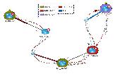
G2G is a P2P (peer to peer) extension for ArcGIS Desktop.
G2G is a P2P (peer to peer) extension for Arcgis Desktop. The extension allows two or more users to collaborate without any intermediate server. G2G (gis to gis) supports:
1) Text chatting,
2) Exchange of Map content (geo-referenced screenshots),
3) Ink and graphics collaboration (shared editing),
4) Share navigation (one person can pan the Map...
Category: Internet / Misc. Servers
Publisher: ESRI, License: Freeware, Price: USD $0.00, File Size: 1.3 MB
Platform: Windows
Arcgis Explorer Desktop is a free GIS viewer that gives you an easy way to explore, visualize, and share GIS information. Arcgis Explorer adds value to any GIS because it helps you deliver your authoritative data to a broad audience.
Easy and intuitive to use it's easy for anyone to begin working with Arcgis Explorer, with its intuitive and easy to use...
Category: Home & Education / Miscellaneous
Publisher: Environmental Systems Research Institute, Inc., License: Freeware, Price: USD $0.00, File Size: 100.5 MB
Platform: Windows
Arcgis Explorer is a free, downloadable GIS viewer that gives you an easy way to explore, visualize and share GIS information. Arcgis Explorer adds value to any GIS because it helps you deliver your authoritative data to a broad audience.
The Arcgis Explorer Desktop Current User setup is intended for users who do not have administrator access on their computers and...
Category: Desktop Enhancements / Shell & Desktop Managers
Publisher: Environmental Systems Research Institute, Inc., License: Freeware, Price: USD $0.00, File Size: 94.0 MB
Platform: Windows
Projection Engine Expansion Pack - Adds more projections and geotransformations for use with Arcgis Explorer Desktop.
Arcgis Explorer Desktop adds value to any GIS because it helps you deliver your authoritative data to a broad audience.
With Arcgis Explorer Desktop, you can access ready-to-use Arcgis Online basemaps and layers.
Category: Multimedia & Design / Multimedia App's
Publisher: Environmental Systems Research Institute, Inc., License: Freeware, Price: USD $0.00, File Size: 69.9 MB
Platform: Windows
The Arcgis Military Analyst extension incorporates a suite of display and analysis tools tailored to meet the special needs of the defense and intelligence user. With Arcgis Military Analyst, you can create, query, analyze, and display spatial data in a variety of formats.
Arcgis Military Analyst maximizes the use of the standard suite of the Department of...
Category: Multimedia & Design / Multimedia App's
Publisher: Environmental Systems Research Institute, Inc., License: Freeware, Price: USD $0.00, File Size: 31.9 MB
Platform: Windows
ArcReader is a free, easy-to-use desktop mapping application that allows users to view, explore, and print maps and globes. Anyone with ArcReader can view high-quality interactive maps authored by a high-level Arcgis Desktop product and published with the Arcgis Publisher extension.
ArcReader is a free and easy-to-use application that allows users to view and print...
Category: Desktop Enhancements / Shell & Desktop Managers
Publisher: Environmental System Research Institute, Inc., License: Freeware, Price: USD $0.00, File Size: 499.2 MB
Platform: Windows
The Arcgis Editor for OpenStreetMap is designed to help Arcgis Desktop users to become active members in the growing community of users building an open and freely available database of geographic data.
The provided tools allow you to download data from the OSM servers and store it locally in a geodatabase. You can then use the familiar editing environment of...
Category: Business & Finance / Business Finance
Publisher: ESRI, License: Freeware, Price: USD $0.00, File Size: 3.6 MB
Platform: Windows
Arcgis Image Server is designed to be open, enabling developers to expand its functionality and integrate it with their applications. The core structures that Arcgis Image Server uses are a combination of Extensible Markup Language (XML) and simple tables stored as shapefiles. The Service Editor component provides a graphic user interface (GUI) that enables you to create services...
Category: Utilities / Misc. Utilities
Publisher: Environmental Systems Research Institute, Inc., License: Freeware, Price: USD $0.00, File Size: 3.8 MB
Platform: Windows
This utility adds LAS file read capability to ArcGIS.
This utility adds LAS file read capability to Arcgis. Point x, y, z, intensity, return and classification values are read from the file and presented as a standard 3-D point data layer which can then be used as input to extensions such as 3-D Analyst.
Category: Multimedia & Design / Multimedia App's
Publisher: GeoCue, License: Freeware, Price: USD $0.00, File Size: 8.4 MB
Platform: Windows
The API is built on the Microsoft Silverlight platform which is integrated with Visual Studio 2010 and Expression Blend 4. The Arcgis API for Silverlight enables you to create rich internet and desktop applications that utilize the powerful mapping, geocoding, and geoprocessing capabilities provided by Arcgis Server and Bing™ services.
To use the API, simply download...
Category: Software Development / Misc. Programming
Publisher: ESRI, License: Freeware, Price: USD $0.00, File Size: 7.7 MB
Platform: Windows
The Geosoft Plug-in for Arcgis is an extension to the Arcgis desktop software that provides data retrieval using DAP and also support for reading Geosoft file formats. The plug-in enables users to view Geosoft grid files as a raster layer inside ArcMap. The plug-in also enables users to view Geosoft Maps as layers.
Geosoft plug-in for Arcgis includes access to Seeker,...
Category: Utilities / Misc. Utilities
Publisher: Geosoft Inc., License: Freeware, Price: USD $0.00, File Size: 133.5 MB
Platform: Windows
The ArcPhoto Tools are a set of geoprocessing tools and ArcMap user interface enhancements to enable the quick import of digital photography into the Arcgis framework. The tools work directly off the EXIF (Exchangeable image file format) header information that is encoded into digital imagery. This information usually includes information about the type of camera used, focal length,...
Category: Multimedia & Design / Multimedia App's
Publisher: ESRI, License: Freeware, Price: USD $0.00, File Size: 25.0 MB
Platform: Windows
SWATeditor is a companion software to ArcSWAT.
SWATeditor is a companion software to ArcSWAT. SWATeditor reads the project database generated by ArcSWAT interface to edit swat input files, execute SWAT, perform sensitivity, autocalibration and uncertainty analysis. This is a standalone program and does not require Arcgis, thus helping users of ArcSWAT to share their project with others that do not have Arcgis or much...
Category: Business & Finance / Applications
Publisher: Grassland, Soil & Water Research Laboratory, USDA-ARS, License: Freeware, Price: USD $0.00, File Size: 15.6 MB
Platform: Windows
SemGrid (Simple easy manager of Grid data, for SEMoLa).
SemGrid (Simple easy manager of Grid data, for SEMoLa). Some of its features are: Freeware raster GIS, for Windows OS, import and export of grid layers from ASCII grid files of Surfer (grd), GeoMedia (asc), Arcgis (asc) and binary or ASCII from Idrisi32 (rdc, rst), GeoEAS, GRASS, Map algebra, Markov chains estimation and simulation and much more.
Category: Business & Finance / Applications
Publisher: Francesco Danuso, University of Udine, License: Freeware, Price: USD $0.00, File Size: 7.9 MB
Platform: Windows
 Freeware
An interactive Flash USA Map with all the features you need for your web site or project. This is the ideal solution for dealer maps, real-estate listings, or visualizing state statistics. Nearly every aspect of the Map is customizable. However, unlike competing products, our Map is very simple to install and edit. Just upload XML and SWF files and embed.
Category: Internet / Flash Tools
Publisher: http://www.flashusamap.com/trial/flashus, License: Freeware, Price: USD $0.00, File Size: 93.8 KB
Platform: Unknown
Map of Africa is one of the many maps created for GPS TrackMaker.
Map of Africa is one of the many maps created for GPS TrackMaker. You are able to download the installation package from the TrackMaker website. In order to preview the contents of this package, you need to install GPS TrackMaker.
Using the above mentioned application, you will be able to see the Map of Africa. Just click on the "Open Temporary...
Category: Home & Education / Miscellaneous
Publisher: Geo Studio Technology, License: Freeware, Price: USD $0.00, File Size: 18.3 MB
Platform: Windows
Program shows you an actual X3 sector-map, with detailed information about most in-game objects.
Program shows you an actual X3 sector-Map, with detailed information about most in-game objects. The Map is based on a log-file that is created with an in-game script (by Andrei[<>Ace]). If you just want to view the standard Map (or if you don’t have the game) the program will work with the included default Map, which was created with an English X3 game...
Category: Games / Misc. Games
Publisher: SUU Design, License: Freeware, Price: USD $0.00, File Size: 1.4 MB
Platform: Windows
New Zealand Map Reference Converter (NZMapConv) is software that LINZ provides to convert Map references between the old NZMS260 Map series and the new NZTopo50 Map series.NZMapConv is a Windows programme designed to convert individual coordinates entered manually.
Category: Multimedia & Design / Media Management
Publisher: Land Information New Zealand, License: Freeware, Price: USD $0.00, File Size: 2.4 MB
Platform: Windows
When the XMAP software is communicating with an XEDE via the comms cable each Map will show, at the top of the Map display, an RPM and load value (x and y axis for the Map) in real time. Also in each Map a yellow highlighted block will show the current position within the Map. Beside the real-time display on each Map are the undo and redo buttons which...
Category: Home & Education / Miscellaneous
Publisher: ChipTorque, License: Freeware, Price: USD $0.00, File Size: 1.7 MB
Platform: Windows
Sig Panama Has :
Digital maps of Panama, Digital Map of Panama-City, digital Map of Taboga, digital Map of Bocas del Toro, digital Map of Colon and Free Zone, digital Map of Contadora Island, digital Map of Coronado, Panama, Zona Libre, Map of Panama, Map of Panama City, Map of Colon, Map of Zona Libre, Map of...
Category: Internet / Misc. Plugins
Publisher: DP Imperial, LLC., License: Freeware, Price: USD $0.00, File Size: 44.9 MB
Platform: Windows
This program allows connections to personal geodatabases and multi-user geodatabases using the 2-tier connect architecture (direct-connect). To install this little program, first you need to have on your computer Arcgis Explorer software. The software is easy to install and easy to manipulate.
Category: Multimedia & Design / Image Editing
Publisher: Environmental Systems Research Institute, Inc., License: Freeware, Price: USD $0.00, File Size: 47.6 MB
Platform: Windows
Freeware
Arm Map Explorer recreates all the functionalities of Google Maps on your desktop while expanding them with new extras. Map Explorer lets you locate and view any place on the planet using dynamic interactive maps. These maps are draggable, which means there is no need for you to click and wait for graphics to reload each time you want to view adjacent parts of a Map....
Category: Internet / Flash Tools
Publisher: ArmCode, License: Freeware, Price: USD $0.00, File Size: 5.5 MB
Platform: Windows
The easiest way to get a paper map with MapPlot is the Plot Map menu.
The easiest way to get a paper Map with MapPlot is the Plot Map menu.
On the following dialog, simply paper size and scale have to be chosen - the result is ready to be printed directly, edited (e.g. for additional entries) or to be displayed as a preview.
Category: Utilities / Misc. Utilities
Publisher: AGIS GmbH, License: Freeware, Price: USD $0.00, File Size: 5.4 MB
Platform: Windows

Importation/Exportation: Import/export trails to gpx file. Unlimited number of trails, and TrackPoints. Export to gpx, Excel, PDF, XPS and KML/KMZ. Data table: Very flexible data table that allows sorting by columns, with inheritance of data, attributes, etc. Presentation on Map: View on Map in accordance with the active trail, which comes from providers of maps, as in...
Category: Home & Education / Miscellaneous
Publisher: Aplicaciones Topográficas S.L., License: Freeware, Price: USD $0.00, File Size: 27.0 MB
Platform: Windows
Tibia Map Viewer is a useful freeware and Open Source application that allows you to view maps generated by Tibia game client and create or edit Map symbols.
You can view the entire Tibia Map you have explored, both upper and lower levels of the Map, with zoom ratio from 25 to 400 percents. It also allows you to export to BMP file.
Category: Games / Tools & Editors
Publisher: Yury Sidorov, License: Freeware, Price: USD $0.00, File Size: 193.7 KB
Platform: Windows
Spinning Gobe Sample demonstrates how to manipulate the navigation, Map style, Map font size, and view of the Map programmatically through the MapPoint ActiveX Control. Using this simple Visual Basic project, you will learn the objects, methods, and properties that are used to navigate a MapPoint Map or change how it looks.
Category: Home & Education / Miscellaneous
Publisher: Microsoft, License: Freeware, Price: USD $0.00, File Size: 3.4 MB
Platform: Windows
The C-Map Chart Catalog allows you to view, navigate, select and order C-Map electronic charts, or various weather options, in an interactive way. After selection of required items is completed, simply press the 'E-mail order' button, and enter the address of your local C-Map distributor.
Category: Home & Education / Hobbies
Publisher: Jeppesen Marine, License: Freeware, Price: USD $0.00, File Size: 6.1 MB
Platform: Windows
C&C 3 Map Manager streamlines the process of installing custom maps for C&C 3: Tiberium Wars and Kane's Wrath. Now you can install fan maps from C&C fansites without having to delve into your computer's folders to find the right place to put them: Map Manager handles this for you. Map Manager also allows you to delete fan maps after you get sick of...
Category: Games / Tools & Editors
Publisher: CNC Generals World, License: Freeware, Price: USD $0.00, File Size: 612.3 KB
Platform: Windows
Karnaugh map minimalizator - for minimalize logical functions for 3-8 variables.
Karnaugh Map minimalizator - for minimalize logical functions for 3-8 variables. This program help you safe logical circuits. This program is special for students. On left you can see a full Map of your function. Negation of variable is big capital.
Category: Home & Education / Mathematics
Publisher: Vaclav Kozak, License: Freeware, Price: USD $0.00, File Size: 253.0 KB
Platform: Windows
The D2D Map Editor enables the rapid creation of multilayered tile based map grids.
The D2D Map Editor enables the rapid creation of multilayered tile based Map grids. It’s easy to learn and can be used by programmers and non-programmers alike. The maps generated can be deployed in games and applications developed in C++, C#, Actionscript and XML.
D2D Map Editor has been developed in C# and is currently released as a Beta version.
Category: Games / Tools & Editors
Publisher: D2D Map Editor, License: Freeware, Price: USD $0.00, File Size: 2.5 MB
Platform: Windows
Character Map displays all of the characters for a selected font.
Character Map displays all of the characters for a selected font. Features:
- Pastes any character into your current document.
- Special characters can be translated into their HTML-equivalents.
- More than a replacement for the Windows (9x/NT) character Map "charmap".
- Many additional features
- Ready for €
- Uncrippled...
Category: Utilities / Misc. Utilities
Publisher: Thomas Bigler, License: Freeware, Price: USD $0.00, File Size: 88.5 KB
Platform: Windows
With links and additional information on important topics for geography lessons.
With links and additional information on important topics for geography lessons. 3D-view of atlas (book) maps on a virtual globe, high resolution physical Map, political Map, satellite images, land coverage and earth-at-night Map. Create your own Map legend, use the drawing tool, move and insert atlas symbols and much more.
Category: Multimedia & Design / Fonts
Publisher: Imagon GmbH, License: Freeware, Price: USD $0.00, File Size: 6.1 MB
Platform: Windows
If you don't have internet access on your phone, or you want to self-select a larger region of mapping, then the Map Chooser tool can be used to make Map tile selections. Choose your own mapping areas with the flexible select tool that lets you select unlimited areas of mapping. Based on a grid, you can choose any grid squares you like - so you can pick an area in Sussex and...
Category: Home & Education / Miscellaneous
Publisher: ViewRanger, License: Freeware, Price: USD $0.00, File Size: 213.2 MB
Platform: Windows
MapCreator 2.0 is a software to create maps and animated maps with a good quality.
MapCreator can be used in presentations because is versatile and can be adequate for any kind of presentation, from travel presentations to professional presentations.
MapCreator is geo-referenced so any Map or portion of the Map will have the exactly portions of latitude and longitude,...
Category: Home & Education / Miscellaneous
Publisher: primap software, License: Freeware, Price: USD $0.00, File Size: 103.3 MB
Platform: Windows
Nokia Map Manager is a program that allows you to manage and transfer GPS maps to mobile phone.
Nokia Map Manager is a program that allows you to manage and transfer GPS maps to mobile phone. The Map Manager is for the 6110 Navigator only. The program is provided with scan function to search maps on the computer and DVD. Nokia Map Manager is an additional application and is used together with Nokia PC Suite 6.86 and later versions.
Nokia Map Manager helps...
Category: Internet / Communications
Publisher: Nokia, License: Freeware, Price: USD $0.00, File Size: 0
Platform: Windows
CaddyConnect is a software that helps you to connect the Caddy devices to your computer and download the required course Map (subject to a valid Golf Plus membership or Map Credit being available). Once the Map has been successfully downloaded onto the Caddy Lite, it is ready for use when the device is switched on and the course selected when the player arrives at the golf...
Category: Business & Finance / Business Finance
Publisher: GolfPlus UK Limited, License: Freeware, Price: USD $0.00, File Size: 10.2 MB
Platform: Windows
In this game there will be a map filled with colored grids.
In this game there will be a Map filled with colored grids. Your colony starts with the home grid in the center of the Map marked by a flag. The goal of the game is to turn all the grids into the same color. You can change the color of your home grid and all connected grids by clicking on other colored grids in the Map. Continue the process and you will be able to turn all...
Category: Games / Misc. Games
Publisher: Novel Games Limited, License: Freeware, Price: USD $0.00, File Size: 264.5 KB
Platform: Windows
NetBrain Map Edition Lite is a free software designed to help network professionals to learn network skills easier and faster. For instance, you can use this software to document your learning process toward CCIE, CCNP or CCNA with a data-driven Map. Using NetBrain Map Edition Lite, dynamic network diagrams can be created instantly in many different ways. For example, you...
Category: Internet / News Applications
Publisher: NetBrain Technologies,Inc., License: Freeware, Price: USD $0.00, File Size: 53.0 MB
Platform: Windows
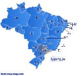
Dongsoft Interactive Brazil Flash Maps for websites, interactive Map applications, presentations, and more.
The innovation of this fully-clickable Map will revolutionize your website navigation and provide visitors with a simple and seamless method of accessing information. Using the Map as a central navigation tool, information can be accessed with greater speed,...
Category: Software Development / Help File Utilities
Publisher: maps flash, License: Freeware, Price: USD $0.00, File Size: 156.0 KB
Platform: Windows
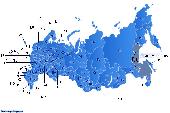
Dongsoft Interactive Russia Flash Maps for websites, interactive Map applications, presentations, and more.
The innovation of this fully-clickable Map will revolutionize your website navigation and provide visitors with a simple and seamless method of accessing information. Using the Map as a central navigation tool, information can be accessed with greater speed,...
Category: Software Development / Help File Utilities
Publisher: clickable map, License: Freeware, Price: USD $0.00, File Size: 156.0 KB
Platform: Windows
This application was written for importing .
This application was written for importing .Map files created with editors such as Hammer into Cartography Shop. It will scan a .Map file and generate a .CSM file with all dependent textures required by the .CSM file. All brushes are separated for easier level modification.
Category: Utilities / Misc. Utilities
Publisher: Apex, License: Freeware, Price: USD $0.00, File Size: 1.4 MB
Platform: Windows
Live Satellite Maps or Google maps is a web server mapping applications.
Live Satellite Maps or Google maps is a web server mapping applications.Provides scrolling Map images and satellite photos around the earth and even the route between different places.Since 6 October 2005, live satellite Maps is part of local Google.Google live satellite Map provides the ability to zoom in or zoom out to show the Map.The user can control the Map with...
Category: Home & Education / Science
Publisher: www.satelliteview-of-my-house.com, License: Freeware, Price: USD $0.00, File Size: 643.0 KB
Platform: Windows
Gismaps Viewer is a GIS viewer that can be used for geospatial analysis and map production.
Gismaps Viewer is a GIS viewer that can be used for geospatial analysis and Map production.
The main features are:
- read Shape files using geographic coordinate system
- view satellite images (MrSid, jpeg, bmp and tiff file formats)
- generate thematic maps, queries and labels
- export do Google Earth KML (shp2kml)
- configure Map colors...
Category: Multimedia & Design / Graphics Viewers
Publisher: Gismaps Sistemas Ltda., License: Freeware, Price: USD $0.00, File Size: 10.2 MB
Platform: Windows
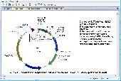
BVTech Plasmid can draw circle or linear plasmid map with double strands or single strand.
BVTech Plasmid can draw circle or linear plasmid Map with double strands or single strand. You can label the plasmid with genes and restriction sites in different colors, text, and styles. Plasmid Map can be highly customized by drag-droping or directly setting properties. BVTech Plasmid provides many drawing objects, includs lines, arrows, rectangles, circles, and text boxes....
Category: Home & Education / Science
Publisher: BV Tech, Inc., License: Freeware, Price: USD $0.00, File Size: 2.5 MB
Platform: Windows
The Creeper World Map Editor (CWME) allows you to create and edit maps for use in Creeper World.
The Creeper World Map Editor (CWME) allows you to create and edit maps for use in Creeper World. You can specify the terrain, change the background image, and create/edit Creeper emitters and spore waves. You can also specify the location and the number of totems, upgrades, survival pods, and artifacts. In short, you can create nearly any Map you can imagine.
Category: Games / Tools & Editors
Publisher: Knuckle Cracker, LLC, License: Freeware, Price: USD $0.00, File Size: 2.3 MB
Platform: Windows
Create a professional site map for your Web pages without writing a single line of code.
Create a professional site Map for your Web pages without writing a single line of code. The process is fully automated and is based on the Navigational or directory structure of your website. eXactMapper Lite offers three different and totally customizable HTML/DHTML site Map styles, including a UL list, static tree and an index page. You can easily embed a site Map into...
Category: Software Development / Tools & Editors
Publisher: Exacttrend, License: Freeware, Price: USD $0.00, File Size: 1.5 MB
Platform: Windows
Get a full 3D satellite map view of El Petacon on your PC.
Get a full 3D satellite Map view of El Petacon on your PC. If you have already installed Google Earth, you will be able to view the El Petacón 3D Map. You will enjoy a beautiful view of this geographic place and you will have the world's geographic information at your fingertips.
Category: Home & Education / Miscellaneous
Publisher: Maplandia, License: Freeware, Price: USD $0.00, File Size: 331 B
Platform: Windows
You can capture the Google Map window and save it as JPG format, and also show the planned route on Google Map directly.
Main Features:
- Travel Planning
- Travel database saved by calendar
- Travel detail information
- Travel files list
- Software control Function
Category: Home & Education / Miscellaneous
Publisher: GlobalSat Technology Corporation, License: Freeware, Price: USD $0.00, File Size: 68.1 MB
Platform: Windows
The Biogeography Branch’s Sampling Design Tool for Arcgis provides users a means to efficiently sample a population, be it people, animals, objects or processes, in a GIS environment. The tool was created for sampling when the population and component sampling units are defined by known dimensions.
The Sampling Design Tool was developed in response to a need by...
Category: Business & Finance / Applications
Publisher: Center for Coastal Monitoring and Assessment, License: Freeware, Price: USD $0.00, File Size: 236.7 KB
Platform: Windows