Free Downloads: Coordinate System
License: All | Free
DraftSight is a drafting automation software tool.
DraftSight is a drafting automation software tool.A Coordinate System determines each point of a drawing surface or entity unambiguosly.DraftSight uses the Cartesian Coordinate System consisting of three Coordinate axes.Axes are arranged orthogonally crossing at the origin.
Category: Multimedia & Design / Image Editing
Publisher: Dassault Systemes, License: Freeware, Price: USD $0.00, File Size: 66.5 MB
Platform: Windows
Do you have coordinates for some places of interest?
Do you have coordinates for some places of interest? Do you want to find them on Earth's surface? There are more than 2,000 Coordinate systems available to make Google Earth follow your interests! Plex.Mark! simply placemarks your world!
Have you found a place in Google Earth and you would like to have the coordinates in your Coordinate System? Plex.Mark! will...
Category: Internet / Browser Accessories
Publisher: Plexscape, License: Freeware, Price: USD $0.00, File Size: 601.9 KB
Platform: Windows
MMS Coordinate Converter is a free utility with which you can convert a survey Coordinate between different systems and datums.
The utility will convert between the Cape (Clarke) / Wgs84 datums with coordinates in Geographical / UTM / LO formats similar to the functions available in Model- and Survey-Maker.
Category: Multimedia & Design / Media Management
Publisher: Model Maker Systems, License: Freeware, Price: USD $0.00, File Size: 6.8 MB
Platform: Windows
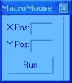
Moves mouse to desired coordinate by the push of a button.
Moves mouse to desired Coordinate by the push of a button. Useful with macro applications for clicking certain areas of the screen when you are not there.This will take up very little memory so as to not slow down other utilities running on the System. The interface is made very small to keep it from taking up space on the screen and interfering with other running macros.
Category: Web Authoring / Web Design Utilities
Publisher: Exterior House Color, License: Freeware, Price: USD $0.00, File Size: 20.0 KB
Platform: Windows
The Geocentric Datum of Australia (GDA) is a Coordinate reference System that best fits the shape of the earth as a whole. It has an origin that coincides with the centre of mass of the earth, hence the term 'geocentric'.
The state datum in Queensland is the Geocentric Datum of Australia 1994 (GDA94) replacing the previously adopted Australian Geodetic Datum 1984...
Category: Home & Education / Miscellaneous
Publisher: Department of Natural Resources and Mines, License: Freeware, Price: USD $0.00, File Size: 7.7 MB
Platform: Windows
You can use your existing digital (vector) maps in Autodesk MapGuide® software by converting them to Spatial Data Files (SDF). SDF is a special data format for delivering large amounts of data quickly over an intranet or the Internet. The SDF Loader is a utility used to create Spatial Data Files (SDF) and their accompanying Spatial Index Files (SIF) from a variety of GIS data formats. These...
Category: Multimedia & Design / Multimedia App's
Publisher: Autodesk, Inc., License: Freeware, Price: USD $0.00, File Size: 54.6 MB
Platform: Windows
Design elements of this product coordinate with the following products: Smile and Joy Pack.
Design elements of this product Coordinate with the following products: Smile and Joy Pack. It has high-resolution (print quality) JPG and PNG files (with transparency). You may use graphics to customize your own personal blog or website as long as credit notice is given to the designer.
Category: Desktop Enhancements / Shell & Desktop Managers
Publisher: StoryRock Inc., License: Freeware, Price: USD $0.00, File Size: 16.5 MB
Platform: Windows
JCapPM allows you to associate coordinate information (x/y) to each photo.
JCapPM allows you to associate Coordinate information (x/y) to each photo. JCapPM can communicate with Google Earth which allows you to geotag all your files using Google Earth. You can use JCapPM's filter in order to geotag only filtered photos at once.
Category: Home & Education / Miscellaneous
Publisher: ZeroG Software, License: Freeware, Price: USD $0.00, File Size: 2.5 MB
Platform: Windows
Design elements of this pack coordinate with the following products: Splendor Pack.
Design elements of this pack Coordinate with the following products: Splendor Pack. You may use graphic elements in layouts and other craft projects that are submitted to scrapbooking magazines for publication, online galleries, or other non-retail web communities, as long as proper credit is given to the designer by name, including credit
notice of any graphic you have altered in...
Category: Desktop Enhancements / Shell & Desktop Managers
Publisher: StoryRock Inc., License: Freeware, Price: USD $0.00, File Size: 23.5 MB
Platform: Windows
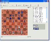
NetChess is a chess program that allows you to play with opponent over internet/intranet or on the local computer. You can load or save game. The built-in chat provides a quick and efficient solution to essential communication between players. This software will verify your moves according to chess rules. Features include chess-clock, move logging, Coordinate System, and much more.
Category: Games / Strategy & War
Publisher: RS Software Lab, License: Freeware, Price: USD $0.00, File Size: 344.0 KB
Platform: Unknown
GPS Sway is a simple coordinate conversion program.
GPS Sway is a simple Coordinate conversion program. It handles all forms of latitude and longitude (degrees, degrees minutes, degrees minutes seconds) as well as UTM coordinates and will convert from any form to another. It also handles signs or character direction.
Category: Multimedia & Design / Media Management
Publisher: GPSFileDepot, License: Freeware, Price: USD $0.00, File Size: 154.2 KB
Platform: Windows
Asymptote is a powerful descriptive vector graphics language that provides a natural Coordinate-based framework for technical drawing. Labels and equations are typeset with LaTeX, for high-quality PostScript output.
A major advantage of Asymptote over other graphics packages is that it is a programming language, as opposed to just a graphics program.
Category: Multimedia & Design / Multimedia App's
Publisher: Andy Hammerlindl, John Bowman, Tom Prince, License: Freeware, Price: USD $0.00, File Size: 3.5 MB
Platform: Windows
SurvCE Application is a complete data collection System for Real Time (RTK) GPS and Total Stations with in-field Coordinate geometry SurvCE, which combines advanced functionality, ease-of-use and robust capability to make it the first choice in data collection software. This tool supports the widest range of popular Carlson SurvCE #1 Data Collection Software Choice and new release...
Category: Business & Finance / Database Management
Publisher: Carlson Software, License: Freeware, Price: USD $0.00, File Size: 3.5 MB
Platform: Windows
The Grid InQuest software provides a means for transforming coordinates between ETRS89 (WGS84) and the National Coordinate systems of Great Britain, Northern Ireland and the Republic of Ireland. It provides a fully three dimensional transformation incorporating the latest geoid model and is the nationally recognised software for performing these conversions.
In conjunction...
Category: Home & Education / Miscellaneous
Publisher: Quest Geo Solutions Ltd, License: Freeware, Price: USD $0.00, File Size: 0
Platform: Windows
This applet constructs quadrilaterals from the x and y Coordinate values of four given points, and also determines the category of the constructed quadrilateral (rectangle, square etc.).
Category: Home & Education / Mathematics
Publisher: eridanus.info, License: Freeware, Price: USD $0.00, File Size: 10.6 KB
Platform: Linux, Windows
PHOTOMOD GeoMosaic is intended for working with various types of digital images, including aerial and space imagery as well as digitized raster maps.
The program functionality includes:
- Georeferencing of raster images;
- Transforming images from one Coordinate System to another, using an extensive database supplied or custom created...
Category: Multimedia & Design / Multimedia App's
Publisher: Racurs, License: Freeware, Price: USD $0.00, File Size: 36.5 MB
Platform: Windows
Explain why and how a pinball shooter can be used to help understand ideas about reactions.
Explain why and how a pinball shooter can be used to help understand ideas about reactions.
Describe on a microscopic level what contributes to a successful reaction (with illustrations).
Describe how the reaction Coordinate can be used to predict whether a reaction will proceed or slow.
Use the potential energy diagram to determine: The activation energy for the...
Category: Home & Education / Science
Publisher: University of Colorado, Department of Physics, License: Freeware, Price: USD $0.00, File Size: 1.9 MB
Platform: Windows
COGO (COordinate GeOmetry) is an engineering tool used to determine geometric relationships.
COGO (Coordinate GeOmetry) is an engineering tool used to determine geometric relationships. There are a number of ways to create a geometric model. There is a command language that allows the user to define and solve geometric problems in engineering terms. There are Windows forms that you fill in to create the geometry. And you can execute COGO inside of AutoCAD using the Windows forms...
Category: Multimedia & Design / Image Editing
Publisher: Colorado DOT, License: Freeware, Price: USD $0.00, File Size: 3.5 MB
Platform: Windows
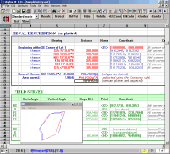
CopanMobile for Palm OS is a very functional and easy-to-use geomatics engineering tool for computing and managing plane surveying and mapping coordinates. It does numerous Coordinate geometry (COGO) calculations, processes and adjusts raw field survey data, computes and adjusts map traverse data, performs map or deed checks, calculates curves, areas and perimeters, performs...
Category: Multimedia & Design / Multimedia App's
Publisher: Underhill Geomatics Ltd., License: Freeware, Price: USD $0.00, File Size: 341.0 KB
Platform: Palm
CopanMobile for Pocket PC is a very functional and easy-to-use geomatics engineering tool for computing and managing plane surveying and mapping coordinates. It does numerous Coordinate geometry (COGO) calculations, processes and adjusts raw field survey data, computes and adjusts map traverse data, performs map or deed checks, calculates curves, areas and perimeters, performs...
Category: Business & Finance / Applications
Publisher: Underhill Geomatics Ltd., License: Freeware, Price: USD $0.00, File Size: 341.0 KB
Platform: Windows
 Freeware
A NetCDF file is a format of file that usually uses in climate data. NetCDF files usually has multi-dimension that each dimension is a separate variable. NetCDF variables that contain Coordinate data are referred to as Coordinate variables, scalar Coordinate variables, or multidimensional Coordinate variables. For example, if you want to save the rainfall data for a...
Category: Home & Education / Science
Publisher: AgriMetSoft, License: Freeware, Price: USD $0.00, File Size: 13.9 MB
Platform: Windows
GraphSight Junior is an easy to use freeware handy 2D math-graphing program.
GraphSight Junior is an easy to use freeware handy 2D math-graphing program. It was originally designed to help students and teachers satisfy their day-after-day math plotting needs. It makes it easy to plot and explore common Y(X) = F(X) Cartesian graphs, set text labels on the Coordinate plane, zoom or shift a graph with just a single click & move of mouse. The resulting picture...
Category: Home & Education / Miscellaneous
Publisher: CradleFields.com, License: Freeware, Price: USD $0.00, File Size: 393.0 KB
Platform: Windows
Equation grapher is an easy-to-use software for 2D function graphing.
Equation grapher is an easy-to-use software for 2D function graphing. 2D function graphs can be plotted in Cartesian and polar Coordinate systems .Equation grapher is an easy-to-use software for 2D function graphing. 2D function graphs can be plotted in Cartesian and polar Coordinate systems .Equation grapher is an easy-to-use software for 2D function graphing. 2D function graphs...
Category: Home & Education / Mathematics
Publisher: GraphNow, License: Freeware, Price: USD $0.00, File Size: 1.2 MB
Platform: Windows
Copan for Pocket PC is a very functional and easy-to-use geomatics engineering tool for computing and managing plane surveying and mapping coordinates.
It does numerous Coordinate geometry (COGO) calculations, processes and adjusts raw field survey data, computes and adjusts map traverse data, performs map or deed checks, calculates curves, areas and perimeters, performs...
Category: Multimedia & Design / Multimedia App's
Publisher: Underhill Geomatics Ltd, License: Freeware, Price: USD $0.00, File Size: 662.0 KB
Platform: Windows
Copan for Mobile 6 is a very functional and easy-to-use geomatics engineering tool for computing and managing plane surveying and mapping coordinates.
It does numerous Coordinate geometry (COGO) calculations, processes and adjusts raw field survey data, computes and adjusts map traverse data, performs map or deed checks, calculates curves, areas and perimeters, performs...
Category: Multimedia & Design / Multimedia App's
Publisher: Underhill Geomatics Ltd, License: Freeware, Price: USD $0.00, File Size: 662.0 KB
Platform: Windows
ZGrapher is a simple graphic utility.
ZGrapher is a simple graphic utility. It can be helpful for any user, from a schoolboy to a professional mathematician. Using this program you can plot graphs of the following types: Y(x), X(y), R(a) – in polar coordinates, X(t) and Y(t) – parametric equations and graphs of tables. To create a graph you should specify its parameters – formula, graph’s width, style,...
Category: Home & Education / Mathematics
Publisher: Palam Software, Inc., License: Freeware, Price: USD $0.00, File Size: 619.8 KB
Platform: Windows
TerraVisionTM is an Open Source distributed, interactive terrain visualization System developed by SRI International. It allows users to navigate, in real time, through a 3-D graphical representation of a real landscape created from elevation data and aerial images of that landscape. There are many terrain visualization tools on the market, but here are some of the features that make...
Category: Multimedia & Design / Graphics Viewers
Publisher: SRI International, License: Freeware, Price: USD $0.00, File Size: 2.1 MB
Platform: Windows
This program is a tool for stretching a bitmap image (a raster image), trimming it to a box, and calibrating it. This is primarily of use when dealing with a scanned image of a paper map. Often when making a scan it is hard to get the image precisely aligned; sometimes with old maps the paper has stretched. It can be useful where you want to make a tiled map from a number of original images....
Category: Multimedia & Design / Multimedia App's
Publisher: Map Library, License: Freeware, Price: USD $0.00, File Size: 755.8 KB
Platform: Windows
Freeware
Arm Map Explorer recreates all the functionalities of Google Maps on your desktop while expanding them with new extras. Map Explorer lets you locate and view any place on the planet using dynamic interactive maps. These maps are draggable, which means there is no need for you to click and wait for graphics to reload each time you want to view adjacent parts of a map. Basically, viewing...
Category: Internet / Flash Tools
Publisher: ArmCode, License: Freeware, Price: USD $0.00, File Size: 5.5 MB
Platform: Windows
The Balloon Browser recognizes and highlights geo-coordinates in web pages.
The Balloon Browser recognizes and highlights geo-coordinates in web pages. Hovering over a recognized location advises another application to show a map of the corresponding area. For now the only program Balloon Browser can interact with is Google Earth.
Instead of waiting for the one true geo-notation and markup standard, Balloon Browser tries to parse a variety of common...
Category: Internet / Browsers
Publisher: Michael Krause, License: Freeware, Price: USD $0.00, File Size: 5.6 MB
Platform: Windows
ArcScripts is intended for the free exchange of scripts and tools related to ESRI software products.
ArcScripts is intended for the free exchange of scripts and tools related to ESRI software products. Please alert the moderator if this script is a demo, trial-version, or an advertisement for a retail product.
Akin to the GRIDSPOT AML in workstation ArcInfo, this VB tool overlays a point shapefile or point coverage on a raster layer and assigns the value of the raster to the...
Category: Multimedia & Design / Multimedia App's
Publisher: Dan Rathert, License: Freeware, Price: USD $0.00, File Size: 7.4 KB
Platform: Windows
A free sampler to give a taste of the style of my kit Solace.
A free sampler to give a taste of the style of my kit Solace.
Contains one background, a swoosh, scattered crosses and three word arts.
High-resolution (print quality) JPG and PNG files (with transparency).
Design elements of this pack Coordinate
with the following products:
Solace Pack
Category: Multimedia & Design / Multimedia App's
Publisher: Becca Herman, License: Freeware, Price: USD $0.00, File Size: 5.8 MB
Platform: Windows
Gismaps Viewer is a GIS viewer that can be used for geospatial analysis and map production.
Gismaps Viewer is a GIS viewer that can be used for geospatial analysis and map production.
The main features are:
- read Shape files using geographic Coordinate System
- view satellite images (MrSid, jpeg, bmp and tiff file formats)
- generate thematic maps, queries and labels
- export do Google Earth KML (shp2kml)
- configure map colors...
Category: Multimedia & Design / Graphics Viewers
Publisher: Gismaps Sistemas Ltda., License: Freeware, Price: USD $0.00, File Size: 10.2 MB
Platform: Windows
Freeware
With this tool you can add GPS coordinates to vCards - elektronic business cards - that you have previously exported from e. g. Microsoft Outlook. Therefore the tool uses the address data contained within the vCards and adds the exact GPS position on that basis to the vCard. This way you can use these vCards for example in compatible car navigation systems. Among others following...
Category: Home & Education / Home Inventory
Publisher: AB-Tools.com, License: Freeware, Price: USD $0.00, File Size: 1.9 MB
Platform: Windows
The MEP (Mechanical/Electrical/Plumbing) Modeler is an extension to ArchiCAD 14.
The MEP (Mechanical/Electrical/Plumbing) Modeler is an extension to ArchiCAD 14. Architectural practices and architectural departments of A/E firms using ArchiCAD can use MEP Modeler to create, edit or import 3D MEP networks (ductwork, piping and cable trays) and Coordinate them with the ArchiCAD Virtual Building.
Category: Multimedia & Design / Image Editing
Publisher: Graphisoft, License: Freeware, Price: USD $0.00, File Size: 12.6 MB
Platform: Windows
Biodesigner is a molecular modeling and visualization program for personal computers.
Biodesigner is a molecular modeling and visualization program for personal computers.
The program is capable of creating homologous models of proteins, evaluate, and refine the models.
The program provides multiple file format support (PDB, Hyperchem, Alchemy, Insight, Sybyl).
Also features realtime monitoring of various molecular properties, including distances, angles...
Category: Multimedia & Design / Multimedia App's
Publisher: Piotr Rotkiewicz, License: Freeware, Price: USD $0.00, File Size: 2.0 MB
Platform: Windows
Geometry is a calculator which uses many of the formulas found in geometry.
Geometry is a calculator which uses many of the formulas found in geometry. The program will calculate surface area and volume of a variety of geometric figures such as prisms, cone, sphere, pyramids, torus and cylinder. The software will perform calculations involving the pythagorean theorem, sine, cosine, tangent, special triangles, regular polygons, circles, arcs, triangles, squares,...
Category: Business & Finance / Calculators
Publisher: Travis East, License: Freeware, Price: USD $0.00, File Size: 2.7 MB
Platform: Windows
To learn AutoFEM Tutorial, the presence of AutoCAD and AutoFEM Analysis is not necessary, although it is desirable. Force, pressure, rotation, acceleration, bearing load, hydrostatic pressure, torque, and temperature can be applied to the structure as external loads. To fix the structure, complete restriction of movement can be used, as well as partial restriction concerning the axes (in...
Category: Multimedia & Design / Image Editing
Publisher: AutoFEM Software, License: Freeware, Price: USD $0.00, File Size: 88.6 MB
Platform: Windows
Pentobi is a computer program that plays the board game Blokus.
Pentobi is a computer program that plays the board game Blokus. Supports the game variants classic, classic two-player, and duo. The game provides different levels of playing strength, can save and load games in Smart Game Format including comments and move variations. Also provides board display with optional move numbers and Coordinate labels. Moreover can export images of board...
Category: Games / Misc. Games
Publisher: Markus Enzenberger, License: Freeware, Price: USD $0.00, File Size: 5.0 MB
Platform: Windows
akTabStrip if a very small and lightweight tab strip control which looks identical to the TabCtl32 control used in VB.
This tabstrip control is not a container control itself, but requires you to use frame controls. But this control does automatically show and hide the appropriate frame as you click on the tabs - no code required. It can also move the top left Coordinate of...
Category: Business & Finance / Business Finance
Publisher: akTools, License: Freeware, Price: USD $0.00, File Size: 137.6 KB
Platform: Windows
Free automated mouse clicking on your screen by coordinates or wherever you decide to leave your mouse. Also includes a screen Coordinate finder.
Category: Desktop Enhancements / Misc. Themes
Publisher: Mofiki Software, License: Freeware, Price: USD $0.00, File Size: 1.0 MB
Platform: Windows
Plan, Estimate, and Manage Your Static Scanning Project
Features:
- Utilize aerial imagery from multiple online sources including Bing, Google and Yahoo maps
- Place scan positions using automatic control detection and System range
- Import or create control Coordinate network
- Identify three possible scan position times based on...
Category: Business & Finance / Project Management
Publisher: Certainty 3D, License: Freeware, Price: USD $0.00, File Size: 17.6 MB
Platform: Windows
ActiveGPS is a reciever that makes the driver aware of speedcameras.
ActiveGPS is a reciever that makes the driver aware of speedcameras. Speedcameras are being set up in many locations all over europe and they are very easy to miss when your're passing, perhaps little too fast. ActiveGPS warns the driver 17 seconds before approaching a speedcamera/Coordinate.
ActiveGPS is a 16 channel GPS-reciever.
On the display you can swap...
Category: Utilities / Misc. Utilities
Publisher: A&TJ, License: Freeware, Price: USD $0.00, File Size: 4.8 MB
Platform: Windows
User can paint individual lines by dragging the cursor over lines and identify data interactively.
User can paint individual lines by dragging the cursor over lines and identify data interactively.
In this version of Data Paint you have interactive Rotating Scatter Plot, Simple Scatter Plot, Bar Chart, Star Plot and Parallel Coordinate Plot.
This software can be customized for a specific need.
Category: Business & Finance / Business Finance
Publisher: Man Machine Interface, Inc, License: Freeware, Price: USD $0.00, File Size: 2.4 MB
Platform: Windows
Abykus is an easy-to-use spreadsheet designed for business and scientific applications. The program combines object-oriented functionality with traditional spreadsheet operations, allowing you to store multi-value data types (such as arrays and matrixes) in a single cell. This not only saves valuable space on your worksheets, but it also significantly reduces the overhead needed to manage...
Category: Business & Finance
Publisher: Abykus.com, License: Freeware, Price: USD $0.00, File Size: 581.9 KB
Platform: Windows
STRUPLO for Windows is a MS-Windows version of STRUVIR, a program for producing polyhedra plots for Inorganic crystal structures. It incorporates a Graphical User Interface (GUI) to make production of these plots much easier. Most of the commonly used features of STRUVIR are directly available from the GUI. The interface is similar to that of Ortep-3 for Windows, and loading a Coordinate...
Category: Home & Education / Science
Publisher: Louis J. Farrugia, License: Freeware, Price: USD $0.00, File Size: 1.4 MB
Platform: Windows
A comprehensive field software for Windows OS to control your receivers, automate GNSS post processing surveying tasks (Static, Fast Static, Stop&Go, Data Acquisition), and to perform RTK survey and stakeout tasks with the following features:
- Always provides information on receiver while surveying.
- Data logging to receiver and controller.
- Increased...
Category: Utilities / Misc. Utilities
Publisher: JAVAD GNSS Inc., License: Freeware, Price: USD $0.00, File Size: 25.9 MB
Platform: Windows
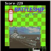
Battleship (touch enabled) for mobile, strategy game.
Battleship (touch enabled) for mobile, strategy game. Play this free mobile game by wapfrog and hit our leader board. Battleship is a guessing game. Your aim is to sink all your opponent ships before your opponent sinks your ships. At first you will need to place your ships on the board or accept the initial random order. Once ships are in place, each player will attack on any available...
Category: Games / Misc. Games
Publisher: wapfrog.com, License: Freeware, Price: USD $0.00, File Size: 177.0 KB
Platform: Windows, Palm
Alerts on attacks:
TravianManager can play sounds on attacks and warn you.
Alerts on attacks:
TravianManager can play sounds on attacks and warn you. You can even get notified by email or icq.
Sends automatically troops:
You select the villages you want to farm and TravianManager is doing the job automatically. Selects the best villages and calculates the production of the target...
Stay out of troubles:
If a village has to high defense,...
Category: Games / Tools & Editors
Publisher: TravianManager.net, License: Freeware, Price: USD $0.00, File Size: 202.0 KB
Platform: Windows
ArcWelding PowerPac (AWPP) is an add-in to RobotStudio, which is a unique, geometry based off-line programming tool for generating arc welding programs. The programmer defines weld locations on the CAD geometries and the System automatically creates robot positions in relation to that geometry including approach and departure positions.
AWPP provides superior process support...
Category: Software Development / Misc. Programming
Publisher: ABB, License: Freeware, Price: USD $0.00, File Size: 5.0 MB
Platform: Windows