Free Downloads: Create Delivery Route Map
License: All | Free
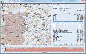
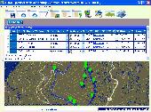
MyRouteOnline is an easy to use Route planner that that allows you to plan routes from Excel spreadsheet. Excel Add-in that uploads addresses and saves time, fuel and money by helping you Map multiple locations and find the best Route. Online Route planning goes far beyond paper maps or a GPS system, it is the only way to find the optimal Route for your needs,...
Category: Business & Finance / Business Finance
Publisher: MyRouteOnline, License: Freeware, Price: USD $0.00, File Size: 3.1 MB
Platform: Windows
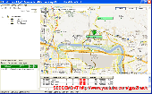
You can capture the Google Map window and save it as JPG format, and also show the planned Route on Google Map directly.
Main Features:
- Travel Planning
- Travel database saved by calendar
- Travel detail information
- Travel files list
- Software control Function
Category: Home & Education / Miscellaneous
Publisher: GlobalSat Technology Corporation, License: Freeware, Price: USD $0.00, File Size: 68.1 MB
Platform: Windows
A Windows based simulator to find the optimal route to the weather conditions and forecasts.
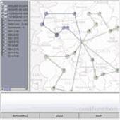
A Windows based simulator to find the optimal Route to the weather conditions and forecasts. According to one estimate Americans waste more than 65 billion dollars a year sitting in traffic. An efficient routing system is an indispensible tool for any Delivery Route.
Manually routing your fleet even on a small scale is out of realm of human capacity and is...
Category: Multimedia & Design / Image Editing
Publisher: HouseOfAlgorithms, License: Freeware, Price: USD $0.00, File Size: 1.0 MB
Platform: Windows
The Off-Route Data Acquiring software is designed to
download off-Route data from the STD-500/510/3300
instruments into a file on your computer.
Connect the data collector/analyzer to your
workstation.
-Load off-Route points you need.
-Select off-Route points of interest from the list.
-Save selected off-Route points...
Category: Business & Finance / Business Finance
Publisher: Technekon, License: Freeware, Price: USD $0.00, File Size: 5.3 MB
Platform: Windows
MapCreator 2.0 is a software to Create maps and animated maps with a good quality.
MapCreator can be used in presentations because is versatile and can be adequate for any kind of presentation, from travel presentations to professional presentations.
MapCreator is geo-referenced so any Map or portion of the Map will have the exactly portions of latitude and...
Category: Home & Education / Miscellaneous
Publisher: primap software, License: Freeware, Price: USD $0.00, File Size: 103.3 MB
Platform: Windows
Live Satellite Maps or Google maps is a web server mapping applications.
Live Satellite Maps or Google maps is a web server mapping applications.Provides scrolling Map images and satellite photos around the earth and even the Route between different places.Since 6 October 2005, live satellite Maps is part of local Google.Google live satellite Map provides the ability to zoom in or zoom out to show the Map.The user can control the...
Category: Home & Education / Science
Publisher: www.satelliteview-of-my-house.com, License: Freeware, Price: USD $0.00, File Size: 643.0 KB
Platform: Windows
The program is intended to edit the network routes table. Visual TCP/IP Router has the convenient graphic interface for a new Route adding and for the deleting of any existent. It's very simple to Create new or delete existent Route using the Visaul CP/IP Router. For adding select the connection type, addressable destination, network mask, metric (1 by default), select...
Category: Utilities
Publisher: TM Services, License: Freeware, Price: USD $0.00, File Size: 654.1 KB
Platform: Windows
TransDEM Trainz Edition is a dedicated version of TransDEM, enhanced with specific export functionality for Auran/N3V Trainz Simulator 2010, Trainz Simulator 2009, Trainz Railroad Simulator 2006 and 2004. This additional export functionality enables the user to Create Trainz Route maps in TransDEM, using geo data currently loaded. Direct creation of all files which make up a...
Category: Multimedia & Design / Image Editing
Publisher: Roland Ziegler, License: Freeware, Price: USD $0.00, File Size: 981.3 KB
Platform: Windows
EaziTRAC System 2000 is a PC based tracking application software that uses the Google Map to present the
real time tracking of EaziTRAC 1000 and EaziTRAC 2000 devices on a Map. It can be used world wide and
at the privacy of your home on an internet enabled PC. The EaziTRAC System 2000 features include instant
or continuous tracking with data log and playback...
Category: Security & Privacy / Other
Publisher: Daviscomms (S) PTE LTD, License: Freeware, Price: USD $0.00, File Size: 3.4 MB
Platform: Windows
ITN Converter is a free and reliable application for travelers.
ITN Converter is a free and reliable application for travelers. If you want to travel to a place that you haven’t explored yet, you can use this software in order to establish your Route.
The program has two main functionalities: to plan routes and to convert. This means that it can help you establish your itinerary and convert it to an appropriate format for different GPS...
Category: Multimedia & Design / Digital Media Editors
Publisher: Benichou Software, License: Freeware, Price: USD $0.00, File Size: 904.4 KB
Platform: Windows


 Freeware
org, uses file and position names that suit to the display of the TomTom Rider, uses file, route and position names that suit to the display of the Map&Guide Motorrad Tourenplaner, remembers language, paths, window size and position. . .
Category: Business & Finance / Conversion Applications
Publisher: Christian Pesch, License: Freeware, Price: USD $0.00, File Size: 6.6 MB
Platform: Windows, Mac, Linux, Solaris, FreeBSD, OpenBSD, Java
The Creeper World Map Editor (CWME) allows you to create and edit maps for use in Creeper World.
The Creeper World Map Editor (CWME) allows you to Create and edit maps for use in Creeper World. You can specify the terrain, change the background image, and Create/edit Creeper emitters and spore waves. You can also specify the location and the number of totems, upgrades, survival pods, and artifacts. In short, you can Create nearly any Map you can imagine.
Category: Games / Tools & Editors
Publisher: Knuckle Cracker, LLC, License: Freeware, Price: USD $0.00, File Size: 2.3 MB
Platform: Windows
Tibia Map Viewer is a useful freeware and Open Source application that allows you to view maps generated by Tibia game client and Create or edit Map symbols.
You can view the entire Tibia Map you have explored, both upper and lower levels of the Map, with zoom ratio from 25 to 400 percents. It also allows you to export to BMP file.
Category: Games / Tools & Editors
Publisher: Yury Sidorov, License: Freeware, Price: USD $0.00, File Size: 193.7 KB
Platform: Windows
K&R Easy TRAXX automatically records your path up to 500 waypoints and you can use this path to trace back to your starting point or to upload the Route to your PC.
After you have recorded your path, Easy Traxx can trace back to your starting point. Likewise you can plan a Route or path with the software in GOOGLE-Map.
Category: Home & Education / Miscellaneous
Publisher: Kasper & Richter GmbH & Co. KG, License: Freeware, Price: USD $0.00, File Size: 6.1 MB
Platform: Windows
JOpt.NET TourPlanner is an automated vehicle routing software and dispatching .NET component for logistic applications that can solve Traveling Salesman Problems (TSP) and Capacitated Vehicle Routing Problems with Time Windows (CVRPTW,VRPTW). JOpt.NET offers Route and transport optimisation with respect to various constraints such as time windows, load capacities and pick up and...
Category: Software Development
Publisher: DNA, License: Freeware, Price: USD $0.00, File Size: 3.9 MB
Platform: Windows
This tool allows to preview route files.
This tool allows to preview Route files. The camera can be moved, rotated and zoomed, you can jump to stations and points of interest, and also enable a series of options. If routes contain errors, a report can be optionally displayed.
A file that is passed as a command line argument is automatically opened at startup. If a CSV file is determined to be a CSV object instead...
Category: Multimedia & Design / Multimedia App's
Publisher: trainsimframework, License: Freeware, Price: USD $0.00, File Size: 171.3 KB
Platform: Windows
AutoPlan IFR generates a Route, validates it using the Eurocontrol IFPS vaidator (CFMUV), interprets any error messages Eurocontrol generates, and excludes the Route segments in these error messages from the next attempt.
Features:
- Automatic airways Route generation
- European Navigation Data
- Shortest Path Routing
- Custom DCT...
Category: Business & Finance / Business Finance
Publisher: Christof Edel, License: Freeware, Price: USD $0.00, File Size: 6.1 MB
Platform: Windows
RouteBuilder is a visual railway editor with the ability to export created routes for the simulator BVE.
Main features:
- Route building without knowing BVE commands
- intuitive 2D interface with zoom
- supporting all BVE2 features like curves, switches, height, pitch (not in V1.0), free objects, changing background images, sounds, fog, adhesion, accuracy,...
Category: Multimedia & Design / Digital Media Editors
Publisher: Uwe Post, License: Freeware, Price: USD $0.00, File Size: 5.6 MB
Platform: Windows
Flower Delivery toolbar for internet explorer and firefox for flower lovers Stay connected to Order Flowers Delivery.com with the latest updates on flower Delivery specials and deals and get so much more with the Flower Delivery Community Toolbar
Category: Internet / Browsers
Publisher: Flower Delivery, License: Freeware, Price: USD $0.00, File Size: 1.1 MB
Platform: Windows
Point Blank will test your skills as gamer with fast paced action, precision shooting, and twitch response times. Point Blank’s graphics, surround sound, and camera effects will put you in the middle of the action and test your skills at a whole new level. Lock and load!
Every Map in Point Blank is carefully crafted to give operators an immersive experience. With...
Category: Games / Action
Publisher: Zepetto Inc, License: Freeware, Price: USD $0.00, File Size: 618.6 MB
Platform: Windows
Create a professional site map for your Web pages without writing a single line of code.
Create a professional site Map for your Web pages without writing a single line of code. The process is fully automated and is based on the Navigational or directory structure of your website. eXactMapper Lite offers three different and totally customizable HTML/DHTML site Map styles, including a UL list, static tree and an index page. You can easily embed a site Map...
Category: Software Development / Tools & Editors
Publisher: Exacttrend, License: Freeware, Price: USD $0.00, File Size: 1.5 MB
Platform: Windows
Home
Disclaimer
Alternate Route Project
Home
Disclaimer
Alternate Route Project
Support
...
Category: Business & Finance / Business Finance
Publisher: Alternate Route Project, License: Freeware, Price: USD $0.00, File Size: 10.2 MB
Platform: Windows
With links and additional information on important topics for geography lessons.
With links and additional information on important topics for geography lessons. 3D-view of atlas (book) maps on a virtual globe, high resolution physical Map, political Map, satellite images, land coverage and earth-at-night Map. Create your own Map legend, use the drawing tool, move and insert atlas symbols and much more.
Category: Multimedia & Design / Fonts
Publisher: Imagon GmbH, License: Freeware, Price: USD $0.00, File Size: 6.1 MB
Platform: Windows
A collection of beautiful, high-resolution images of Ford Delivery supercar.
A collection of beautiful, high-resolution images of Ford Delivery supercar. This screensaver features high-quality transitions and 25+ images of the speedy Ford Delivery muscle car. Download and enjoy the Ford Delivery today!
Category: Desktop Enhancements / Screensavers
Publisher: leetsoftware.com, License: Freeware, Price: USD $0.00, File Size: 6.7 MB
Platform: Windows, Mac, 2K, 2K3


 Freeware
An interactive Flash USA Map with all the features you need for your web site or project. This is the ideal solution for dealer maps, real-estate listings, or visualizing state statistics. Nearly every aspect of the Map is customizable. However, unlike competing products, our Map is very simple to install and edit. Just upload XML and SWF files and embed.
Category: Internet / Flash Tools
Publisher: http://www.flashusamap.com/trial/flashus, License: Freeware, Price: USD $0.00, File Size: 93.8 KB
Platform: Unknown
Map of Africa is one of the many maps created for GPS TrackMaker.
Map of Africa is one of the many maps created for GPS TrackMaker. You are able to download the installation package from the TrackMaker website. In order to preview the contents of this package, you need to install GPS TrackMaker.
Using the above mentioned application, you will be able to see the Map of Africa. Just click on the "Open Temporary...
Category: Home & Education / Miscellaneous
Publisher: Geo Studio Technology, License: Freeware, Price: USD $0.00, File Size: 18.3 MB
Platform: Windows
Site Map Builder allows you to Create the Google SiteMaps XML needed within your root directory in order to provide information about your site to Google. This XML must have some syntax that SiteMapBuilder.NET will generate for youExtract links from a site recursively Extract links from a single page Edit and delete link properties Generate Google Site Map XML or TXT Save...
Category: Internet / Tools & Utilities
Publisher: sitemapbuilder.net, License: Freeware, Price: USD $0.00, File Size: 1.3 MB
Platform: Windows
While testing RailDriver® on Trainz 2004, they created their own virtual railroad.
While testing RailDriver® on Trainz 2004, they created their own virtual railroad. Now they're sharing it, and hope you have as much fun running it as they did making it. They decided to make the Route available to you as a free download, along with some extra trains and a session that is sure to test your skill as a dispatcher. Covering 99 baseboards, this Route is...
Category: Games / Simulations
Publisher: P. I. Engineering, Inc., License: Freeware, Price: USD $0.00, File Size: 9.8 MB
Platform: Windows
Program shows you an actual X3 sector-map, with detailed information about most in-game objects.
Program shows you an actual X3 sector-Map, with detailed information about most in-game objects. The Map is based on a log-file that is created with an in-game script (by Andrei[<>Ace]). If you just want to view the standard Map (or if you don’t have the game) the program will work with the included default Map, which was created with an English X3 game...
Category: Games / Misc. Games
Publisher: SUU Design, License: Freeware, Price: USD $0.00, File Size: 1.4 MB
Platform: Windows
New Zealand Map Reference Converter (NZMapConv) is software that LINZ provides to convert Map references between the old NZMS260 Map series and the new NZTopo50 Map series.NZMapConv is a Windows programme designed to convert individual coordinates entered manually.
Category: Multimedia & Design / Media Management
Publisher: Land Information New Zealand, License: Freeware, Price: USD $0.00, File Size: 2.4 MB
Platform: Windows
Importation/Exportation: Import/export trails to gpx file. Unlimited number of trails, and TrackPoints. Export to gpx, Excel, PDF, XPS and KML/KMZ. Data table: Very flexible data table that allows sorting by columns, with inheritance of data, attributes, etc. Presentation on Map: View on Map in accordance with the active trail, which comes from providers of maps, as in...
Category: Home & Education / Miscellaneous
Publisher: Aplicaciones Topográficas S.L., License: Freeware, Price: USD $0.00, File Size: 27.0 MB
Platform: Windows
When the XMAP software is communicating with an XEDE via the comms cable each Map will show, at the top of the Map display, an RPM and load value (x and y axis for the Map) in real time. Also in each Map a yellow highlighted block will show the current position within the Map. Beside the real-time display on each Map are the undo and redo buttons which...
Category: Home & Education / Miscellaneous
Publisher: ChipTorque, License: Freeware, Price: USD $0.00, File Size: 1.7 MB
Platform: Windows
SimSRD is a utility for simulation and virtual air traffic control users (e.
SimSRD is a utility for simulation and virtual air traffic control users (e.g. VATSIM) to perform lookups against the UK Standard Route Document when planning flights. SimSRD offers various features:
- Modern user interface.
-Reverse Route lookups: a Route can be searched for by choosing the arrival airfield or waypoint. The list of valid departure...
Category: Multimedia & Design / Multimedia App's
Publisher: James Reynolds, License: Freeware, Price: USD $0.00, File Size: 4.1 MB
Platform: Windows
Sig Panama Has :
Digital maps of Panama, Digital Map of Panama-City, digital Map of Taboga, digital Map of Bocas del Toro, digital Map of Colon and Free Zone, digital Map of Contadora Island, digital Map of Coronado, Panama, Zona Libre, Map of Panama, Map of Panama City, Map of Colon, Map of Zona Libre, Map of...
Category: Internet / Misc. Plugins
Publisher: DP Imperial, LLC., License: Freeware, Price: USD $0.00, File Size: 44.9 MB
Platform: Windows


 Freeware
Arm Map Explorer recreates all the functionalities of Google Maps on your desktop while expanding them with new extras. Map Explorer lets you locate and view any place on the planet using dynamic interactive maps. These maps are draggable, which means there is no need for you to click and wait for graphics to reload each time you want to view adjacent parts of a Map....
Category: Internet / Flash Tools
Publisher: ArmCode, License: Freeware, Price: USD $0.00, File Size: 5.5 MB
Platform: Windows
Gismaps Viewer is a GIS viewer that can be used for geospatial analysis and map production.
Gismaps Viewer is a GIS viewer that can be used for geospatial analysis and Map production.
The main features are:
- read Shape files using geographic coordinate system
- view satellite images (MrSid, jpeg, bmp and tiff file formats)
- generate thematic maps, queries and labels
- export do Google Earth KML (shp2kml)
- configure Map colors...
Category: Multimedia & Design / Graphics Viewers
Publisher: Gismaps Sistemas Ltda., License: Freeware, Price: USD $0.00, File Size: 10.2 MB
Platform: Windows
The DigiDelivery System is a network appliance similar to a server, which securely stores the media to be delivered.To Create a Delivery, drag
files or folders onto the DigiDelivery client software.
If the file is a Pro Tools session, Digi-
Delivery automatically includes all files related
to the session in the Delivery.
Category: Internet / Misc. Plugins
Publisher: Digidesign, A Division of Avid Technology, Inc., License: Freeware, Price: USD $0.00, File Size: 4.2 MB
Platform: Windows
SC3K Map Editor is the fastest and most accurate terrain editor currently available for SimCity 3000. It gives you the finest possible control over modifications to your terrain.
With SC3K Map Editor you can use an interface very similar to that given by SimCity 3000 so that you can see exactly what your terrain will look like as you Create it.
Also you...
Category: Games / Tools & Editors
Publisher: Tenermerx Software, License: Freeware, Price: USD $0.00, File Size: 990.5 KB
Platform: Windows
Free Fleet Management Windows-Desktop standalone application work with Garmin and A1.
Free Fleet Management Windows-Desktop standalone application work with Garmin and A1.You can send messages and STOPs (destinations on Garmin Map) with short message to driver, direct to his Garmin navigation device.Driver can send message to you using touch-screen keyboard. Ideal for taxi / Delivery dispatch. Lowest communication cost by GPRS. Tracking vehicles at Map at...
Category: Security & Privacy / Other
Publisher: Clarion LLC, License: Freeware, Price: USD $0.00, File Size: 3.4 MB
Platform: Windows
The easiest way to get a paper map with MapPlot is the Plot Map menu.
The easiest way to get a paper Map with MapPlot is the Plot Map menu.
On the following dialog, simply paper size and scale have to be chosen - the result is ready to be printed directly, edited (e.g. for additional entries) or to be displayed as a preview.
Category: Utilities / Misc. Utilities
Publisher: AGIS GmbH, License: Freeware, Price: USD $0.00, File Size: 5.4 MB
Platform: Windows
FolderMap can create a map of your folders.
FolderMap can Create a Map of your folders. This would be very useful for those of you that have a big collection of files (even it is music files or doc files or anything else) and you want to find the constraction of your folders or disks and save it or
Category: Utilities / File & Disk Management
Publisher: sprog.110mb.com, License: Freeware, Price: USD $0.00, File Size: 1.1 MB
Platform: Windows, Mac, 2K, 2K3
Site Mapper will analyze the contents of a web site, and Create a detailed Map with an indexed listing of all resources by page and category.
Features:
- Spellcheck documents as they are mapped
- Built in document preview functionality
- Integrates with your favorite document editor
- Functions with local and online files
- Save...
Category: Web Authoring / Web Design Utilities
Publisher: Trellian, License: Freeware, Price: USD $0.00, File Size: 2.4 MB
Platform: Windows
Spinning Gobe Sample demonstrates how to manipulate the navigation, Map style, Map font size, and view of the Map programmatically through the MapPoint ActiveX Control. Using this simple Visual Basic project, you will learn the objects, methods, and properties that are used to navigate a MapPoint Map or change how it looks.
Category: Home & Education / Miscellaneous
Publisher: Microsoft, License: Freeware, Price: USD $0.00, File Size: 3.4 MB
Platform: Windows
The C-Map Chart Catalog allows you to view, navigate, select and order C-Map electronic charts, or various weather options, in an interactive way. After selection of required items is completed, simply press the 'E-mail order' button, and enter the address of your local C-Map distributor.
Category: Home & Education / Hobbies
Publisher: Jeppesen Marine, License: Freeware, Price: USD $0.00, File Size: 6.1 MB
Platform: Windows
xGPS Manager is a must-have tool for iPhone owners.
xGPS Manager is a must-have tool for iPhone owners. It is a desktop application that talks nice to iPhone application xGPS, which is a maps and navigation tool for iPhones. This desktop application allows you to carry out certain tasks that are harder to do on iPhone.
For example, you can manage your maps in the desktop application and sync them with the iPhone app. Managing maps...
Category: Home & Education / Miscellaneous
Publisher: Xwaves, License: Freeware, Price: USD $0.00, File Size: 4.5 MB
Platform: Windows


 Freeware
Convert ESRI ShapeFiles (.SHP) geolocation data into AnyMap format to be used with AnyChart. AnyChart Flash Map Converter allows making use of a wide choice of maps with AnyChart Flash Component, a GIS visualization system that recognizes Map data in AnyMap format only. AnyChart Flash Map Converter makes it easy to visualize any geolocation data without hefty expenses...
Category: Web Authoring / Image Mapping Tools
Publisher: AnyChart.Com, License: Freeware, Price: USD $0.00, File Size: 1.6 MB
Platform: Windows
Having flowers sent to somebody that you care about is not just for young lovers anymore.
Having flowers sent to somebody that you care about is not just for young lovers anymore. No, today you can send flowers or arrange for Orlando flowers Delivery for anybody, and for any reason at all. Today flowers are being received and appreciated by a broad spectrum of people. Why? Because flowers offer an expression of sentiment in way that nothing else can. No matter how...
Category: Desktop Enhancements / Screensavers
Publisher: Orlando Flower Delivery, License: Freeware, Price: USD $0.00, File Size: 313.0 KB
Platform: Windows
AnalogX HyperTrace is a GUI version of traceroute, which shows you the Route that information travels from your machine to another machine on the internet.
Of course, AnalogX wasn't happy just making a GUI version, HyperTrace is also faster, and not just a little bit - an average of 20-30x faster than before! It displays each hop, machine name, machine response time,...
Category: Internet / Tools & Utilities
Publisher: AnalogX, License: Freeware, Price: USD $0.00, File Size: 347.0 KB
Platform: Windows
DigiMap is a graphical program for simple digitization of Map data to Create ASCI files of ordered x,y,z triplets. It is a quick and easy alternative to expensive digitizing tablets and software. Maps (such as geological, topographic, structural, or isopach) in common Windows file formats (JPEG, PNG, TIFF, PCX, TGA, BMP, WMF, EMF, PSD, GIF) can be opened or scanned in DigiMap and...
Category: Multimedia & Design / Fonts
Publisher: KWare (Ken Wohletz), License: Freeware, Price: USD $0.00, File Size: 8.4 MB
Platform: Windows
TrafficEye allows you to know before you go about the traffic and enables you to plan ahead the Route.
With this program keeping your eye on the roads has never been easier.
The program features: traffic flow, road conditions, traffic cameras, incidents, current weather, maps and much more.
Category: Internet / Communications
Publisher: TheWeatherNetwork, License: Freeware, Price: USD $0.00, File Size: 10.2 MB
Platform: Windows


