Free Downloads: Data Flow Mapping
License: All | Free
HydroSHEDS is a Mapping product that provides hydrographic information for regional and global-scale applications in a consistent format. It offers a suite of geo-referenced Data sets (vector and raster) at various scales, including river networks, watershed boundaries, drainage directions, and Flow accumulations. HydroSHEDS is based on high-resolution elevation Data...
Category: Home & Education / Miscellaneous
Publisher: WWF-CSP, License: Freeware, Price: USD $0.00, File Size: 1.7 MB
Platform: Windows
iMindMap Basic is a Mind Mapping software which will get you Mind Mapping quickly and easily.
iMindMap Basic is a Mind Mapping software which will get you Mind Mapping quickly and easily. A simple tool to help you start thinking in a clear and creative way, iMindMap Basic uses a process that has been enhancing the way people think for decades. iMindMap Basic is completely free for life and is a great starter package for those who want to start exploring the uses of Mind...
Category: Home & Education / Teaching Tools
Publisher: Buzan Online, License: Freeware, Price: USD $0.00, File Size: 213.6 MB
Platform: Windows
1888 Quick Flow Chart Creator is a very small and useful program which helps its users to create and draw Flow charts in a quick and effective way. The program is able to create customized Flow charts as it contains all the symbols which are required in the drawing process. The 1888 Quick Flow Chart Creator application can be a very helpful companion when you need to...
Category: Business & Finance / Database Management
Publisher: 1888softwaredownloads.com, License: Freeware, Price: USD $0.00, File Size: 364.2 KB
Platform: Windows
WinADFM is designed to provide tools for programming the ADFM™ and accQmin™ Flow meters, field deployment, diagnostic , testing, Data collection, and Data review.
WinADFM can be used in-house to create a station configuration file containing all parameters for setting up, programming, and starting the ADFM or accQmin. The software can also be used...
Category: Business & Finance / Business Finance
Publisher: Teledyne Isco, Inc, License: Freeware, Price: USD $0.00, File Size: 2.9 MB
Platform: Windows
 Freeware
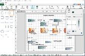
Create flowcharts easily with this free Windows software. Whether you're Mapping out ideas, laying out the structure of your organization or creating UML diagrams, ClickCharts is the perfect user-friendly program to get you going. Simplify complex processes, troubleshoot bottlenecks and find areas for improvement. Organize your ideas visually and make even the most complicated process...
Category: Business & Finance / Business Finance
Publisher: NCH Software, License: Freeware, Price: USD $0.00, File Size: 1.7 MB
Platform: Windows
So that you can identify the Mapping & GIS product that best suits your needs, use this simple Product Comparison. There are four main product types that you can use to create a GPS Data collection and maintenance system, or mobile GIS solution. Use the links below to select a product group, and compare the features of each product within that group.
Category: Internet / Communications
Publisher: Trimble Navigation Limited, License: Freeware, Price: USD $0.00, File Size: 2.7 MB
Platform: Windows
The Microdrone Airborne Mapping extension to Orbit GIS provides the tools required for automated flight and high precision Mapping. It contains a Waypoint Generator, a Microdrone in-flight tracker, and a captation tool. Further image-, stereoprocessing and orthorectification can be executed using the Strabo Photogrammetry extension to Orbit GIS.
Category: Multimedia & Design / Multimedia App's
Publisher: Orbit GeoSpatial Technologies, License: Freeware, Price: USD $0.00, File Size: 30.0 MB
Platform: Windows
Create flowcharts easily with this free Windows software. Whether you're Mapping out ideas, laying out the structure of your organization or creating UML diagrams, ClickCharts is the perfect user-friendly program to get you going. Simplify complex processes, troubleshoot bottlenecks and find areas for improvement. Organize your ideas visually and make even the most complicated process...
Category: Business & Finance / Presentation Tools
Publisher: NCH Software, License: Freeware, Price: USD $0.00, File Size: 570.3 KB
Platform: Windows

Create flowcharts easily with this free Windows software. Whether you're Mapping out ideas, laying out the structure of your organization or creating UML diagrams, ClickCharts is the perfect user-friendly program to get you going. Simplify complex processes, troubleshoot bottlenecks and find areas for improvement. Organize your ideas visually and make even the most complicated process...
Category: Business & Finance / Business Finance
Publisher: NCH Software, License: Freeware, Price: USD $0.00, File Size: 1.5 MB
Platform:
In the world of Data warehousing, SQL Server Integration Service (SSIS) is a popular platform for building high performance Data integration solutions including Extraction, Transformation and Load (ETL) packages for Data warehousing.
But programming Integration Service has become more popular in between SSIS developers recently. So to help SSIS developers for boosting...
Category: Software Development / Components: VB
Publisher: SQL Lion, License: Freeware, Price: USD $0.00, File Size: 128.0 KB
Platform: Windows
The Flowtite™ Hydraulic Flow Calculator is designed to analyze head loss and pumping energy requirements or slope gradients in different pipe materials.
The Flow Calculator will assist the engineer in the process of pipe material selection. The Flow loss and cost of frictional resistance are keys to the proper selection of pipe when the life of the pipe and cost...
Category: Home & Education / Science
Publisher: Winkler Consulting, License: Freeware, Price: USD $0.00, File Size: 11.6 MB
Platform: Windows
Water Point Mapping is a process for monitoring the distribution and status of water points in rural and urban areas. It supports local level planning and can improve accountability for water sector performance at local and national levels.
It uses the Google Earth application to visualise Data. Once Google Earth has been installed, it can be run offline.
...
Category: Home & Education / Miscellaneous
Publisher: WaterAid, License: Freeware, Price: USD $0.00, File Size: 880.0 KB
Platform: Windows
Software tool to interface between digital instruments and windows software.
Software tool to interface between digital instruments and windows software.
The Flow-BUS DDE (Dynamic Data Exchange) Server is gathering Data from the modules connected to the Flow-BUS, and at the same time transferring Data to this modules.
DDE provides the user a basic level of interprocess communication between windows applications and...
Category: Software Development / Misc. Programming
Publisher: Bronkhorst High-Tech B.V., License: Freeware, Price: USD $0.00, File Size: 8.4 MB
Platform: Windows
UsbSensorViewer is a software that applies to different resolutions, display temperature, differential pressure and Flow. Absolute or relative timing may be chosen and Data are displayed in graphs. The software also contains Data-logging capabilities and Data may be exported to Excel format.
Category: Utilities / Misc. Utilities
Publisher: Sensirion AG, License: Freeware, Price: USD $0.00, File Size: 581.5 KB
Platform: Windows
GPSeismic® is a suite of survey, Mapping, and Data management applications to support geophysical exploration.
GPSeismic applications offer advanced functionality to assist
the GNSS, INS, and conventional surveyor with a variety of tasks including the following:
-A wide range of both graphical, numeric and SQL based controller upload point selection methods...
Category: Business & Finance / Applications
Publisher: Dynamic Survey Solutions, Inc., License: Freeware, Price: USD $0.00, File Size: 162.8 MB
Platform: Windows
The DFC Control Terminal software shipped with DFC26/36/46 mass Flow controllers allows you to send the set point to the controller and receive back the current Flow rate in the desired engineering units, control mode of the proportional solenoid valve, calibrate ADC/DAC and gas Flow table, change the DFC’s address, operate the Totalizer and hi/low alarm, execute...
Category: Utilities / System Utilities
Publisher: AALBORG, License: Freeware, Price: USD $0.00, File Size: 2.1 MB
Platform: Windows
FlowFix is a configuration application for the fieldbus connection and active fluid.
FlowFix is a configuration application for the fieldbus connection and active fluid. It gives an overview of the available fluids (calibration curves) and allows the user to activate the desired fluid, fieldbus address and baudrate. It is suitable for digital Bronkhorst mass Flow/pressure meters/controllers equiped with a digital 'Multibus' PCBoard, like EL-Flow,...
Category: Software Development / Misc. Programming
Publisher: Bronkhorst High-Tech B.V., License: Freeware, Price: USD $0.00, File Size: 8.4 MB
Platform: Windows
PowerWorld Viewer is a freeware program designed to make it easy to exchange power flow cases.
PowerWorld Viewer is a freeware program designed to make it easy to exchange power Flow cases. You can view a solved power Flow case graphically using animated one-lines.
With Viewer, you can view Data, pan and zoom on one-line diagrams, contour Data, and distribute your power system cases to others. Viewer does not, however, allow you to make any...
Category: Business & Finance / Database Management
Publisher: PowerWorld Corporation, License: Freeware, Price: USD $0.00, File Size: 37.7 MB
Platform: Windows
MICRODEM is a freeware microcomputer Mapping program written by Professor Peter Guth of the Oceanography Department, U.S. Naval Academy. It requires a 32 bit version of Windows (NT/2000/XP or 95/98/ME). You may freely use MICRODEM with no restrictions.
MICRODEM displays and merges
- digital elevation models
- satellite imagery
- scanned maps
...
Category: Multimedia & Design / Graphics Viewers
Publisher: Petmar Triilobite Breeding Ranch, License: Freeware, Price: USD $0.00, File Size: 84.9 MB
Platform: Windows
A hydrogeology-based parameter estimation program for groundwater flow model.
A hydrogeology-based parameter estimation program for groundwater Flow model.
MODAC is a parameter estimation package for groundwater Flow model calibration. It couples the widely used three-dimensional groundwater Flow model MODFLOW (1996 version) and the inverse hydraulic parameter estimation procedures developed by Guo and Zhang (1994, 2000).
Category: Home & Education / Science
Publisher: Guo and Zhang, License: Freeware, Price: USD $0.00, File Size: 3.0 MB
Platform: Windows
expressor Studio provides game-changing ease-of-use with a drag-and-drop and wizard driven interface that enables developers to easily connect to standard Data sources and targets, map Data to common business names and types, and design and run complex Data Flow applications in minutes. It extends its unique semantic integration capabilities with Semantic Types - a...
Category: Business & Finance / Database Management
Publisher: expressor software, License: Freeware, Price: USD $0.00, File Size: 1.5 MB
Platform: Windows
Codus is a comprehensive code generation tool for object-relational mapping.
Codus is a comprehensive code generation tool for object-relational Mapping. For a given database it automatically generates a full Data access layer, web services for distributed programming, strongly-typed collections, and a full set of unit tests.
Category: Software Development / Misc. Programming
Publisher: intesar66, License: Freeware, Price: USD $0.00, File Size: 4.4 MB
Platform: Windows
QuakeMap is a powerful GPS/mapping program for your Windows computer.
QuakeMap is a powerful GPS/Mapping program for your Windows computer. It can be downloaded here for free. The trial mode allows you to use most features indefinitely. When you need to unlock certain powerful features, a License Key can be ordered here. QuakeMap is designed for ease of use. It eatures intuitive user interface, supports most popular Garmin and Magellan receivers, reads and...
Category: Utilities / Misc. Utilities
Publisher: quakemap.com, License: Freeware, Price: USD $0.00, File Size: 821.2 KB
Platform: Windows
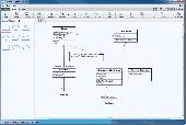
Was designed for facilitating professional flow chart drawing.
Was designed for facilitating professional Flow chart drawing. User-friendly and MS Office-compatible integrated environment for composing a number of types of charts and exporting them to a varity of graphics formats. Users can create delicate Flow charts in an easy and professional way and generate high quality images comparable to Visio's.
Category: Multimedia & Design / Digital Media Editors
Publisher: Sodensoft Studio, License: Freeware, Price: USD $0.00, File Size: 299.8 KB
Platform: Windows
DIVA-GIS is a free computer program for Mapping and geographic Data analysis (a geographic information system (GIS). With DIVA-GIS you can make maps of the world, or of a very small area, using, for example, state boundaries, rivers, a satellite image, and the locations of sites where an animal species was observed.
Category: Business & Finance / Applications
Publisher: diva-gis, License: Freeware, Price: USD $0.00, File Size: 3.8 MB
Platform: Windows
SWSTAT contains a number of options for statistically analyzing time-series data.
SWSTAT contains a number of options for statistically analyzing time-series Data. The time-series Data are read from a Watershed Data Management (WDM) file. The computed statistics and (or) time series can be written back to the WDM file or to a text file.
Uses Flow-duration analysis and class intervals to compute absolute error, root mean square error,...
Category: Business & Finance / Business Finance
Publisher: U.S. Geological Survey, License: Freeware, Price: USD $0.00, File Size: 2.6 MB
Platform: Windows
PCM SurveyCERT makes pipe mapping easier for surveyors in the field.
PCM SurveyCERT makes pipe Mapping easier for surveyors in the field. Survey Data may either be viewed in real time or be saved within the PCM to be reviewed later.The PCM SurveyCERT installation bundle includes both PC and PDA versions of the application.
Category: Software Development / Misc. Programming
Publisher: Radiodetection Ltd, License: Freeware, Price: USD $0.00, File Size: 5.7 MB
Platform: Windows
Freeware
Let It Flow is an interesting puzzle game for free. Get the water flowing to the crops and animals before time runs out. Rotate the pipes so that they connect from the pump to the crops and animals before the time runs out. Watch out for spillages, and don't forget to pump the water to get it moving. Try to make sure they are connected in such a way that water doesn't spill on the...
Category: Games / Puzzles
Publisher: NowStat.com, License: Freeware, Price: USD $0.00, File Size: 2.7 MB
Platform: Windows
RD8000 SurveyCERT makes cable & pipe mapping easier for surveyors in the field.
RD8000 SurveyCERT makes cable & pipe Mapping easier for surveyors in the field. Survey Data may either be viewed in real time or be saved within the RD8000 to be reviewed later.
An useful software that you can easy get it on your computers. The RD8000 can pass survey Data to a compatible PDA or PC in real time using Bluetooth® wireless technology.
Category: Multimedia & Design / Multimedia App's
Publisher: Radiodetection Ltd., License: Freeware, Price: USD $0.00, File Size: 5.9 MB
Platform: Windows
The FxEngine is a C++ Framework which simplifies the plugin architecture for the Data Flow processing. It provides a full control to the plugin architecture for applications that require custom solutions.
Category: Software Development / Misc. Programming
Publisher: smprocess.com, License: Freeware, Price: USD $0.00, File Size: 2.5 MB
Platform: Windows, Mac, 2K, 2K3, Vista
This is a tool that you can run from your own PC to aid you with valve selection.
This is a tool that you can run from your own PC to aid you with valve selection. With minimal input this program will provide automatic calculation of the required Flow Velocity, Mach Number, Flow Noise and Valve Flow Coefficient (CV). Norrisize is compatible with Windows 7, Windows Vista, Windows XP, Windows 2003, and Windows 2000.
Category: Business & Finance / Business Finance
Publisher: Norriseal, License: Freeware, Price: USD $0.00, File Size: 13.8 MB
Platform: Windows
FCS Filter is an utility for filtering flow cytometry (FCS) data files.
FCS Filter is an utility for filtering Flow cytometry (FCS) Data files. The program has been designed to gate out microbead populations and to remove debris and other unnecessary events from the FCS Data files that can interfere with the clustering procedure of the FCAP Array software. The filtering process is based on a gate defined by the user. The gate should be defined...
Category: Utilities / Misc. Utilities
Publisher: Soft Flow, License: Freeware, Price: USD $0.00, File Size: 0
Platform: Windows
PMapServer7 is a free add-on for UI-View32.
PMapServer7 is a free add-on for UI-View32. To use it, first download and register a copy of UI-View32. There are versions of PMapServer that will work with with Precision Mapping V5, V6 and V7.UI-View32 street level Mapping of the whole of the USA. To support Precision Mapping, UI-View32 uses a plug-in map server (PMapServer) that integrates seamlessly into the program....
Category: Home & Education / Miscellaneous
Publisher: Bill Diaz, License: Freeware, Price: USD $0.00, File Size: 5.4 MB
Platform: Windows
Trizbort is a simple tool which can be used to create maps for interactive fiction.
Trizbort is a simple tool which can be used to create maps for interactive fiction.
Over the years a number of styles have evolved for interactive fiction Mapping. Trizbort focuses on creating maps in only one of these styles, as popularised by Infocom: labelled boxes for rooms, with lines connecting them.
Whether you're playing or writing interactive fiction,...
Category: Multimedia & Design / Digital Media Editors
Publisher: Genstein, License: Freeware, Price: USD $0.00, File Size: 596.2 KB
Platform: Windows
Coanda is a developement software used for total flow.
Coanda is a developement software used for total Flow.
The output file lists the input parameters and provides the total Flow through and off of the screen as well as the wetted screen length for screens that accept all of the inflow. The output file is also tab-delimited for easy cutting-and-pasting into spreadsheets. Column headings do not appear lined up in the...
Category: Software Development / Misc. Programming
Publisher: Tony L. Wahl, License: Freeware, Price: USD $0.00, File Size: 1.6 MB
Platform: Windows
Spatial Workshop is Mapping software used for spatial information integration, query, analysis and reporting.
You build spatial applications with a few clicks or support complex business processes with geospatial and business Data from Oracle, Smallworld, ESRI, maps, files, spreadsheets and other sources.
You can combine and model geospatial Data,...
Category: Multimedia & Design / Multimedia App's
Publisher: Spatial Eye bv, License: Freeware, Price: USD $0.00, File Size: 176.7 MB
Platform: Windows
Freeware
OzGIS is an extensive system for the analysis and display of geographically referenced Data. About 150 menus provide an enormous range of options for: . importing Data from databases, spreadsheets and Geographic Information Systems (GISs) or downloaded from Census Bureaux or Mapping agencies. . processing Data in preparation for display and analysis ....
Category: Home & Education / Mathematics
Publisher: OzGIS, License: Freeware, Price: USD $0.00, File Size: 313.0 KB
Platform: Windows
Ais Decoder accepts AIS Data from an AIS Receiver, the Internet or a Local Network connection, decodes the Data and presents the decoded Data in a form suitable for display and analysis by Mapping program (eg Google Earth or Google Maps), or for analysis using Excel, or by a database (eg MySql).
The decoder will decode all the NMEA content of all 27 AIS mesage...
Category: Business & Finance / Business Finance
Publisher: Neal Arundale, License: Freeware, Price: USD $0.00, File Size: 2.8 MB
Platform: Windows
If you don't have internet access on your phone, or you want to self-select a larger region of Mapping, then the Map Chooser tool can be used to make map tile selections. Choose your own Mapping areas with the flexible select tool that lets you select unlimited areas of Mapping. Based on a grid, you can choose any grid squares you like - so you can pick an area in...
Category: Home & Education / Miscellaneous
Publisher: ViewRanger, License: Freeware, Price: USD $0.00, File Size: 213.2 MB
Platform: Windows
Freeware
Design flowcharts and diagrams easily with this free Mac software. Quickly create strong visuals of an organization, process, mind map, UML diagram and more. Map out your value streams and Data Flow. Find bottlenecks in the process and ways to optimize productivity. Jump start the process with template options or start fresh with your choice of shapes, symbols, line connector...
Category: Business & Finance / Business Finance
Publisher: NCH Software, License: Freeware, Price: USD $0.00, File Size: 4.6 MB
Platform: Mac
Easily create HTML image/photo maps with this free friendly image Mapping utility from the authors of the best free photo editing software - Photo Pos Pro photo editor . Pos HTML Image Mapper includes WYSIWYG interface allowing you Mapping images and photos fast and easy. Using the software you can easily create graphic toolbars to your website; you can easily link desired...
Category: Web Authoring / HTML Color Pickers
Publisher: PowerOfSoftware Ltd., License: Freeware, Price: USD $0.00, File Size: 7.9 MB
Platform: Windows
nanoNavigator is a free software package that makes setup, programming and maintenance fast and easy. Once a PC is connected to the Nanoline base unit through one of the serial connectivity option modules, the user has complete control. It takes only four simple steps to create a control Flow chart using nanoNavigator. After the project is loaded, nanoNavigator can start and stop the...
Category: Business & Finance / Database Management
Publisher: Phoenix Contact, License: Freeware, Price: USD $0.00, File Size: 48.3 MB
Platform: Windows
Data export module "DDE server" for Advanced Serial Data Logger is used for Data transmit received by Advanced Serial Data Logger picked out from byte Flow by parser to other programs on DDE technology. The Data export module works as server; it means that it gives access to reading Data on every variable received from parser. Using...
Category: Software Development / Misc. Programming
Publisher: AGG Software, License: Freeware, Price: USD $0.00, File Size: 1.0 MB
Platform: Windows
The Colorado Urban Hydrograph Procedure (CUHP) is an evolution of the Snyder unit hydrograph.
The Colorado Urban Hydrograph Procedure (CUHP) is an evolution of the Snyder unit hydrograph. It has been calibrated to the Colorado front range using of Data collected by the U.S. Geological Survey beginning in 1969. Data from 30 sites, representing a full range of land uses in the Denver Metro Area, was used to develop empirical relationships between the input hyetograph and...
Category: Business & Finance / Database Management
Publisher: Urban Drainage and Flood Control District, License: Freeware, Price: USD $0.00, File Size: 5.4 MB
Platform: Windows
The Audio Text Manager (ATM) is designed to give you a fast, graphical view of the call Flow patterns configured in the Unity database and allow you to modify that Flow quickly and easily. The ATM is made up of 3 basic view areas on the screen. The Tree and Grid view tabs on the left and the Information tabs.
Category: Audio / Utilities & Plug-Ins
Publisher: Cisco Systems, Inc., License: Freeware, Price: USD $0.00, File Size: 2.4 MB
Platform: Windows
The Coverage Calculator software is used to configure EAW Commercial loudspeaker systems listed within the program in a distributed layout using SPL (sound pressure level) Mapping as the primary criteria.
FEATURES:
-User-adjustable layout density.
-SPL map of listening area with adjustable resolution and frequency.
-Database of measured loudspeaker Data...
Category: Audio / Utilities & Plug-Ins
Publisher: EAW, License: Freeware, Price: USD $0.00, File Size: 3.9 MB
Platform: Windows
EntityDAC Express is a free ORM for Delphi with LINQ support. It provides a powerful framework that allows performing object-relational Mapping of database objects to Delphi classes with full support for encapsulation, inheritance, polymorphism and other OOP features. To retrieve Data from a database, LINQ is used as a database independent query engine. In addition, there is a...
Category: Software Development / Databases & Networks
Publisher: Devart, License: Freeware, Price: USD $0.00, File Size: 111.5 MB
Platform: Windows
Thoughtograph is simple, effective and rewarding to use.
Thoughtograph is simple, effective and rewarding to use.
A Thot is a Thoughtograph document, it is a visual representation of your thoughts taking shape.
For those familiar with mind Mapping, spider diagrams and concept Mapping the interface will feel familiar and intuitive.
For those new to laying out their thoughts visually it will liberate...
Category: Home & Education / Miscellaneous
Publisher: 3MRT Limited, License: Freeware, Price: USD $0.00, File Size: 15.5 MB
Platform: Windows
The SAR Training Processor (STP) is a graphical tool written to assist in learning and teaching the Flow of SAR processing. After installation, you will have a start-menu shortcut that you can use to run the SAR Training Processor.A number of algorithms have been developed to effectively process SAR Data from its raw signal into well focused images. The most common SAR processing...
Category: Multimedia & Design / Multimedia App's
Publisher: Alaska Satellite Facility Geophysical Institute, License: Freeware, Price: USD $0.00, File Size: 10.6 MB
Platform: Windows
The LookLOCAL Firefox Toolbar is a convenient extension to the Firefox browser that enables you to map a location, get directions, or search for products and services from any web site or page you are on without first navigating to an online Mapping site. Highlight and right click on a search topic, an address in your browser window or type an address directly into the toolbar, click...
Category: Business & Finance / MS Office Addons
Publisher: IDELIX Software Inc., License: Freeware, Price: USD $0.00, File Size: 29.0 KB
Platform: Windows