Free Downloads: Drawing Maps Software
License: All | Free
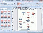
MapComp is a powerful and free Windows Software for Drawing images of linkage Maps and to compare linkage Maps and indicate common markers.
MapInspect can display, print and save images, and has no limit to the number of Maps it can compare (but only neighbouring Maps are compared). Maps can be flipped within MapINspect, an the...
Category: Multimedia & Design / Multimedia App's
Publisher: MapInspect, License: Freeware, Price: USD $0.00, File Size: 616.7 KB
Platform: Windows
Easy to create mind Maps (graphical representations of thought processes) for brainstorming, problem solving, rational analysis, and decision marking. Easy to use Drawing tools, many pre-drawn flowchart templates and more than 600 flowchart symbols and flowchart samples, Drawing couldn't be easier!
Category: Games / Tools & Editors
Publisher: EdrawSoft, License: Freeware, Price: USD $0.00, File Size: 20.9 MB
Platform: Windows
 Freeware
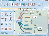
Easy to create mind Maps (graphical representations of thought processes) for brainstorming, problem solving, rational analysis, and decision marking. Easy to use Drawing tools, many pre-drawn flowchart templates and more than 600 flowchart symbols and flowchart samples, Drawing couldn't be easier! Why Choose Edraw Mind Map 1.Smart Drawing guide can layout the mind...
Category: Games / Tools & Editors
Publisher: EdrawSoft, License: Freeware, Price: USD $0.00, File Size: 28.6 MB
Platform: Windows

FSS Google Maps Downloader is a tool that can download the Google Maps images to your PC. This is a clearly free program. There is no spyware or adware. It's absolutely safe to install and to run. The interface is very simple and self explaining. It runs low on system resources consumption and is supported on all Windows versions. It can save them to your hard disk,...
Category: Internet / Download Managers
Publisher: FreeSmartSoft, License: Freeware, Price: USD $0.00, File Size: 874.0 KB
Platform: Windows
Diffuse maps represent the absorption of light.
Diffuse Maps represent the absorption of light. Diffuse Maps are what people call "textures". They are the color textures or photographic textures usually applied to 3d models.
ShaderMap creates displacement Maps using the light data stored inside of diffuse Maps. Evenly lit diffuse Maps generally create better quality Maps with ShaderMap.
Category: Home & Education / Miscellaneous
Publisher: Rendering Systems Inc., License: Freeware, Price: USD $0.00, File Size: 4.0 MB
Platform: Windows
Freeware
MindMaple is an effective Software method for brainstorming, note taking, organizing, and managing projects by stimulating both sides of the brain through use of visual contents and Maps. MindMaple is focused on improving user friendly interface to create Maps. The interface allows the user to add topics by click-dragging from an existing topic box, so called the...
Category: Business & Finance / MS Office Addons
Publisher: MindMaple Inc., License: Freeware, Price: USD $0.00, File Size: 9.7 MB
Platform: Windows
This Software development kit (SDK) provides the binaries and programming reference for the Bing Maps Silverlight Control. You can use this control to build your own web sites that use Bing Maps.
The Bing Maps Silverlight Control combines the power of Silverlight and Bing Maps to provide an enhanced mapping experience. Developers can use the Bing...
Category: Utilities / Misc. Utilities
Publisher: Microsoft, License: Freeware, Price: USD $0.00, File Size: 3.8 MB
Platform: Windows
SensAct -SENSORS CONVERSION Maps AND ACTUATORS COMMAND Maps
This Software pack contents the sensors conversion Maps and the actuators command Maps like motorized throttles, gasoline injectors corrections, ...
It is mandatory to install it to select the type of sensor and actuators that are equiping the ECUs, because these Maps are no longer...
Category: Business & Finance / Applications
Publisher: Skynam, License: Freeware, Price: USD $0.00, File Size: 3.4 MB
Platform: Windows
The Overlay Maker is a networked Drawing program with the ability to manipulate paint objects and add icons. It is designed to support military planning however can be used for a broad range of Drawing requirements. The program replicates the creation of overlay graphics on Maps or other background images. It supports multiple overlays and a range of graphic Drawing...
Category: Multimedia & Design / Fonts
Publisher: alistairdickie, License: Freeware, Price: USD $0.00, File Size: 4.1 MB
Platform: Windows
TninkGraph is a graphic editor for drawing concept maps.
TninkGraph is a graphic editor for Drawing concept Maps. This program contains many interesting and useful features. It provides you with tools to move and design elements. With ThinkGraph you can draw Maps with different layouts: vertical, horizontal, topic Maps; and different styles: boxes, lines, branches. The program saves data in SVG format, so then you can open...
Category: Multimedia & Design / Digital Media Editors
Publisher: Michel Kern, License: Freeware, Price: USD $0.00, File Size: 6.3 MB
Platform: Windows
PlanetGIS Explorer is a free viewer for PlanetGIS maps and GIS exchange files.
PlanetGIS Explorer is a free viewer for PlanetGIS Maps and GIS exchange files. PlanetGIS Explorer allows you to navigate through Maps, query map elements and view attribute information from linked database tables. Also PlanetGIS Explorer allows you to customize the appearance of Maps for purposes of creating hardcopy printouts, but does not allow you to save any changes to...
Category: Multimedia & Design / Graphics Viewers
Publisher: Planet GIS, License: Freeware, Price: USD $0.00, File Size: 5.4 MB
Platform: Windows

Paint online bear. Demonstrations, hints, tips and books. How to Draw Storyboards. Heres the place to start if you dont know the conventions of storyboarding. Or perhaps youd like to use existing clipart and cut.Drawing hands tutorial - learn how to draw hands from life - a free, original online Drawing tutorial.Drawing - original Drawing lessons, how to draw...
Category: Games / Kids
Publisher: Paint online, License: Freeware, Price: USD $0.00, File Size: 10.0 KB
Platform: Windows, Mac
MapCreator combines a cartography and a graphics programme.
MapCreator combines a cartography and a graphics programme. The Software is designed to create Maps and animated Maps of the highest quality as often required for presentations. For example, this could be Maps needed for a travel presentation. But also in
Category: Multimedia & Design
Publisher: primap.com, License: Freeware, Price: USD $0.00, File Size: 103.3 MB
Platform: Windows, Vista
W4MapLauncher is a free software application that contains more than 85 standard maps of W4.
W4MapLauncher is a free Software application that contains more than 85 standard Maps of W4.This Software application allows you to play on the new Maps in multiplayer or on-line.This launcher has also an aspect mode of 4:3 and 16:10, it is easy to install and to use
Category: Games / Misc. Games
Publisher: AlexBond, License: Freeware, Price: USD $0.00, File Size: 23.8 MB
Platform: Windows
Live Satellite Maps or Google maps is a web server mapping applications.
Live Satellite Maps or Google Maps is a web server mapping applications.Provides scrolling map images and satellite photos around the earth and even the route between different places.Since 6 October 2005, live satellite Maps is part of local Google.Google live satellite Map provides the ability to zoom in or zoom out to show the map.The user can control the map with your...
Category: Home & Education / Science
Publisher: www.satelliteview-of-my-house.com, License: Freeware, Price: USD $0.00, File Size: 643.0 KB
Platform: Windows
Nokia Maps 3D browser plugin is a free mapping product and service by Nokia for its mobile phones and for internet browsers. Nokia Maps includes voice guided navigation for both pedestrians and drivers for 74 countries in 46 different languages and there are Maps for over 180 countries.
See the world in high-resolution 3D. Everything from the sky to the street. Plan...
Category: Internet / Browser Accessories
Publisher: Nokia, License: Freeware, Price: USD $0.00, File Size: 9.8 MB
Platform: Windows
Freeware
Free standalone Software DataPult Desktop creates heat Maps from your data quickly and efficiently. Key features: Direct data import from MS Excel with one click. The ability to create animated Maps of data over several years. Interactive Maps and diagrams. 39 map colorings for making heat Maps. Intelligent identification of...
Category: Business & Finance / MS Office Addons
Publisher: DataPult, License: Freeware, Price: USD $0.00, File Size: 21.0 MB
Platform: Windows
When you are looking for a powerful tool to satisfy various needs regarding vectors, raster and satellite imagery, you will find ILWIS Academic an efficient application. The program comes with such useful features as points to create Maps, lines for segment Maps, closed area segments for polygon Maps, spatial operations for raster Maps and so on. Whilst using images...
Category: Home & Education / Miscellaneous
Publisher: ITC, License: Freeware, Price: USD $0.00, File Size: 19.4 MB
Platform: Unknown

OkMap is a GPS and map Software that:
-Works with vectorial Maps and calibrates raster Maps
-Organizes paths by creating waypoints, routes and tracks
-Uploads/downloads data to/from your GPS
-Uses altitude DEM data
-Supports GPS real-time navigation
-Sends/receives vehicles position and display tracks on Maps in real time
-Provides autorouting...
Category: Business & Finance / Applications
Publisher: Gian Paolo Saliola, License: Freeware, Price: USD $0.00, File Size: 20.2 MB
Platform: Windows
GDS Images and Document Maps is a unique document search utility.
GDS Images and Document Maps is a unique document search utility. GDS Images and Document Maps is a rather unique application that will enable you to store all your documents and images alongside other important files and folders right on your desktop so that you can use it straight from there, without the need to bother around with looking with looking for every single file...
Category: Utilities / Misc. Utilities
Publisher: toggle, License: Freeware, Price: USD $0.00, File Size: 558.8 KB
Platform: Windows
CacheMaps retreives a variety of maps for your caches from the Internet.
CacheMaps retreives a variety of Maps for your caches from the Internet.
CacheMaps uses the Geocaching loc- or gpx-files as input. Directely from the Geocaching site or as exported from GSAK.CacheMaps v4 has been designed to be used next to GSAK. A lot of the functionality that was available in previous versions of CacheMaps, is available in GSAK now in a much better form. What...
Category: Audio / Utilities & Plug-Ins
Publisher: BigBird Productions, License: Freeware, Price: USD $0.00, File Size: 153.2 KB
Platform: Windows
MUD Map Designer is a tool that was developed for MUD programmers that wish to make Maps for plotting or simply beneficial reasons. All files can be exported to several different image types. You can create your own setup files and map icons to use to customize each game!
Here are some key features:
-You can save, load, or export Maps. You can export Maps into one...
Category: Software Development / Help File Utilities
Publisher: Stonefall Studios, License: Freeware, Price: USD $0.00, File Size: 455.0 KB
Platform: Windows
Simple technical drawing software (CAD).
Simple technical Drawing Software (CAD). Ideal for garden design, mechanical engineering drawings, electrical / electronic, building and room plans, and general diagramming. Output in PDF format for the web. Copy and paste graphics. Create standard symbols to re-use. Scale, mirror and rotate. Accurate scale Drawing printing. Drafting tools to compare with pro packages.
Category: Multimedia & Design / Multimedia App's
Publisher: Peter Howard, License: Freeware, Price: USD $0.00, File Size: 655.4 KB
Platform: Windows
AMC Bridge has developed a number of utilities to automate Drawing creation for various SolidWorks users in the past few years.
This experience taught us a few generic requirements that are applicable to different end-user conditions, which we decided to package for all of you as the initial step to simplify your Drawing creation process.
As all other...
Category: Multimedia & Design / Multimedia App's
Publisher: AMC Bridge LLC, License: Freeware, Price: USD $0.00, File Size: 806.7 KB
Platform: Windows
With MapAuthor you can create, print and save desktop Maps, using data that you obtain from commercial sources or perhaps your in-hous GIS department as shapefiles (shapefiles are a very common GIS exchange format.) You can also produce internet-based Maps based on Google Maps, for use on your web site.
MapAuthor allows you to link your own data to Maps, for...
Category: Internet / Misc. Plugins
Publisher: MapAuthor.com, License: Freeware, Price: USD $0.00, File Size: 6.3 MB
Platform: Windows
Download, View, and Print Maps with the MrSID Viewer.
Download, View, and Print Maps with the MrSID Viewer.
To download and view Maps offline you need a special viewer. Maps are stored in MrSID format. The MRSID Viewer is a freeware tool. This library provides access to the MrSID viewer developed by LizardTech.
NOTE:
LizardTech dropped the link for that stand-alone viewer download from...
Category: Multimedia & Design / Graphics Viewers
Publisher: Lizardtech, License: Freeware, Price: USD $0.00, File Size: 2.0 MB
Platform: Windows
Drawing for Children is a Drawing application specially designed for children, even for those who still can't read. Colorful icons make children to understand the graphical actions they are representing.
The application includes normal Drawing commands as lines, circles, shapes, etc. and many different ways of Drawing, so children learn how to use...
Category: Home & Education / Kids & Parenting
Publisher: Fabricant par dA©faut, License: Freeware, Price: USD $0.00, File Size: 1.2 MB
Platform: Windows
The Accurasee Drawing System provides Drawing tools to help implement time tested methods of alignments and measurements. It can be used to help any artist arrive at correct overall proportions. It was created in an effort to simplify the process of comparing distances and aligning features and when used properly, the Accurasee Measurement System has proven to be able to teach...
Category: Multimedia & Design / Multimedia App's
Publisher: Accurasee, License: Freeware, Price: USD $0.00, File Size: 2.5 MB
Platform: Windows
Learn to draw vehicles step by step!
Learn to draw vehicles step by step! ABC Drawing School IV is a simple to use Software providing lessons for Drawing vehicles. Easy to follow visual instructions show how to connect simple forms like circles and rectangles with a few lines to complete drawings. One click selection from many colors and customizing of draw width is easy to use even for children. Follow the...
Category: Home & Education / Miscellaneous
Publisher: Jutta Behling, ABC-Ware, License: Freeware, Price: USD $0.00, File Size: 3.7 MB
Platform: Windows
You will either mess up your work place with huge Maps and travel guides or just switch on to Schmap Player to guide you for your travel.
This amazing travel guide with elaborated Maps and destinations can be downloaded and used for free. The main interface of this application comprises the guide menu with: European guides, US guides, Canadian guides, Australian guides, and...
Category: Internet / Web Search Utilities
Publisher: Schmap, Inc., License: Freeware, Price: USD $0.00, File Size: 2.0 MB
Platform: Windows
Pencil is an animation/drawing software.
Pencil is an animation/Drawing Software. It lets you create traditional hand-drawn animation (cartoon) using both bitmap and vector graphics. Animations can be exported as SWF/Flash files.
Category: Multimedia & Design / Animation
Publisher: les-stooges.org, License: Freeware, Price: USD $0.00, File Size: 5.3 MB
Platform: Windows, 2K, Vista
DrawTools sample shows how to create a Windows Forms application for Drawing graphic objects in a Windows client area using mouse and Drawing tools. Drawing tools implemented in this sample are: Rectangle, Ellipse, Line, and Pencil. There are well-known techniques for creating such type of applications, like: interaction with mouse, flicker-free Drawing, implementing...
Category: Multimedia & Design / Digital Media Editors
Publisher: Alex Fr, License: Freeware, Price: USD $0.00, File Size: 4.1 KB
Platform: Windows
Pie chart symbols for use as location markers on maps.
Pie chart symbols for use as location markers on Maps. There are three full sets of pies in the font. One is mapped to the upper-case letters A-U, and one to the lower case a-u . The third set is mapped to the number keys: the unshifted keys ` 1 2 3 4 5 6 7 8 9 0 represent 0%, 10%, 20%, 30%, 40%, 50%, 60%, 70%, 80%, 90%, and 100%, and their shifted counterparts ~ ! @ # $ % ^ & * (...
Category: Multimedia & Design / Multimedia App's
Publisher: Curtis Clark, License: Freeware, Price: USD $0.00, File Size: 12.5 KB
Platform: Windows
Avoid getting lost with Nokia Maps, whether you're driving or walking.
Avoid getting lost with Nokia Maps, whether you're driving or walking.It's free and here's what you get:
-full navigation and Maps for over 70 countries
-Drive and Walk navigation in over 90 countries
- real-time voice guidance for Drive and Walk
- Maps for over 180 countries with free updates
- real-time weather services
-...
Category: Internet / Download Managers
Publisher: Nokia, License: Freeware, Price: USD $0.00, File Size: 2.7 MB
Platform: Windows
Beader's Canvas is a drawing software and using it you can also modify pictures.
Beader's Canvas is a Drawing Software and using it you can also modify pictures.The canvas is the area in the center of the screen where you create patterns. Patterns can be created from a picture or by Drawing. You can work on up to three patterns at once on the canvas.
Category: Home & Education / Miscellaneous
Publisher: Robert Dunn, License: Freeware, Price: USD $0.00, File Size: 1021.8 KB
Platform: Windows
This utility generates random images which resemble real relief maps.
This utility generates random images which resemble real relief Maps. The randomized Maps contain settlements with random names, hills, plains, lakes and seasides. The generated images are public domain and can be used anywhere. Note that the generated se
Category: Multimedia & Design
Publisher: greenfish.xtreemhost.com, License: Freeware, Price: USD $0.00, File Size: 247.0 KB
Platform: Windows, Mac, Vista
VYM (View Your Mind) is a tool to generate and manipulate maps which show your thoughts.
VYM (View Your Mind) is a tool to generate and manipulate Maps which show your thoughts. Such Maps can help you to improve your creativity and effectivity. You can use them for time management, to organize tasks, to get an overview over complex contexts, to sort your ideas etc.
Category: Home & Education / Miscellaneous
Publisher: Uwe Drechsel, License: Freeware, Price: USD $0.00, File Size: 4.0 MB
Platform: Windows
Freeware
This utility is a standalone tool that is useful to find differences between to similar drawings. Compares all Drawing entities in the selected Drawing space (Model,Layout) Compares all other Drawing structures such as: Layers, Blocks, Text Styles, Layouts, etc. Compare dwg drawings from R12 to 2007. Creates three separate views outputs (A not B, B not A, and...
Category: Multimedia & Design / Graphics Viewers
Publisher: Holbrook Enterprises, Inc. dba WireCAD, License: Freeware, Price: USD $0.00, File Size: 14.4 MB
Platform: Windows

OkCustomMap is a software to produce Garmin Custom Maps.
OkCustomMap is a Software to produce Garmin Custom Maps.
Supports many map formats:
- OkMap
- Ecw
- GeoTiff
- World files
- OziExplorer
- GpsTuner
You can customize:
- The quality of the output JPEG images (0=Bad, 100=Good)
- The KML transparency (0=Transparent, 255=Opaque)
- The KML draw order (0=Invisible, 1-49=Under the vectorial...
Category: Business & Finance / Applications
Publisher: Gian Paolo Saliola, License: Freeware, Price: USD $0.00, File Size: 3.2 MB
Platform: Windows
Spatial Workshop is mapping Software used for spatial information integration, query, analysis and reporting.
You build spatial applications with a few clicks or support complex business processes with geospatial and business data from Oracle, Smallworld, ESRI, Maps, files, spreadsheets and other sources.
You can combine and model geospatial data,...
Category: Multimedia & Design / Multimedia App's
Publisher: Spatial Eye bv, License: Freeware, Price: USD $0.00, File Size: 176.7 MB
Platform: Windows
xGPS Manager is a must-have tool for iPhone owners.
xGPS Manager is a must-have tool for iPhone owners. It is a desktop application that talks nice to iPhone application xGPS, which is a Maps and navigation tool for iPhones. This desktop application allows you to carry out certain tasks that are harder to do on iPhone.
For example, you can manage your Maps in the desktop application and sync them with the iPhone app....
Category: Home & Education / Miscellaneous
Publisher: Xwaves, License: Freeware, Price: USD $0.00, File Size: 4.5 MB
Platform: Windows
C&C 3 Map Manager streamlines the process of installing custom Maps for C&C 3: Tiberium Wars and Kane's Wrath. Now you can install fan Maps from C&C fansites without having to delve into your computer's folders to find the right place to put them: Map Manager handles this for you. Map Manager also allows you to delete fan Maps after you get sick of...
Category: Games / Tools & Editors
Publisher: CNC Generals World, License: Freeware, Price: USD $0.00, File Size: 612.3 KB
Platform: Windows
With MetroWizzz- the Autorouting MetroGuide Wizard, you can make your GPS capable of autorouting with MetroGuide Maps. The wizard is self explaining. In just 6 simple steps you will have autorouting capabilities with MetroGuide Maps on your GPS. You can upload up to 1Gb of Maps to your GPS.
Category: Home & Education / Miscellaneous
Publisher: Geodude, License: Freeware, Price: USD $0.00, File Size: 962.2 KB
Platform: Windows
Drawing graphs without the right tool is simply difficult.
Drawing graphs without the right tool is simply difficult. uDraw(Graph) automates this task for you. Find out how uDraw(Graph) creates your flow charts, diagrams, hierarchies or structure visualizations using automatic layout - much faster than with any standard Drawing program. With the API, uDraw(Graph) can even be embedded in your own programs as a visualization component.
Category: Multimedia & Design / Image Editing
Publisher: University Bremen, FB3, Germany, License: Freeware, Price: USD $0.00, File Size: 2.6 MB
Platform: Windows
MOTOEXTRAS™ offers several bundles of popular Maps and other extra content such as 3D city Maps at special prices. MOTONAV Toolbox is a FREE Windows utility designed to connect your navigation device with your PC.
You must download it to see all available updates, purchase updates, download the necessary files and upload updates and new content to your...
Category: Multimedia & Design / Graphics Viewers
Publisher: Nav N Go Kft., License: Freeware, Price: USD $0.00, File Size: 8.0 MB
Platform: Windows
A windows tool for Drawing over your desktop and applications
This project was registered on SourceForge.net on Aug 1, 2010, the Software is a free easy to use Drawing tool , you can select from 15 different colors , change the size of your pen choosing from one of the 5 pen dimensions offered , you can free draw anything you like over your desktop and...
Category: Desktop Enhancements / Shell & Desktop Managers
Publisher: Brian Hoary, License: Freeware, Price: USD $0.00, File Size: 1.1 MB
Platform: Windows
ProJob is a free software utility supplied by Prolec for use with Digital Terrain Maps (DTM).
ProJob is a free Software utility supplied by Prolec for use with Digital Terrain Maps (DTM). Its principle function is to take one of the many standard industry formats for these DTMs and convert it into a .tri file. A .tri file is the proprietary format used by Prolec's Digmaster Pro machine control product, and because of the way that Digmaster Pro and ProJob work...
Category: Multimedia & Design / Graphics Viewers
Publisher: Prolec Ltd, License: Freeware, Price: USD $0.00, File Size: 3.5 MB
Platform: Windows
Get 100s of Bibles, 1,000s of resources, maps and commentaries including all popular Bibles.
Get 100s of Bibles, 1,000s of resources, Maps and commentaries including all popular Bibles. Includes massive numbers of Bible Maps , digital resources and linked lookups. Create and manage your own notes, produce sermons, Bible study classes and more. NIV, NASB coming soon.
Category: Home & Education / Religion & Spirituality
Publisher: Bible Software, License: Freeware, Price: USD $0.00, File Size: 28.2 MB
Platform: Windows
Need to print at home and work?
Need to print at home and work? Sharing Maps with friends? All you need is the free CC3 Viewer! Based on version FastCAD , the viewer is compatible with all versions of Campaign Cartographer (CC2 and up).
It is updated the viewer to be compatible with Maps created in Campaign Cartographer 3, including bitmap symbols and sheet effects.
The CC3 Viewer works...
Category: Home & Education / Miscellaneous
Publisher: ProFantasy Software Ltd, License: Freeware, Price: USD $0.00, File Size: 57.0 MB
Platform: Windows
APRS SA does most of the functions of the original APRS(tm) with a big difference: The Maps it uses to plot the locations are Street Atlas 4.0 or 5.0 Maps. This allows great precision in locating objects and stations. This program track a moving vehicle and do it at the street level.
Category: Home & Education / Miscellaneous
Publisher: Brent Hildebrand, KH2Z, License: Freeware, Price: USD $0.00, File Size: 2.0 MB
Platform: Windows