Free Downloads: Editing Raster Map
License: All | Free
With the CAD Studio's utility - GeoRefImg - you can automatically place georeferenced Raster files (pictures) also in AutoCAD or Architectural Desktop (this correlation functionality is by default available only in AutoCAD Map, Civil3D and Raster Design). GeoRefImg - georeferencing for AutoCAD and ADT - automatic repositioning of Raster images (with georeference...
Category: Multimedia & Design / Image Editing
Publisher: CAD Studio, License: Freeware, Price: USD $0.00, File Size: 55.3 KB
Platform: Windows
This program is a tool for stretching a bitmap image (a Raster image), trimming it to a box, and calibrating it. This is primarily of use when dealing with a scanned image of a paper Map. Often when making a scan it is hard to get the image precisely aligned; sometimes with old maps the paper has stretched. It can be useful where you want to make a tiled Map from a number...
Category: Multimedia & Design / Multimedia App's
Publisher: Map Library, License: Freeware, Price: USD $0.00, File Size: 755.8 KB
Platform: Windows
GraphicsGale is a software for editing raster format image.
GraphicsGale is a software for Editing Raster format image. You can retouch a photo, paint a picture, and so on. In addition, you can make an animation with seeing its preview in real-time. This feature must be useful for making an animated GIF or a video-game character.
Category: Multimedia & Design / Media Management
Publisher: HUMANBALANCE Co.,Ltd., License: Freeware, Price: USD $0.00, File Size: 1.6 MB
Platform: Windows
GTXImage CAD is a total Raster and vector drawing system for bringing paper drawings into a modern CAD, EDM or GIS environment. It includes powerful, industry standard two-dimensional CAD functionality that fully supports comprehensive hybrid Raster and vector capabilities. It also provides highly efficient Raster enhancement and Editing features that permit you to...
Category: Multimedia & Design / Image Editing
Publisher: GTX, License: Freeware, Price: USD $0.00, File Size: 248.0 MB
Platform: Windows
 Freeware
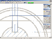
If you want to edit a Raster file in your CAD program, you first have to convert it to a vector file. RasterVect does just that, transforming paper drawings or Raster images into a vector format. Raster images can be imported by scanning original paper drawings. There is TWAIN and WIA support for importing from all scanners. The target vector formats (DXF, WMF, EMF, EPS and...
Category: Multimedia & Design / Image Editing
Publisher: RasterVect Software, License: Freeware, Price: USD $0.00, File Size: 2.8 MB
Platform: Windows

The free AvisMap Viewer opens most GIS/CAD and Raster image file types and most ArcView, ArcExplorer, and MapInfo projects. Besides just opening and viewing files, the Viewer supports an extensive list of features including visual layer properties control, legend control, thematic mapping, spatial and attribute querying, custom labeling, on-Map measurements, hyper-linking, PDF...
Category: Software Development / Components & Libraries
Publisher: AvisMap GIS Technologies, License: Freeware, Price: USD $0.00, File Size: 22.3 MB
Platform: Windows
When you are looking for a powerful tool to satisfy various needs regarding vectors, Raster and satellite imagery, you will find ILWIS Academic an efficient application. The program comes with such useful features as points to create maps, lines for segment maps, closed area segments for polygon maps, spatial operations for Raster maps and so on. Whilst using images from satellite...
Category: Home & Education / Miscellaneous
Publisher: ITC, License: Freeware, Price: USD $0.00, File Size: 19.4 MB
Platform: Unknown
Freeware
An interactive Flash USA Map with all the features you need for your web site or project. This is the ideal solution for dealer maps, real-estate listings, or visualizing state statistics. Nearly every aspect of the Map is customizable. However, unlike competing products, our Map is very simple to install and edit. Just upload XML and SWF files and embed.
Category: Internet / Flash Tools
Publisher: http://www.flashusamap.com/trial/flashus, License: Freeware, Price: USD $0.00, File Size: 93.8 KB
Platform: Unknown
Twine lets you organize your story graphically with a map that you can re-arrange as you work.
Twine lets you organize your story graphically with a Map that you can re-arrange as you work. Links automatically appear on the Map as you add them to your passages, and passages with broken links are apparent at a glance. As you write, focus on your text with a fullscreen Editing mode like Dark Room. Rapidly switch between a published version of your story and the...
Category: Multimedia & Design / Digital Media Editors
Publisher: gimcrackd.com, License: Freeware, Price: USD $0.00, File Size: 7.1 MB
Platform: Windows
Map of Africa is one of the many maps created for GPS TrackMaker.
Map of Africa is one of the many maps created for GPS TrackMaker. You are able to download the installation package from the TrackMaker website. In order to preview the contents of this package, you need to install GPS TrackMaker.
Using the above mentioned application, you will be able to see the Map of Africa. Just click on the "Open Temporary...
Category: Home & Education / Miscellaneous
Publisher: Geo Studio Technology, License: Freeware, Price: USD $0.00, File Size: 18.3 MB
Platform: Windows
Program shows you an actual X3 sector-map, with detailed information about most in-game objects.
Program shows you an actual X3 sector-Map, with detailed information about most in-game objects. The Map is based on a log-file that is created with an in-game script (by Andrei[<>Ace]). If you just want to view the standard Map (or if you don’t have the game) the program will work with the included default Map, which was created with an English X3 game...
Category: Games / Misc. Games
Publisher: SUU Design, License: Freeware, Price: USD $0.00, File Size: 1.4 MB
Platform: Windows
New Zealand Map Reference Converter (NZMapConv) is software that LINZ provides to convert Map references between the old NZMS260 Map series and the new NZTopo50 Map series.NZMapConv is a Windows programme designed to convert individual coordinates entered manually.
Category: Multimedia & Design / Media Management
Publisher: Land Information New Zealand, License: Freeware, Price: USD $0.00, File Size: 2.4 MB
Platform: Windows
When the XMAP software is communicating with an XEDE via the comms cable each Map will show, at the top of the Map display, an RPM and load value (x and y axis for the Map) in real time. Also in each Map a yellow highlighted block will show the current position within the Map. Beside the real-time display on each Map are the undo and redo buttons which...
Category: Home & Education / Miscellaneous
Publisher: ChipTorque, License: Freeware, Price: USD $0.00, File Size: 1.7 MB
Platform: Windows
Sig Panama Has :
Digital maps of Panama, Digital Map of Panama-City, digital Map of Taboga, digital Map of Bocas del Toro, digital Map of Colon and Free Zone, digital Map of Contadora Island, digital Map of Coronado, Panama, Zona Libre, Map of Panama, Map of Panama City, Map of Colon, Map of Zona Libre, Map of...
Category: Internet / Misc. Plugins
Publisher: DP Imperial, LLC., License: Freeware, Price: USD $0.00, File Size: 44.9 MB
Platform: Windows
ArcScripts is intended for the free exchange of scripts and tools related to ESRI software products.
ArcScripts is intended for the free exchange of scripts and tools related to ESRI software products. Please alert the moderator if this script is a demo, trial-version, or an advertisement for a retail product.
Akin to the GRIDSPOT AML in workstation ArcInfo, this VB tool overlays a point shapefile or point coverage on a Raster layer and assigns the value of the...
Category: Multimedia & Design / Multimedia App's
Publisher: Dan Rathert, License: Freeware, Price: USD $0.00, File Size: 7.4 KB
Platform: Windows

OkMap is a GPS and Map software that:
-Works with vectorial maps and calibrates Raster maps
-Organizes paths by creating waypoints, routes and tracks
-Uploads/downloads data to/from your GPS
-Uses altitude DEM data
-Supports GPS real-time navigation
-Sends/receives vehicles position and display tracks on maps in real time
-Provides autorouting and geocoding...
Category: Business & Finance / Applications
Publisher: Gian Paolo Saliola, License: Freeware, Price: USD $0.00, File Size: 20.2 MB
Platform: Windows
Freeware
Arm Map Explorer recreates all the functionalities of Google Maps on your desktop while expanding them with new extras. Map Explorer lets you locate and view any place on the planet using dynamic interactive maps. These maps are draggable, which means there is no need for you to click and wait for graphics to reload each time you want to view adjacent parts of a Map....
Category: Internet / Flash Tools
Publisher: ArmCode, License: Freeware, Price: USD $0.00, File Size: 5.5 MB
Platform: Windows
HOI3Editor is a powerful and easy-to-use application, in which you can select and/or edit provinces by clicking the Map. This application is a save game editor for Hearts of Iron 3. With HOI3Editor you can easily occupy provinces. With an easy-to-use interface, this application makes Map Editing look easy.
Category: Utilities / Misc. Utilities
Publisher: Miklos Jakab, License: Freeware, Price: USD $0.00, File Size: 54.5 KB
Platform: Windows
The easiest way to get a paper map with MapPlot is the Plot Map menu.
The easiest way to get a paper Map with MapPlot is the Plot Map menu.
On the following dialog, simply paper size and scale have to be chosen - the result is ready to be printed directly, edited (e.g. for additional entries) or to be displayed as a preview.
Category: Utilities / Misc. Utilities
Publisher: AGIS GmbH, License: Freeware, Price: USD $0.00, File Size: 5.4 MB
Platform: Windows
Easily create HTML image/photo maps with this free friendly image mapping utility from the authors of the best free photo Editing software - Photo Pos Pro photo editor . Pos HTML Image Mapper includes WYSIWYG interface allowing you mapping images and photos fast and easy. Using the software you can easily create graphic toolbars to your website; you can easily link desired areas in...
Category: Web Authoring / HTML Color Pickers
Publisher: PowerOfSoftware Ltd., License: Freeware, Price: USD $0.00, File Size: 7.9 MB
Platform: Windows
Tibia Map Viewer is a useful freeware and Open Source application that allows you to view maps generated by Tibia game client and create or edit Map symbols.
You can view the entire Tibia Map you have explored, both upper and lower levels of the Map, with zoom ratio from 25 to 400 percents. It also allows you to export to BMP file.
Category: Games / Tools & Editors
Publisher: Yury Sidorov, License: Freeware, Price: USD $0.00, File Size: 193.7 KB
Platform: Windows
Spinning Gobe Sample demonstrates how to manipulate the navigation, Map style, Map font size, and view of the Map programmatically through the MapPoint ActiveX Control. Using this simple Visual Basic project, you will learn the objects, methods, and properties that are used to navigate a MapPoint Map or change how it looks.
Category: Home & Education / Miscellaneous
Publisher: Microsoft, License: Freeware, Price: USD $0.00, File Size: 3.4 MB
Platform: Windows
The C-Map Chart Catalog allows you to view, navigate, select and order C-Map electronic charts, or various weather options, in an interactive way. After selection of required items is completed, simply press the 'E-mail order' button, and enter the address of your local C-Map distributor.
Category: Home & Education / Hobbies
Publisher: Jeppesen Marine, License: Freeware, Price: USD $0.00, File Size: 6.1 MB
Platform: Windows
Panoply is a Java application which enables the user to plot Raster images of geo-gridded data from netCDF datasets. Panoply is an utility that enable user to plot Raster image. Depending on the data, it can draw global longitude-latitude images or pole-t
Category: Multimedia & Design / Illustration
Publisher: giss.nasa.gov, License: Freeware, Price: USD $0.00, File Size: 9.4 MB
Platform: Windows, Mac, 2K, 2K3, Vista
C&C 3 Map Manager streamlines the process of installing custom maps for C&C 3: Tiberium Wars and Kane's Wrath. Now you can install fan maps from C&C fansites without having to delve into your computer's folders to find the right place to put them: Map Manager handles this for you. Map Manager also allows you to delete fan maps after you get sick of...
Category: Games / Tools & Editors
Publisher: CNC Generals World, License: Freeware, Price: USD $0.00, File Size: 612.3 KB
Platform: Windows
Karnaugh map minimalizator - for minimalize logical functions for 3-8 variables.
Karnaugh Map minimalizator - for minimalize logical functions for 3-8 variables. This program help you safe logical circuits. This program is special for students. On left you can see a full Map of your function. Negation of variable is big capital.
Category: Home & Education / Mathematics
Publisher: Vaclav Kozak, License: Freeware, Price: USD $0.00, File Size: 253.0 KB
Platform: Windows
The D2D Map Editor enables the rapid creation of multilayered tile based map grids.
The D2D Map Editor enables the rapid creation of multilayered tile based Map grids. It’s easy to learn and can be used by programmers and non-programmers alike. The maps generated can be deployed in games and applications developed in C++, C#, Actionscript and XML.
D2D Map Editor has been developed in C# and is currently released as a Beta version.
Category: Games / Tools & Editors
Publisher: D2D Map Editor, License: Freeware, Price: USD $0.00, File Size: 2.5 MB
Platform: Windows
Character Map displays all of the characters for a selected font.
Character Map displays all of the characters for a selected font. Features:
- Pastes any character into your current document.
- Special characters can be translated into their HTML-equivalents.
- More than a replacement for the Windows (9x/NT) character Map "charmap".
- Many additional features
- Ready for €
- Uncrippled...
Category: Utilities / Misc. Utilities
Publisher: Thomas Bigler, License: Freeware, Price: USD $0.00, File Size: 88.5 KB
Platform: Windows
With links and additional information on important topics for geography lessons.
With links and additional information on important topics for geography lessons. 3D-view of atlas (book) maps on a virtual globe, high resolution physical Map, political Map, satellite images, land coverage and earth-at-night Map. Create your own Map legend, use the drawing tool, move and insert atlas symbols and much more.
Category: Multimedia & Design / Fonts
Publisher: Imagon GmbH, License: Freeware, Price: USD $0.00, File Size: 6.1 MB
Platform: Windows
If you don't have internet access on your phone, or you want to self-select a larger region of mapping, then the Map Chooser tool can be used to make Map tile selections. Choose your own mapping areas with the flexible select tool that lets you select unlimited areas of mapping. Based on a grid, you can choose any grid squares you like - so you can pick an area in Sussex and...
Category: Home & Education / Miscellaneous
Publisher: ViewRanger, License: Freeware, Price: USD $0.00, File Size: 213.2 MB
Platform: Windows
MapCreator 2.0 is a software to create maps and animated maps with a good quality.
MapCreator can be used in presentations because is versatile and can be adequate for any kind of presentation, from travel presentations to professional presentations.
MapCreator is geo-referenced so any Map or portion of the Map will have the exactly portions of latitude and longitude,...
Category: Home & Education / Miscellaneous
Publisher: primap software, License: Freeware, Price: USD $0.00, File Size: 103.3 MB
Platform: Windows
SemGrid (Simple easy manager of Grid data, for SEMoLa).
SemGrid (Simple easy manager of Grid data, for SEMoLa). Some of its features are: Freeware Raster GIS, for Windows OS, import and export of grid layers from ASCII grid files of Surfer (grd), GeoMedia (asc), ArcGis (asc) and binary or ASCII from Idrisi32 (rdc, rst), GeoEAS, GRASS, Map algebra, Markov chains estimation and simulation and much more.
Category: Business & Finance / Applications
Publisher: Francesco Danuso, University of Udine, License: Freeware, Price: USD $0.00, File Size: 7.9 MB
Platform: Windows
Nokia Map Manager is a program that allows you to manage and transfer GPS maps to mobile phone.
Nokia Map Manager is a program that allows you to manage and transfer GPS maps to mobile phone. The Map Manager is for the 6110 Navigator only. The program is provided with scan function to search maps on the computer and DVD. Nokia Map Manager is an additional application and is used together with Nokia PC Suite 6.86 and later versions.
Nokia Map Manager helps...
Category: Internet / Communications
Publisher: Nokia, License: Freeware, Price: USD $0.00, File Size: 0
Platform: Windows
Freeware
VSceneGIS Desktop. (GIS) Analysis, Computing and Editing. Customer Project Development, Analysis, Computing and GIS Editing. VSceneGIS Desktop applies the concept of Tree and Graph Topology to implement the data model in a GIS. Validation, Editing and Topological Behavior Export and import of data sources: PostgreSQL / PostGIS, Oracle, MySQL, SQLite / SpatiaLite,...
Category: Home & Education / Science
Publisher: vscenegis.com, License: Freeware, Price: USD $0.00, File Size: 118.4 MB
Platform: Windows
Pixelitor is a cross-platform raster graphics editor written in Java.
Pixelitor is a cross-platform Raster graphics editor written in Java. It supports image filters, drawing, layers, unlimited undo, etc.
Category: Multimedia & Design / Image Editing
Publisher: sourceforge.net, License: Freeware, Price: USD $0.00, File Size: 1.1 MB
Platform: Windows, Mac, Vista
CaddyConnect is a software that helps you to connect the Caddy devices to your computer and download the required course Map (subject to a valid Golf Plus membership or Map Credit being available). Once the Map has been successfully downloaded onto the Caddy Lite, it is ready for use when the device is switched on and the course selected when the player arrives at the golf...
Category: Business & Finance / Business Finance
Publisher: GolfPlus UK Limited, License: Freeware, Price: USD $0.00, File Size: 10.2 MB
Platform: Windows
In this game there will be a map filled with colored grids.
In this game there will be a Map filled with colored grids. Your colony starts with the home grid in the center of the Map marked by a flag. The goal of the game is to turn all the grids into the same color. You can change the color of your home grid and all connected grids by clicking on other colored grids in the Map. Continue the process and you will be able to turn all...
Category: Games / Misc. Games
Publisher: Novel Games Limited, License: Freeware, Price: USD $0.00, File Size: 264.5 KB
Platform: Windows
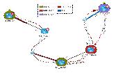
NetBrain Map Edition Lite is a free software designed to help network professionals to learn network skills easier and faster. For instance, you can use this software to document your learning process toward CCIE, CCNP or CCNA with a data-driven Map. Using NetBrain Map Edition Lite, dynamic network diagrams can be created instantly in many different ways. For example, you...
Category: Internet / News Applications
Publisher: NetBrain Technologies,Inc., License: Freeware, Price: USD $0.00, File Size: 53.0 MB
Platform: Windows
Easily Draw and Create Graphic Images. DrawPad is an easy-to-use image composition and manipulation program, and an essential tool for all types of graphic design projects, including: Creating banner ads or invitations, Make sketches and paintings on your computer, Draw diagrams, icons and other web graphics. DrawPad is ideal for creating images, drawings, and for paintings. DrawPad features...
Category: Multimedia & Design / Graphics Viewers
Publisher: NCH Software, License: Freeware, Price: USD $0.00, File Size: 1.7 MB
Platform: Windows
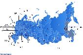
Dongsoft Interactive Russia Flash Maps for websites, interactive Map applications, presentations, and more.
The innovation of this fully-clickable Map will revolutionize your website navigation and provide visitors with a simple and seamless method of accessing information. Using the Map as a central navigation tool, information can be accessed with greater speed,...
Category: Software Development / Help File Utilities
Publisher: clickable map, License: Freeware, Price: USD $0.00, File Size: 156.0 KB
Platform: Windows
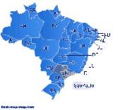
Dongsoft Interactive Brazil Flash Maps for websites, interactive Map applications, presentations, and more.
The innovation of this fully-clickable Map will revolutionize your website navigation and provide visitors with a simple and seamless method of accessing information. Using the Map as a central navigation tool, information can be accessed with greater speed,...
Category: Software Development / Help File Utilities
Publisher: maps flash, License: Freeware, Price: USD $0.00, File Size: 156.0 KB
Platform: Windows
This application was written for importing .
This application was written for importing .Map files created with editors such as Hammer into Cartography Shop. It will scan a .Map file and generate a .CSM file with all dependent textures required by the .CSM file. All brushes are separated for easier level modification.
Category: Utilities / Misc. Utilities
Publisher: Apex, License: Freeware, Price: USD $0.00, File Size: 1.4 MB
Platform: Windows
Easily Draw and Create Graphic Images. DrawPad is an easy-to-use image composition and manipulation program, and an essential tool for all types of graphic design projects, including: Creating banner ads or invitations, Make sketches and paintings on your computer, Draw diagrams, icons and other web graphics. DrawPad is ideal for creating images, drawings, and for paintings. DrawPad features...
Category: Multimedia & Design / Graphics Viewers
Publisher: NCH Software, License: Freeware, Price: USD $0.00, File Size: 12.7 MB
Platform: Mac
Live Satellite Maps or Google maps is a web server mapping applications.
Live Satellite Maps or Google maps is a web server mapping applications.Provides scrolling Map images and satellite photos around the earth and even the route between different places.Since 6 October 2005, live satellite Maps is part of local Google.Google live satellite Map provides the ability to zoom in or zoom out to show the Map.The user can control the Map with...
Category: Home & Education / Science
Publisher: www.satelliteview-of-my-house.com, License: Freeware, Price: USD $0.00, File Size: 643.0 KB
Platform: Windows
Gismaps Viewer is a GIS viewer that can be used for geospatial analysis and map production.
Gismaps Viewer is a GIS viewer that can be used for geospatial analysis and Map production.
The main features are:
- read Shape files using geographic coordinate system
- view satellite images (MrSid, jpeg, bmp and tiff file formats)
- generate thematic maps, queries and labels
- export do Google Earth KML (shp2kml)
- configure Map colors...
Category: Multimedia & Design / Graphics Viewers
Publisher: Gismaps Sistemas Ltda., License: Freeware, Price: USD $0.00, File Size: 10.2 MB
Platform: Windows
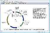
BVTech Plasmid can draw circle or linear plasmid map with double strands or single strand.
BVTech Plasmid can draw circle or linear plasmid Map with double strands or single strand. You can label the plasmid with genes and restriction sites in different colors, text, and styles. Plasmid Map can be highly customized by drag-droping or directly setting properties. BVTech Plasmid provides many drawing objects, includs lines, arrows, rectangles, circles, and text boxes....
Category: Home & Education / Science
Publisher: BV Tech, Inc., License: Freeware, Price: USD $0.00, File Size: 2.5 MB
Platform: Windows
This stand alone application aids in the loading of CD's of CADRG data from NIMA.
This stand alone application aids in the loading of CD's of CADRG data from NIMA. The application uses ArcInfo Workstation, ArcObjects, and ArcSDE to load each frame file from the CD into either a Raster dataset or a Raster catalog. The application comes with an installer and the unpacked product aswell.
Category: Multimedia & Design / Image Editing
Publisher: ESRI, License: Freeware, Price: USD $0.00, File Size: 1.1 MB
Platform: Windows
The Creeper World Map Editor (CWME) allows you to create and edit maps for use in Creeper World.
The Creeper World Map Editor (CWME) allows you to create and edit maps for use in Creeper World. You can specify the terrain, change the background image, and create/edit Creeper emitters and spore waves. You can also specify the location and the number of totems, upgrades, survival pods, and artifacts. In short, you can create nearly any Map you can imagine.
Category: Games / Tools & Editors
Publisher: Knuckle Cracker, LLC, License: Freeware, Price: USD $0.00, File Size: 2.3 MB
Platform: Windows
Create a professional site map for your Web pages without writing a single line of code.
Create a professional site Map for your Web pages without writing a single line of code. The process is fully automated and is based on the Navigational or directory structure of your website. eXactMapper Lite offers three different and totally customizable HTML/DHTML site Map styles, including a UL list, static tree and an index page. You can easily embed a site Map into...
Category: Software Development / Tools & Editors
Publisher: Exacttrend, License: Freeware, Price: USD $0.00, File Size: 1.5 MB
Platform: Windows
Get a full 3D satellite map view of El Petacon on your PC.
Get a full 3D satellite Map view of El Petacon on your PC. If you have already installed Google Earth, you will be able to view the El Petacón 3D Map. You will enjoy a beautiful view of this geographic place and you will have the world's geographic information at your fingertips.
Category: Home & Education / Miscellaneous
Publisher: Maplandia, License: Freeware, Price: USD $0.00, File Size: 331 B
Platform: Windows