Free Downloads: Elevation
License: All | Free
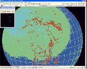
Create the GeoDatabase for the entire world. This program create the geographical location Latitude, Longitude, and Altitude (Elevation) for every city, village, region, state, county in the World. The program crawls the data from the website www.heavens-above.com which collect data from US Geological Survey for the USA (and dependencies) and The National Imaging and Mapping Agency for...
Category: Software Development
Publisher: Mewsoft, License: Freeware, Price: USD $0.00, File Size: 1.1 MB
Platform: Windows
LocalConnect is the included application for converting and uploading Vectors, Images, Maps, and Elevation to GISRoam.
LocalConnect includes tools to automatically convert your source data to GISRoam formats and projections in the following formats:
* Elevation in the form of DTED, DEM, ARCGrid, GEOTIFF, SRTM, XYZ Grid, and BIL.
* Imagery in the form of MRsid,...
Category: Internet / File Sharing
Publisher: Cogent3D, License: Freeware, Price: USD $0.00, File Size: 26.4 MB
Platform: Windows
SatCalc is a free software which calculates Azimuth and Elevation for geostationary satellites used for television broadcast.
Features include the calculation of the LNB skew and calculation of sun outage which occurs in spring and fall. The calculated data is presented graphically and can also be printed out and exported to HTML or CSV.
A list of Longitude...
Category: Business & Finance / Applications
Publisher: Martin Kirisits, License: Freeware, Price: USD $0.00, File Size: 1.6 MB
Platform: Windows
You can enter your City/State OR Zipcode and it outputs a lot of useful information like Azimuth, Elevation, Latitude, Longitude, and Magnetic Deviation. It also has a text database for the satellites that makes it easy to modify satellite names and easy to add or delete satellites.
Category: Home & Education / Miscellaneous
Publisher: NeuroSoft, License: Freeware, Price: USD $0.00, File Size: 1.6 MB
Platform: Windows
Astro Helper will tell you the angle of Elevation above the horizon (altitude) and the direction in degrees from North (Azimuth) of the selected objects. It will simultaneously display the coordinates of 22 objects from a database of over 22,000 objects. With these coordinates you can point your Dobsonian mounted telescope or other "Alt/Az" mounted scope. If you have an...
Category: Home & Education / Astrology & Numerology
Publisher: Mark Casazza Consulting, License: Freeware, Price: USD $0.00, File Size: 3.3 MB
Platform: Windows
Geographic databases management and exploitation, attribute-based and spatial queries, several join types, several classification methods, thematic cartography, statistics and geo-statistics, spatial analysis, interpolations, digital Elevation models, remote-sensing and image processing, simulation, operational research, interactive metric measurements
Category: Home & Education / Miscellaneous
Publisher: IRD, License: Freeware, Price: USD $0.00, File Size: 14.2 MB
Platform: Windows
AutoDEM (aka as AutoMNT) is a freeware GIS software to create Digital Elevation Models (DEM) from scanned topographic maps for Windows.
Through different data layers (map, contours, DEM, etc.), AutoDEM provides many tools for :
-Topographic map analysis
-Contour lines extraction and reconstruction
-Contours to DEM interpolation and DEM analysis
-DEM to TIN...
Category: Multimedia & Design / Animation
Publisher: Joachim Pouderoux, License: Freeware, Price: USD $0.00, File Size: 27.6 MB
Platform: Windows
Bonus Content - Garage Items has the following features :
- Create detailed Floor plans, Elevation views and Cross-sections
- Visualize and design with 3D models and virtual tours
- Choose from over 18,000 Library items including
CAD Details and name
brand manufacturers
- Use automated building tools, like Automatic Framing and Roof Generation
Category: Home & Education / Miscellaneous
Publisher: Chief Architect Inc, License: Freeware, Price: USD $0.00, File Size: 3.0 MB
Platform: Windows
RackTools® software increases the efficiency of your business by allowing engineers and salespeople to quickly and easily specify Middle Atlantic Products, and create accurate rack Elevation, plan, side and rear view drawings, purchase orders, and quotes in minutes.
This innovative software utilizes the familiar drag-and-drop interface for creating scale system drawings...
Category: Business & Finance / Business Finance
Publisher: Middle Atlantic Products, License: Freeware, Price: USD $0.00, File Size: 139.7 MB
Platform: Windows
With EME System helps to track the moon or any selected radio source with a high accurate (16 bits) Azimuth/Elevation display (runs also without the interface) and a complete real time dialogue with the hardware interface to point your antenna toward the moon or the selected source with the same accuracy.
Category: Internet / Misc. Plugins
Publisher: F1EHN, License: Freeware, Price: USD $0.00, File Size: 3.0 MB
Platform: Windows
Prog Finder was designed to help users conveniently adjust their Terristeral antenna and Satellite dish.
This program is designed simply enough. Even a novice can easily understand how to modify its options. The interface is user-friendly, and the main buttons are organized in such a manner, as to easily guide you through the entire configuration process. Furthermore, this utility...
Category: Business & Finance / Applications
Publisher: ProgDVB, License: Freeware, Price: USD $0.00, File Size: 6.4 MB
Platform: Windows
In this game, you need to shoot free kicks.
In this game, you need to shoot free kicks. First, you need to set the angle of the shot, then you need to set the Elevation, and then you need to set the curvature, and finally you set the force of the shot. You need to set all these carefully so that yo
Category: Games / Sports
Publisher: novelgames.com, License: Freeware, Price: USD $0.00, File Size: 262.0 KB
Platform: Windows, Vista, 7 (32-Bit, 64-Bit)
VisualGPS incorporates many advanced features found in professional programs.
VisualGPS incorporates many advanced features found in professional programs. Its sole purpose is to display graphically specific NMEA 0183 sentences and show the effects of selective availability (SA).
Main Features:
- Azimuth and Elevation Graph - View all satellites that are in view. Each satellite identifies its pseudo random number (PRN) and its azimuth and...
Category: Home & Education / Miscellaneous
Publisher: VisualGPSLLC, License: Freeware, Price: USD $0.00, File Size: 1.7 MB
Platform: Windows
The program runs on Autocad 2007/2008/2009 32bits, Autocad 2010 32bits, Autocad 2009 64bits, Autocad 2010 64bits, and BricsCAD v10.
Geographical information.- You can draw the DTM of all the world, because the program is compatible with SRTM format and it download the files by you and draws the result.
Professional.- It's not only a program to calculate a delaunay triangulation but you...
Category: Home & Education / Science
Publisher: Aplicaciones Topogr?ficas S.L., License: Freeware, Price: USD $0.00, File Size: 24.8 MB
Platform: Windows
Demonstrates high resolution imagery (0.
Demonstrates high resolution imagery (0.2 meters per pixel) and Elevation data (1.6 meters per pixel) served by the World Wind WMS, and visualized by the World Wind Java client. You can launch this application by using Java Web Start. It is a useful program for visualizing high resolution photos.
Category: Home & Education / Miscellaneous
Publisher: goworldwind, License: Freeware, Price: USD $0.00, File Size: 1.1 KB
Platform: Windows
StereoWorks is an easy to use yet powerful and intuitive tool to create 3D reconstruction surfaces from stereoscopic SEM images. The software is self-installing and requires no extra hardware to work.The software allows the user to make detailed Elevation maps from a pair of SEM images and obtain data such as height, area and roughness irrespective of the magnification.
Category: Multimedia & Design / Digital Media Editors
Publisher: LycoSoftware, License: Freeware, Price: USD $0.00, File Size: 2.2 MB
Platform: Windows
HydroSHEDS is a mapping product that provides hydrographic information for regional and global-scale applications in a consistent format. It offers a suite of geo-referenced data sets (vector and raster) at various scales, including river networks, watershed boundaries, drainage directions, and flow accumulations. HydroSHEDS is based on high-resolution Elevation data obtained during a...
Category: Home & Education / Miscellaneous
Publisher: WWF-CSP, License: Freeware, Price: USD $0.00, File Size: 1.7 MB
Platform: Windows
"Ballistic Anatomic Trajectory" is a software dedicated to ballistic experts and police labs.
"Ballistic Anatomic Trajectory" is a software dedicated to ballistic experts and police labs.
Very easy to use, it will give you different trajectory angles in direction and Elevation. You will be able to see the body from every possible viewpoint, import another body model developed in a 3d modelling software. You will be able also to specify the exact body height and...
Category: Home & Education / Science
Publisher: Ballistic3D, License: Freeware, Price: USD $0.00, File Size: 8.8 MB
Platform: Windows
DXF2XYZ converts a DXF file to an XYZ file, ie a comma delimited text file containing just xyz coordinates. It can be useful for extracting the raw XYZ coordinates from a DXF file containing say contours or other Elevation entities.
This utility it limited to extracting the XYZ coordinates from the following DXF entity types:
POINT, LINE, POLYLINE / VERTEX, LWPOLYLINE
Category: Business & Finance / Calculators
Publisher: H. Wind, License: Freeware, Price: USD $0.00, File Size: 657.6 KB
Platform: Windows
MICRODEM is a freeware microcomputer mapping program written by Professor Peter Guth of the Oceanography Department, U.S. Naval Academy. It requires a 32 bit version of Windows (NT/2000/XP or 95/98/ME). You may freely use MICRODEM with no restrictions.
MICRODEM displays and merges
- digital Elevation models
- satellite imagery
- scanned maps
...
Category: Multimedia & Design / Graphics Viewers
Publisher: Petmar Triilobite Breeding Ranch, License: Freeware, Price: USD $0.00, File Size: 84.9 MB
Platform: Windows
Console applications and batch scripts are regularly run at Windows startup and in schedule.
Console applications and batch scripts are regularly run at Windows startup and in schedule. The main inconvenience of this is that every application creates a new console window which flickers on the screen. Hidden Start (or Hstart) is a small startup manager that allows console applications and batch files to be started without any windows in the background. Hstart is very small (~12 Kb), but...
Category: Utilities / Launchers
Publisher: NTWind Software, License: Freeware, Price: USD $0.00, File Size: 13.0 KB
Platform: Windows

Importation/Exportation: Import/export trails to gpx file. Unlimited number of trails, and TrackPoints. Export to gpx, Excel, PDF, XPS and KML/KMZ. Data table: Very flexible data table that allows sorting by columns, with inheritance of data, attributes, etc. Presentation on map: View on map in accordance with the active trail, which comes from providers of maps, as in 'Satellite' mode...
Category: Home & Education / Miscellaneous
Publisher: Aplicaciones Topográficas S.L., License: Freeware, Price: USD $0.00, File Size: 27.0 MB
Platform: Windows
Flight pro sim
Test Your Skills by Flying Different Planes
Currently you can fly the 1903 Wright Flyer, strange flapping wing "Ornithopters", a 747, A320, various military jets and several light singles.
Fly Different Helicopters
Fly a medical helicopter and land on a remote snow covered mountain, or how about taking charge with the latest military Westland Lynx. The...
Category: Games / Simulations
Publisher: Flight pro sim, License: Freeware, Price: USD $0.00, File Size: 1.3 MB
Platform: Windows
The Section3D Editor and Viewer application was developed to enhance corridor modeling and cross section capabilities of Autodesk Civil 3D. Section3D can be used with any combination of alignments, profiles and surfaces to create custom user defined templates without VBA programming. Cross sections are dynamically linked with all Civil 3D objects and can be superimposed on the adjacent sections...
Category: Multimedia & Design / Image Editing
Publisher: Section3D by E.J. Solutions, License: Freeware, Price: USD $0.00, File Size: 2.2 MB
Platform: Windows
TerraVisionTM is an Open Source distributed, interactive terrain visualization system developed by SRI International. It allows users to navigate, in real time, through a 3-D graphical representation of a real landscape created from Elevation data and aerial images of that landscape. There are many terrain visualization tools on the market, but here are some of the features that make...
Category: Multimedia & Design / Graphics Viewers
Publisher: SRI International, License: Freeware, Price: USD $0.00, File Size: 2.1 MB
Platform: Windows
The ArcGIS Military Analyst extension incorporates a suite of display and analysis tools tailored to meet the special needs of the defense and intelligence user. With ArcGIS Military Analyst, you can create, query, analyze, and display spatial data in a variety of formats.
ArcGIS Military Analyst maximizes the use of the standard suite of the Department of Defense geospatial...
Category: Multimedia & Design / Multimedia App's
Publisher: Environmental Systems Research Institute, Inc., License: Freeware, Price: USD $0.00, File Size: 31.9 MB
Platform: Windows
Wild Metal Country is one of those Rockstar Games' classics that are available for free now.
Wild Metal Country is one of those Rockstar Games' classics that are available for free now. Unlike other classics, this one does not involve criminal gangs, but there is still plenty to blow up in the game. Because this game is old, Rockstar had to modify it to run in modern computers, though that's not guaranteed.
You are a tank running around on scorched earth, and...
Category: Games / Arcade
Publisher: Rockstar Games, License: Freeware, Price: USD $0.00, File Size: 0
Platform: Windows
ASE is an application that allows you to create and modify aircraft situation files for ACSIM, EuroScope and TWRTrainer.
ASE has an interactive OpenGL display, similar to VRC, to easily view and edit situations as you see them. You can simply use the mouse to pan and zoom around the display.
Main features:
- Online Euroscope Scenario Repository (New)
...
Category: Multimedia & Design / Graphics Viewers
Publisher: Craig Phillips, License: Freeware, Price: USD $0.00, File Size: 1.3 MB
Platform: Windows
This new cool 3D screensaver represents most popular and cute ATN's Night Vision Riflescopes.
This new cool 3D screensaver represents most popular and cute ATN's Night Vision Riflescopes.American Technologies Network Corporation manufactures and distributes the widest array of Night Vision equipment in the world. Now you can see them in 3D! Original 3D technology of presentation of the Night Vision Riflescopes gives the chance to look at them from any side!ATN prides itself as an...
Category: Desktop Enhancements / Screensavers
Publisher: American Technologies Network Corp., License: Freeware, Price: USD $0.00, File Size: 3.6 MB
Platform: Windows
Main Features:
- 3D and 2D map based user interface
- Units are individual, section, or platoon/battery sized units
- Click on the 3D map to issue unit movement waypoints
- Multiple players over LAN and Internet, each controlling specific forces
- Real time with 30 second time steps, time compression adjustable up to x1,000
- Detailed combat results,...
Category: Games / Strategy & War
Publisher: Historical Software Corporation, License: Freeware, Price: USD $0.00, File Size: 173.0 MB
Platform: Windows
ER Mapper Image Compressor - compressing, mosaicking and color balancing aerial and satellite images to JPEG 2000 and ECW formats makes them manage, share and use in your business activities. ER Mapper Image Compressor is a flexible, high-speed geospatial image data compression application.
Category: Multimedia & Design / Image Editing
Main features:
-ER Mapper Algorithm (.alg)
-ER Mapper Raster Dataset (.ers)
Publisher: Earth Resource Mapping, License: Freeware, Price: USD $0.00, File Size: 33.5 MB
Platform: Windows
The ActiveWorlds program, developped by Activeworlds.Inc USA, is a combination of 3D instant chat, virtual world browser and real-time 3D construction using the latest technology as seen in RPG games. Fog, particules, action commands, lightning modes, easy-to-use terrain Elevation for a natural landscape, move commands and object compatibility are just some of its features. Looks or...
Category: Internet
Publisher: Activeworlds.Inc, License: Freeware, Price: USD $0.00, File Size: 5.2 MB
Platform: Windows
GPicSync automatically inserts location in your photos metadata so they can also be used with any 'geocode aware' application like Picasa/Google Earth, Flickr, loc.alize.us.
Main fetures:
- automatically geocode your photos (in the EXIF header)
- use a GPS tracklog in the GPX format or NMEA format (multiple selection possible)
- Support Elevation...
Category: Multimedia & Design / Digital Media Editors
Publisher: Google Project, License: Freeware, Price: USD $0.00, File Size: 0
Platform: Windows
World Wind lets PC users zoom from satellite altitude into any place on the globe.
World Wind lets PC users zoom from satellite altitude into any place on the globe. Leveraging Landsat satellite imagery and Shuttle Radar Topography Mission data, World Wind lets you experience Earth terrain in visually rich 3D, just as if you were really there. Virtually visit any place in the world. Look across the Andes, into the Grand Canyon, over the Alps, or along the African Sahara....
Category: Home & Education / Science
Publisher: NASA, License: Freeware, Price: USD $0.00, File Size: 15.0 MB
Platform: Windows, 2K
 Freeware
org, uses file and position names that suit to the display of the TomTom Rider, uses file, route and position names that suit to the display of the Map&Guide Motorrad Tourenplaner, remembers language, paths, window size and position. . .
Category: Business & Finance / Conversion Applications
Publisher: Christian Pesch, License: Freeware, Price: USD $0.00, File Size: 6.6 MB
Platform: Windows, Mac, Linux, Solaris, FreeBSD, OpenBSD, Java
Freeware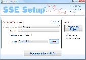
SSE Setup is a FREE, easy to use, install creator ( setup builder ) to make installers for your software. Full-featured, trusted, mature, professional. * Installs can run on most all Windows OS's such as Windows 7 & 8.1 (you can disable support for any OS's you don't want) * Installs both 32-bit and 64-bit programs * NOT some complicated scripting language! (unlike many other...
Category: Software Development / Installation Programs
Publisher: Chris Long, License: Freeware, Price: USD $0.00, File Size: 5.7 MB
Platform: Windows, Other

OkMap is a GPS and map software that:
-Works with vectorial maps and calibrates raster maps
-Organizes paths by creating waypoints, routes and tracks
-Uploads/downloads data to/from your GPS
-Uses altitude DEM data
-Supports GPS real-time navigation
-Sends/receives vehicles position and display tracks on maps in real time
-Provides autorouting and geocoding...
Category: Business & Finance / Applications
Publisher: Gian Paolo Saliola, License: Freeware, Price: USD $0.00, File Size: 20.2 MB
Platform: Windows
he original design was one player game with a Joystick with trigger (arrows and space bar), two buttons for turret rotation, a third button to align the turret with the tank body (point it forward as it is easy to get disoriented), and a start button (keyboard 1). The coin intakes would be keyboard 5 as a standard MAME interface. The new configuration is a dual joystick configuration. The left...
Category: Games / Misc. Games
Publisher: RogueSynapse, License: Freeware, Price: USD $0.00, File Size: 45.0 MB
Platform: Windows