Free Downloads: Eplum Raster
License: All | Free
When you are looking for a powerful tool to satisfy various needs regarding vectors, Raster and satellite imagery, you will find ILWIS Academic an efficient application. The program comes with such useful features as points to create maps, lines for segment maps, closed area segments for polygon maps, spatial operations for Raster maps and so on. Whilst using images from satellite...
Category: Home & Education / Miscellaneous
Publisher: ITC, License: Freeware, Price: USD $0.00, File Size: 19.4 MB
Platform: Unknown
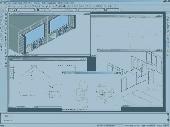
GTXImage CAD is a total Raster and vector drawing system for bringing paper drawings into a modern CAD, EDM or GIS environment. It includes powerful, industry standard two-dimensional CAD functionality that fully supports comprehensive hybrid Raster and vector capabilities. It also provides highly efficient Raster enhancement and editing features that permit you to make the...
Category: Multimedia & Design / Image Editing
Publisher: GTX, License: Freeware, Price: USD $0.00, File Size: 248.0 MB
Platform: Windows
With the CAD Studio's utility - GeoRefImg - you can automatically place georeferenced Raster files (pictures) also in AutoCAD or Architectural Desktop (this correlation functionality is by default available only in AutoCAD Map, Civil3D and Raster Design). GeoRefImg - georeferencing for AutoCAD and ADT - automatic repositioning of Raster images (with georeference world...
Category: Multimedia & Design / Image Editing
Publisher: CAD Studio, License: Freeware, Price: USD $0.00, File Size: 55.3 KB
Platform: Windows
ArcScripts is intended for the free exchange of scripts and tools related to ESRI software products.
ArcScripts is intended for the free exchange of scripts and tools related to ESRI software products. Please alert the moderator if this script is a demo, trial-version, or an advertisement for a retail product.
Akin to the GRIDSPOT AML in workstation ArcInfo, this VB tool overlays a point shapefile or point coverage on a Raster layer and assigns the value of the...
Category: Multimedia & Design / Multimedia App's
Publisher: Dan Rathert, License: Freeware, Price: USD $0.00, File Size: 7.4 KB
Platform: Windows
 Freeware
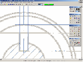
If you want to edit a Raster file in your CAD program, you first have to convert it to a vector file. RasterVect does just that, transforming paper drawings or Raster images into a vector format. Raster images can be imported by scanning original paper drawings. There is TWAIN and WIA support for importing from all scanners. The target vector formats (DXF, WMF, EMF, EPS and...
Category: Multimedia & Design / Image Editing
Publisher: RasterVect Software, License: Freeware, Price: USD $0.00, File Size: 2.8 MB
Platform: Windows
GraphicsGale is a software for editing raster format image.
GraphicsGale is a software for editing Raster format image. You can retouch a photo, paint a picture, and so on. In addition, you can make an animation with seeing its preview in real-time. This feature must be useful for making an animated GIF or a video-game character.
Category: Multimedia & Design / Media Management
Publisher: HUMANBALANCE Co.,Ltd., License: Freeware, Price: USD $0.00, File Size: 1.6 MB
Platform: Windows
Panoply is a Java application which enables the user to plot Raster images of geo-gridded data from netCDF datasets. Panoply is an utility that enable user to plot Raster image. Depending on the data, it can draw global longitude-latitude images or pole-t
Category: Multimedia & Design / Illustration
Publisher: giss.nasa.gov, License: Freeware, Price: USD $0.00, File Size: 9.4 MB
Platform: Windows, Mac, 2K, 2K3, Vista
Pixelitor is a cross-platform raster graphics editor written in Java.
Pixelitor is a cross-platform Raster graphics editor written in Java. It supports image filters, drawing, layers, unlimited undo, etc.
Category: Multimedia & Design / Image Editing
Publisher: sourceforge.net, License: Freeware, Price: USD $0.00, File Size: 1.1 MB
Platform: Windows, Mac, Vista
This stand alone application aids in the loading of CD's of CADRG data from NIMA.
This stand alone application aids in the loading of CD's of CADRG data from NIMA. The application uses ArcInfo Workstation, ArcObjects, and ArcSDE to load each frame file from the CD into either a Raster dataset or a Raster catalog. The application comes with an installer and the unpacked product aswell.
Category: Multimedia & Design / Image Editing
Publisher: ESRI, License: Freeware, Price: USD $0.00, File Size: 1.1 MB
Platform: Windows
PHOTOMOD GeoMosaic is intended for working with various types of digital images, including aerial and space imagery as well as digitized Raster maps.
The program functionality includes:
- Georeferencing of Raster images;
- Transforming images from one coordinate system to another, using an extensive database supplied or custom created coordinate...
Category: Multimedia & Design / Multimedia App's
Publisher: Racurs, License: Freeware, Price: USD $0.00, File Size: 36.5 MB
Platform: Windows
pdf2raster is a small tool for converting pages of a pdf file into raster images (gif, png or jpg).
pdf2raster is a small tool for converting pages of a pdf file into Raster images (gif, png or jpg).
The quality of the result is very good, specially when using antialias and the file size is relatively small, when applying a color reduction to 256 colors or less.
Category: Multimedia & Design / Media Management
Publisher: RebluSoft, License: Freeware, Price: USD $0.00, File Size: 283.0 KB
Platform: Windows
RASTER Music Tracker (RMT) is a cross-platform tool for making Atari XE/XL music on PC (OS Win9x).
Raster Music Tracker (RMT) is a cross-platform tool for making Atari XE/XL music on PC (OS Win9x). RMT uses Atari XE/XL music routine of my own - They developed it for a very long time and I hope it will take a fancy of all Atari musicians and fans. ;-)
They are still working on this RMT project in my spare time (it means already hundreds of hours of programming, debugging,...
Category: Audio / Music Creation
Publisher: Radek Sterba, License: Freeware, Price: USD $0.00, File Size: 500.0 KB
Platform: Windows
This program is a tool for stretching a bitmap image (a Raster image), trimming it to a box, and calibrating it. This is primarily of use when dealing with a scanned image of a paper map. Often when making a scan it is hard to get the image precisely aligned; sometimes with old maps the paper has stretched. It can be useful where you want to make a tiled map from a number of original...
Category: Multimedia & Design / Multimedia App's
Publisher: Map Library, License: Freeware, Price: USD $0.00, File Size: 755.8 KB
Platform: Windows
Geomatica FreeView is a flexible data viewing tool supporting over 100 Raster and vector formats for loading, viewing, selection, and enhancement. FreeView is useful for any geospatial data viewing application, and is freely distributable.
FreeView includes a modern interface with many useful display tools, including fast roam and zoom, image enhancements, numeric values...
Category: Business & Finance / Database Management
Publisher: PCI Geomatics, License: Freeware, Price: USD $0.00, File Size: 39.9 MB
Platform: Windows
Freeware
JPG to PDF Converter Free is easy to use, document conversion utility, that designed to convert JPG/JPEG into PDF files. Can convert JPG/JPEG and many Raster image formats into one PDF document in batch mode. If you need to convert some or thousands of JPG or any images, located in one or many different folders, into a PDF, this is your conversion tool. Can merge several JPG images into...
Category: Business & Finance / Document Management
Publisher: FM Software Studio, License: Freeware, Price: USD $0.00, File Size: 721.0 KB
Platform: Windows
Live DXF2BMP is free software that converts CAD generated drawing to Raster image; drawings can be generated by any CAD program that support DXF format such as AutoCAD.
The most amazing thing in this utility is that its standalone converter, so no AutoCAD® or other CAD program installation is required! Output image file properties can be controlled by the user; such as colors,...
Category: Audio / Rippers & Encoders
Publisher: Engineering Knowledge, License: Freeware, Price: USD $0.00, File Size: 1.6 MB
Platform: Windows
The program helps you to to view the image files on the Mac, and convert them to numerous vector and Raster formats including PDF, JPG, GIF, TIF, PSD, PICT, PNG, BMP, and SGI. You can navigate throught the images in a folder using navigation keys and keyboard shortcuts. Changing the view size allows to view at different zoom amounts.
Category: Multimedia & Design / Graphics Viewers
Publisher: Cristallight Inc., License: Freeware, Price: USD $0.00, File Size: 361.0 KB
Platform: Mac, Linux
TerraView handles vector data (polygons, lines and points) and Raster data (grids and images), both stored in a relational or geo-relational database, including ACCESS, PostgreSQL, MySQL and Oracle. TerraView is able to convert to the current version of TerraLib database only databases in the immediately previous version.
Category: Home & Education / Miscellaneous
Publisher: TerraView, License: Freeware, Price: USD $0.00, File Size: 113.9 MB
Platform: Windows
Ghostscript is the name of a set of software that provides: An interpreter for the PostScript (TM) language, with the ability to convert PostScript language files to many Raster formats, view them on displays, and print them on printers that don't have PostScript language capability built in; An interpreter for Portable Document Format (PDF) files, with the same abilities; The...
Category: Multimedia & Design / Multimedia App's
Publisher: ghostscript.com, License: Freeware, Price: USD $0.00, File Size: 0
Platform: Windows
MIview is an OpenGL based medical image viewer that contains useful tools such as a DICOM anonymizer and format conversion utility. MIView can read DICOM, Analyze/Nifti, and Raster images, and can write Analyze/Nifti and Raster images. It can also read an
Category: Multimedia & Design / Graphics Viewers
Publisher: gbooksoft.com, License: Freeware, Price: USD $0.00, File Size: 1.7 MB
Platform: Windows
The program helps you to view the image files on the Mac, and convert them to numerous vector and Raster formats including PDF, EPS, JPG, GIF, TIF, PSD, PICT, PNG, BMP, and SGI.
You can navigate through the images in a folder using navigation keys and keyboard shortcuts. Changing the view size allows to view at different zoom amounts.Also you have ability to rotate selected Image...
Category: Multimedia & Design / Graphics Viewers
Publisher: Cristallight Software, License: Freeware, Price: USD $0.00, File Size: 4.8 MB
Platform: Mac
The DualCAD project is an ongoing project "over 17 years" to create a freeware cad application that handles the basic needs of most microstation users. Currently DualCAD is aimed at the 2D user with perhaps rotated views , reference files, and hybrid Raster files. DualCAD can be run under LINUX using WINE. For more advanced CAD needs please look at PcsCustom. DualCAD Review is...
Category: Multimedia & Design / Image Editing
Publisher: Pangaea CAD Solutions, License: Freeware, Price: USD $0.00, File Size: 7.6 MB
Platform: Windows
FlamMap is a fire behavior mapping and analysis program that computes potential fire behavior characteristics (spread rate, flame length, fireline intensity, etc.) over an entire FARSITE landscape for constant weather and fuel moisture conditions. For more information, look under National Systems in the menu at the top of each page.
The FlamMap software creates Raster maps...
Category: Business & Finance / Business Finance
Publisher: SEM, License: Freeware, Price: USD $0.00, File Size: 6.2 MB
Platform: Windows
Pixel-Zip is a Raster image compressor and decompressor designed specifically for the graphic arts and related markets with especially developed large file, 16-bit and native CMYK mode compression support with algorithms tailored at maximum colour and quality retention. You may not know this, but many similar technologies in the market actually convert CMYK images into RGB, compress and...
Category: Multimedia & Design / Authoring Tools
Publisher: Pixel-Zip Team, License: Freeware, Price: USD $0.00, File Size: 1.2 MB
Platform: Windows
The online image viewer is a free online Raster imaging service that allows people to view, resize, edit and convert the popular image formats within their web browsers. By using it, webmasters, bloggers or anyone creating a web site are able to embed the high-quality images into their web pages. Loading PDF, BMP, GIF, ICO, JPEG, JPEG 2000, PCX, PNG, PSD, TIF, WMF, WBMP, TGA, PGX, RAS,...
Category: Multimedia & Design / Graphics Viewers
Publisher: Viscomsoft Online, License: Freeware, Price: USD $0.00, File Size: 655.4 KB
Platform: Windows
TCDView is a composite document viewer.
TCDView is a composite document viewer. It allows to collect a set of Raster or ector documents into a single composite document. Individual drawings in the omposite document can be selected to allow changing of their parameters, their osition in common world coordinates and their visible areas (viewports).
Category: Utilities / System Utilities
Publisher: Tessel Systems, License: Freeware, Price: USD $0.00, File Size: 7.8 MB
Platform: Windows
OrbisGIS is a Geographic Information System developped for and by research.
OrbisGIS is a Geographic Information System developped for and by research. This cross-platform GIS is developed by French IRSTV institute and is able to manipulate and create vectorial and Raster spatial data. OrbisGIS is distributed under GPL 3 license.
Category: Home & Education / Miscellaneous
Publisher: Free Software Foundation, Inc., License: Freeware, Price: USD $0.00, File Size: 15.4 MB
Platform: Windows
Watch a true dumbness on your desktop.
Watch a true dumbness on your desktop. This incredible saver shows you a dumb text message with dumb Raster font, black letters on fantastic white background. Absolutely stunning 1D graphics and no sound FX make your experience with this screensaver absolutely unique!
Category: Desktop Enhancements / Screensavers
Publisher: Unusual Software, License: Freeware, Price: USD $0.00, File Size: 614.4 KB
Platform: Windows
This is a program for viewing AFPDS print files.
This is a program for viewing AFPDS print files. It can save pages as TIF, PDF, and AFP. It can also be used to extract resources, search for text, and copy text. Be advised though, that if your AFP files contain BCOCA objects, GOCA objects, or non-Raster
Category: Utilities / File & Disk Management
Publisher: compulsivecode.com, License: Freeware, Price: USD $0.00, File Size: 239.0 KB
Platform: Windows, Mac, 2K, 2K3

The free AvisMap Viewer opens most GIS/CAD and Raster image file types and most ArcView, ArcExplorer, and MapInfo projects. Besides just opening and viewing files, the Viewer supports an extensive list of features including visual layer properties control, legend control, thematic mapping, spatial and attribute querying, custom labeling, on-map measurements, hyper-linking, PDF export...
Category: Software Development / Components & Libraries
Publisher: AvisMap GIS Technologies, License: Freeware, Price: USD $0.00, File Size: 22.3 MB
Platform: Windows

OkMap is a GPS and map software that:
-Works with vectorial maps and calibrates Raster maps
-Organizes paths by creating waypoints, routes and tracks
-Uploads/downloads data to/from your GPS
-Uses altitude DEM data
-Supports GPS real-time navigation
-Sends/receives vehicles position and display tracks on maps in real time
-Provides autorouting and geocoding...
Category: Business & Finance / Applications
Publisher: Gian Paolo Saliola, License: Freeware, Price: USD $0.00, File Size: 20.2 MB
Platform: Windows
progeCAD 2008 Smart!, Free for personal use, powered by the most recent IntelliCAD engine, Works with AutoCAD DWG, has the same AutoCAD Like menus and commands, uses the same same support files, .mnu .shx, .pat, AutoLISP, Raster Images. Layouts, model and paper space, all the same stuff you are used to working with in AutoCAD. Has Basic Rendering Options. has Express Tools. export to PDF...
Category: Multimedia & Design / Multimedia App's
Publisher: iCADsales.com, License: Freeware, Price: USD $0.00, File Size: 90.2 MB
Platform: Windows
The GNU plotutils package contains software for both programmers and technical users.
The GNU plotutils package contains software for both programmers and technical users. Its centerpiece is libplot, a powerful C/C function library for exporting 2-D vector graphics in many file formats, both vector and Raster. It can also do vector graphics animations.
Category: Software Development / Misc. Programming
Publisher: GnuWin32, License: Freeware, Price: USD $0.00, File Size: 4.0 MB
Platform: Windows
SemGrid (Simple easy manager of Grid data, for SEMoLa).
SemGrid (Simple easy manager of Grid data, for SEMoLa). Some of its features are: Freeware Raster GIS, for Windows OS, import and export of grid layers from ASCII grid files of Surfer (grd), GeoMedia (asc), ArcGis (asc) and binary or ASCII from Idrisi32 (rdc, rst), GeoEAS, GRASS, map algebra, Markov chains estimation and simulation and much more.
Category: Business & Finance / Applications
Publisher: Francesco Danuso, University of Udine, License: Freeware, Price: USD $0.00, File Size: 7.9 MB
Platform: Windows
Epic Pinball is a game that brings the thrill and excitement of real pinball to life on your PC.
Epic Pinball is a game that brings the thrill and excitement of real pinball to life on your PC. The game is played seen from a 2D top-down view within a scrollable window with plain Raster graphics in 320x200. It can be played on the x86 computer family for MS-DOS.
Category: Games / Arcade
Publisher: DJ, License: Freeware, Price: USD $0.00, File Size: 6.8 MB
Platform: Windows
SuperEdit is a standalone editor for Tessel Composite Documents (TCD).
SuperEdit is a standalone editor for Tessel Composite Documents (TCD). It offers advanced functions to edit full size Raster images. SuperEdit shares editing capabilities with CADRaster and can be used by customers that do not use AutoCAD.
SuperEdit is excellent tool to correct defects introduced by the source material or scanning process. After that you can use scanned...
Category: Multimedia & Design / Digital Media Editors
Publisher: Tessel Systems, License: Freeware, Price: USD $0.00, File Size: 10.1 MB
Platform: Windows
35 Unique and 3.990 icons fully editable vector (ai, xaml, design, swf, fh11) formats and many Raster (ico, psd, png, bmp, gif, jpg, icns) formats.Software Developer , Web Developer and Professionals high quality free Vista Style Toolbar Icon CollectionThe Vista Style Icon Collection Set is ideal for toolbar.Next-generation Icons for web and Windows.Developers and designers with a...
Category: Multimedia & Design / Fonts
Publisher: Horizon Software Co., License: Freeware, Price: USD $0.00, File Size: 809.0 KB
Platform: Windows
FugroViewer is a robust, easy-to-use software designed to help users make the most of their geospatial data. Developed by Fugro Geospatial Services, FugroViewer is designed for use with various types of Raster- and vector-based geospatial datasets, including data from photogrammetric, LiDAR, and IFSAR sources.
Category: Home & Education / Miscellaneous
Publisher: Fugro Geospatial Services, License: Freeware, Price: USD $0.00, File Size: 2.8 MB
Platform: Windows
Quantum GIS provides a continously growing number of capabilities provided by core functions and plugins. You can visualize, manage, edit, analyse data, and compose printable maps. QGIS is an official project of the Open Source Geospatial Foundation (OSGeo). It runs on Linux, Unix, Mac OSX, and Windows and supports numerous vector, Raster, and database formats and functionalities.
Category: Home & Education / Miscellaneous
Publisher: qgis.org, License: Freeware, Price: USD $0.00, File Size: 92.2 MB
Platform: Windows
Blue Saturn Wallpaper is images that can be used as Desktop Backgrounds.
Blue Saturn Wallpaper is images that can be used as Desktop Backgrounds. Normally it's simple Raster images. If you want to fill as background you should select desktop wallpapers resolution with the same resolution as your display. Blue Saturn Wallpaper is only at 1024x768 size.
Category: Desktop Enhancements / Misc. Themes
Publisher: WallpaperPimper, License: Freeware, Price: USD $0.00, File Size: 128.0 KB
Platform: Windows
UCCDraw ActiveX Control with FULL source code! UCCDraw is an ActiveX Component that enables you to build Visio-style charts from within your application. Figure 1:Allows you to create flow charts, vector drawings, Raster images and more with the ability to include hyperlinks and various shading and coloring effects. You can group objects together, include images and text, link...
Category: Software Development
Publisher: ucancode software, License: Freeware, Price: USD $0.00, File Size: 488.3 KB
Platform: Windows
Easily Draw and Create Graphic Images. DrawPad is an easy-to-use image composition and manipulation program, and an essential tool for all types of graphic design projects, including: Creating banner ads or invitations, Make sketches and paintings on your computer, Draw diagrams, icons and other web graphics. DrawPad is ideal for creating images, drawings, and for paintings. DrawPad features...
Category: Multimedia & Design / Graphics Viewers
Publisher: NCH Software, License: Freeware, Price: USD $0.00, File Size: 1.7 MB
Platform: Windows
In 2049, the human population of Earth embarks on a migratory voyage to try to colonize other planets. They leave mechanical "orbots" to clean up the mess they made on Earth through littering and pollution.
Raster, a high-level orbot who watches Earth through a planetwide computer network, is accidentally attached to a working nuclear missile by a lesser orbot and...
Category: Games / Action
Publisher: segabandonware, License: Freeware, Price: USD $0.00, File Size: 1.5 MB
Platform: Windows
Easily Draw and Create Graphic Images. DrawPad is an easy-to-use image composition and manipulation program, and an essential tool for all types of graphic design projects, including: Creating banner ads or invitations, Make sketches and paintings on your computer, Draw diagrams, icons and other web graphics. DrawPad is ideal for creating images, drawings, and for paintings. DrawPad features...
Category: Multimedia & Design / Graphics Viewers
Publisher: NCH Software, License: Freeware, Price: USD $0.00, File Size: 12.7 MB
Platform: Mac
HydroSHEDS is a mapping product that provides hydrographic information for regional and global-scale applications in a consistent format. It offers a suite of geo-referenced data sets (vector and Raster) at various scales, including river networks, watershed boundaries, drainage directions, and flow accumulations. HydroSHEDS is based on high-resolution elevation data obtained during a...
Category: Home & Education / Miscellaneous
Publisher: WWF-CSP, License: Freeware, Price: USD $0.00, File Size: 1.7 MB
Platform: Windows
EzLog is a full-featured professional software system for the management, quality control, viewing, plotting, printing and digitising of Well Logs. EzLog incorporates viewing of very long Raster files with images of well log prints, calibration of a reference grid overlaid on the well log print.
Category: Business & Finance / Business Finance
Publisher: Petramode Limited, License: Freeware, Price: USD $0.00, File Size: 4.8 MB
Platform: Windows
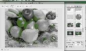
Free Image Editor is a bitmap image-editing application that lets you retouch existing photos or create original graphics. Free Image Editor gives you the tools and supplies of a professional graphic design studio. There is TWAIN and support for importing from any scanner. Free Image Editor provides a rich graphics toolset for digital photography, print production and Web design....
Category: Multimedia & Design / Graphics Viewers
Publisher: AskedFiles, License: Freeware, Price: USD $0.00, File Size: 1.6 MB
Platform: Windows
The DualCAD project is an ongoing project "over 17 years" to create a freeware cad application that handles the basic needs of most microstation users. Currently DualCAD is aimed at the 2D user with perhaps rotated views , reference files, and hybrid Raster files. DualCAD can be run under LINUX using WINE. For more advanced CAD needs please look at PcsCustom. DualCAD Review is...
Category: Multimedia & Design / Image Editing
Publisher: Pangaea CAD Solutions, License: Freeware, Price: USD $0.00, File Size: 1.9 MB
Platform: Windows
LizardTech MG4 Decode is a free graphical utility which provides you with the ability to decode LiDAR files compressed to MrSID Generation 4 (MG4) back to LAS or ASCII formats. The MrSID file format is a proprietary technology that provides tools for the rapid compression, viewing, and manipulation of geospatial Raster and LiDAR data.
Category: Multimedia & Design / Media Management
Publisher: Lizardtech, License: Freeware, Price: USD $0.00, File Size: 21.6 MB
Platform: Windows
The Geosoft Plug-in for MapInfo is an extension to the MapInfo desktop software that provides data retrieval using DAP and also support for reading Geosoft file formats. The plug-in enables users to view Geosoft grid files as a Raster layer inside MapInfo. The plug-in also enables users to view Geosoft Maps as layers.
Category: Home & Education / Miscellaneous
Publisher: GEOSoft, License: Freeware, Price: USD $0.00, File Size: 109.1 MB
Platform: Windows