Free Downloads: Garmin Road Maps For Samsung Monte
License: All | Free
The Garmin Communicator Plugin is a free Internet browser plugin that transfers data between your Garmin GPS device and your computer.
For example, with the Garmin Communicator Plugin you can add the Maps you purchase at Garmin.com to your device. Or, you can upload your training data from your Garmin fitness device to Garmin Connect™.
Category: Internet / Communications
Publisher: Garmin Ltd or its subsidiaries, License: Freeware, Price: USD $0.00, File Size: 14.2 MB
Platform: Windows

OkCustomMap is a software to produce Garmin Custom Maps.
OkCustomMap is a software to produce Garmin Custom Maps.
Supports many map formats:
- OkMap
- Ecw
- GeoTiff
- World files
- OziExplorer
- GpsTuner
You can customize:
- The quality of the output JPEG images (0=Bad, 100=Good)
- The KML transparency (0=Transparent, 255=Opaque)
- The KML draw order (0=Invisible, 1-49=Under the vectorial...
Category: Business & Finance / Applications
Publisher: Gian Paolo Saliola, License: Freeware, Price: USD $0.00, File Size: 3.2 MB
Platform: Windows
Garmin MapConverter was developed to be a tool that will allow you to convert Maps and unlock codes on your Windows PC to the Macintosh format. Transferred Maps will remain fully accessible on your Windows PC. It works on Windows XP, Windows Vista, Windows 7.
Category: Utilities / Misc. Utilities
Publisher: Garmin Ltd or its subsidiaries, License: Freeware, Price: USD $0.00, File Size: 2.6 MB
Platform: Windows
Garmin nRoute is the popular piece of software that allows for auto-routing on a laptop computer with a Garmin GPS unit.
Category: Internet / Misc. Plugins
nRoute is a powerful and feature-rich tool that supports waypoints, tracks, points of interest, addresses and more, but is primarily for navigating and tracking in real time.
nRoute is also compatible with most Garmin units.
Publisher: Garmin Ltd or its subsidiaries, License: Freeware, Price: USD $0.00, File Size: 105.4 MB
Platform: Windows
FSM Moving Map is a Freeware software with some neat features.
FSM Moving Map is a Freeware software with some neat features. With proper Road Maps, you will be able to find your Road (or lack of) in FS environment, or fly at ease using Sectional or terminal charts.
The concept is very simple: you, the user define all the Maps once you are flying, FSMMM will try to locate the best map available, and display it on...
Category: Home & Education / Miscellaneous
Publisher: RanaInside, License: Freeware, Price: USD $0.00, File Size: 1.1 MB
Platform: Windows
Keep track of discount Garmin GPS deals on with this Firefox toolbar.
Keep track of discount Garmin GPS deals on with this Firefox toolbar.compare and buy all the latest Garmin satellite navigation systems. If you want a discount Garmin GPS system this is the Firefox toolbar to use. We also provide information on the latest offers, price cuts and discount voucher codes to help you buy the latest Garmin GPS at the cheapest price...
Category: Internet / Browsers
Publisher: Discount Garmin GPS, License: Freeware, Price: USD $0.00, File Size: 1.1 MB
Platform: Windows
FREE GPS Software for your Garmin, Magellan or Lowrance GPS.
FREE GPS Software for your Garmin, Magellan or Lowrance GPS.
EasyGPS is the fast and easy way to upload and download waypoints, routes, and tracks between your Windows computer and your Garmin, Magellan, or Lowrance GPS. EasyGPS lists all of your waypoints on the left side of the screen, and shows a plot of your GPS data on the right. Use EasyGPS to back up and organize...
Category: Internet / Communications
Publisher: TopoGrafix, License: Freeware, Price: USD $0.00, File Size: 3.9 MB
Platform: Windows
Upgrading software for your Garmin GPS just got easier thanks to WebUpdater—Garmin's free new application that automatically detects and installs the most recent version of operating software for your compatible Garmin GPS. WebUpdater's simple interface makes it easy to upgrade your operating software. Just connect your Garmin GPS to your computer,...
Category: Utilities / Misc. Utilities
Publisher: Garmin Ltd or its subsidiaries, License: Freeware, Price: USD $0.00, File Size: 7.2 MB
Platform: Windows
Free Fleet Management Windows-Desktop standalone application work with Garmin and A1.
Free Fleet Management Windows-Desktop standalone application work with Garmin and A1.You can send messages and STOPs (destinations on Garmin MAP) with short message to driver, direct to his Garmin navigation device.Driver can send message to you using touch-screen keyboard. Ideal for taxi / delivery dispatch. Lowest communication cost by GPRS. Tracking vehicles at map at...
Category: Security & Privacy / Other
Publisher: Clarion LLC, License: Freeware, Price: USD $0.00, File Size: 3.4 MB
Platform: Windows
MarineUpdater is a Windows-based PC application which works in conjunction with a Garmin USB card reader, a Garmin data card, and an Internet connection to generate software update cards for your fixed-mount Garmin marine products. Products which support MarineUpdater will program a data card with information about your Garmin marine product and other Garmin...
Category: Home & Education / Miscellaneous
Publisher: Garmin Ltd or its subsidiaries, License: Freeware, Price: USD $0.00, File Size: 2.0 MB
Platform: Windows
Application designed to calculate the value and greeks of vanilla and exotic options, primarily via Monte Carlo simulation.
Calculation of fair value and greeks for the following option
Binary (Cash-or-nothing) Options (using standard analytical formulae).
Asian Options (using Monte Carlo simulation).
Barrier Options (using Monte Carlo...
Category: Home & Education / Miscellaneous
Publisher: MG Soft, License: Freeware, Price: USD $0.00, File Size: 3.1 MB
Platform: Windows
This mapset contains topographic, hydro, Road, trail, POI, and public land data for the state of Montana. Topo lines dissipate quicker as zoom scale increases. Much improved over the Garmin 24K series when zoomed out. Specialized Night Mode colors to maximize viewability while retaining useful landowner colorization scheme.
Category: Home & Education / Miscellaneous
Publisher: Northwest Environmental Services, License: Freeware, Price: USD $0.00, File Size: 421.3 MB
Platform: Windows
Based on the memory card game.
Based on the memory card game. Road Sign Search lets you play while you learn the meaning of Road signs for the UK Driving Theory Test. Two decks of cards are dealt face down; one carries images of Road signs and the other descriptions of Road signs. You
Category: Games / Educational Games
Publisher: diktyon.co.uk, License: Freeware, Price: USD $0.00, File Size: 652.0 KB
Platform: Windows, Mac, 2K, 2K3
Back to the 2 Dimensions in a arcade car driving game :a Road and plenty of things to see and overtake ! Every element,car,Road,Road objects is freely customizable and expandable;it includes a Road+Road objects editor. Written in java ,the source code is available.
Category: Games / Arcade
Publisher: Francesco Piazza, License: Freeware, Price: USD $0.00, File Size: 1024 B
Platform: Windows, Linux
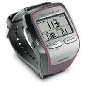
Screensaver with a Garmin Forerunner theme. .
Screensaver with a Garmin Forerunner theme.
Category: Desktop Enhancements / Screensavers
Publisher: Garmin Forerunner 305, License: Freeware, Price: USD $0.00, File Size: 1.5 MB
Platform: Windows
MyGPS is a Freeware software for the creation and the management of longitude and latitude calibrated Maps.
The software can define points of interest obtaining their coordinates (waypoints), can create routes (routepoints), can visualize track paths (trackpoints).
Using a serial link, points routes and tracks can be shared with "eTrex" and "Geko"...
Category: Home & Education / Miscellaneous
Publisher: GPSInfo, License: Freeware, Price: USD $0.00, File Size: 2.3 MB
Platform: Windows
Turtle Sport is a free software developed to communicate with Garmin fitness products (forerunner and edge).
Turtle Sport retrieves yours training sessions from your Garmin and it makes diagram. You can also order your training sessions by category and training mode. With Turtle Sport, it is also possible to map your GPS training paths in Google Earth.
Athlete...
Category: Home & Education / Miscellaneous
Publisher: TurtleSport, License: Freeware, Price: USD $0.00, File Size: 6.9 MB
Platform: Windows

The Approach displays and updates your exact position on stunningly detailed, preloaded course Maps throughout the United States, and many European and other countries. Click to see Garmin's current Approach G5 course listing. Approach's highly sensitive GPS receiver pinpoints your position and removes guesswork from your game. And as you move, Approach automatically updates your...
Category: Home & Education / Miscellaneous
Publisher: GeminiPress Publishing, License: Freeware, Price: USD $0.00, File Size: 45.3 MB
Platform: Windows, Mac, Palm
Palm Desktop for Garmin iQue 3600 is one of the first PDAs to offer built-in GPS, as opposed to the jackets often used with other models.
Mapping integrates well - you can add a location to any address book entry, for example - but you can only route to an address from your present location, not from one distant one to another.
Category: Multimedia & Design / Multimedia App's
Publisher: Garmin Ltd or its subsidiaries, License: Freeware, Price: USD $0.00, File Size: 11.7 MB
Platform: Windows

FSS Google Maps Downloader is a tool that can download the Google Maps images to your PC. This is a clearly free program. There is no spyware or adware. It's absolutely safe to install and to run. The interface is very simple and self explaining. It runs low on system resources consumption and is supported on all Windows versions. It can save them to your hard disk,...
Category: Internet / Download Managers
Publisher: FreeSmartSoft, License: Freeware, Price: USD $0.00, File Size: 874.0 KB
Platform: Windows
In this game there will be a city with some of the numbered buildings shown.
In this game there will be a city with some of the numbered buildings shown. Your task is to construct a Road that loops the city. The Road must not branch and there must only be one loop. The number on a building indicates the number of faces of this building facing a Road. Click at an edge to create a Road, click again to mark that edge with a cross to remind...
Category: Games / Misc. Games
Publisher: Novel Games Limited, License: Freeware, Price: USD $0.00, File Size: 253.7 KB
Platform: Windows
This software will not work unless you already own a MapSource product.
This software will not work unless you already own a MapSource product.
Main Features:
- Improved memory issues when running on Windows 7.
- Improved map projection for many map products.
- Changed mouse-wheel functionality to zoom in and out.
- Added support for enhanced map security.
- Fixed unlocking issue.
...
Category: Home & Education / Miscellaneous
Publisher: Garmin Ltd or its subsidiaries, License: Freeware, Price: USD $0.00, File Size: 8.4 MB
Platform: Windows
Horrum is a free and simple, yet fun 3D racing game with infinite road.
Horrum is a free and simple, yet fun 3D racing game with infinite Road.
The goal of the game is to set the best time between two check-points. Beware the traps and the end of the Road, and use or don't power-ups on the Road.
This game requires OpenGL 3D accelerator.
Category: Games / Misc. Games
Publisher: Jordan Tuzsuzov, License: Freeware, Price: USD $0.00, File Size: 1.4 MB
Platform: Windows
GeePeeEx Editor is specifically designed to produce and edit GPX files destined for Garmin's® Automotive Satnav (GPSr) systems. These files can be used as input to Garmin's® POI Loader to produce enhanced Custom POI's (Points of Interest).
Convert CSV files to GPX. Optionally and uniquely, GeePeeEx Editor will search for valid telephone numbers...
Category: Audio / Rippers & Encoders
Publisher: Them, License: Freeware, Price: USD $0.00, File Size: 2.6 MB
Platform: Windows
Diffuse maps represent the absorption of light.
Diffuse Maps represent the absorption of light. Diffuse Maps are what people call "textures". They are the color textures or photographic textures usually applied to 3d models.
ShaderMap creates displacement Maps using the light data stored inside of diffuse Maps. Evenly lit diffuse Maps generally create better quality Maps with ShaderMap.
Category: Home & Education / Miscellaneous
Publisher: Rendering Systems Inc., License: Freeware, Price: USD $0.00, File Size: 4.0 MB
Platform: Windows
Road Doctor™ Viewer is a free software for clients.
Road Doctor™ Viewer is a free software for clients. It can be used to view projects and data views created by Road Doctor™ and Geo Doctor™ software. New views or data cannot be linked to the project. Views created with Road Doctor™ 3D GPR module and single ground penetrating radar files can be opened to the view.
Category: Multimedia & Design / Graphics Viewers
Publisher: Roadscanners Oy, License: Freeware, Price: USD $0.00, File Size: 43.6 MB
Platform: Windows
MapComp is a powerful and free Windows Software for drawing images of linkage Maps and to compare linkage Maps and indicate common markers.
MapInspect can display, print and save images, and has no limit to the number of Maps it can compare (but only neighbouring Maps are compared). Maps can be flipped within MapINspect, an the on-screen order of...
Category: Multimedia & Design / Multimedia App's
Publisher: MapInspect, License: Freeware, Price: USD $0.00, File Size: 616.7 KB
Platform: Windows
GeoVisu is a program that displays georeferenced data (images, graphics) and downloads data recorded by some GPS devices.
GeoVisu has a "Moving map" navigation function, which can be used with any NMEA 0183 compatible or Garmin USB GPS device.
Main features:
- Displays georeferenced image formats : GeoTiff, ECW and ECWP, MrSID, OziExplorer...
Category: Multimedia & Design / Graphics Viewers
Publisher: GeoVisu, License: Freeware, Price: USD $0.00, File Size: 1.7 MB
Platform: Windows
KMLCSV Converter is a tool that enables you to convert the KML file generated from Google Earth (free version) into a formatted CSV file (and vice versa). This CSV file can then be uploaded into your Garmin GPS by using Garmin POI Loader, which can be downloaded for free. This allows you to plot all the custom point of interests (POI) with Google Earth first. Then, you can...
Category: Business & Finance / Calculators
Publisher: Choon-Chern Lim, License: Freeware, Price: USD $0.00, File Size: 2.3 MB
Platform: Windows
This software development kit (SDK) provides the binaries and programming reference for the Bing Maps Silverlight Control. You can use this control to build your own web sites that use Bing Maps.
The Bing Maps Silverlight Control combines the power of Silverlight and Bing Maps to provide an enhanced mapping experience. Developers can use the Bing...
Category: Utilities / Misc. Utilities
Publisher: Microsoft, License: Freeware, Price: USD $0.00, File Size: 3.8 MB
Platform: Windows
The GPS Detector software is used to update the GPS detector's database , updating Maps , routes and camera locations . The device itself is based on pre-installed GPS coordinates, the device can indicate various Road hazards like: Fixed cameras, Red light speed cameras and bus lane cameras, Usual speed measurement places and dangerous zones.
Category: Business & Finance / Business Finance
Publisher: Euro Noliker Kft., License: Freeware, Price: USD $0.00, File Size: 5.5 MB
Platform: Windows
A!K Mouse Off-Road is an odometer for your mouse! It tracks movement of the mouse and the time of a mouse activity. All tracked information is shown on the indicator window and may be exported to a .txt file.
Category: Desktop Enhancements
Publisher: sixfiles.com, License: Freeware, Price: USD $0.00, File Size: 474.0 KB
Platform: Windows, Mac, 2K, 2K3
SensAct -SENSORS CONVERSION Maps AND ACTUATORS COMMAND Maps
This software pack contents the sensors conversion Maps and the actuators command Maps like motorized throttles, gasoline injectors corrections, ...
It is mandatory to install it to select the type of sensor and actuators that are equiping the ECUs, because these Maps are no longer...
Category: Business & Finance / Applications
Publisher: Skynam, License: Freeware, Price: USD $0.00, File Size: 3.4 MB
Platform: Windows
PlanetGIS Explorer is a free viewer for PlanetGIS maps and GIS exchange files.
PlanetGIS Explorer is a free viewer for PlanetGIS Maps and GIS exchange files. PlanetGIS Explorer allows you to navigate through Maps, query map elements and view attribute information from linked database tables. Also PlanetGIS Explorer allows you to customize the appearance of Maps for purposes of creating hardcopy printouts, but does not allow you to save any changes to...
Category: Multimedia & Design / Graphics Viewers
Publisher: Planet GIS, License: Freeware, Price: USD $0.00, File Size: 5.4 MB
Platform: Windows
DNRGarmin is a smart tool used to directly transfer data between Garmin GPS handheld receivers and various GIS software packages.
DNRGarmin was built to provide users the ability to directly transfer data between Garmin GPS handheld receivers and various GIS software packages. Using DNRGarmin a user can use point features (graphics or shapefile) and upload them to the...
Category: Utilities / Misc. Utilities
Publisher: GIS Section, Minnesota Department of Natural Resources, License: Freeware, Price: USD $0.00, File Size: 11.3 MB
Platform: Windows

Convert video files to MP4 format (MPEG4, AAC) compatible with your Samsung phone. You can save videos in high, standard and economy quality. Free Video to Samsung Phones Converter supports such popular Samsung phones as Samsung Acclaim, Behold, Behold II, BlackJack, BlackJack II, Caliber, Captivate, Code, Comeback, Convoy, Convoy 2, Corby, Droid Charge, Epic 4G,...
Category: Multimedia & Design / Video
Publisher: DVDVideoSoft Ltd, License: Freeware, Price: USD $0.00, File Size: 15.1 MB
Platform: Windows
Samsung Easy Support Center is a troubleshooting helper provided by your Samsung computer.
Samsung Easy Support Center is a troubleshooting helper provided by your Samsung computer. It has a system diagnosis function, an Internet After-Sales function, and a system recovery function.With the help of Samsung Easy Support Center you can find answers for solving issues that may occur during the functioning of your system.
Category: Utilities / Misc. Utilities
Publisher: Samsung, License: Freeware, Price: USD $0.00, File Size: 42.8 MB
Platform: Windows
SEAMCAT® is a software tool based on the Monte-Carlo simulation method, which was developed within the frame of European Conference of Postal and Telecommunication administrations (CEPT). This tool permits statistical modelling of different radio interference scenarios for performing sharing and compatibility studies between radiocommunications systems in the same or adjacent...
Category: Internet / Communications
Publisher: European communications Office, License: Freeware, Price: USD $0.00, File Size: 10.7 MB
Platform: Windows
Live Satellite Maps or Google maps is a web server mapping applications.
Live Satellite Maps or Google Maps is a web server mapping applications.Provides scrolling map images and satellite photos around the earth and even the route between different places.Since 6 October 2005, live satellite Maps is part of local Google.Google live satellite Map provides the ability to zoom in or zoom out to show the map.The user can control the map with your...
Category: Home & Education / Science
Publisher: www.satelliteview-of-my-house.com, License: Freeware, Price: USD $0.00, File Size: 643.0 KB
Platform: Windows
The most popular road design and calculation program in Iran.
The most popular Road design and calculation program in Iran.
Roadware is a Windows based package, prepared for Road design and calculations.
Main features:
- English user interface.
- WYSIWYG capability
- Menu deriven
- Unlimited sections
- Customizable section geometry
- DXF output of Cross sections and Longitudinal...
Category: Business & Finance / Applications
Publisher: MAZ Engineering Software, License: Freeware, Price: USD $0.00, File Size: 2.0 MB
Platform: Windows
AdriaROUTE Lite version of map is made without Garmin NT technology so users with older device can use AdriaROUTE map. Some of devices that not support NT technology are: (eTrex Legend, eTrex Vista, eTrex LegendC, eTrex VistaC, GPSMAP 60C, GPSMAP 60CS, CPSMAP 76C, GPSMAP 76CS, iQue3600; iQue M4; iQue M5..).
Category: Utilities / Misc. Utilities
Publisher: Navigo Sistem d.o.o., License: Freeware, Price: USD $0.00, File Size: 149.6 MB
Platform: Windows
MyRouteOnline is an easy to use route planner that that allows you to plan routes from Excel spreadsheet. Excel Add-in that uploads addresses and saves time, fuel and money by helping you map multiple locations and find the best route. Online route planning goes far beyond paper Maps or a GPS system, it is the only way to find the optimal route for your needs, giving your business a...
Category: Business & Finance / Business Finance
Publisher: MyRouteOnline, License: Freeware, Price: USD $0.00, File Size: 3.1 MB
Platform: Windows
GoldSim is the premier Monte Carlo simulation software solution for dynamically modeling complex systems in business, engineering and science. GoldSim supports decision and risk analysis by simulating future performance while quantitatively representing the uncertainty and risks inherent in all complex systems.
Organizations worldwide use GoldSim simulation software to evaluate and...
Category: Games / Simulations
Publisher: GoldSim Technology Group LLC, License: Freeware, Price: USD $0.00, File Size: 104.2 MB
Platform: Windows
When he gets on his bike he becomes invincible at once.
When he gets on his bike he becomes invincible at once. His friends are hot asphalt, cold wind blowing in the face, and his native gun that has never let him down. This daredevil takes all chances to prove that he is the best on the Road, and no car can overtake him. He has a sixth sense for bad guys, so he is always vigilant. Would you help him to withstand in this mortal combat with...
Category: Games / Arcade
Publisher: FreeGamesWay.com, License: Freeware, Price: USD $0.00, File Size: 11.0 MB
Platform: Windows
Start your engine and put the pedal to the metal for the ultimate truckers vs cops Convoy game!
Start your engine and put the pedal to the metal for the ultimate truckers vs cops Convoy game!
Drive your truck around the desert, smashing Road blocks and avoiding the police cars.
Score points for each Road block smashed and for simply keeping on movin' dontcha know!
Collect speed and invincebility bonuses to help you in your quest in this simple yet...
Category: Games / Action
Publisher: Buzzard Games, License: Freeware, Price: USD $0.00, File Size: 7.3 MB
Platform: Windows
Nokia Maps 3D browser plugin is a free mapping product and service by Nokia for its mobile phones and for internet browsers. Nokia Maps includes voice guided navigation for both pedestrians and drivers for 74 countries in 46 different languages and there are Maps for over 180 countries.
See the world in high-resolution 3D. Everything from the sky to the street. Plan...
Category: Internet / Browser Accessories
Publisher: Nokia, License: Freeware, Price: USD $0.00, File Size: 9.8 MB
Platform: Windows
2008 Road Runners Reunion Concert Screensaver in Savanna Illinois.
2008 Road Runners Reunion Concert Screensaver in Savanna Illinois. The photos and music is from the 2008 reunion concert at the Savanna Illinois Fireman's Ball. Band members came from around the US for this benefit ball to raise money for the Savanna Fire Department. A crowd of thousands came to see this good old time rock and roll band perform.
Category: Desktop Enhancements / Screensavers
Publisher: Road Runners Band, License: Freeware, Price: USD $0.00, File Size: 55.0 MB
Platform: Windows
The game Road Attack presents a breathtaking variety of races including shooting.
The game Road Attack presents a breathtaking variety of races including shooting. Drive a super-high-speed racing car equipped with the most advanced weapons. Take a dangerous route destroying the enemies to finish first. Thirst for speed and danger makes the game more captivating. Take a route full of obstacles in a limited period of time at each level. The opponents' cars will stand in...
Category: Games / Arcade
Publisher: FreeGamesWay.com, License: Freeware, Price: USD $0.00, File Size: 2.9 MB
Platform: Windows
This Game have many Features :
-71 tracks
-2 new cars TC6, NS
-Graphics
-Proper shadows (depth/self shadows, terrain lightmap on car, Road, trees...)
-Improved shader effects (powered by a dynamic material & shader generator)
-Car fresnel effect, reflectivity/specular Maps
-New effects "Screen Space Ambient Occlusion" and...
Category: Games / Arcade
Publisher: Crystal Hammer, License: Freeware, Price: USD $0.00, File Size: 0
Platform: Windows
TrafficEye allows you to know before you go about the traffic and enables you to plan ahead the route.
With this program keeping your eye on the roads has never been easier.
The program features: traffic flow, Road conditions, traffic cameras, incidents, current weather, Maps and much more.
Category: Internet / Communications
Publisher: TheWeatherNetwork, License: Freeware, Price: USD $0.00, File Size: 10.2 MB
Platform: Windows